CA Location: South Shore – Lake Tahoe, CA
Duration: 1 – 2 hours
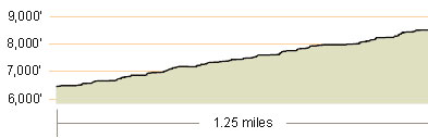
Elevation Change: 2,188′ – from 6,400′ to 8,588′
Recomended Map: Desolation Wilderness Trail Map by Tom Harrison, USGS Topographic Map 7.5 Minute Series: Echo Lake, CA
Elevation Profile:
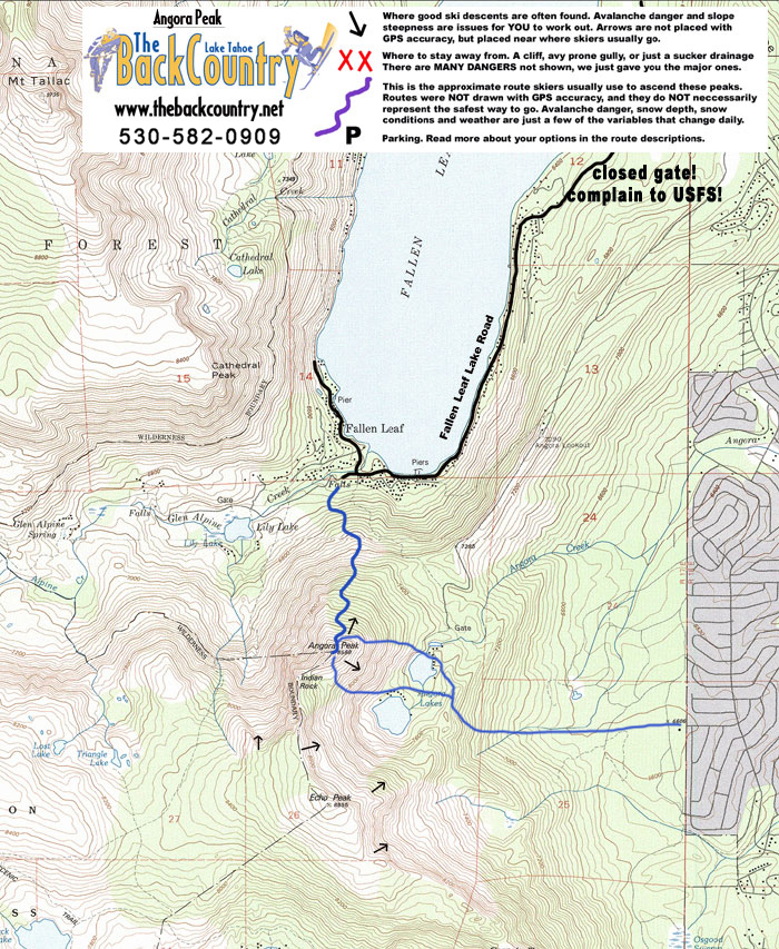
Map of General Route:
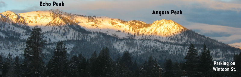
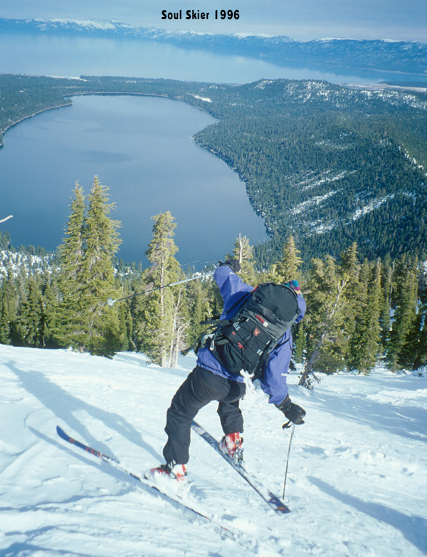
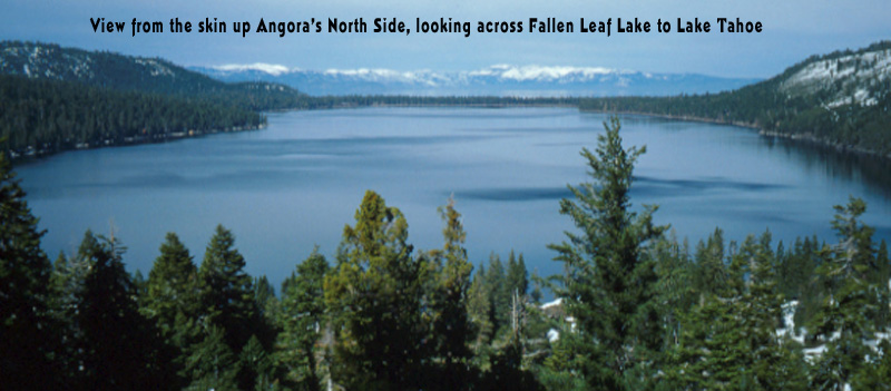
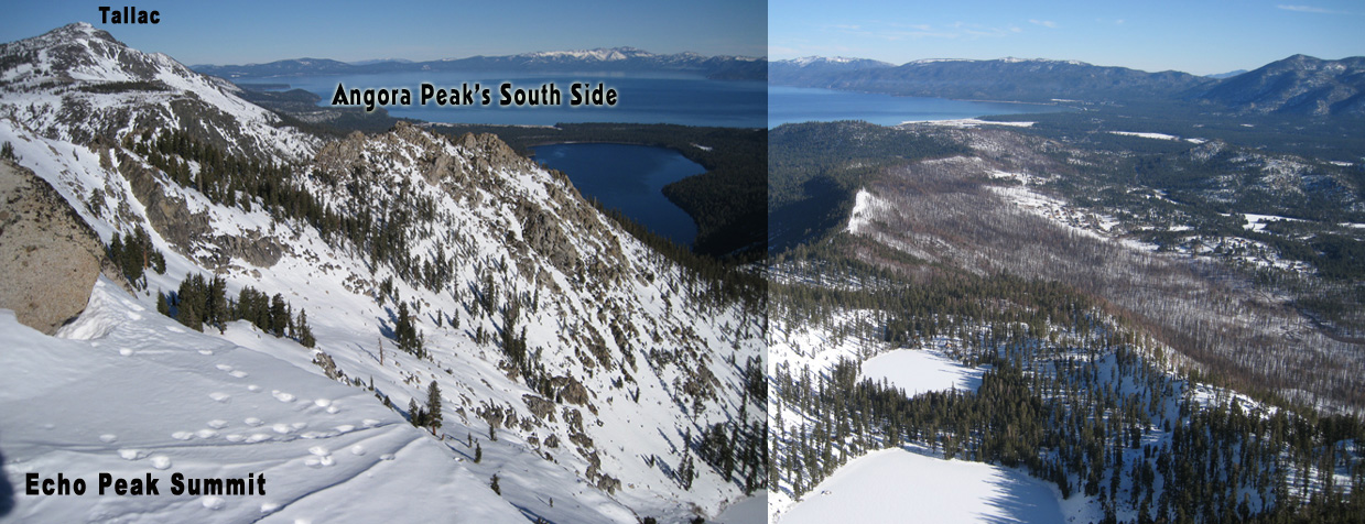
Angora Peak is a small, hidden gem, which sees very little traffic. There is only a 1500’ vertical drop, but you’ll find great terrain; SE facing corn snow, NE facing trees, and steep scary N facing chutes. Views of Lake Tahoe are extra special, with Fallen Leaf Lake right in front of it.
Fallen Leaf Lake Road has been gated for home owners only since about 2005. Contact USFS South Lake Tahoe and TRPA to ask for access to this ideal Desolation Wilderness Trailhead as early as possible, to help locals access our public lands. By the time the gate opens summer for hiking season, the snow is gone. You’ll be wasting your breath of course. I never got anywhere in 20 years of talking out winter land access for skiers. Fallen Leaf Lake Road is generally plowed the full 5 miles back to the fire station and historical trailhead. Very few USFS cabin lease owners use their properties in winter. The road is narrow and a bit beat up, so honestly I realize it’s not going to open again without a rebuild. Snowmobile back there perhaps or go for the long fat bike ride? If you somehow get to the end of Fallen Leaf Lake Road on a powder day, head up into the trees for a 1500′ north facing powder run. Another way to ski Angora is to approach from the south side by climbing Echo Peak. I park at Wintoon circle for Echo, but have never skied Angora from this side. I imagine you could park closer. With good timing you can ski steep south side chutes, dropping down to Angora Lakes. Or take a run down the north side to the fire station and skin back up.
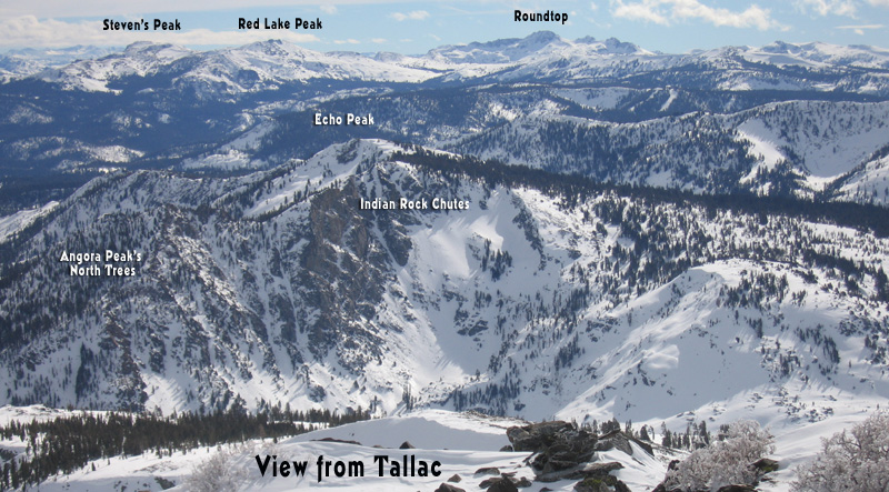
Some of Tahoe’s most impressive couloir skiing is found along the ridge between Angora Peak and Echo Peak, called Indian Cliff Chutes, or Halls of gods Couloirs. I haven’t tried to approach these couloirs from Angora Peak yet, but it’s easy to find them from the summit of Echo Peak. Again Echo and Angora are connected. Echo Peak is described here too. These couloirs need a lot of snow and become skable later in the season. Climb Mt. Tallac prior to heading out there and bring your zoom lens to document the conditions.
For the north facing Indian Cliff Chute descents, here is a recap. Skiers Left is less steep. Every time I’ve been there, they have slid during the storm and expose the rocks a littl. The “A” chutes are a pair right below the highest rock on the peaklet. These aren’t too bad but would be scary in firm conditions. If you walk towards Lake Tahoe down the ridge for a few hundred feet, you’ll find the “Hall of God’s Couloirs”. These are for real, and you probably won’t stumble into them by accident. You can’t see all the way down and sometimes need to do a hip check hop move to get through. I recommend waiting until a healthy snowpack in March to try one of the two Halls Couloirs.
There are even more cool looking chutes along this ridge, as you’ll see in our photo from Tallac’s Summit. I haven’t skied Fallen Angel Couloir yet. Skiing the the north side of Echo in the Indian Cliff area is often wind hardened and sculpted snow. Skinning back up can be difficult. This is an area for experienced backcountry skiers. There is one totally mellow path however, way skiers left of all of this, which is your up track out of there. I think I am repeating all this info on my Echo Peak post as well.
There are no actual sanctioned winter trailheads in Tahoe. Carpool like your life depends on it, be quiet and fast getting onto the snow, blah blah blah. Join Tahoebackcountryalliance.org to help improve public land access in the winter. Call USFS and TRPA and ask why they never cared at all about this issue. CA State Parks is no better. Seriously. That is in their job description – Protect and enhance recreation opportunities and access to public lands. They have only removed access to our public lands and complained that tourism is all they can deal with.

Looking for awesome ski and splitboard tours in the Sierras? We’ve got write ups on many common and uncommon tours curated by the owner of the BackCountry, Mike Schwartz.


