

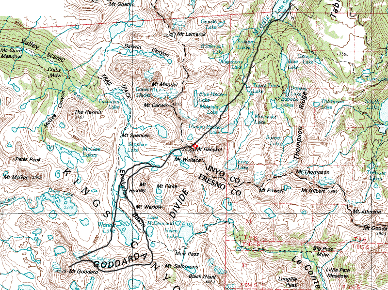
Location: Northern Kings Canyon National Park
Elevation: 13,568′
Elevation Change: about 5000’ and multi-day
Recommended Map: Kings Canyon High Country – Tom Harrison
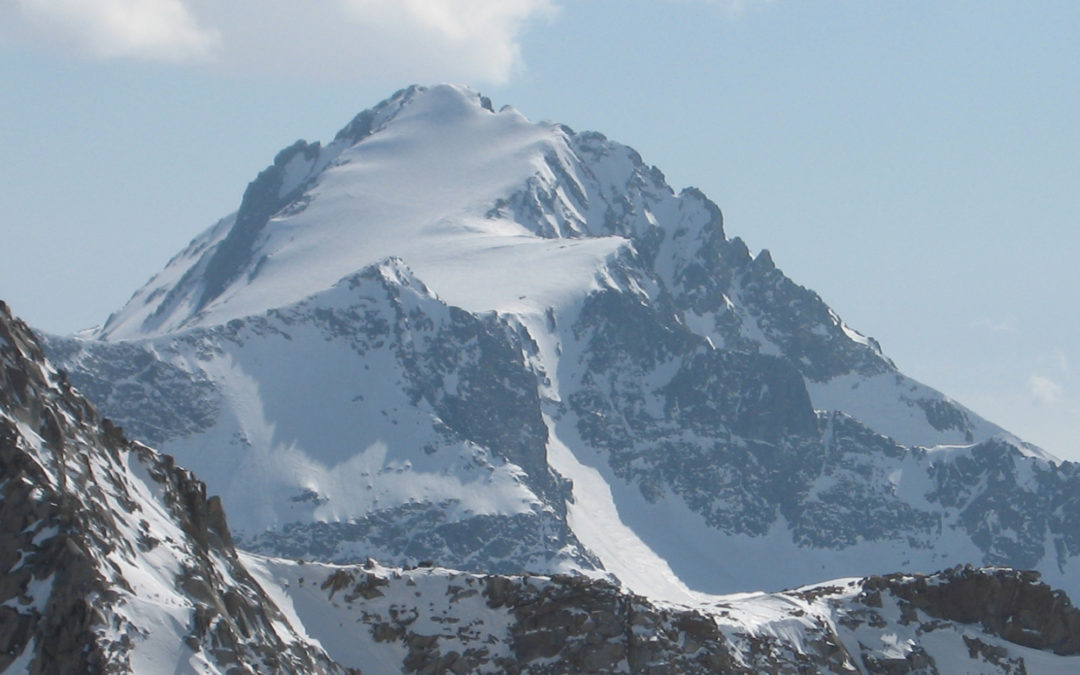
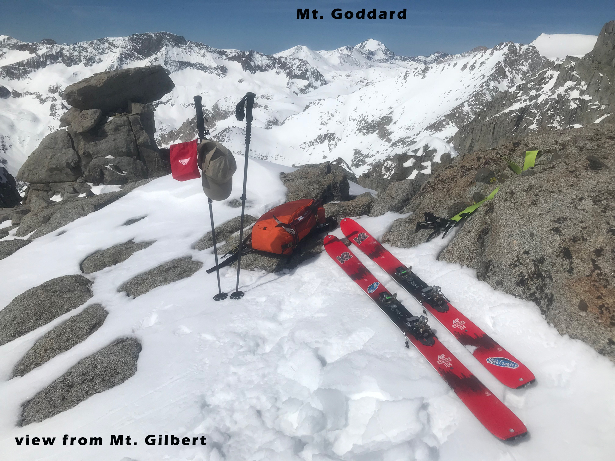
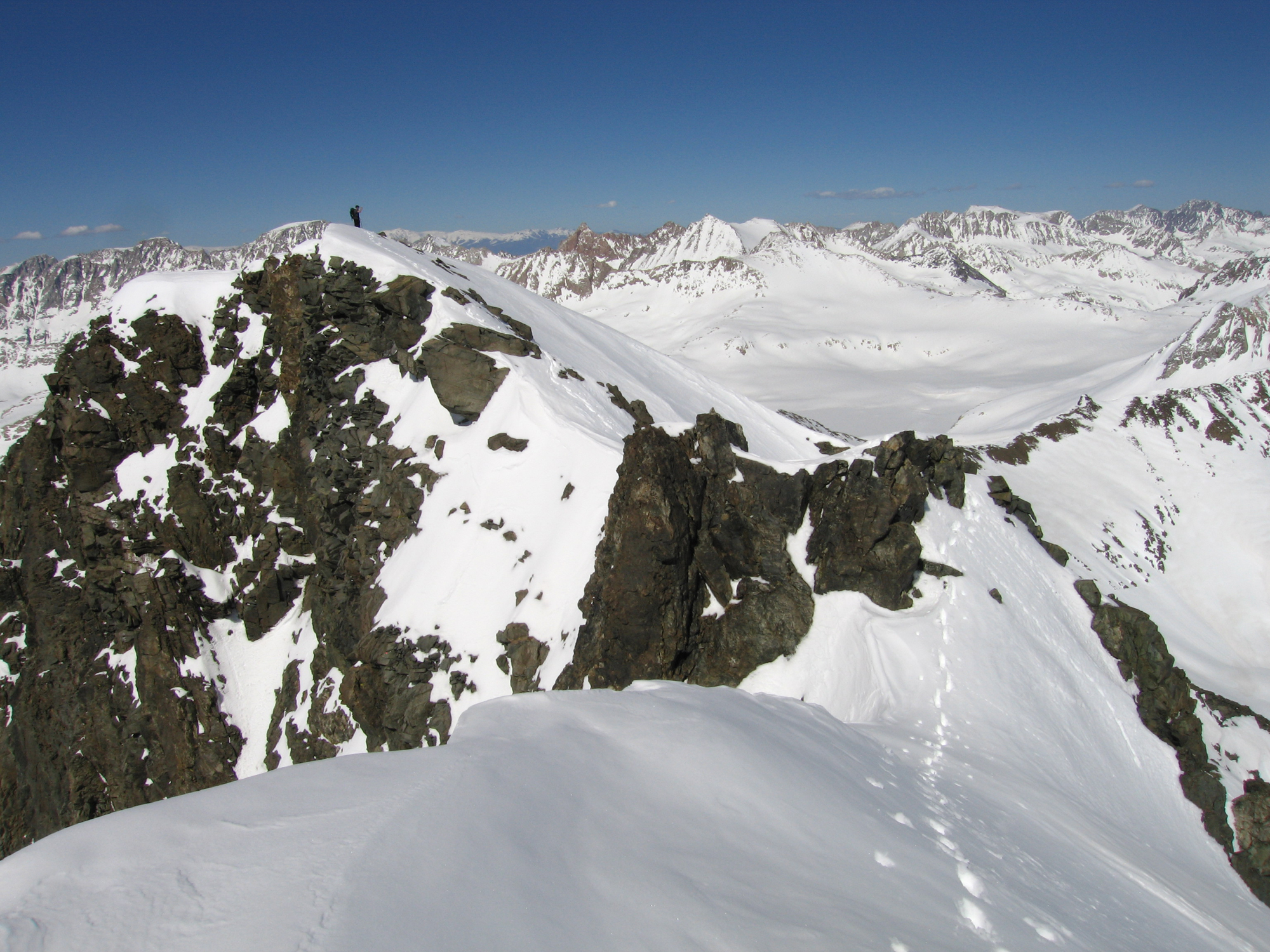
Mt. Goddard can be seen from most every big Eastern Sierra Peak from Bishop to Big Pine. Eric Ongerth and I loved every minute of this 5-day ski tour in 2006, which was built around skiing this peak. Eric picked out a lollypop shaped loop for us starting at the seasonal road closure gate in Aspendale at 8500’, a tiny community above Bishop, CA. He had traversed through this area years earlier in a solo month-long ski tour in leather Tele boots and remembered this big peak near the center of the Sierra. Mt Goddard isn’t far from the John Muir Hut and trail. I never heard of it, although looking at my 20 years of High Sierra ski tour photos, I see that I snapped a few pics from most summits right at this guy. Mt. Goddard is also described in Paul Richin’s Ski Guidebook using an approach from the west. I have no idea how that goes, but I can tell you how our tour goes from the east! We knew there would be a great adventure and some 2-3000’ climbs along the way, but really had no idea of other quality ski descents in the area. It couldn’t have worked out better. Every day I found myself skiing from the summit of beautiful high peaks that stand on their own as worthy and ski objectives.
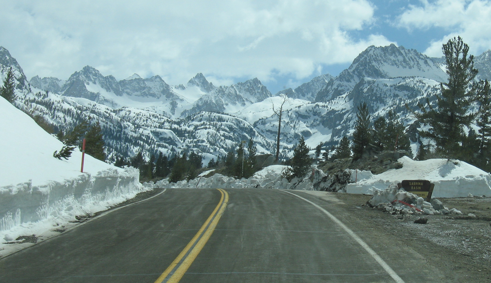
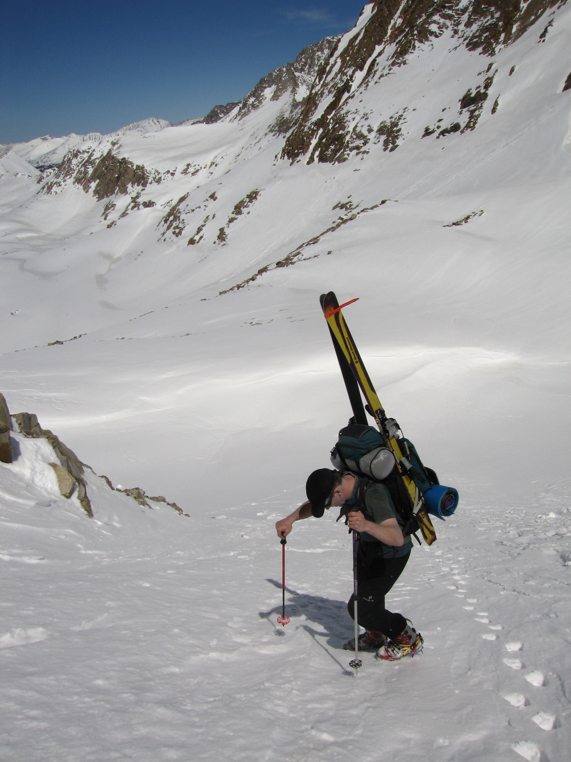
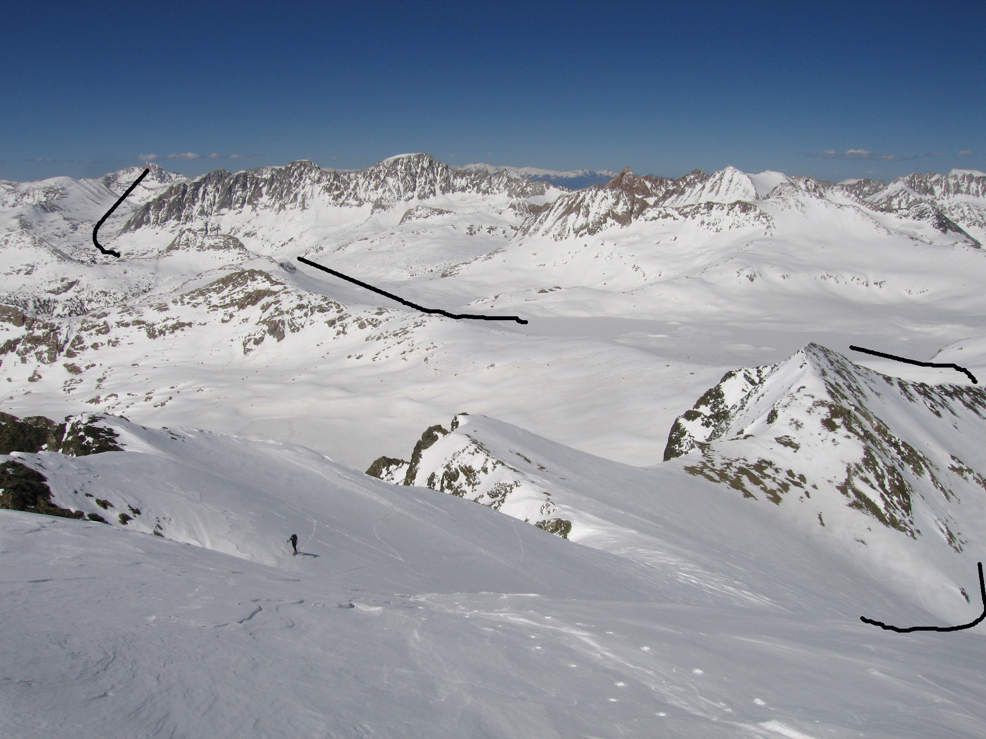
On this ski tour We skied from the summit of the following 13k+ peaks in this order, one each day – Mt. Wallace, Mt. Fiske, Mt. Goddard, Black Giant, and Mt. Powell. We crossed the Eastern Crest between Mt. Wallace and Mt. Haeckel (spelling differs). We returned over the crest via Echo Col. We arrived at the trailhead mid-day and got lucky with a last minute ride in someone’s truck. They had a key to the gate in Aspendale, saving a few miles of walking uphill on asphalt to Lake Sabrina. From there we began skinning across the frozen lake, and setup camp near the base of Picture Peak a few hours later. That’s a sweet one on my list, look it up! In a spitting snow squall that night we got our first taste of poor sleep trying to use a floorless BD Beta Mid Tent. We found it to be lightweight but kinda useless with any wind.
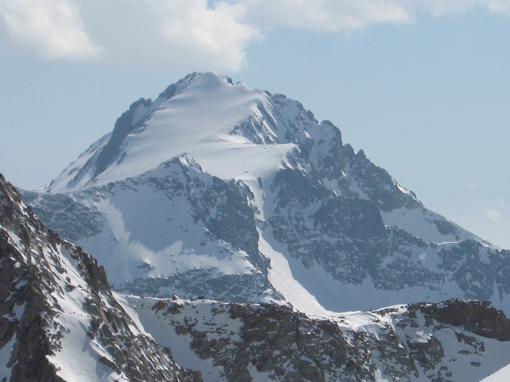
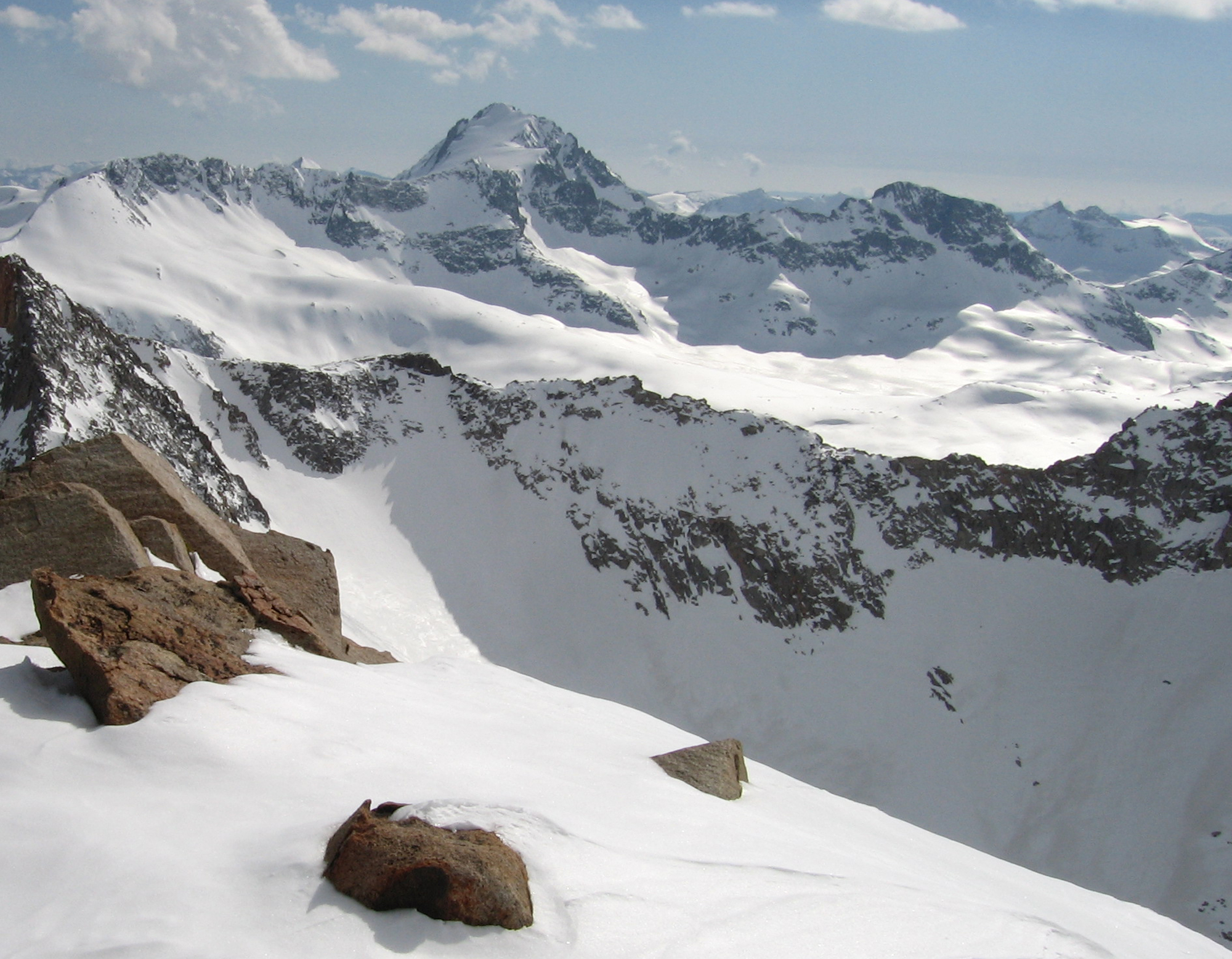
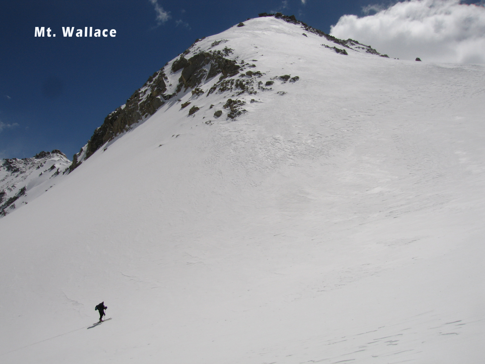
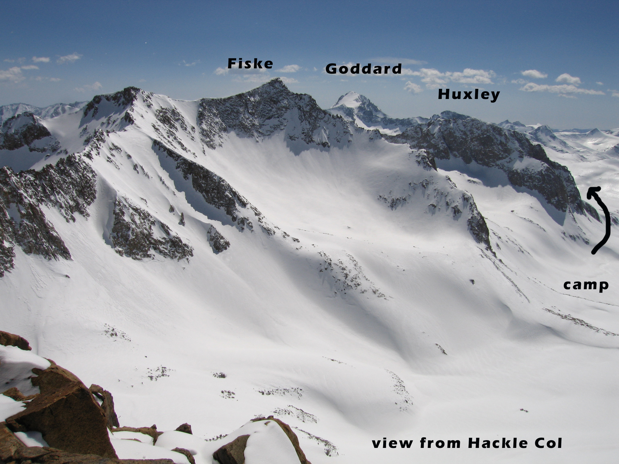
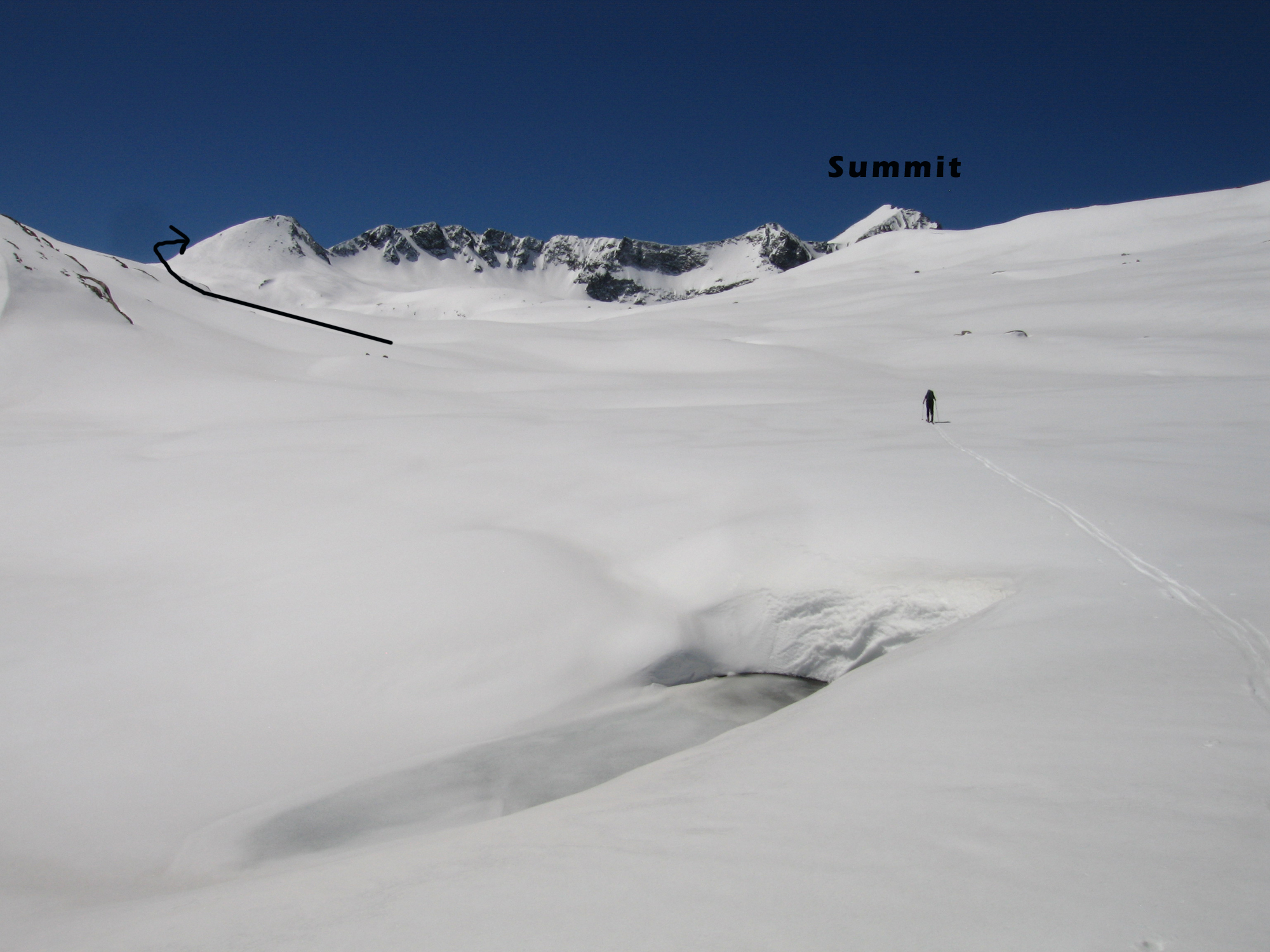
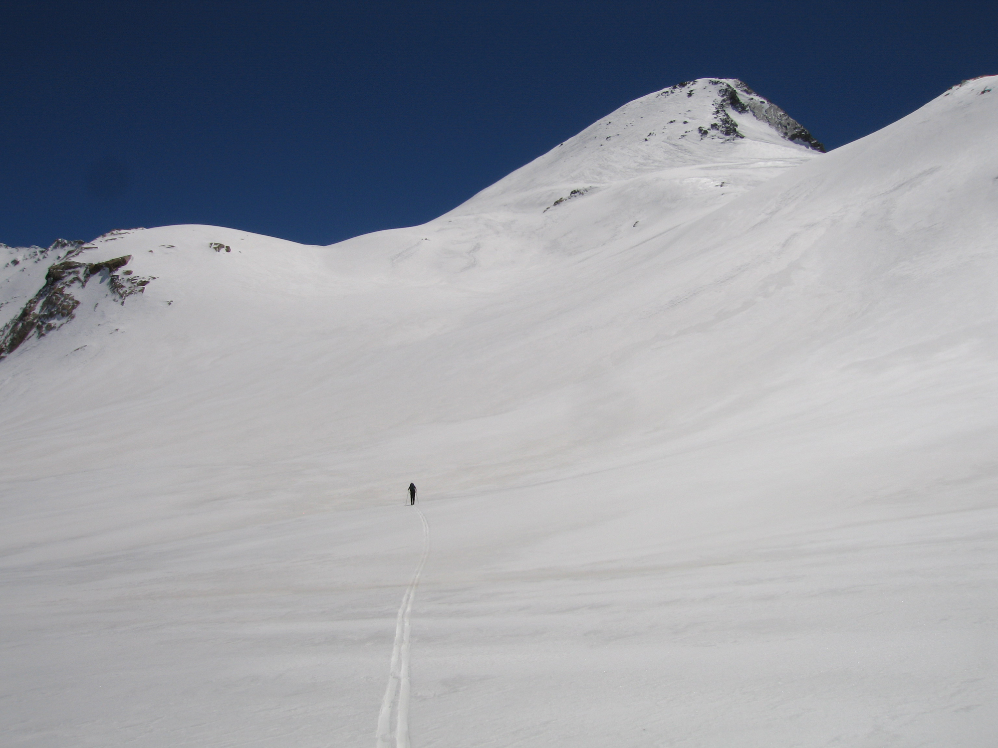
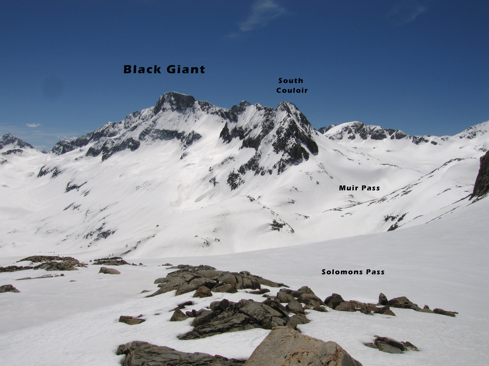
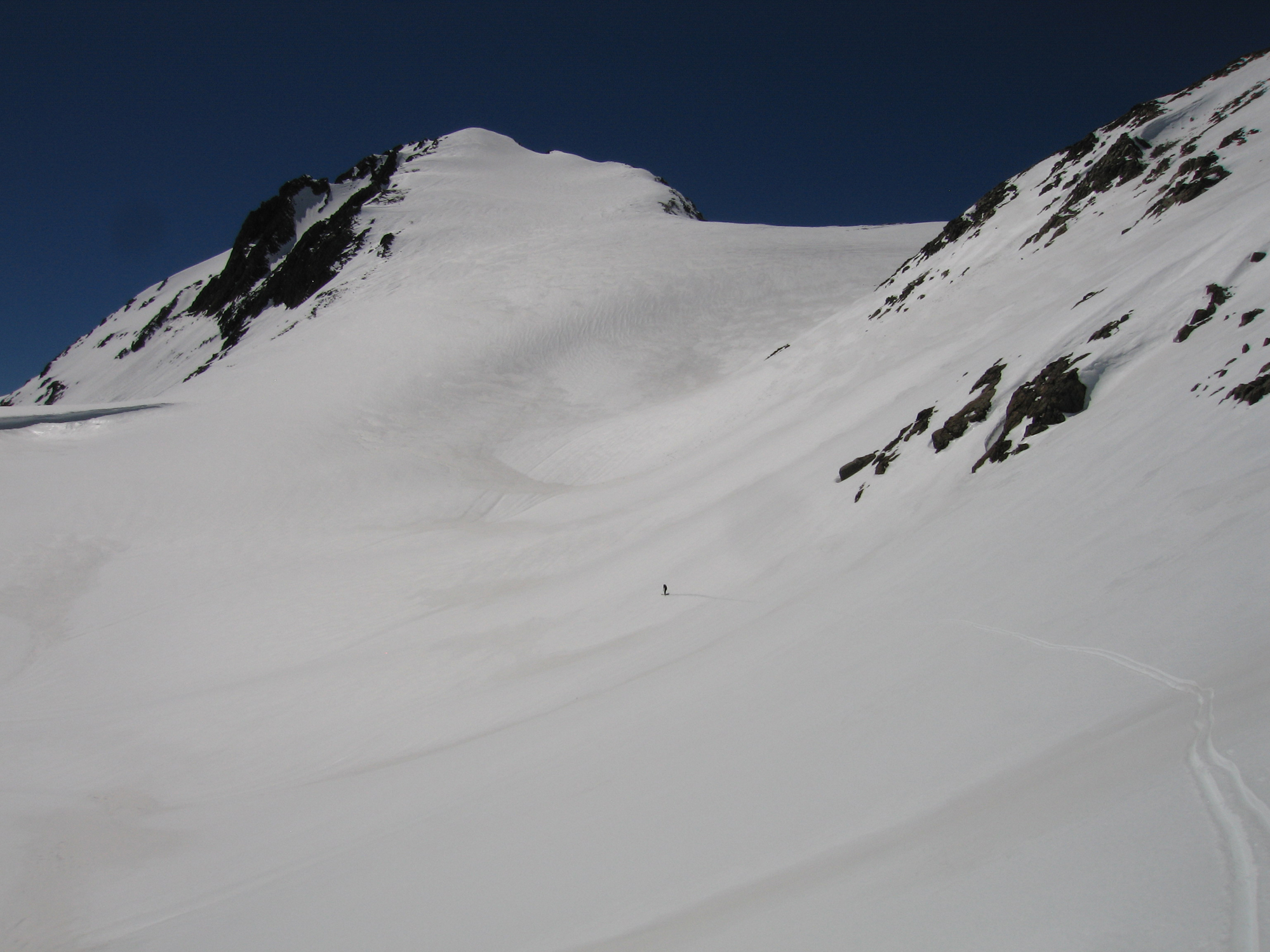
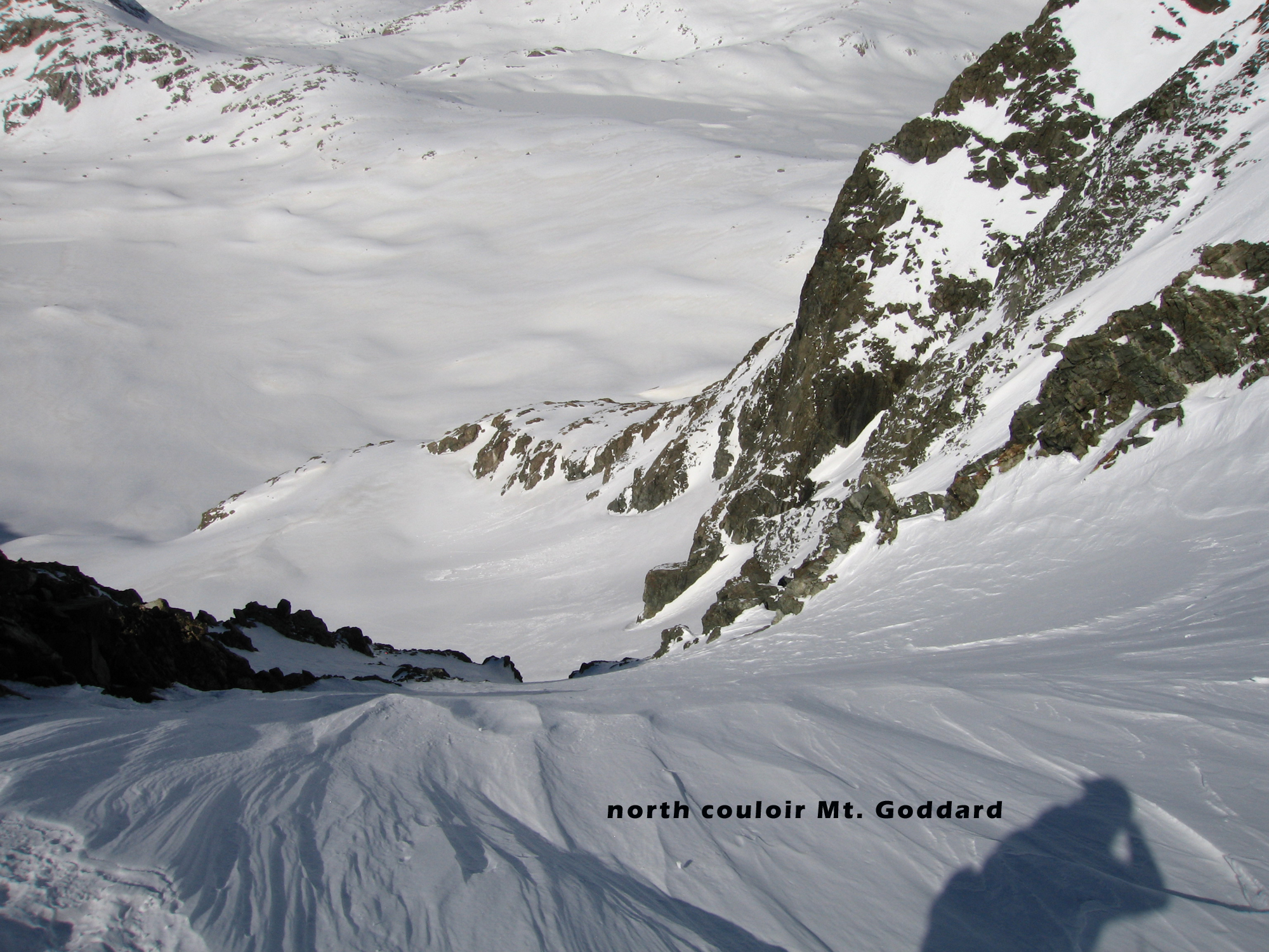
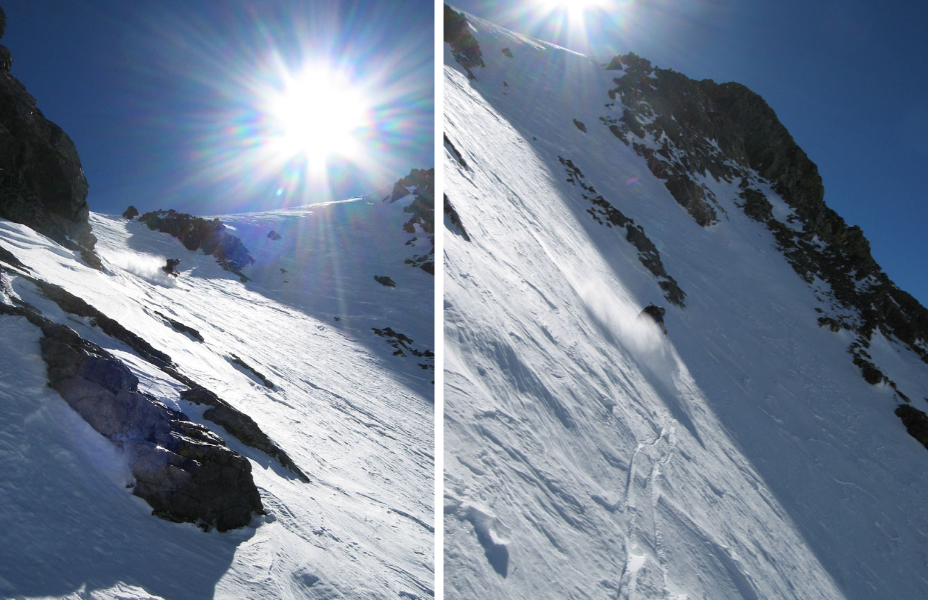
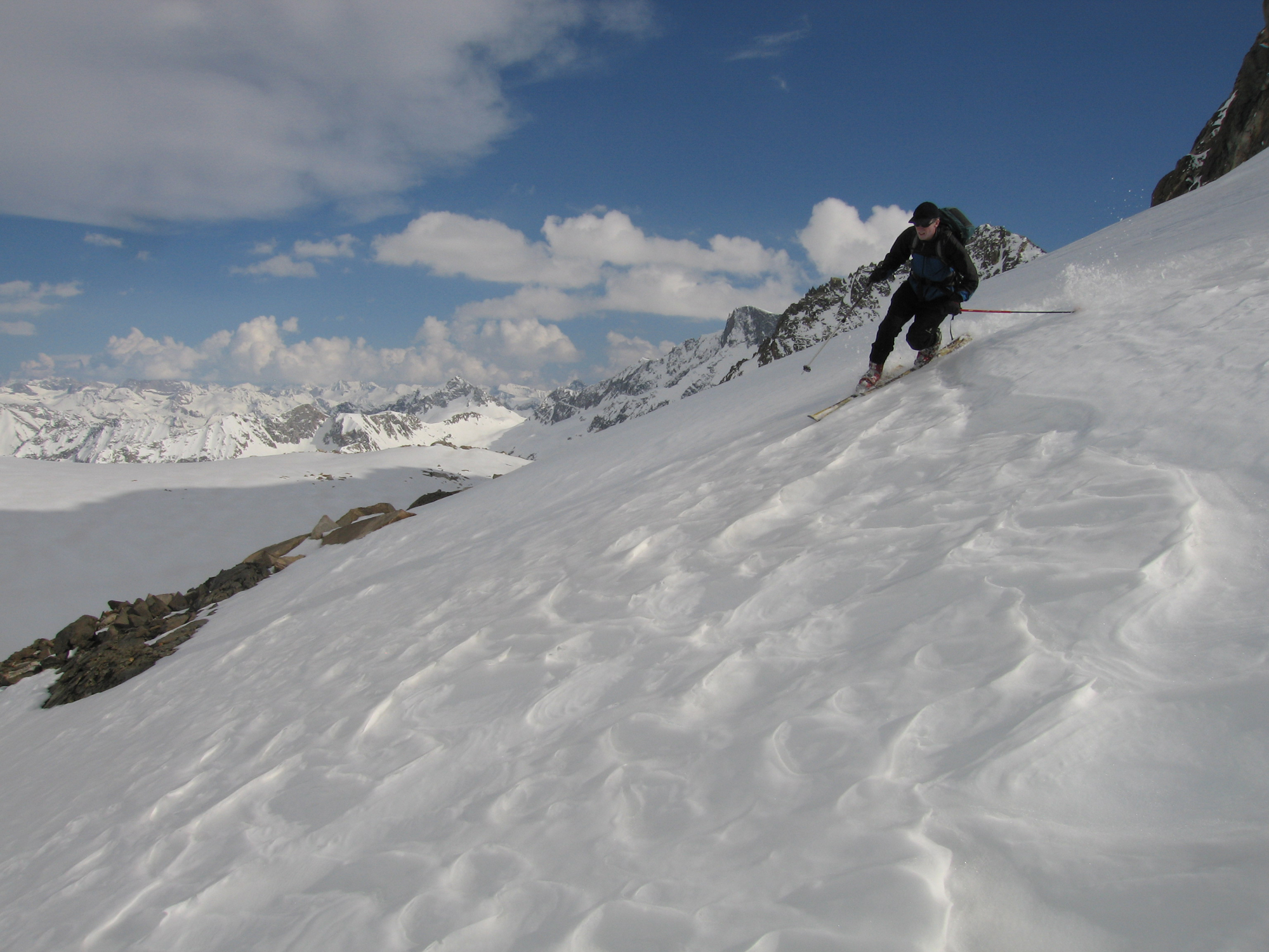
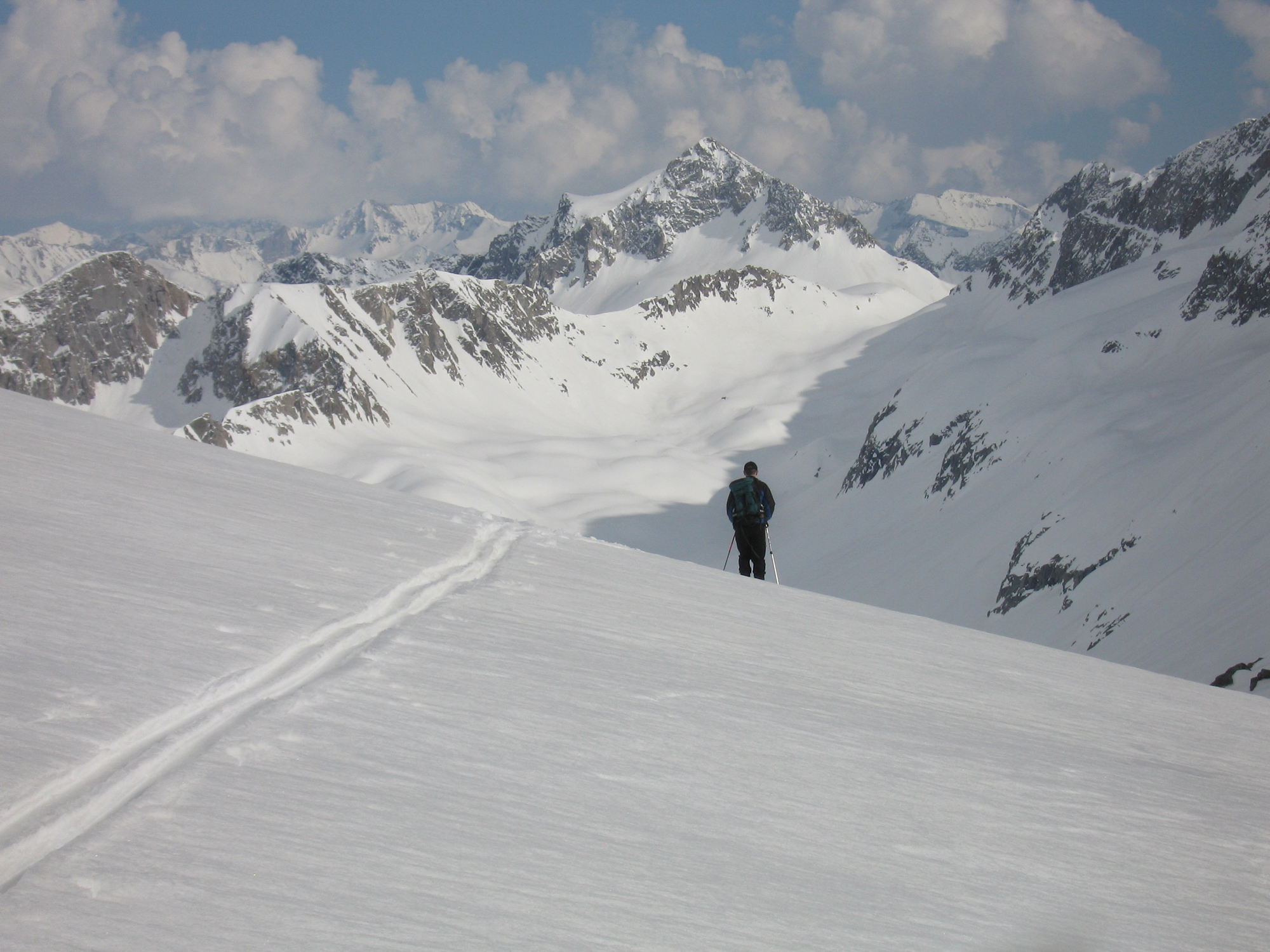
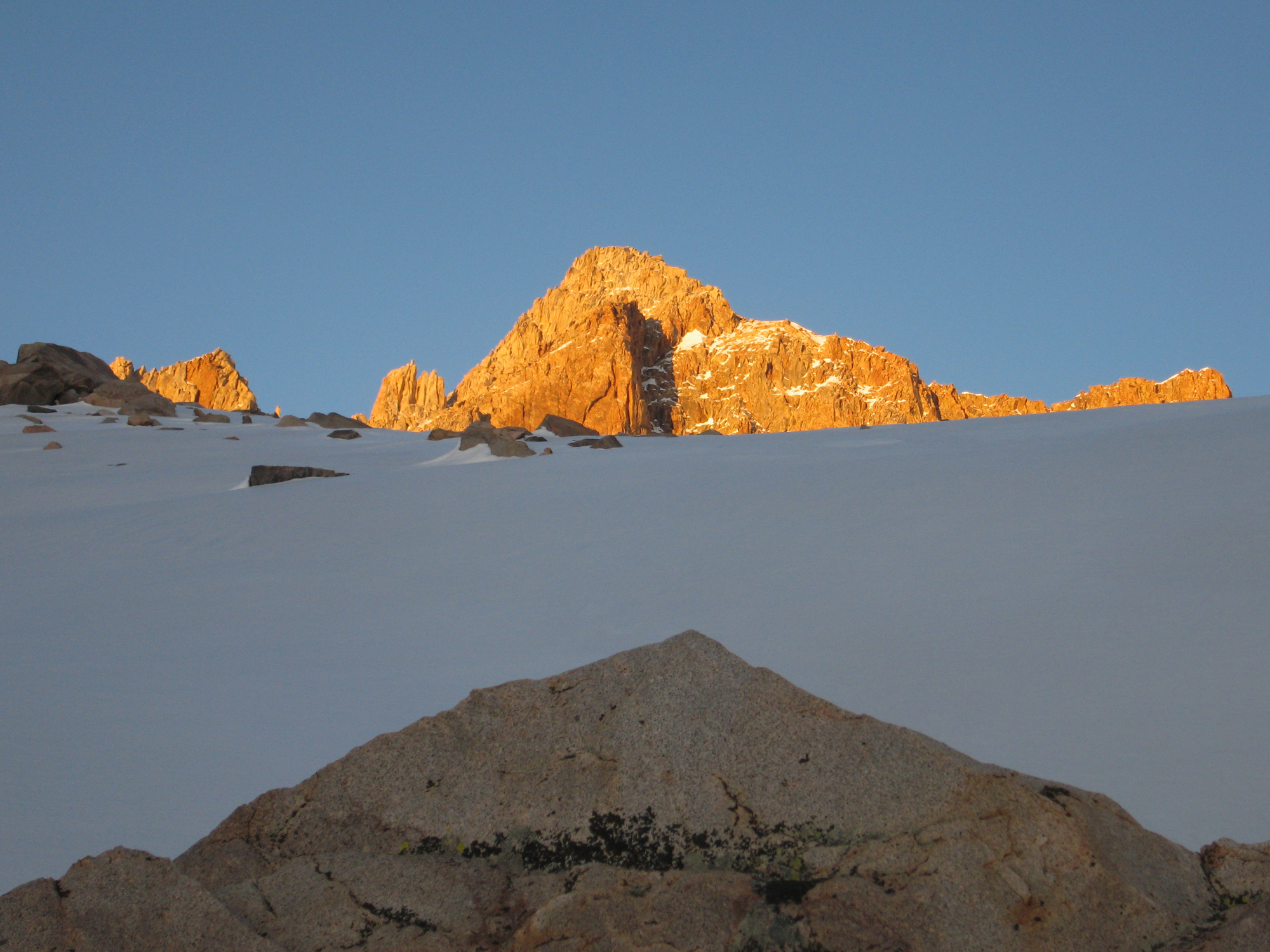
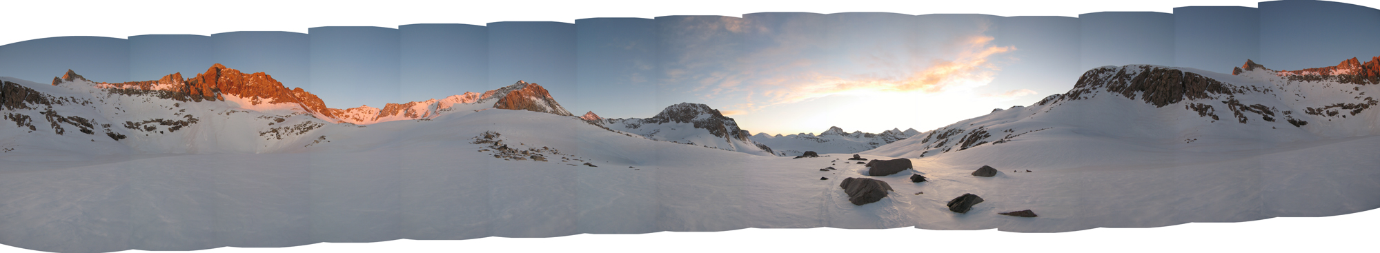
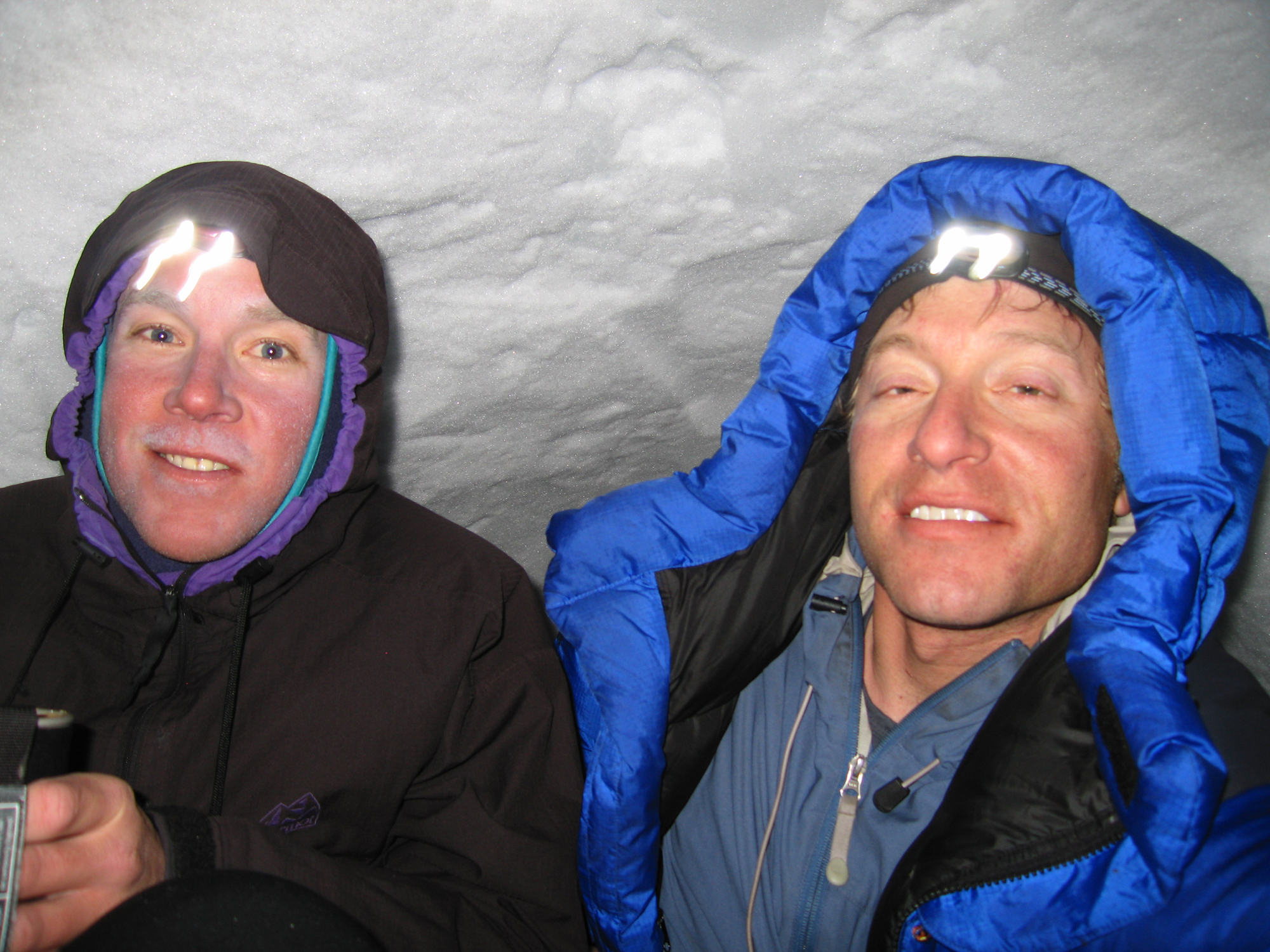
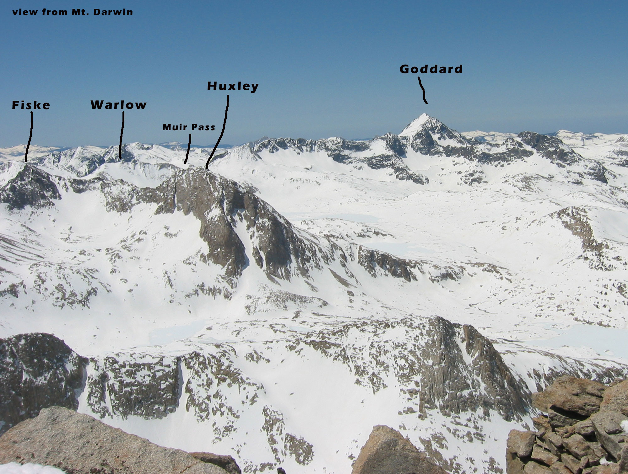
Eric had heard of Mt. Haeckel Col from someone as an alternative to the popular Echo Col crossing. It was just behind Mt. Wallace at the Sierra Crest. The col was easy to find and ski down its 35° SW slopes in some afternoon slop. But first I skinned up to Mt. Wallace and enjoyed maybe 800’ of old shallow powder on the NE side, before dropping over Haeckel Col. After crossing the Sierra Crest here, we dropped to the base of the north side of Mt. Fiske and Mt. Huxley and dropped our camp gear. After lunch we set out on skins in search for a way to the top of Mt. Fiske, the stunning looking mountain staring us in the face from Haeckel col. We circled around west and then skinned to the summit on the south side in the afternoon heat, carefully examining our slope angles and ski pole basket penetration to minimize wet slide danger. Really it was starting to re-freeze and maybe 5pm I think. From the summit we slid down a bit and dropped some nice textured old powder on the steep little north glacier. We had set out just to check it out and get some exercise, but found ourselves enjoying a beautiful climb and ski descent! Mt. Fiske was worthy enough to just go home afterwards and call it a win in my book. When you are travelling above 11,000’ in the middle of the huge Sierra Nevada, the big peaks really only take a few hours to climb. I also love the stroll back to camp afterwards, knowing you are in no hurry to get to work or even a find your car. All you have to do is casually slog some low angle terrain, geek out with your camera as the peaks slowly turn golden at dusk, make some food and crawl into the sleeping bag. After skiing Mt. Fiske on this second day of our tour, we watched the sunset and setup the Beta mid tent in zero wind. Well that was a waste of time trying to fortify that silly thing. We got pummeled by a windstorm just at dark and hopped out to shovel a snow cave just before dark. I lost my hat and a ski pole upper in the dig. Real sleep is what we needed, and snow caves deliver that. In the morning we left the cave about 8am, skiing 16 miles round trip to the summit of Mt. Goddard and returning to the snow cave in maybe an 8-hour day. I believe a slightly easier path to Mt. Goddard would be over Echo Col in both directions. Plan your own route, just go do it! Mt. Goddard has a moderate southeast side to slay the corn, and a wide enough 40° entrance into its 1000’ north couloir that had no cornice.
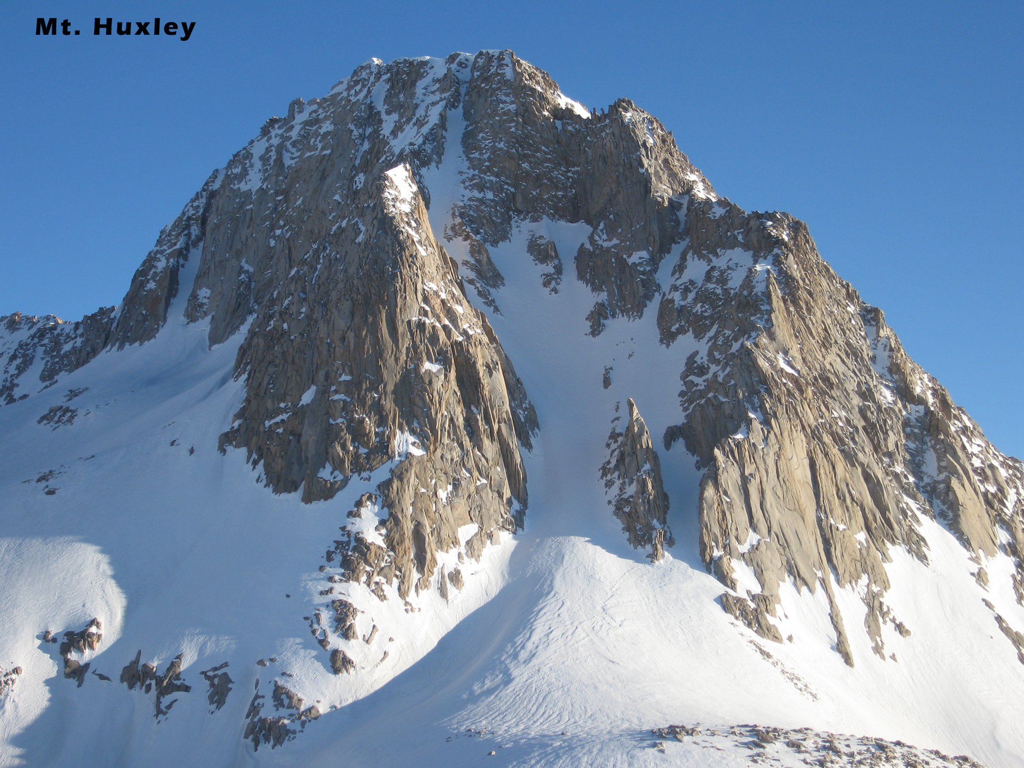
Ok, so now it’s our 3rd day and we are out to go find Mt. Goddard. We skinned low angle terrain for a few hours, wrapping around the north and then west side of Mt. Huxley. Goddard’s north side comes into view and you know you’re going to ski it for sure. Oh, and Eric came back SOLO the next week to ski a steep, sketchy looking, zig-zag north couloir from the summit of Mt. Huxley, re-using our snow cave! That’s on tele skis at 80mm wide!
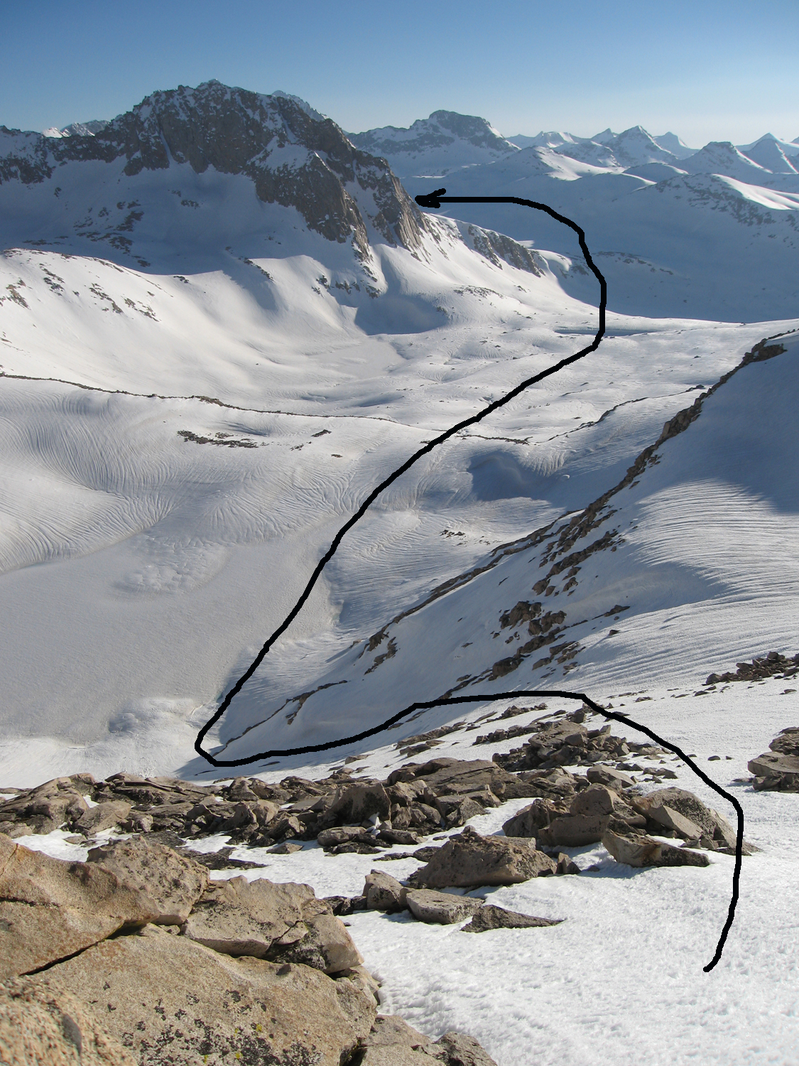
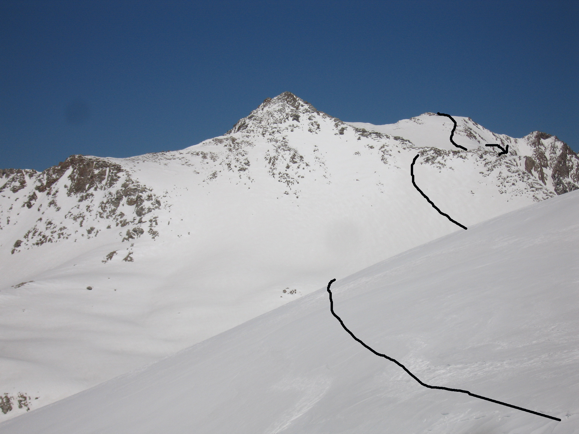
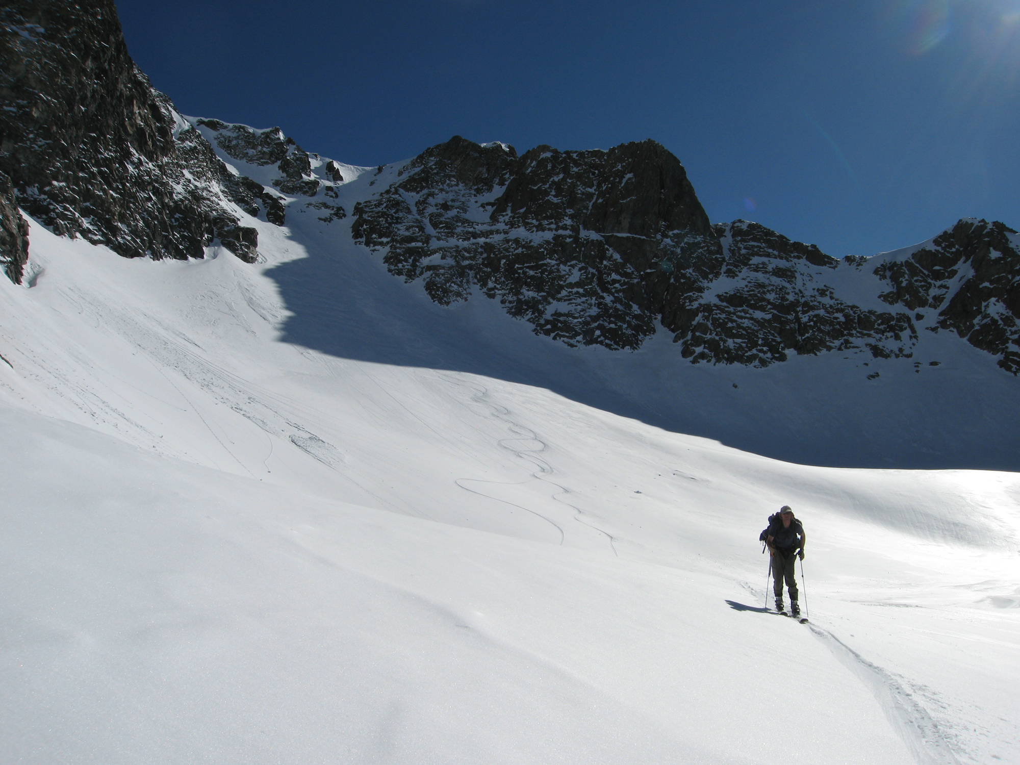
Rather than climb the north couloir of Goddard, Eric had the idea to cross over the peak’s long east ridge at Wanda Pass. This is right next to little Mt. Solomons, which looked really fun to ski with a north or south aspect to choose from. After skinning up and over little Wanda Pass, we bent to the west and skinned/booted up perfect corn snow on the east side of Mt. Goddard, never getting on slopes past 35°. We could have returned that way, but a quick look down the north couloir and it was all we needed to see that we could get into it fairly easily. The snow was annoying windboard in the couloir, but this side of the mountain was just so inspiring to look at all morning during the approach. The snow got better in the apron and we coasted to a spot in the valley to lie down and chill out for the first time in 48 hours. We pulled out our stove and some freeze-dried meals for the first real food all day. We lounged above the buried John Muir Trail 5-10’ below on a sunny windless afternoon, and then leisurely skinned back around Mt. Huxley to our snow cave. I never found my half ski pole or sun hat. The next morning I duct taped my ice axe to the lower ski pole shaft and made a sun hat from the corner of a plastic garbage bag! All good!
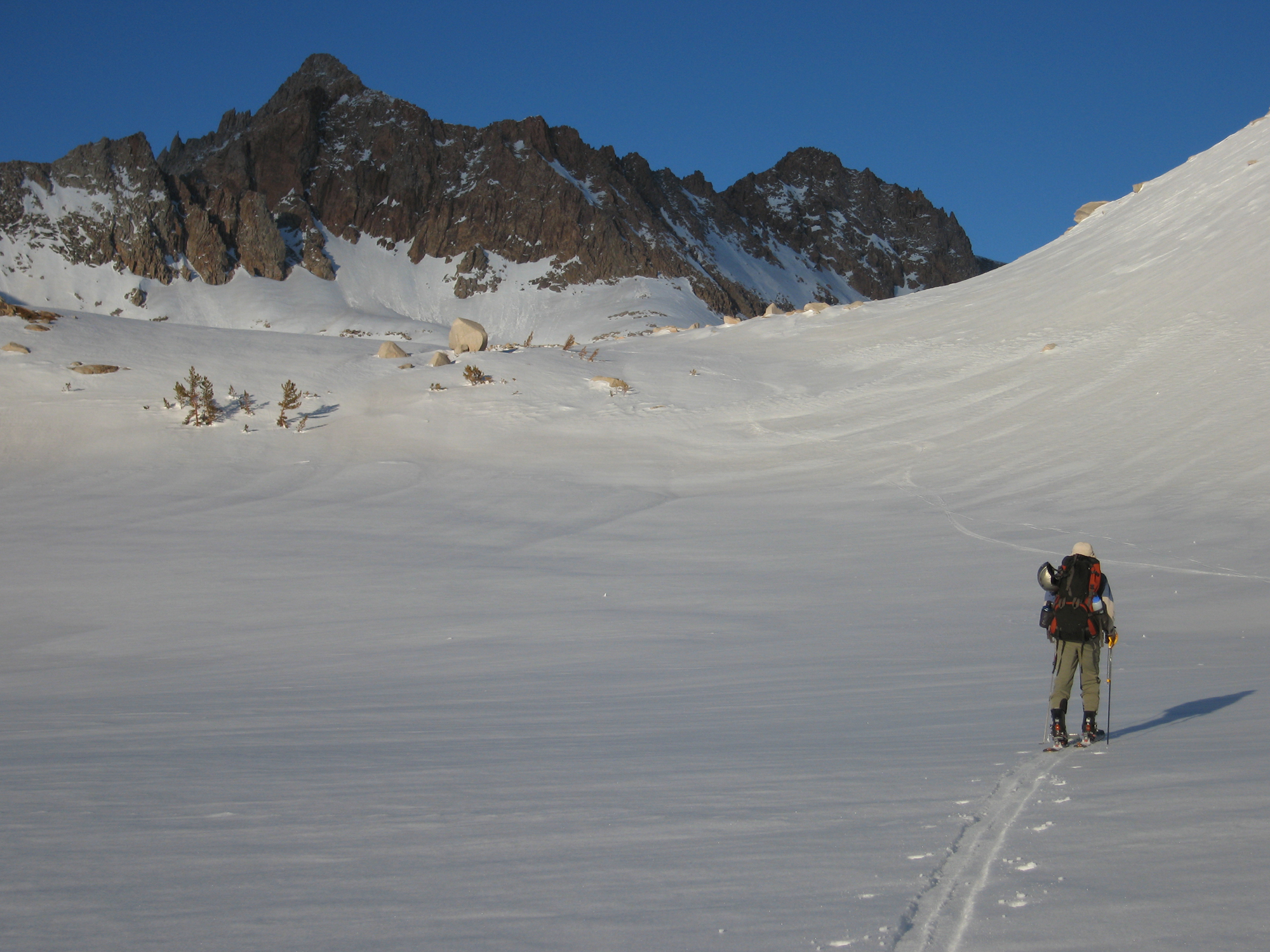
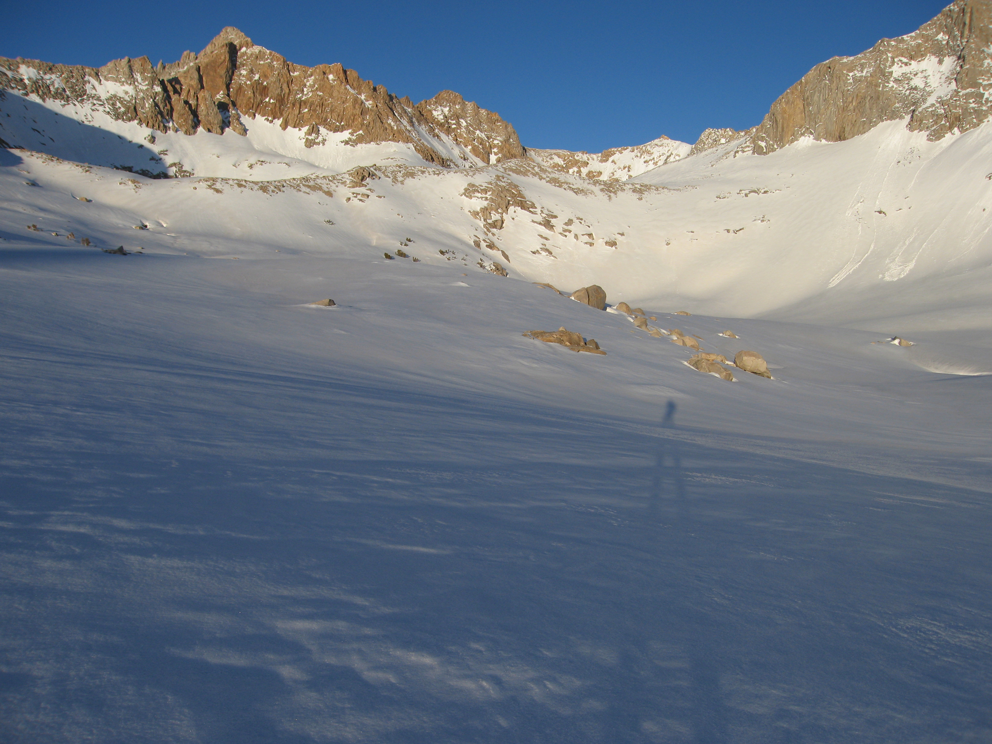
We also checked out the Muir Hut the next day en route to ski Black Giant. That was a fairly easy skin up its west slope, and we found killer hidden couloir to ski down its south side. That evening we moved camp up close to Echo Col, and crossed from west to east in the morning on that final 5th day. From the top of Echo Col I immediately knew I wanted to go up Mt. Powell and ski its S-shaped north couloir from the top. That worked out great and we glided out to Lake Sabrina by afternoon. From there we walked down HWY 168 on asphalt for an hour or so in ski boots with heavy packs to our car at Aspendale. Trail shoes would have been a good idea to stash at each end. If you wait for the Lake Sabrina access gate to open for fishing season, there may not be enough snow to enjoy the travel westward into your high sierra ski tour. I ski from the little town of Aspendale up here in most years and see cars lined up at the gate closure. These skiers are crossing the Sierra Crest in a week with their guides. Same strategy I assume as us; if you’re going on a multi-day dream ski tour like this, try to go when the snow depth is at its deepest!
Mt. Goddard

Looking for awesome ski and splitboard tours in the Sierras? We’ve got write ups on many common and uncommon tours curated by the owner of the BackCountry, Mike Schwartz.


