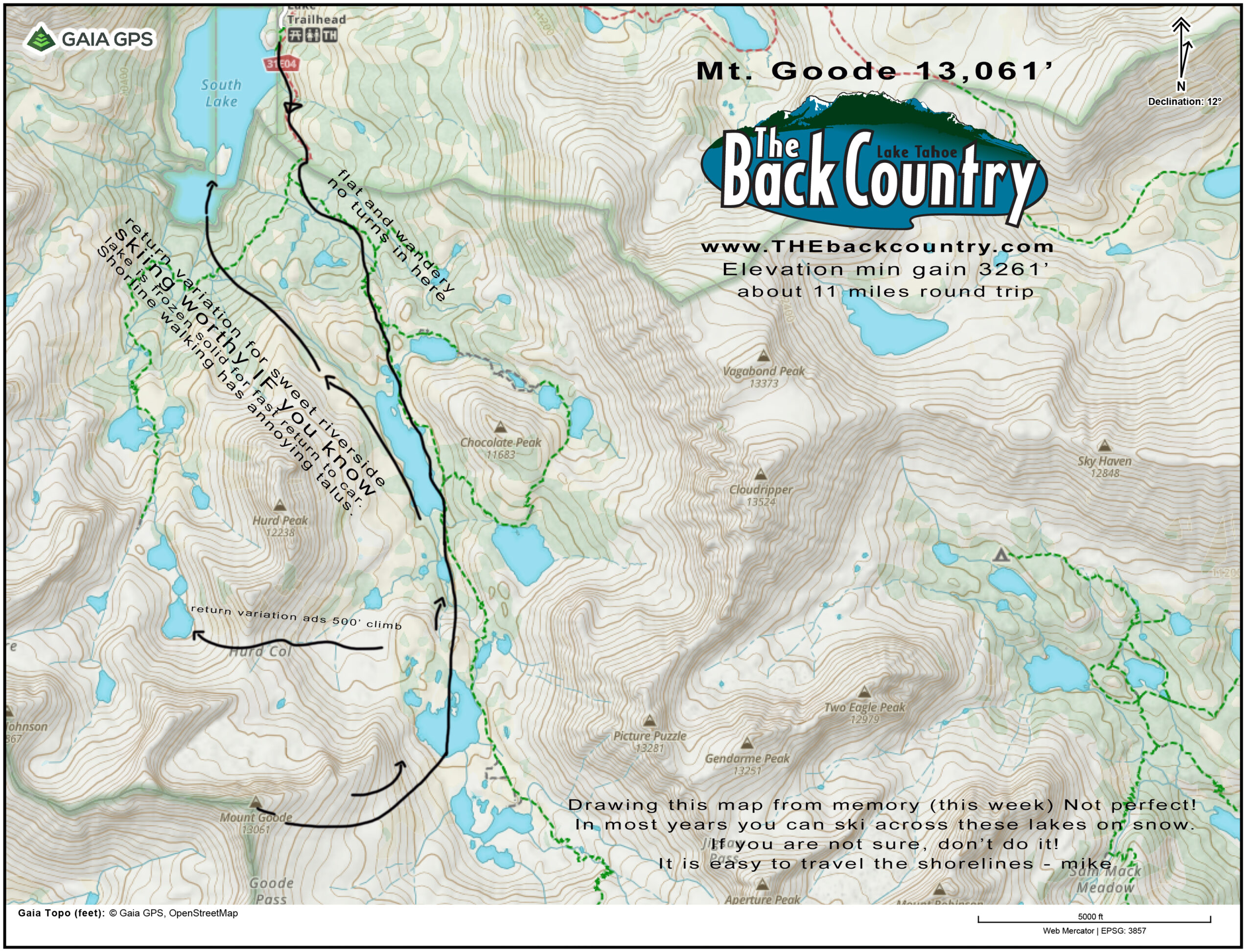
Location: South Lake above Bishop, CA
Elevation: 13,085′
Elevation Change: 3,317′
Recommended Map: Bishop Pass – Tom Harrison
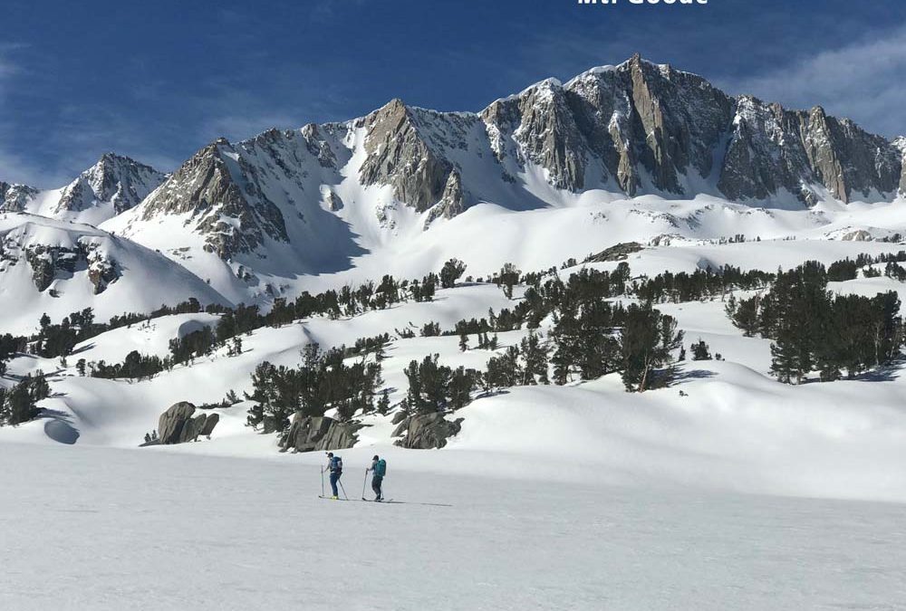
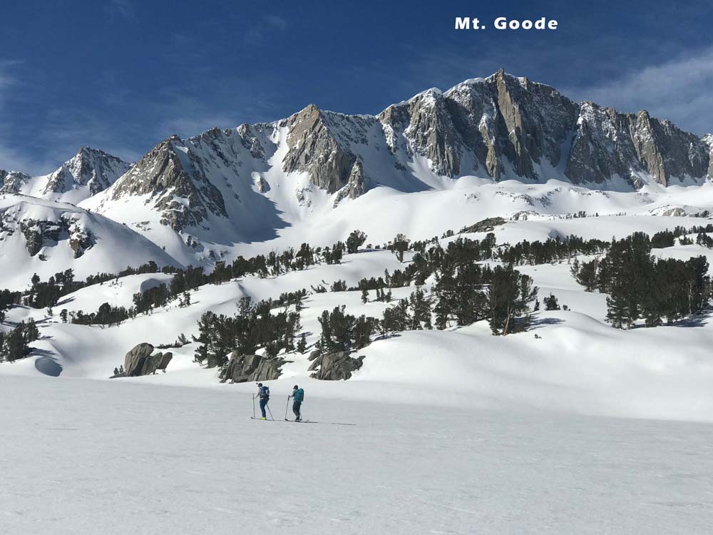
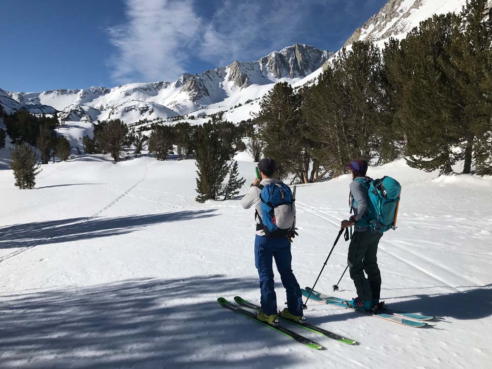
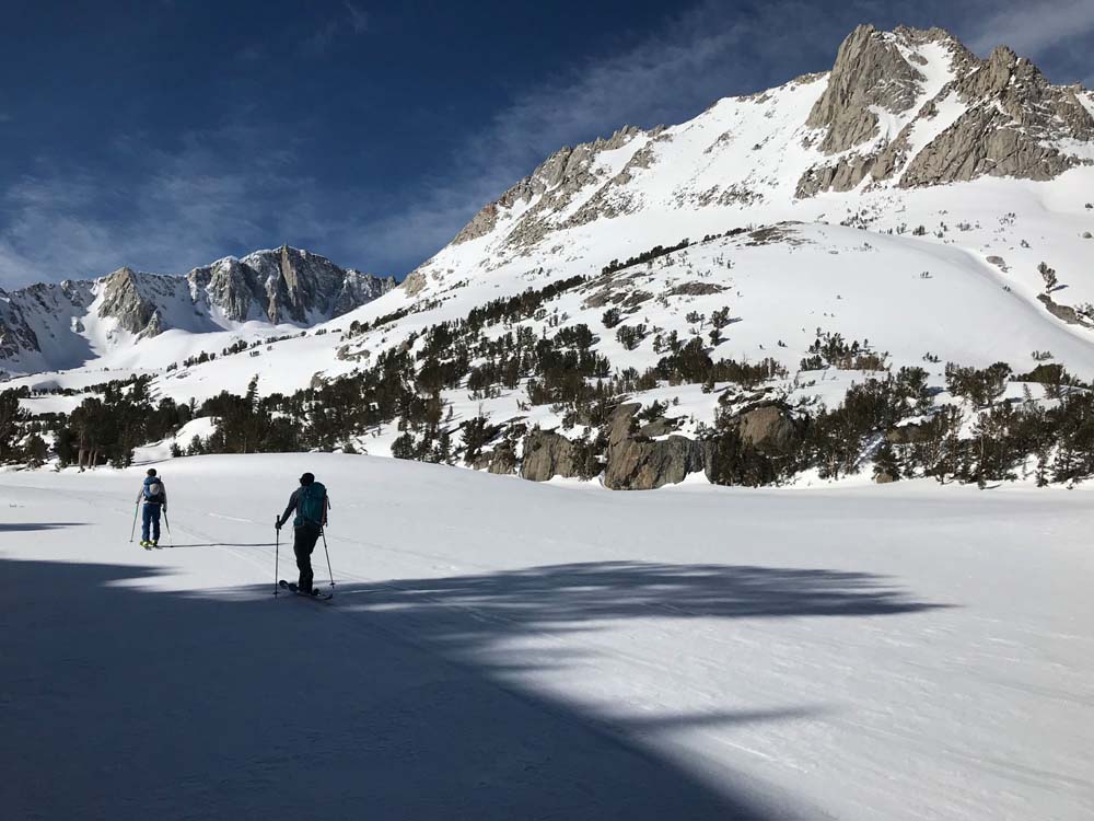
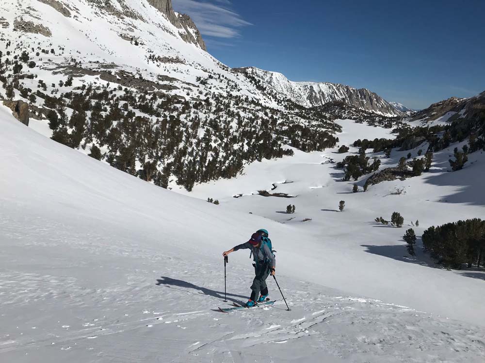
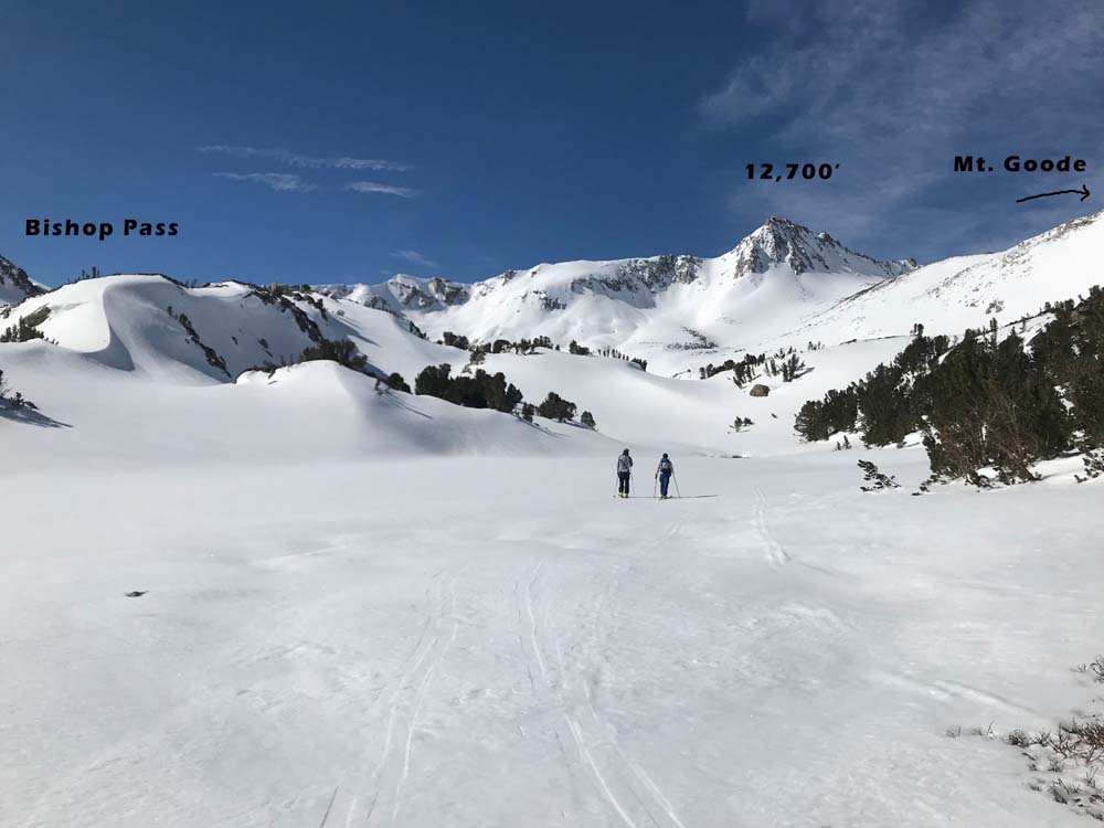
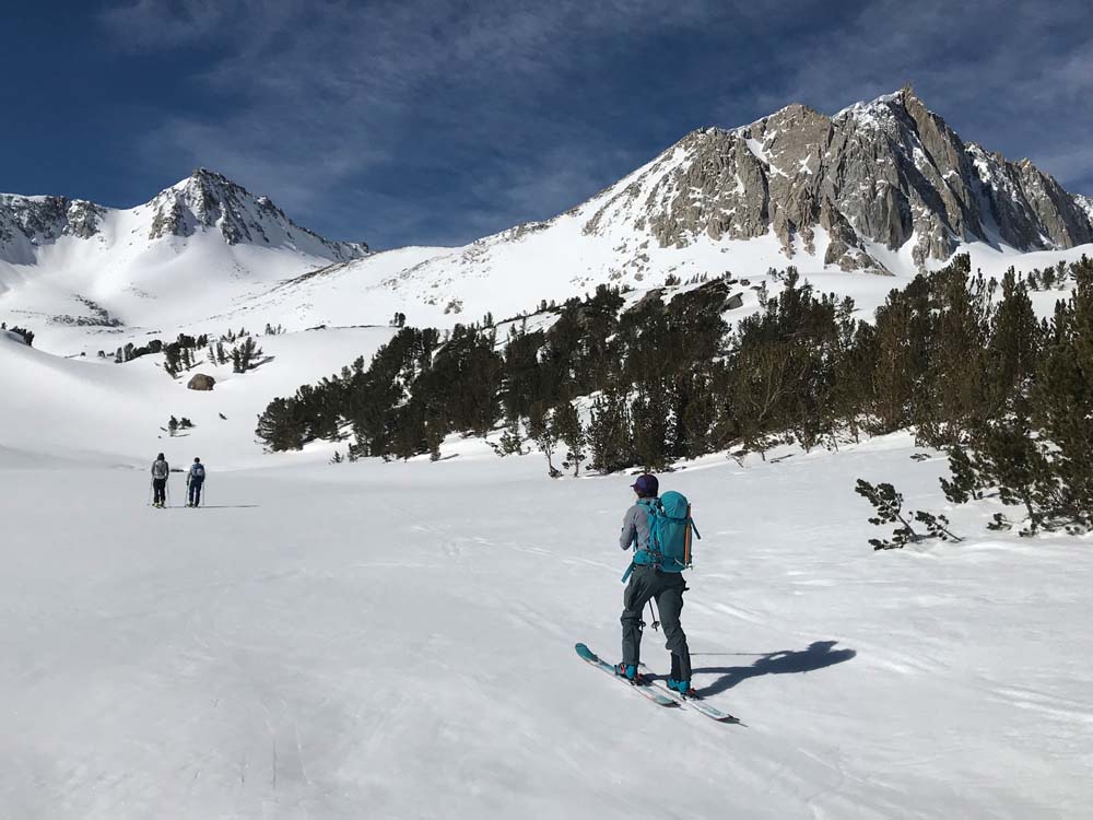
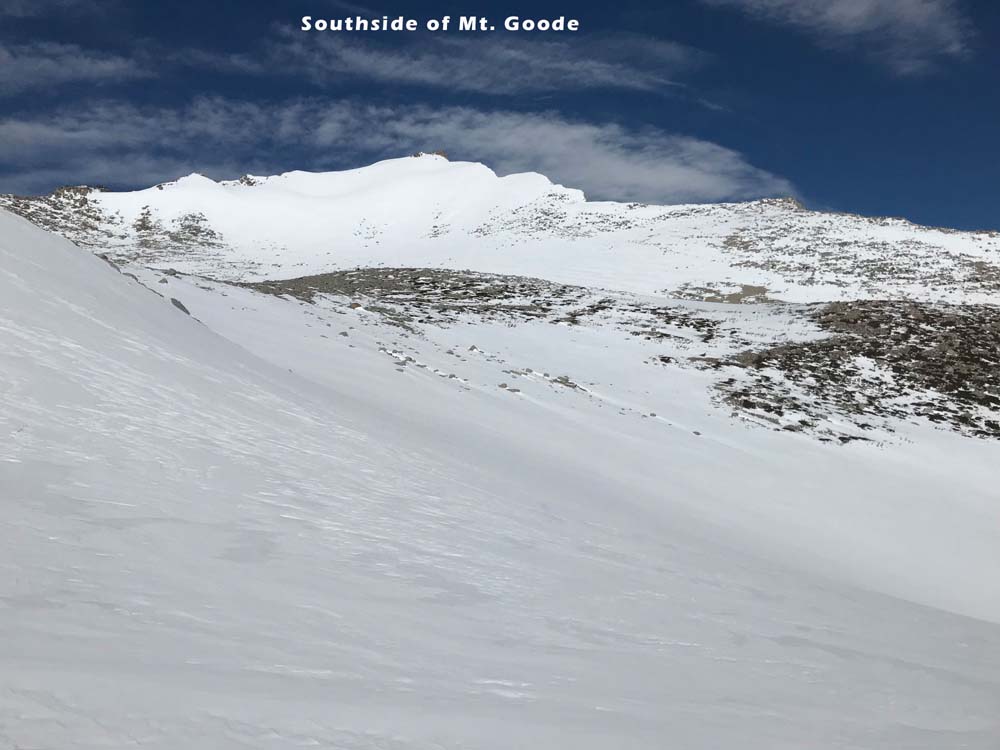
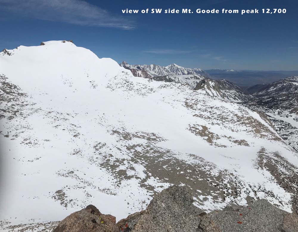
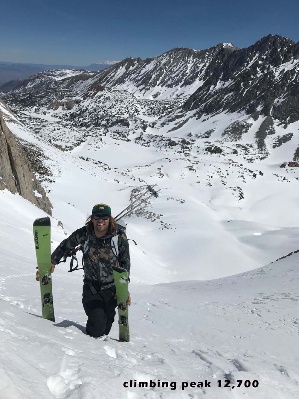
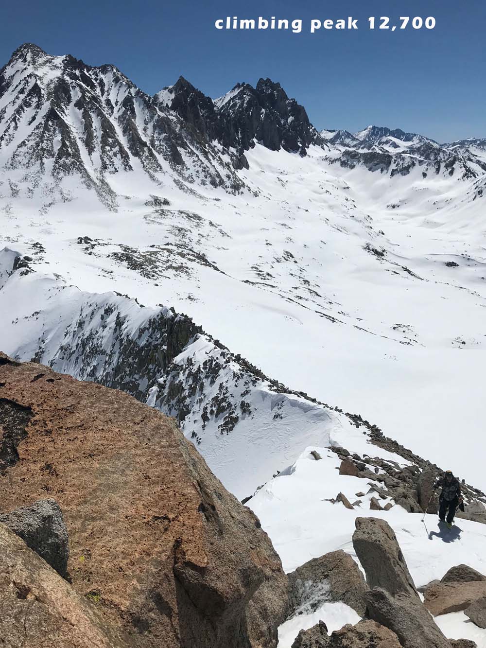
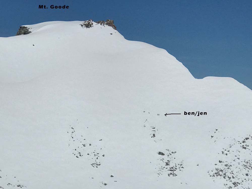
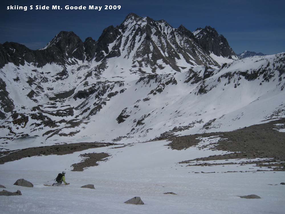
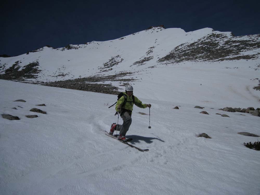
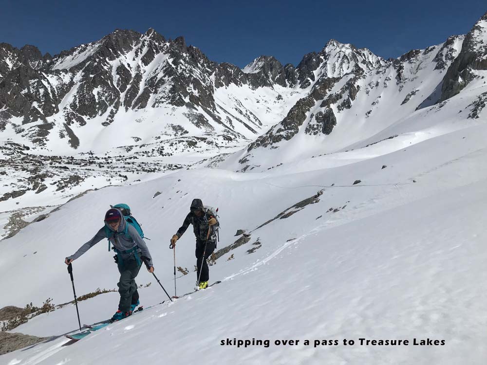
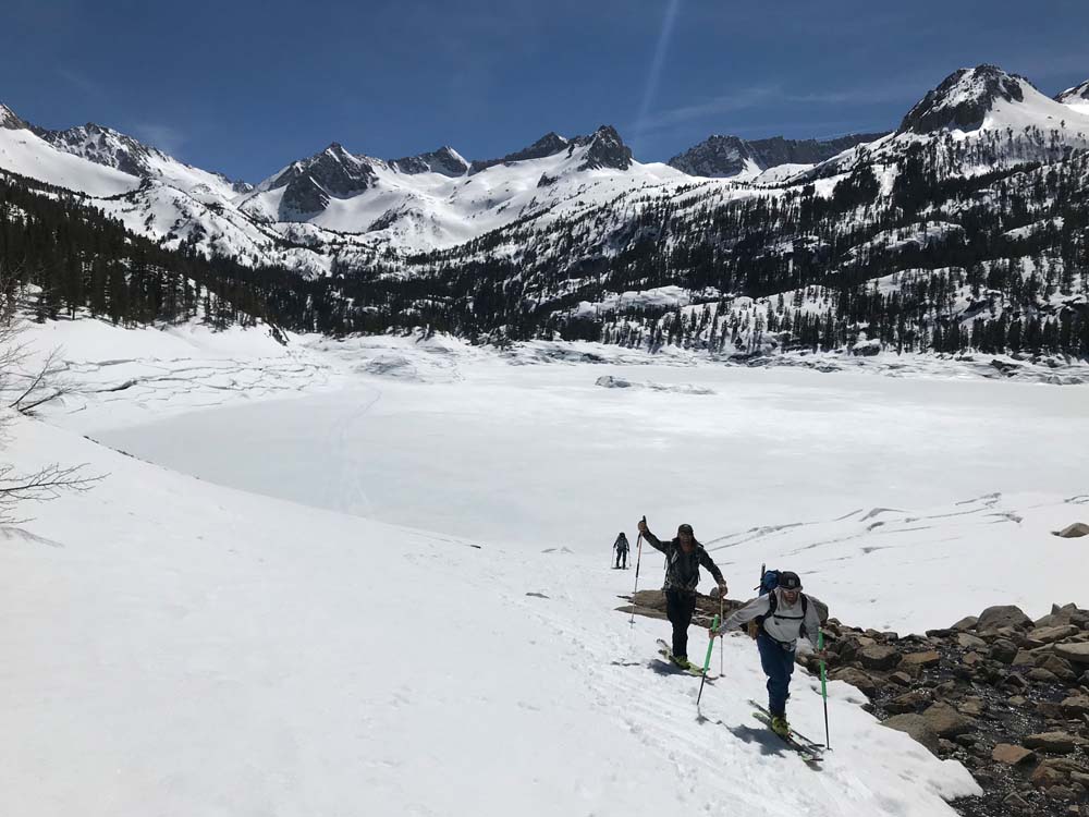
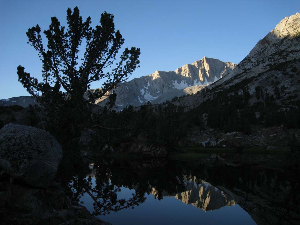
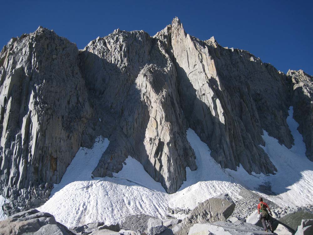
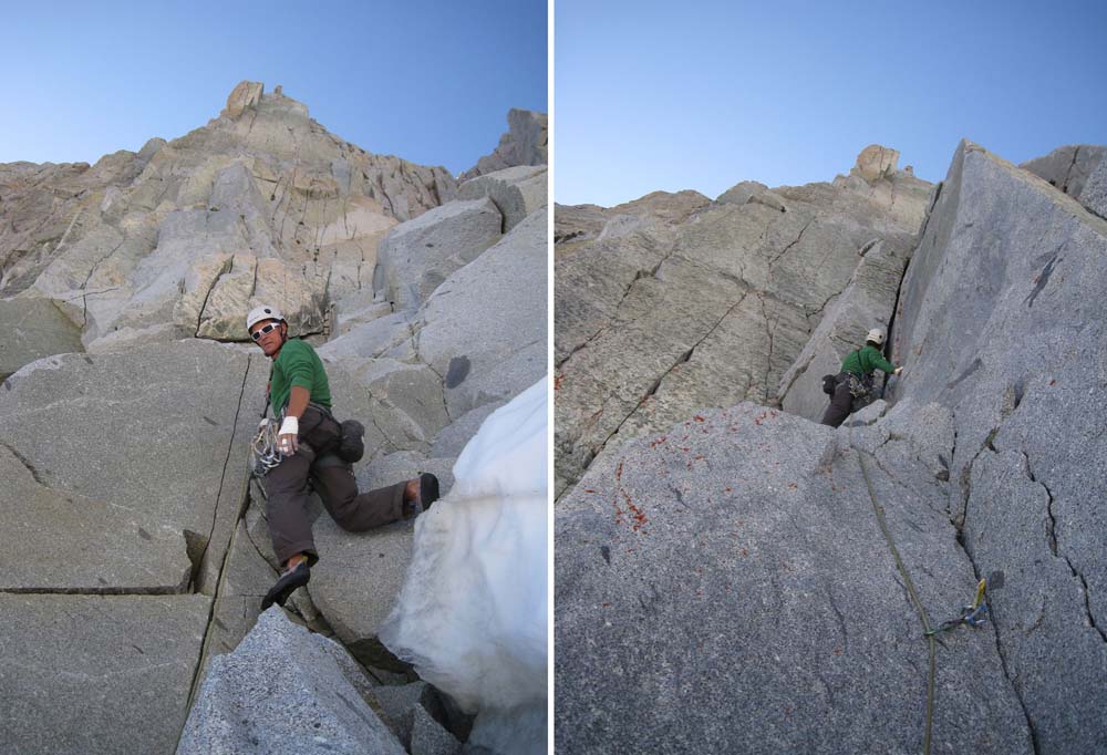
The view of Mt. Goode from Long Lake is one you’ll never forget, and quite easy to reach from your car. What you don’t see is the HUGE south face that allows a great ski descent from the summit and an amazing view. This peak doesn’t see many skiers due to a few extra flat miles you’ll have to push or skin on the return. Plus you don’t see it from anywhere, and the focus is usually Gilbert and Thompson in this area. Most of these pics are from April 23, 2019. This has been a big winter and the South Lake Trailhead Parking lot had not been plowed yet. The county gets the road plowed to within 1.7 miles a few weeks before the actual trailhead opens however. On this particular day 2 in our group skied great corn off the south side of Mt. Goode, while Seth and I skied the un named 12,700′ peak behind it. We all skinned up and over a pass on return into the Treasure Lakes Basin, which got us some more fun turns. I recommend this if you have the gas, as otherwise you’re done making turns when you glide back to the west end of Long Lake. Kicker skins would speed up the few flat miles as another option. Our little pass was easy to spot on the map and a nice 30 degree angle on the north side to ski back through Treasure Lake and eventually to the west end of South Lake.
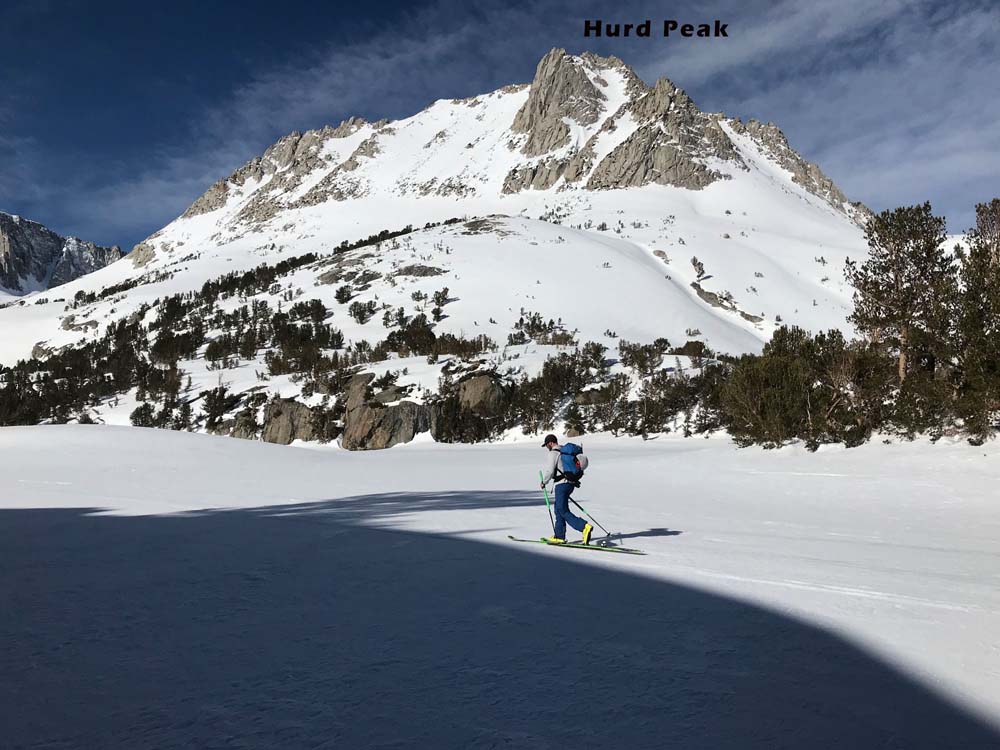
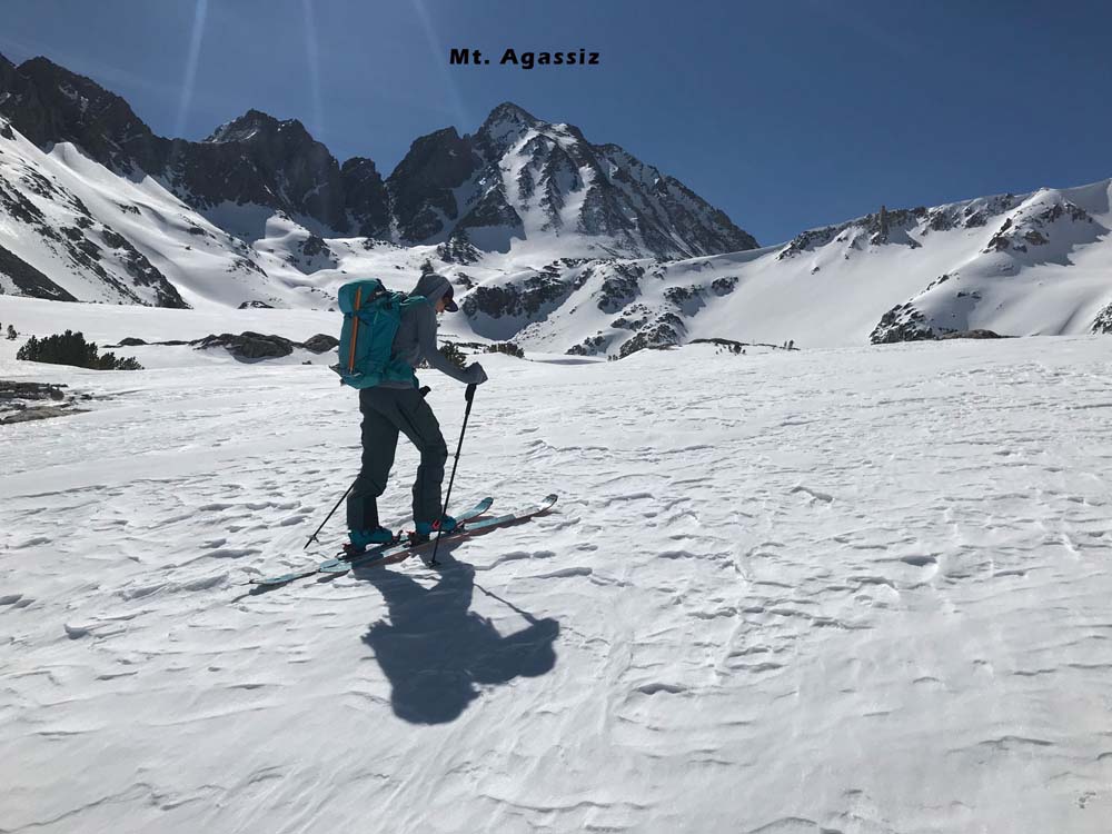
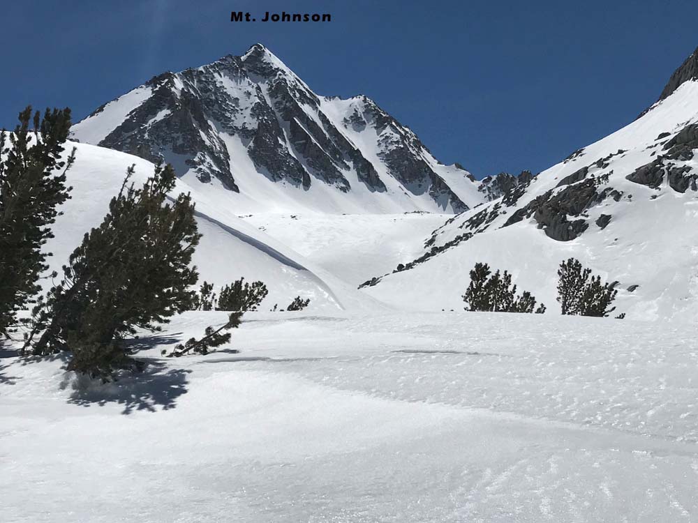
I haven’t seen any other skiable lines on Mt. Goode. The neighboring peaks are really beautiful ski tours and can be combined in a long day. The major peaks are Mt. Agassiz, Hurd Peak, Mt. Gilbert and Mt. Thompson. These are all fairly high at around 13k, but you started at just under 10k! Starting high is pretty sweet…..For a two peak day, try skiing peak 12,700′ and Mt. Goode together. Or Mt. Goode and Mt. Johnson on the way back. Or Hurd Peak on the way to Mt. Goode.
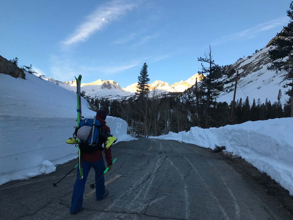
No overnight parking signs are posted in the South Lake parking lot, but no one has ever bothered me sleeping there. There are bathrooms and a sweet view of the other peaks right there. The parking lot doesn’t get much use until summertime. The trailhead parking lot officially opens May 1 or fishing season. I have skied great smooth corn snow as late as early June from the South Lake Parking lot. And if you go in March and have to start back near the Parchers Resort 2-3 miles back, it’s still worth it in my opinion.
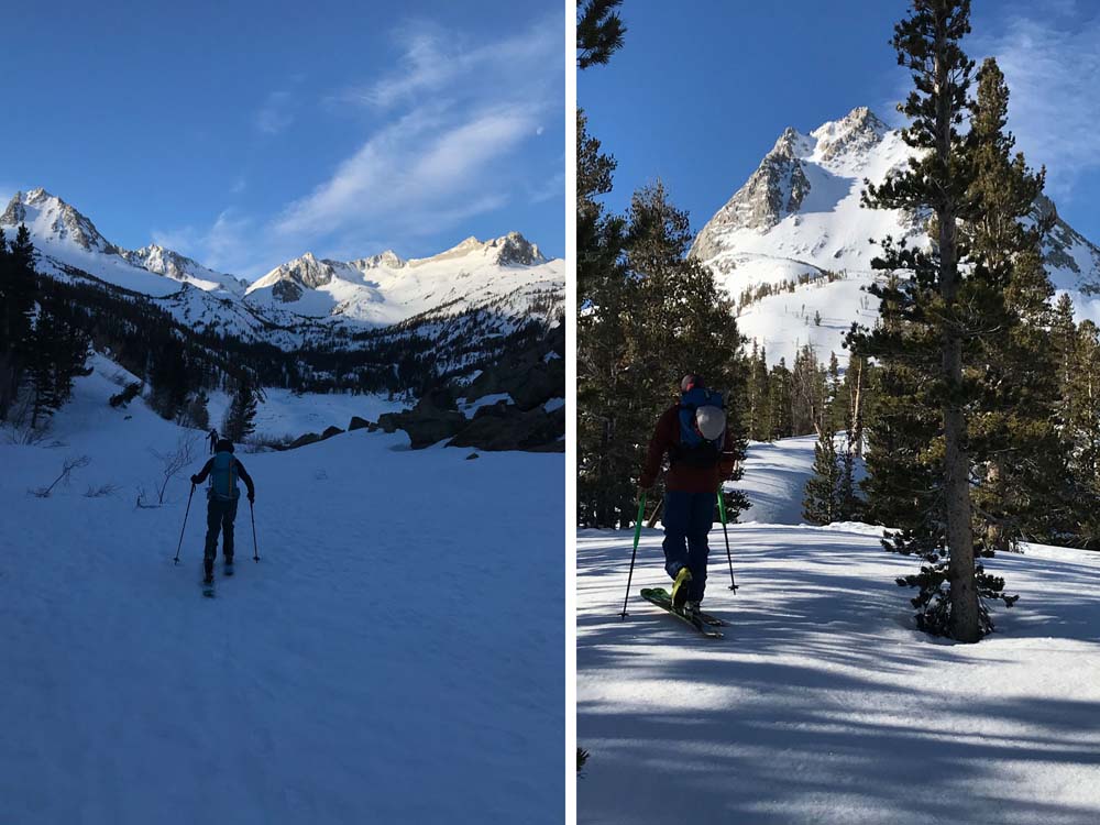
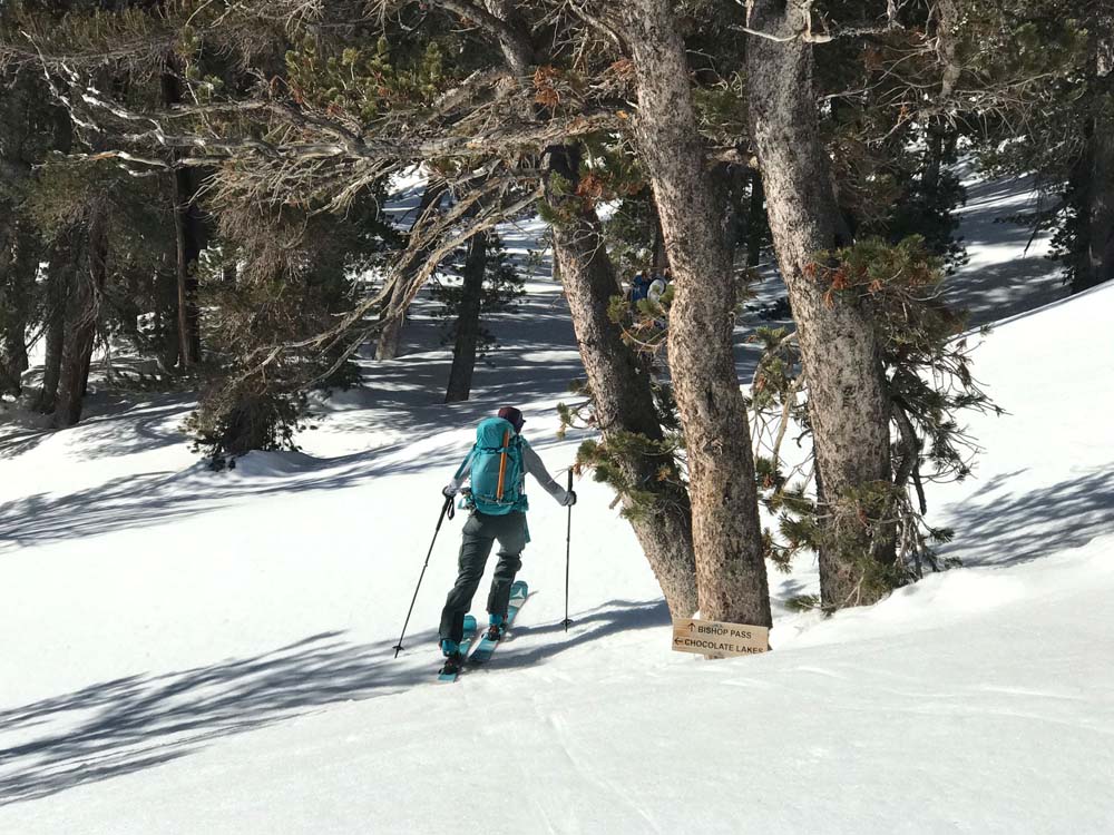
Beta add after a 3/29/26 ski tour to Mt. Goode in very low snow. South Lake was not frozen, I skinned up the summer trail route and found consistent snow in the forest. However, walking around the south side of South Lake isn’t too annoying, there is just one small talus area near the car. If you go around the south side of South Lake and follow a major drainage up to the east end of Long Lake, you are going to bypass some wandery summer trail terrain. I recommend this in either direction and I drew it in my map with the note “sweet riverside skiing”. it’s not a river, but more of a nice steep creek that joins the two major lakes. Or just follow the summer trail on your phone app for a very efficient route that avoids getting around the South Lake Talus. Why go flat for 20 minutes anyway when you can start going up right from the car? Both routes to Long Lake are cool. Try them both in the same day.

Looking for awesome ski and splitboard tours in the Sierras? We’ve got write ups on many common and uncommon tours curated by the owner of the BackCountry, Mike Schwartz.


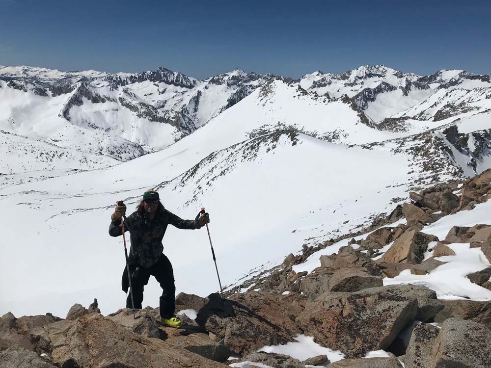
I really enjoyed a solo tour out to Mt. Goode in low snow and firm spring conditions on 3/29/26. Actually I wasn’t alone, I knew 2 young LA dudes were super stoked on walking out there. One of them had some real snow experience but neither had ski touring gear. I told them go get some snowshoes in town, and they DID! They left at 3am or so? I told them I’ll catch them at the summit by leaving at 8am. I almost got there at the same time, and I’ll admit I don’t look a gift horse in the mouth; I got right in their boot track for the steep final headwall climb. it doesn’t look steep in these pictures, but in the funky snow we had, I was really proud of the friend who had zero experience doing this. The summit face was either failing to support us, or firm enough to need crampons. I hope them made it back alive, because I certainly didn’t walk back with them. I left them Backcountry nalgenes and T shirts in the bed of their truck. It was a beautiful bluebird day with a little sketchy lake skirting. I only crossed the final high elevation lake straight on. Long lake wasn’t frozen enough but I played with what I perceived to be shallow water. Afterall I had to catch them. I wasn’t sweating or anything, but I enjoyed how you can flow with your headphones and no one to discuss routes or really anything with. It’s a great exercise to go on a really big mountain rally by yourself once in awhile. You end up playing things a little safer, which is a good reminder of how to do that. And you reflect on all the good stuff in the world and your life. The hardest part of any mountain adventure is motivating to start it. Most of the time you don’t start it because you don’t have a partner. The motivation to start one alone isn’t necessarily easier, it’s just different and quite rewarding. Going out to Mt. Goode is pretty safe terrain and easy to navigate, especially now that I use Gaia on my phone to get through the forested parts. I can’t believe we were the only 3 people in the parking lot. South Lake Trailhead is the best ski touring trailhead I have ever been to.