
Location: Mt. Lassen National Park
Elevation Change: 2-4000′
Recomended Map: National Geographic – Lassen National Park
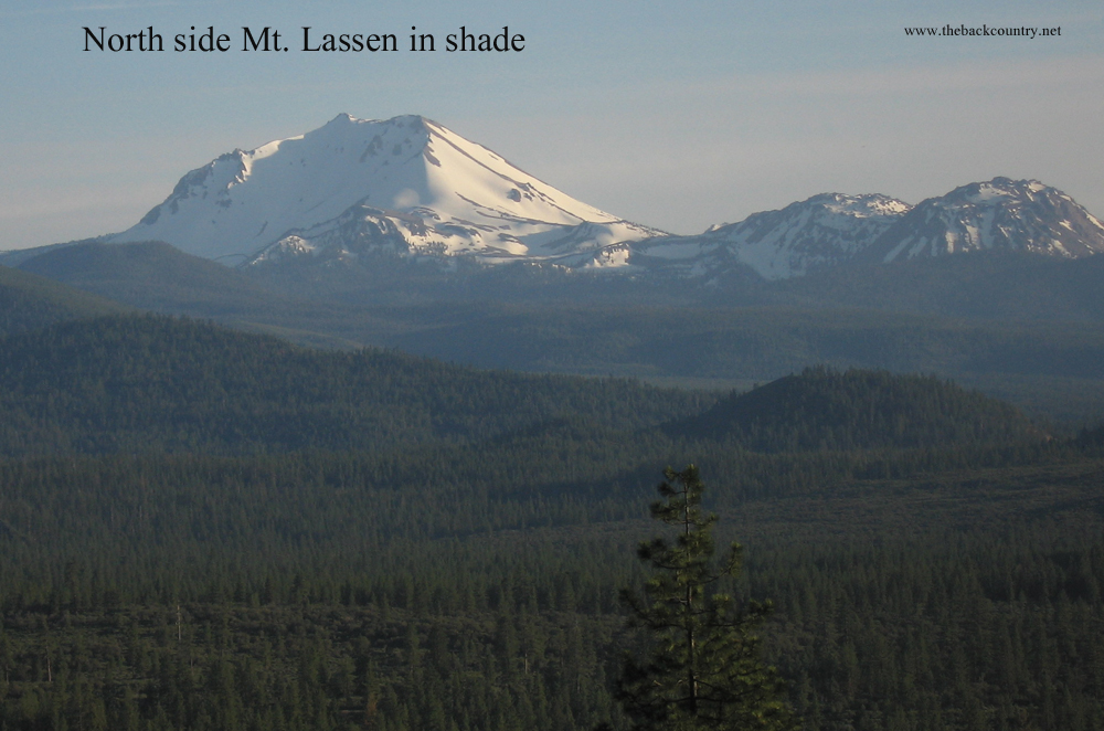
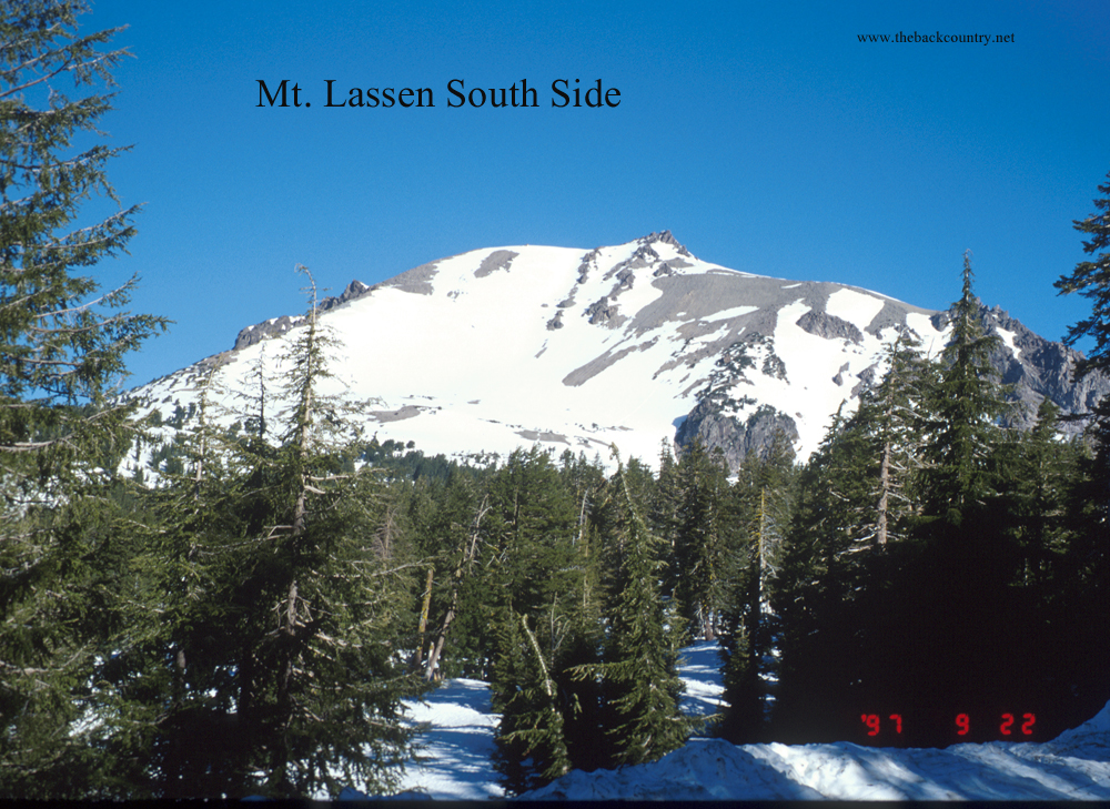
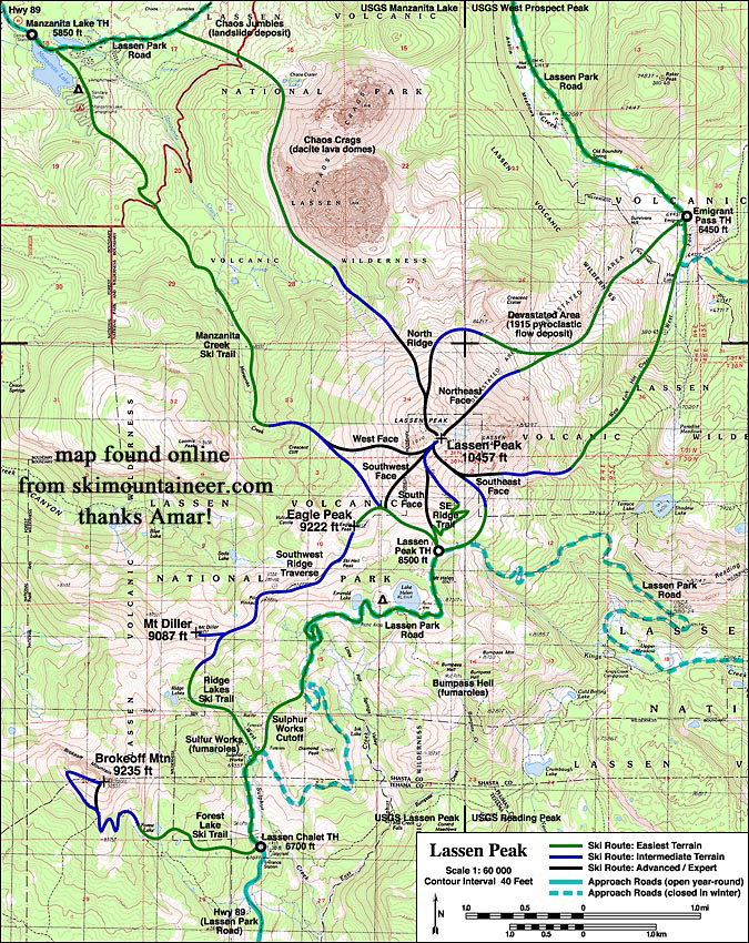
Mt. Lassen 10,457′ is a friendly Northern California peak to ski. There are small sub peaks surrounding it and a nice view to the north of Mt. Shasta on a clear day. You get the feeling of the chain of Cascade Volcanoes which starts with the one you’re standing on. Rent an RV and let’s go! Mt. Lassen gets a ton of snow which hands on through early summer. The crux is getting to the slopes before the sun cups are too deep. The National Park does not plow the road for skier access early enough. Call them and ask why not? Here is the strategy for each possible access point and the timing. In short, Highway CA-89 goes straight through the park and next to the peak, but don’t just look at a map and drive up there before understanding the following below. Also, check the Lassen Park website and social media for updates.
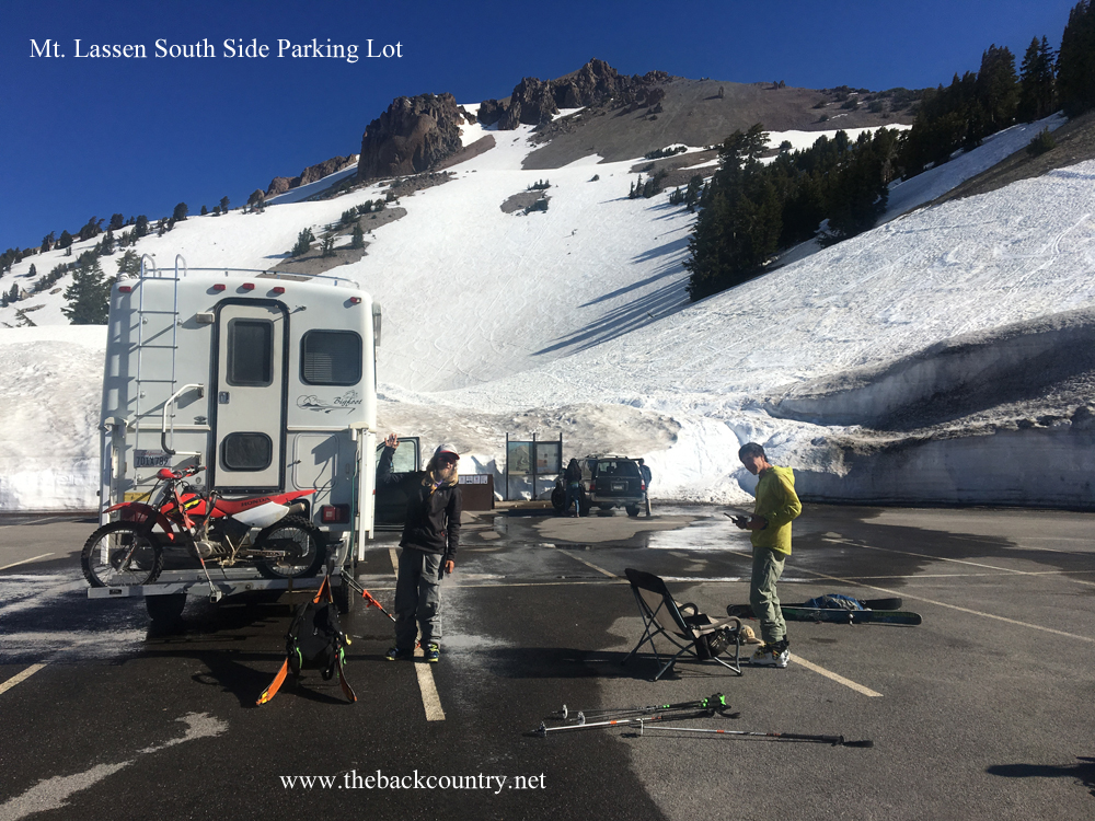
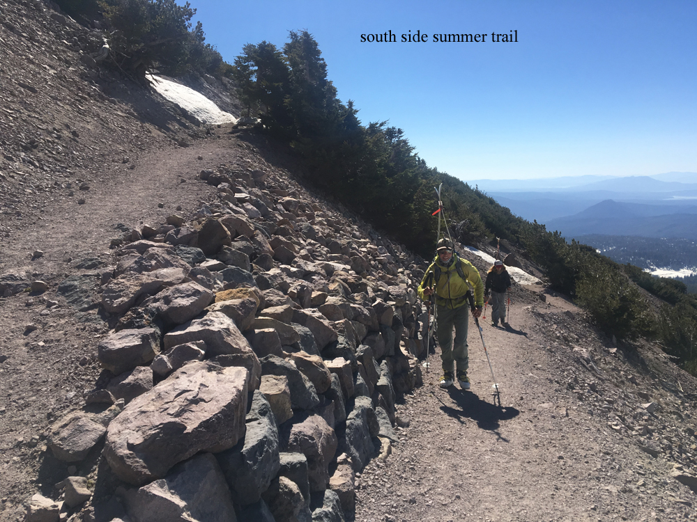
The 6700′ southwest “Chalet” parking lot on CA-89 is as far as you can drive during winter. This is pretty far from the peak but doable for some in a long day at 13 miles and a 3700′ climb. Most people ski the smaller sub peaks from here instead. Then there is a period where the park lets you ride a bike past the closure to reach the summit parking lot. I have never done this but it sounds like a good idea. Less sun cups, less people, and an easy coast back down afterwards. Highway 89 finally opens to vehicle traffic to the desirable 8500′ south side parking lot around July 1, at which time the snow is very sun cupped everywhere. The steeper north and west sides will have the smoothest snow to ski, but the lower half will unfortunately be snow free by this time. Mt. Lassen offers easy access and volcano skiing with moderate slope angles. I save Lassen for the end of year personally. I can’t pass up parking right next to it. Bring fat skis with fresh wax and the dirty sun cups may be less noticeable.
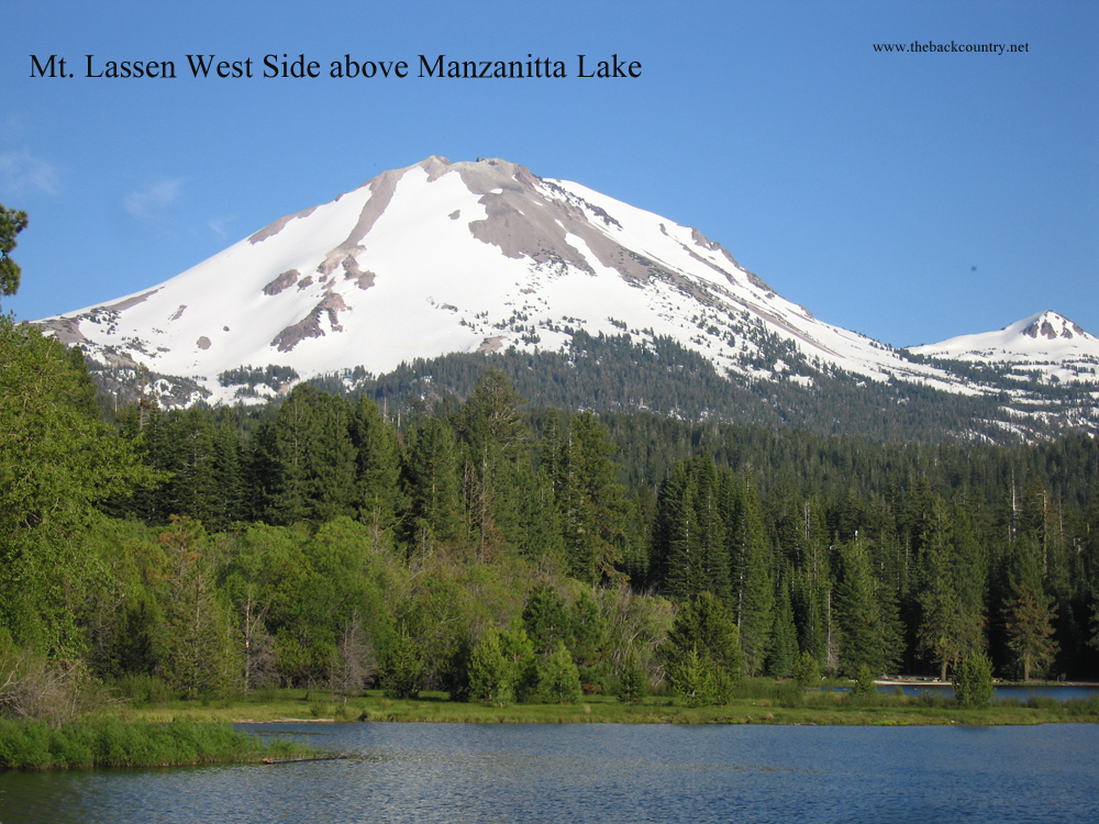
Another possibility for skiing Mt. Lassen in early season is to approach from the Manzanita Lake Campground at the road closure on CA-89, a few miles north of the peak. You can see the west slopes from your car and just beyond Manzanita Lake, which borders the road. I’m not sure if it’s okay to leave your car and go skiing from here, as I’ve never seen a park employee during the road closure. They do plow around the area near this gate. Go for it and leave a note on your car that you’ll be back soon!
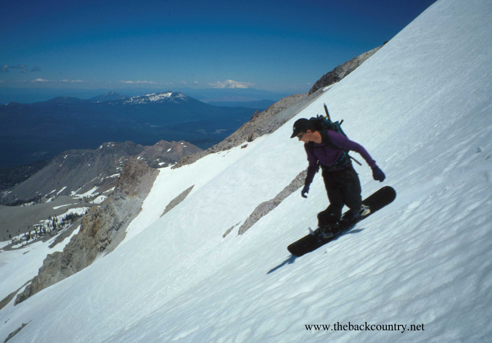
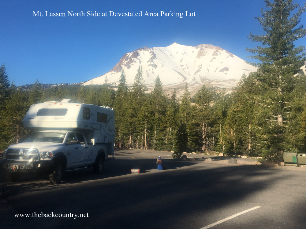
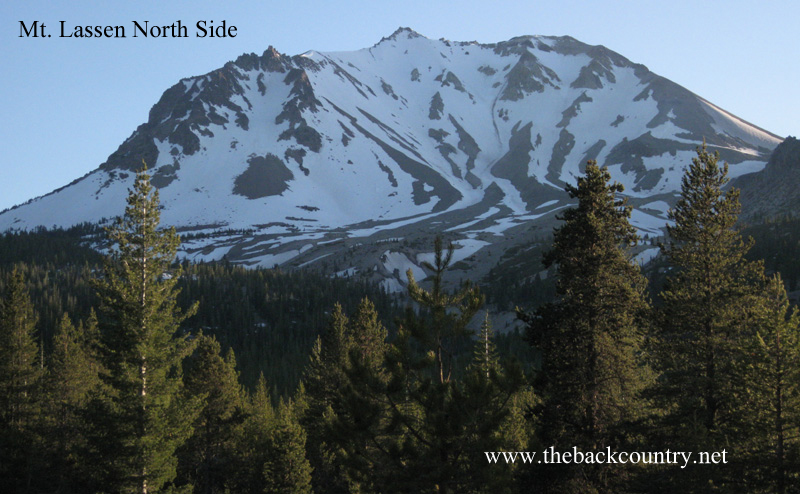
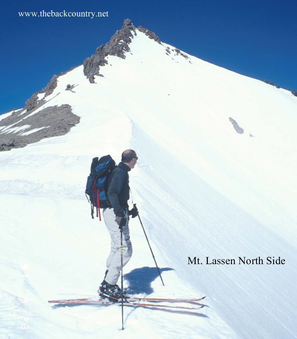
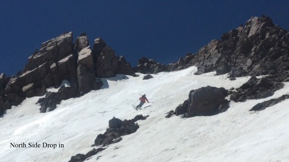
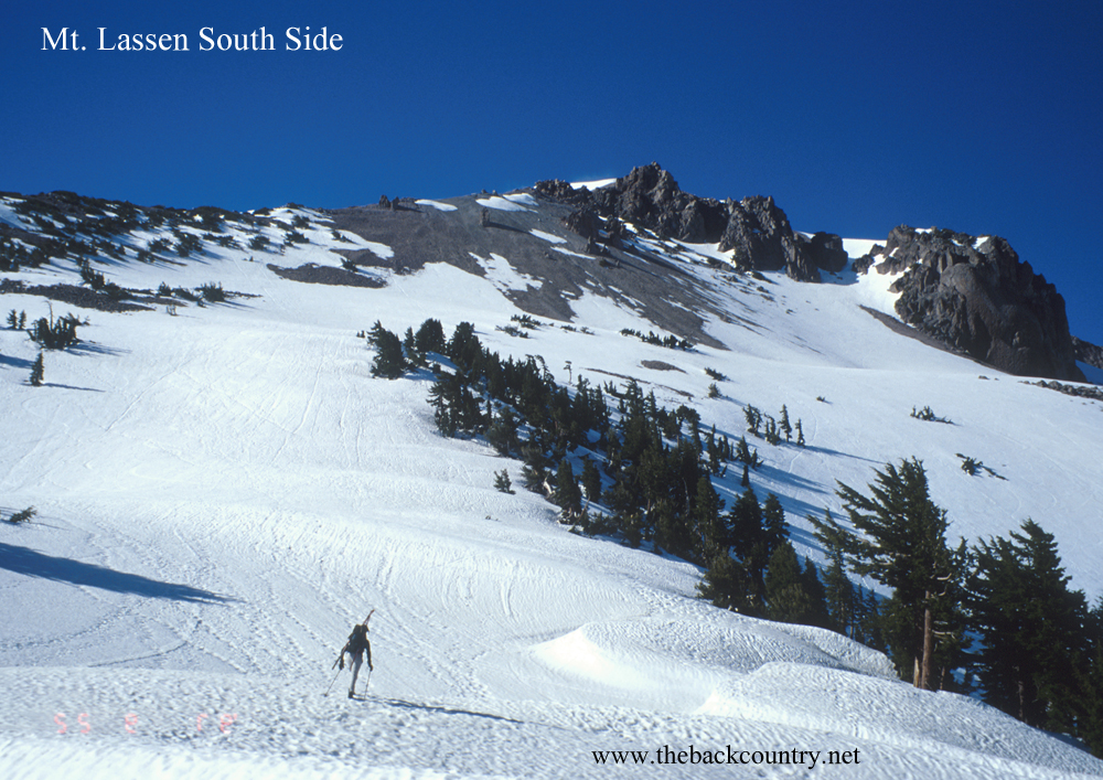
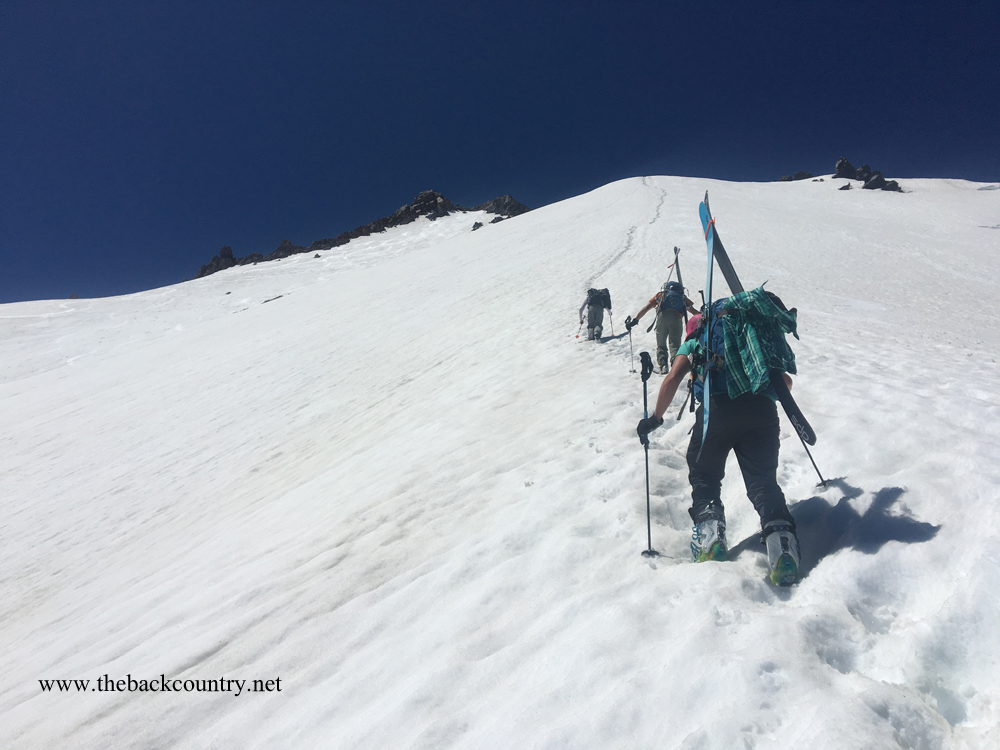
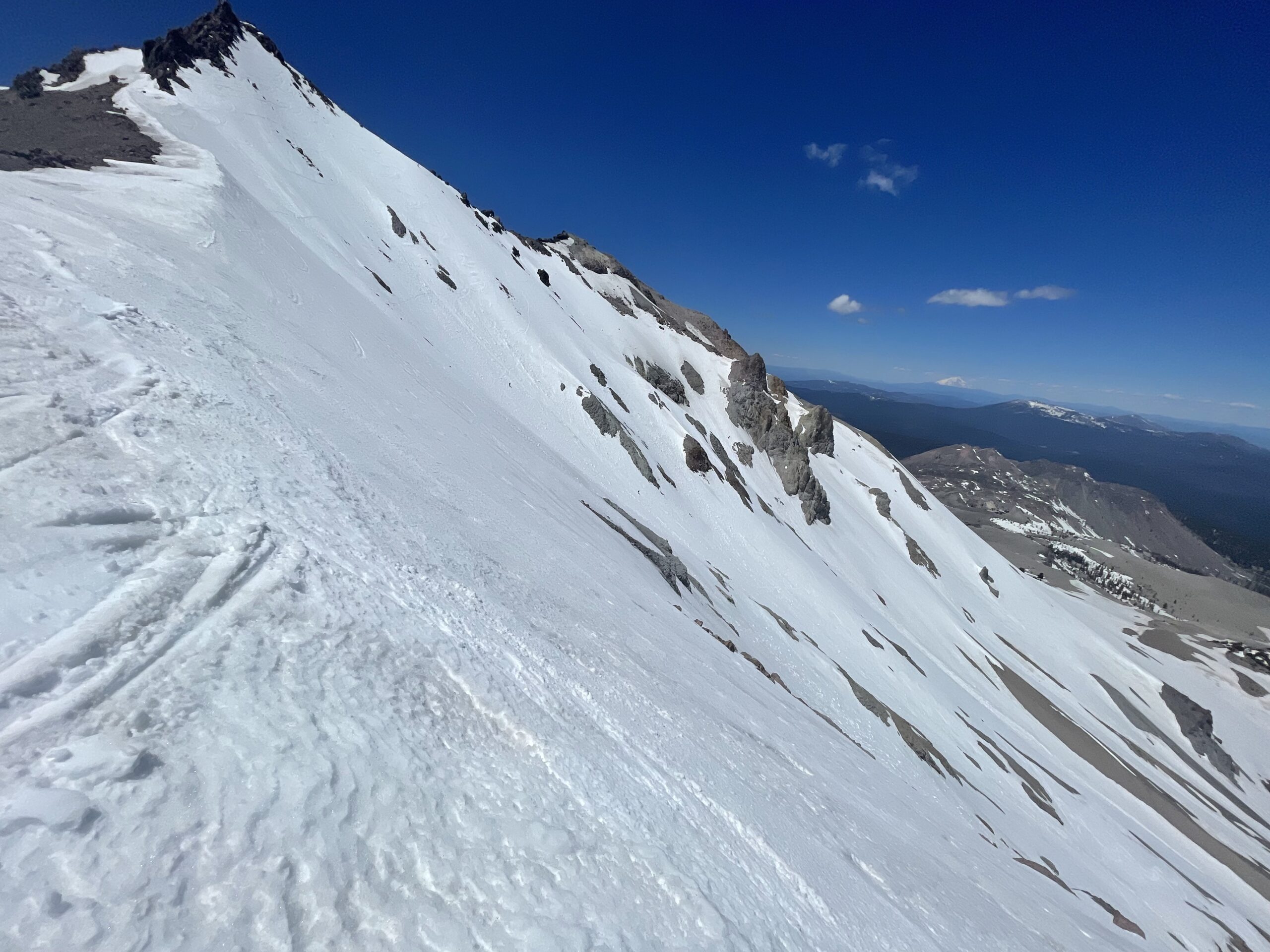
The best ski descent on Mt. Lassen is the north side. Highway CA-89 becomes plowed to the “Devastated” parking area in early spring. This is a 3ish hour drive from Truckee and puts you about 4000′ below the summit. You drive around the east side of the mountain to get there, and you will want to fill up your gas tank in Susanville. The only other gas station is in Old Town, which could be closed. I don’t believe they have a credit card operated pump. When you reach the Devastated area parking, the snow is not far from the car. If you need to walk dirt towards the mountain, it goes as fast as skinning anyway. The snow on the north side will be fairly smooth through the end of May and sometimes pretty good through June. The top looks extremely steep from far away, but it’s not bad. You can enter the north side on either side of the peak with a slope angle of about 35 degrees or have fun walking carefully down into the 40+ degree start just under the summit rocks. Remember, don’t drive north on highway 89 from Truckee thinking you’re going to get to the Devastated Area parking lot before July. You drive to Susanville and then wrap around from the north side of the mountain back into highway CA-89 south for 15 miles to reach the parking lot. Check the Mt. Lassen Road conditions on their website or Instagram.
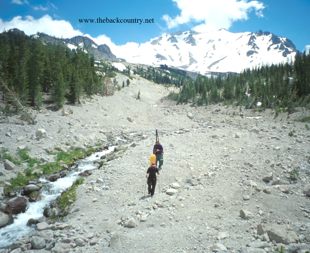
When highway 89 finally opens all the way through the park in July, you’ll want to ski the north side for it’s smoother snow. However, you also will want to take advantage of the higher south side parking lot where snow is at the car. The Devastated area beneath the north side will be burned out most likely quite a bit up the mountain. Therefore when the road opens finally in July, I recommend parking at the high south side lot. After gaining the summit in 2000′, consider skiing about halfway down the north side. Put your skis on your backpack and hike back up when you run out of snow. Bring boot crampons, as the terrain is a bit steep for skinning everywhere on the upper north side. You’ll have logged about 4k and explored both sides of the peak.
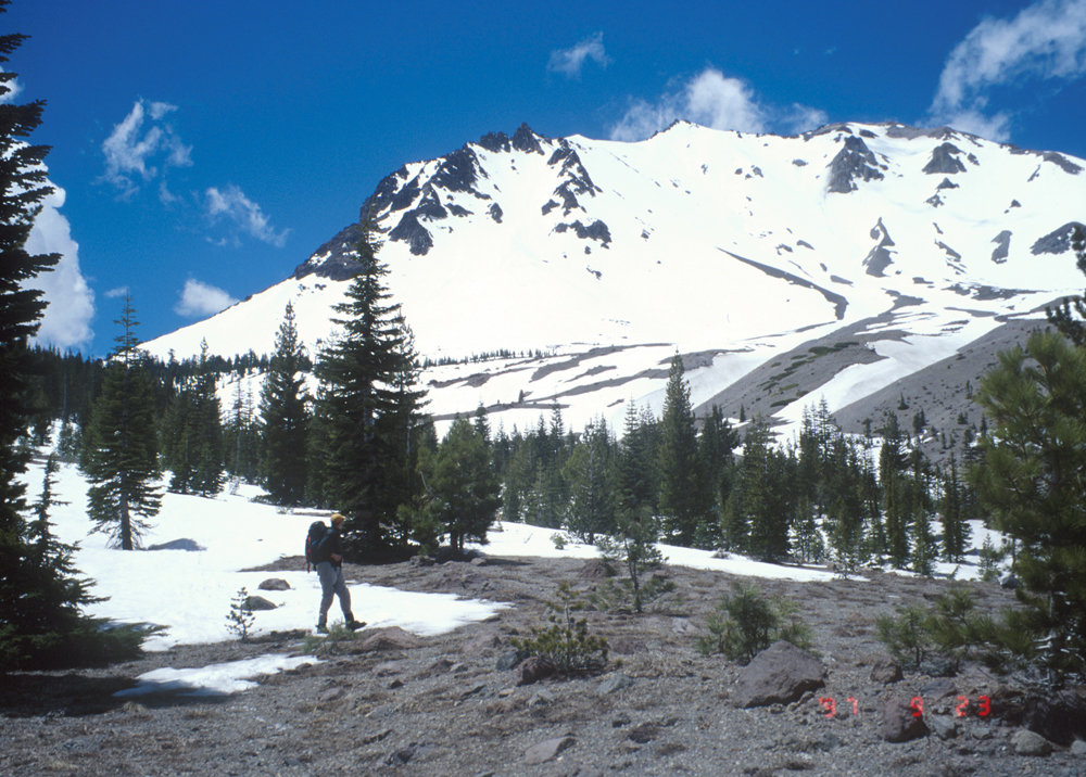
Combining Mt. Lassen with Mt. Shasta is a great weekend. Big brother and little brother about 100 miles apart. Bring ski and boot crampons to any Volcano or spring ski tour above tree line like this. The snow can be firm and the terrain is steep on the upper half of volcanoes. I have never seen ice form on Mt. Lassen, but wind can keep the snow frozen pretty solid. I haven’t skied the surrounding small sub peaks in the park, but they get great reviews. Probably because you can link them in a fun loop. Put some pictures of your trip in the reply to this website post please! Oh, and Mt. Lassen last erupted between 1914 and 1921. It probably won’t erupt while you ski it though. Hard to say.
Mt. Lassen

Looking for awesome ski and splitboard tours in the Sierras? We’ve got write ups on many common and uncommon tours curated by the owner of the BackCountry, Mike Schwartz.


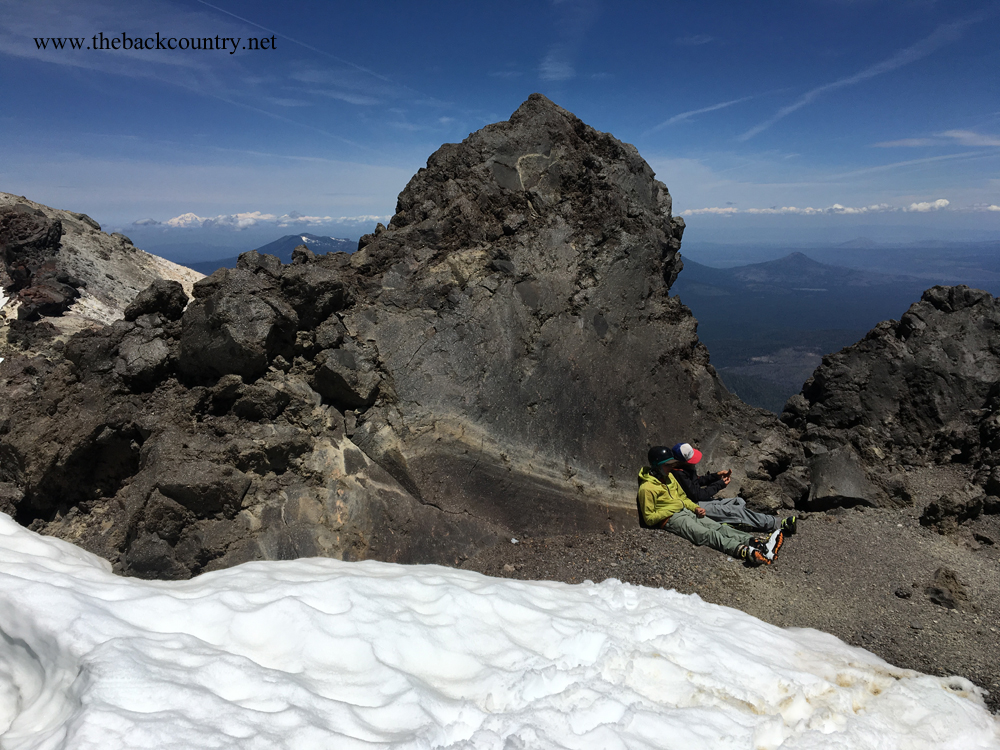
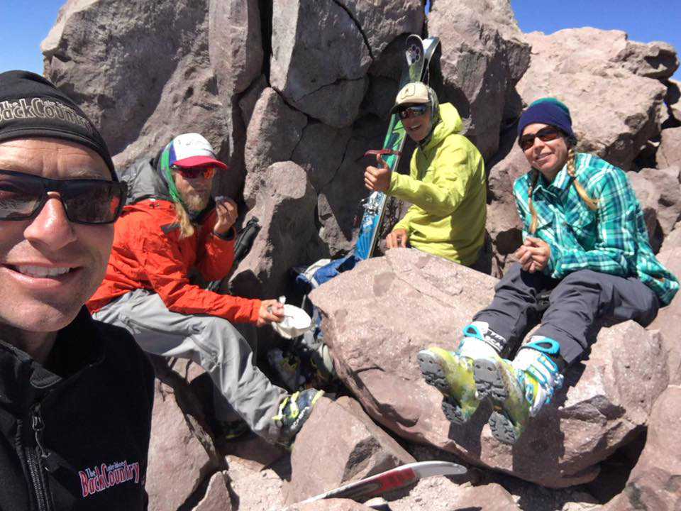
These pics are from May 22, 2022 with Danny and Jake. We skinned from the Devastated Area parking lot and used boot crampons for the last steep few hundred feet. We waited out a windy summit where the snow was hard as a rock. I chose to hang out and see if the wind would die down.There isn’t anywhere to hide from wind up there except one large boulder that doesn’t seem to help. After about 30 minutes we could tell the wind was in fact disappearing, and the top of the south face got a little soft. We know it would get softer after a few turns below the top. this run far skiers left, heading down the south side of the peak was really smooth. I find the smoothest snow in late season is usually closest to the rocks at the edge of the snowfield. We skid down maybe 1500’ and then we climbed back up and found great corn on the North side too. We traversed skiers right into the hidden gully this time. I go every year to Lassen, usually with new people who haven’t done it. It’s hard to convince your friends to go skiing in late May or June, but that’s when you finally get access to the volcanos. It is really fun and like a small party. There are always Tahoe people there, and the park unofficially allows overnight car camping. Thank you for that!