
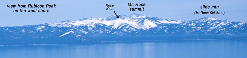
Location: Mt. Rose Wilderness – Lake Tahoe, NV
Duration: 2 – 3 hours
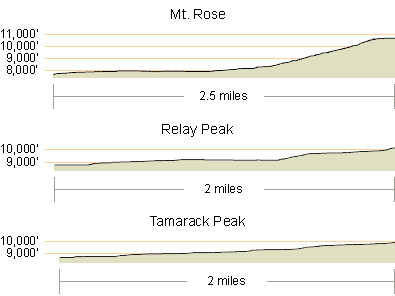
Elevation Change: 2,176′ – from 8,600′ to 10,776′
Recommended Map: Mt. Rose, Nevada
Elevation Profile:
Map of General Route:
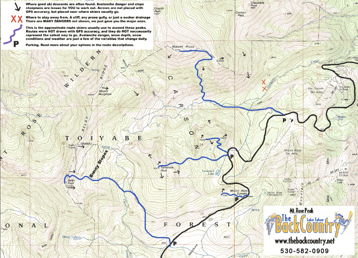
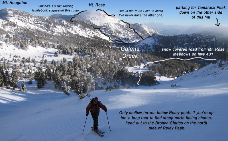
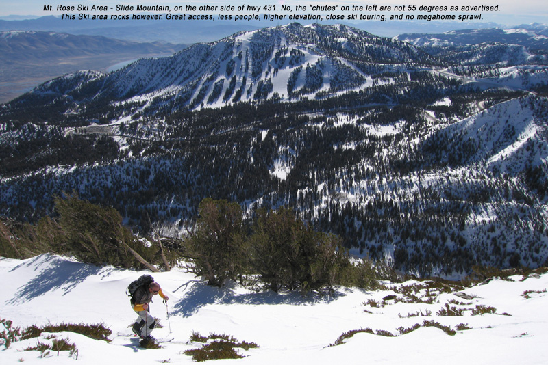
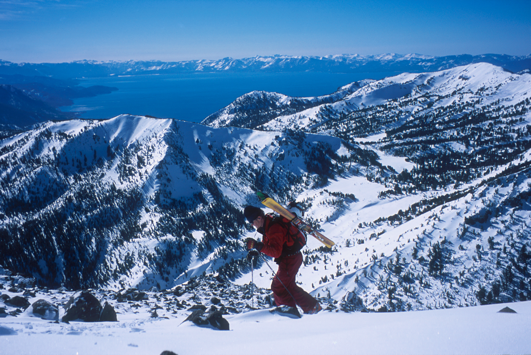
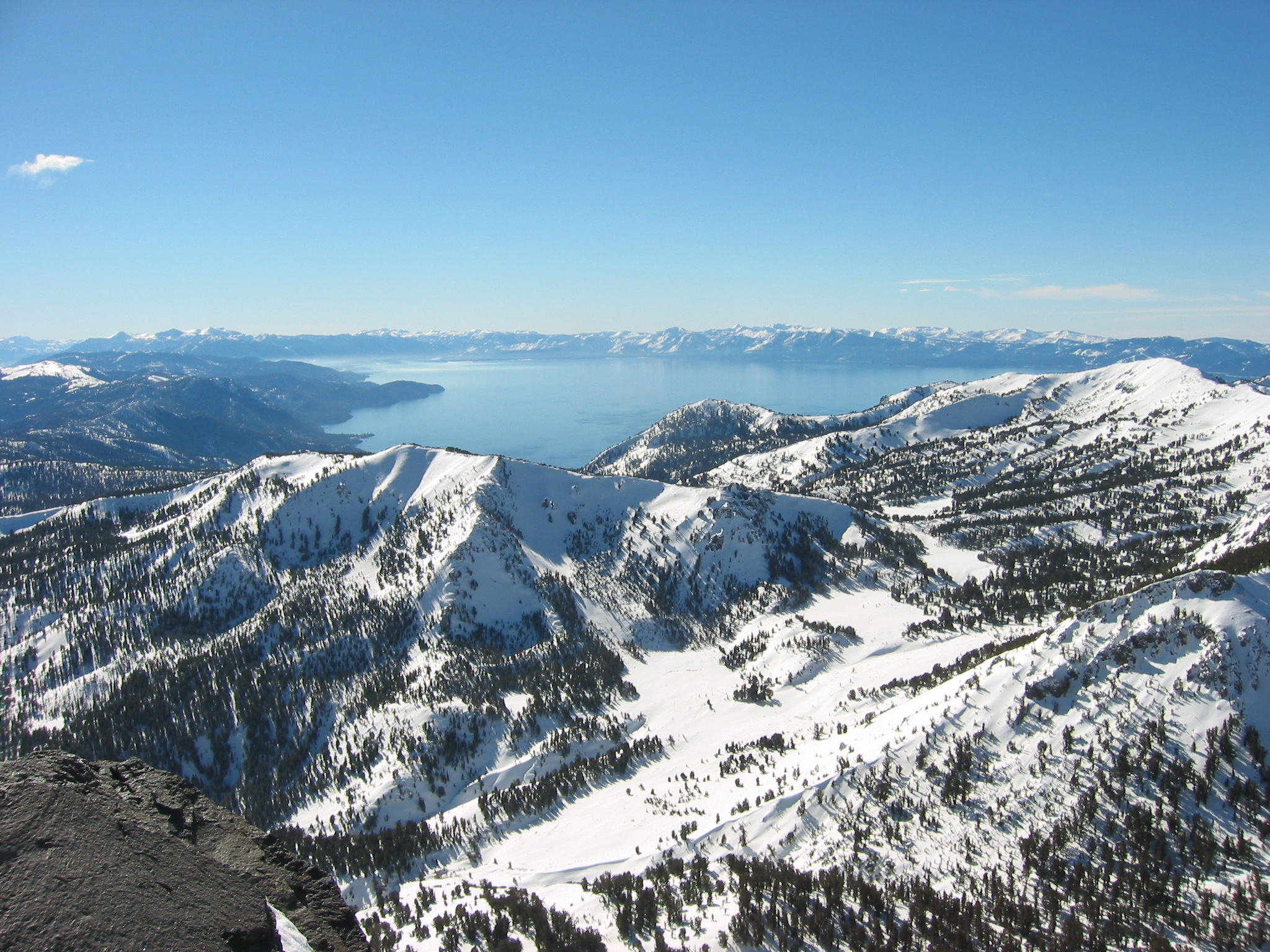
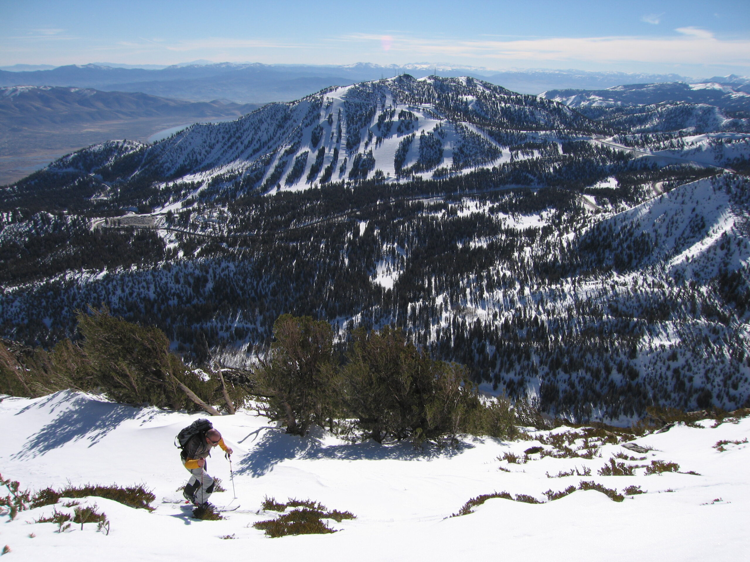
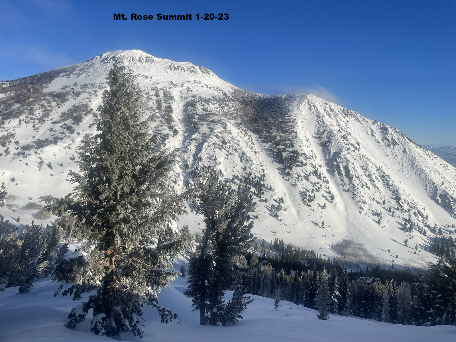
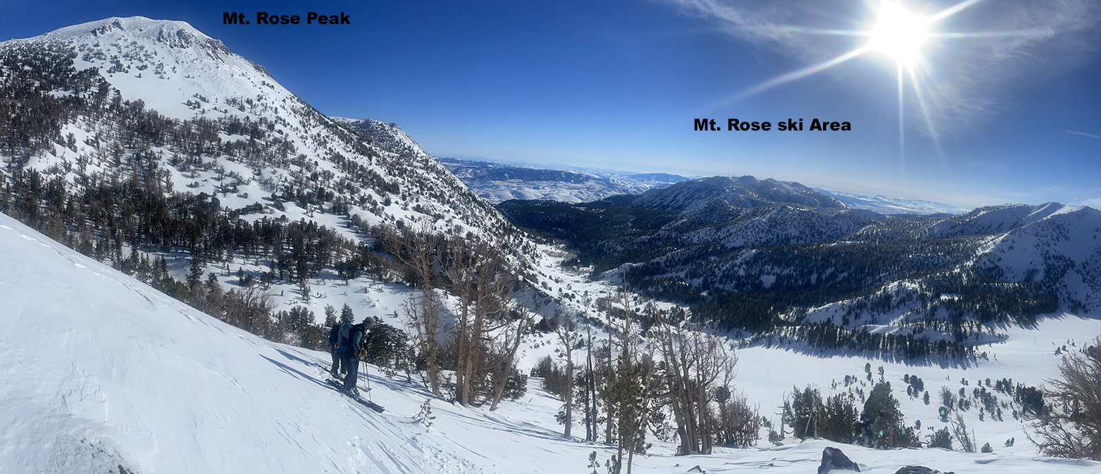
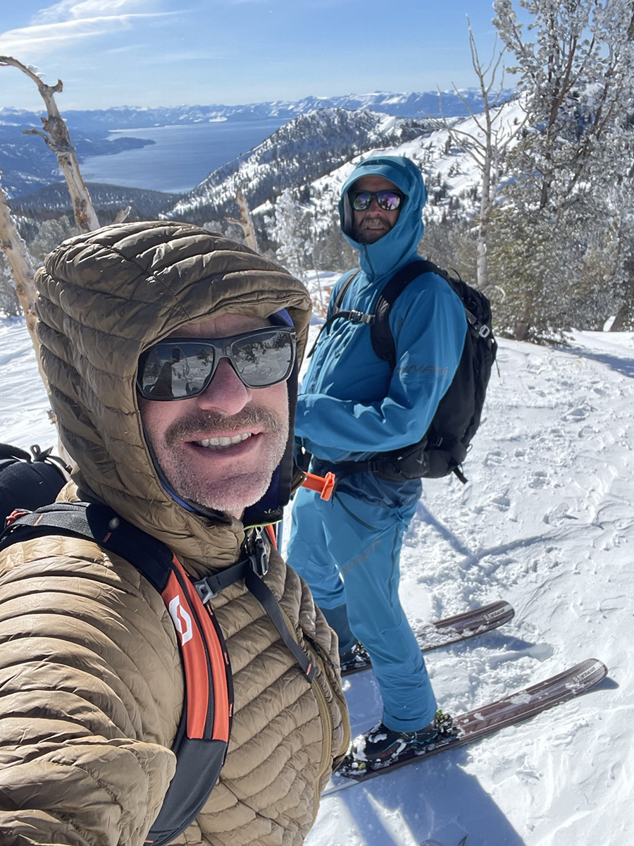
The Mount Rose Wilderness Area is a backcountry winter wonderland for skiers. Access is easy from the top of hwy 431, above the Northeast Shore of Lake Tahoe. With a high elevation parking area at 8,000’, you can count on Mount Rose for producing the deepest and driest snow at times. Spend the day exploring a number of small sub peaks near the car or go for the summit for a stark contrasting view of the Tahoe basin and Nevada high desert. The peak itself is often wind scoured, and rarely climbed in the winter. It’s a nice tick list adventure and views. Have a local show you the better routes which wind through the area or study the map to grasp the possibilities. Climbing halfway up the south side of Mount Rose Peak will reveal major ski touring options as you turn around and see the landscape. Buy a lift ticket at Mt. Rose ski area across the street one day for more views of your backcountry options.
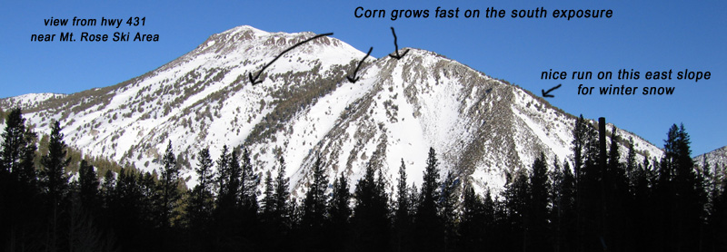
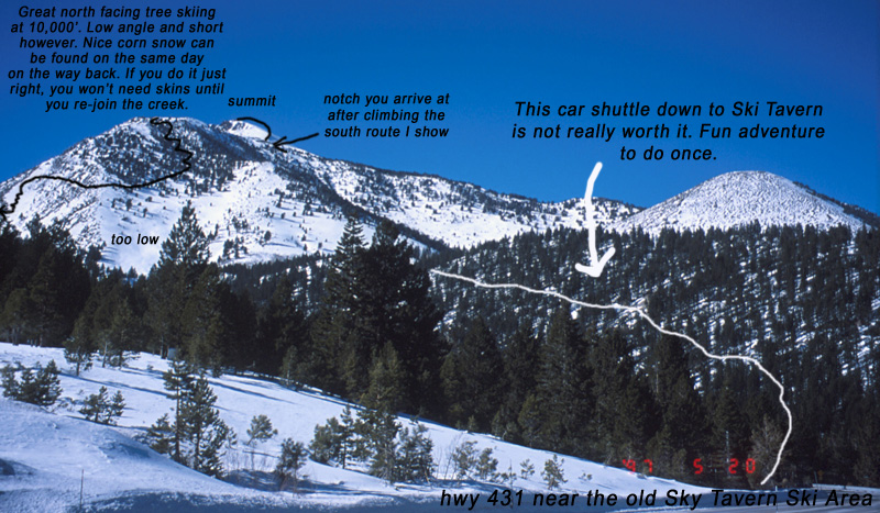
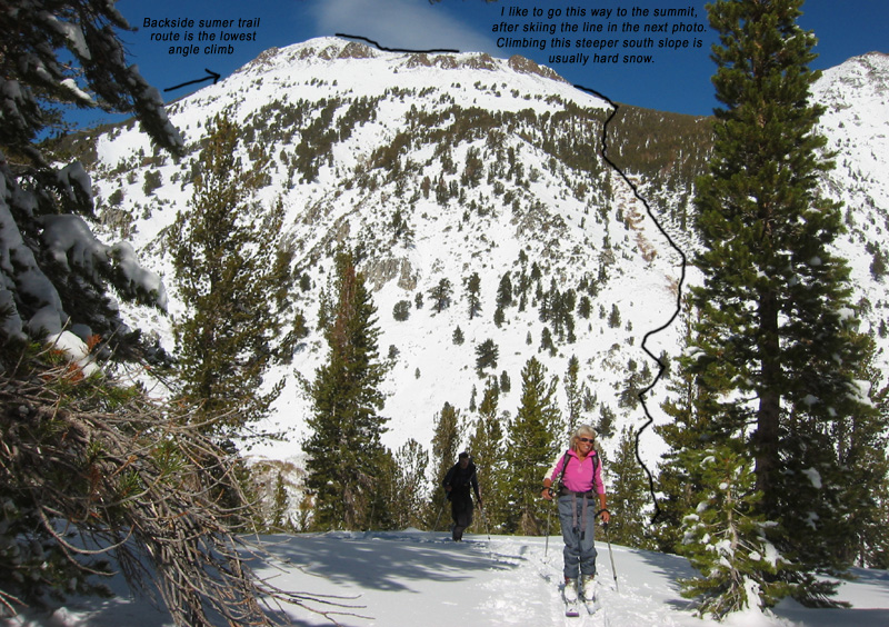
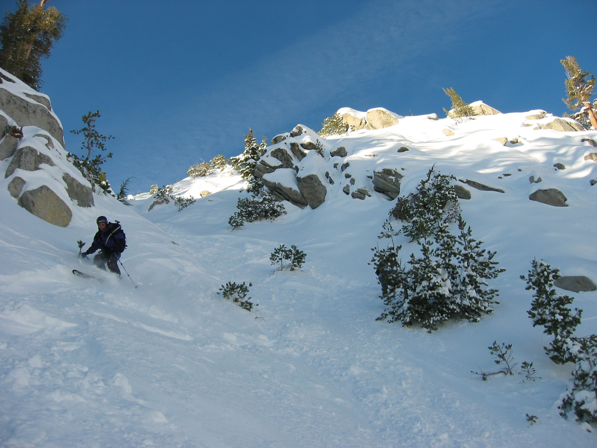
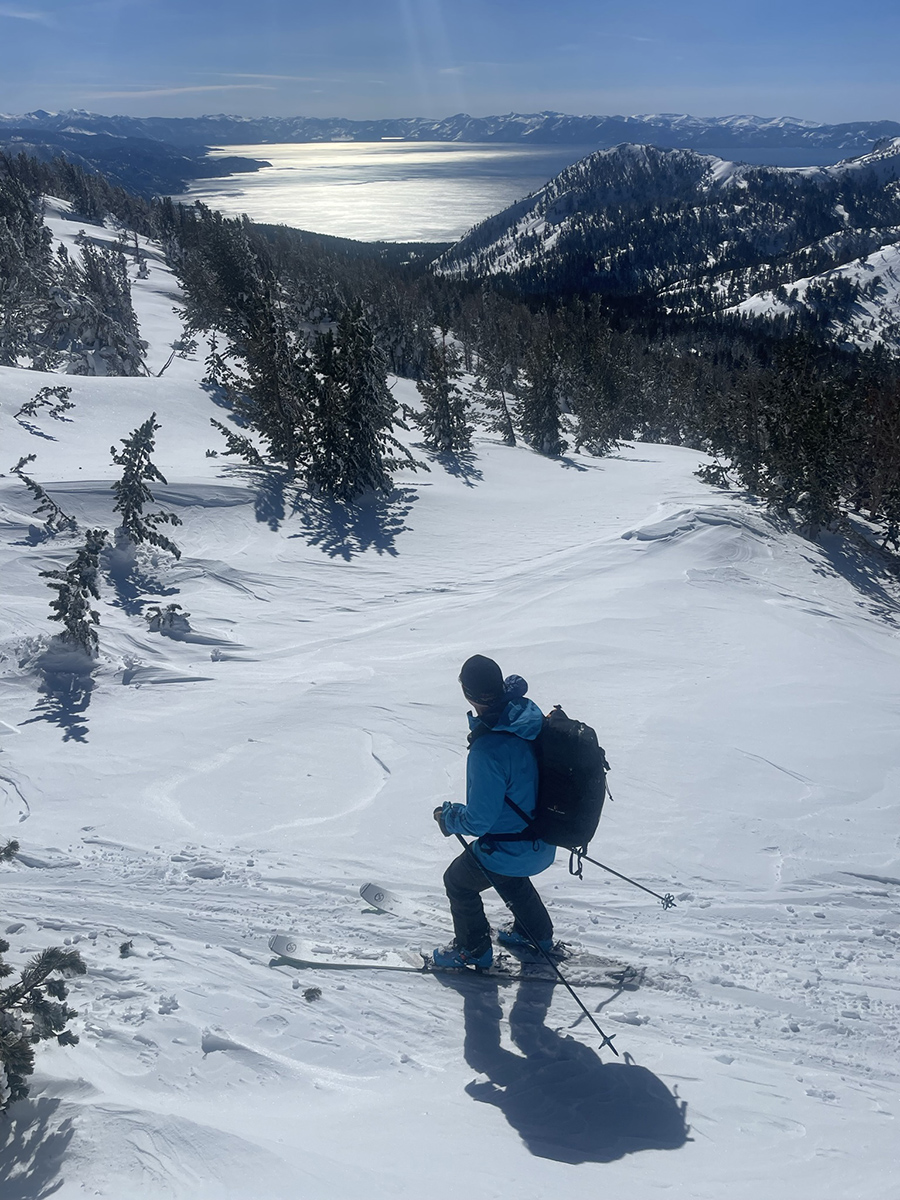
Mt. Rose Peak offers fast growing corn snow on the south and southeast sides but only in strips that melt back or blow away equally quick. I like to ski a mellow east-facing trees above Sky Tavern which begins at 10,000′. Avoid getting sucked into the Galena Creek Drainage if you go touring on the high east slopes. You’ll have to traverse back around the mountain and stay high enough to reach your car or put the skins back on for a few minutes. I’ve never explored the NW side of the mountain where the summer trail goes, maybe this year.
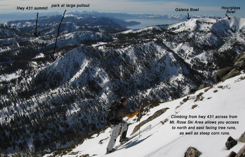
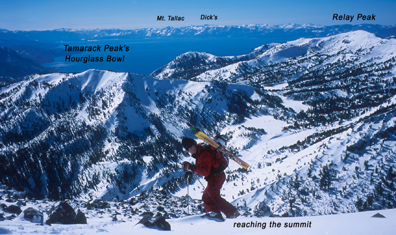
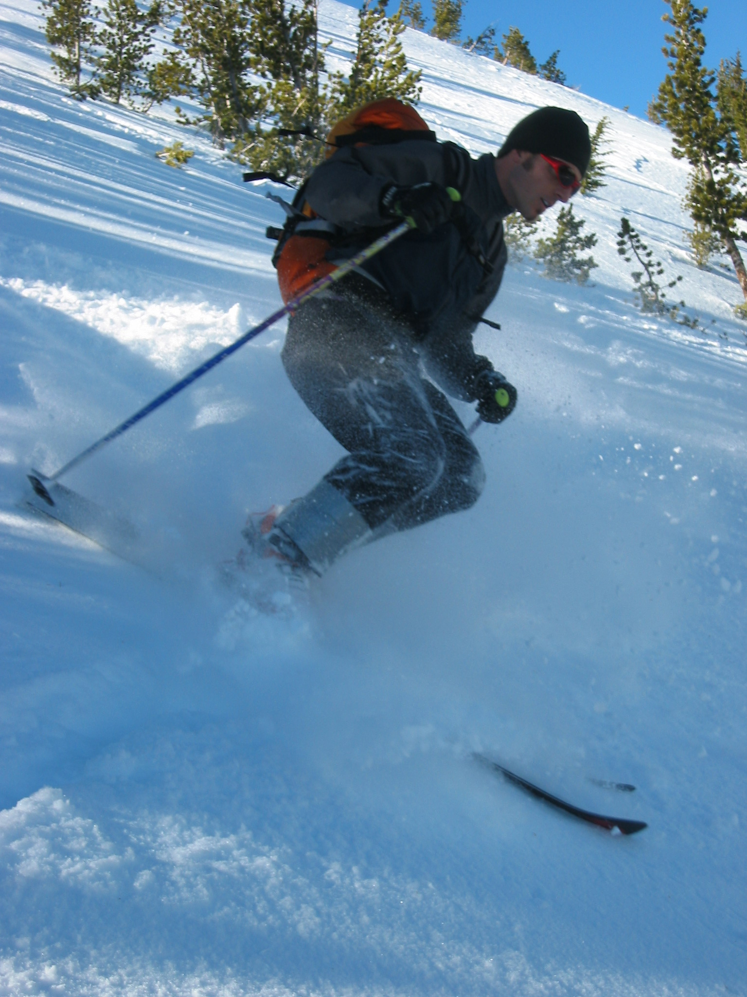
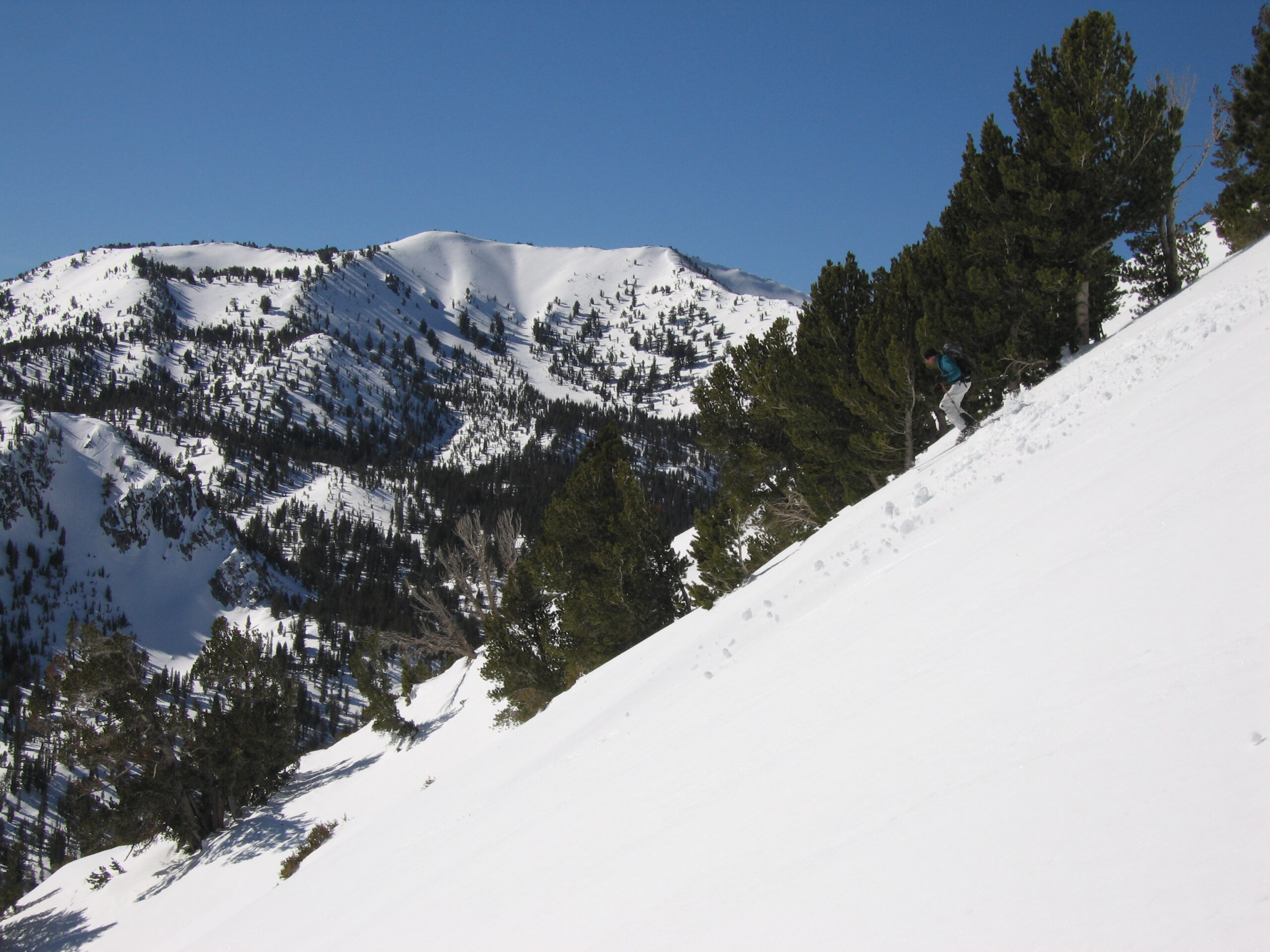
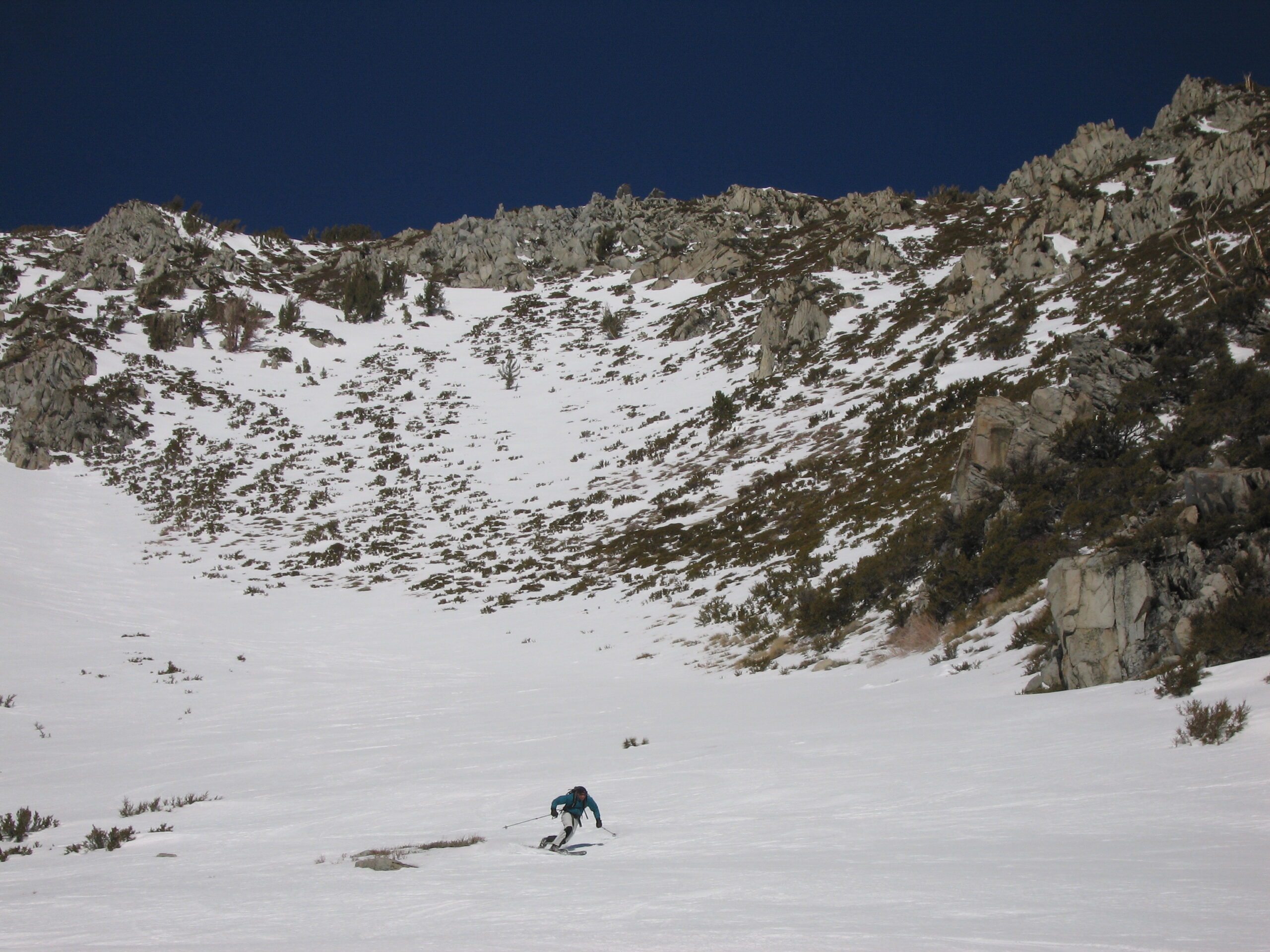
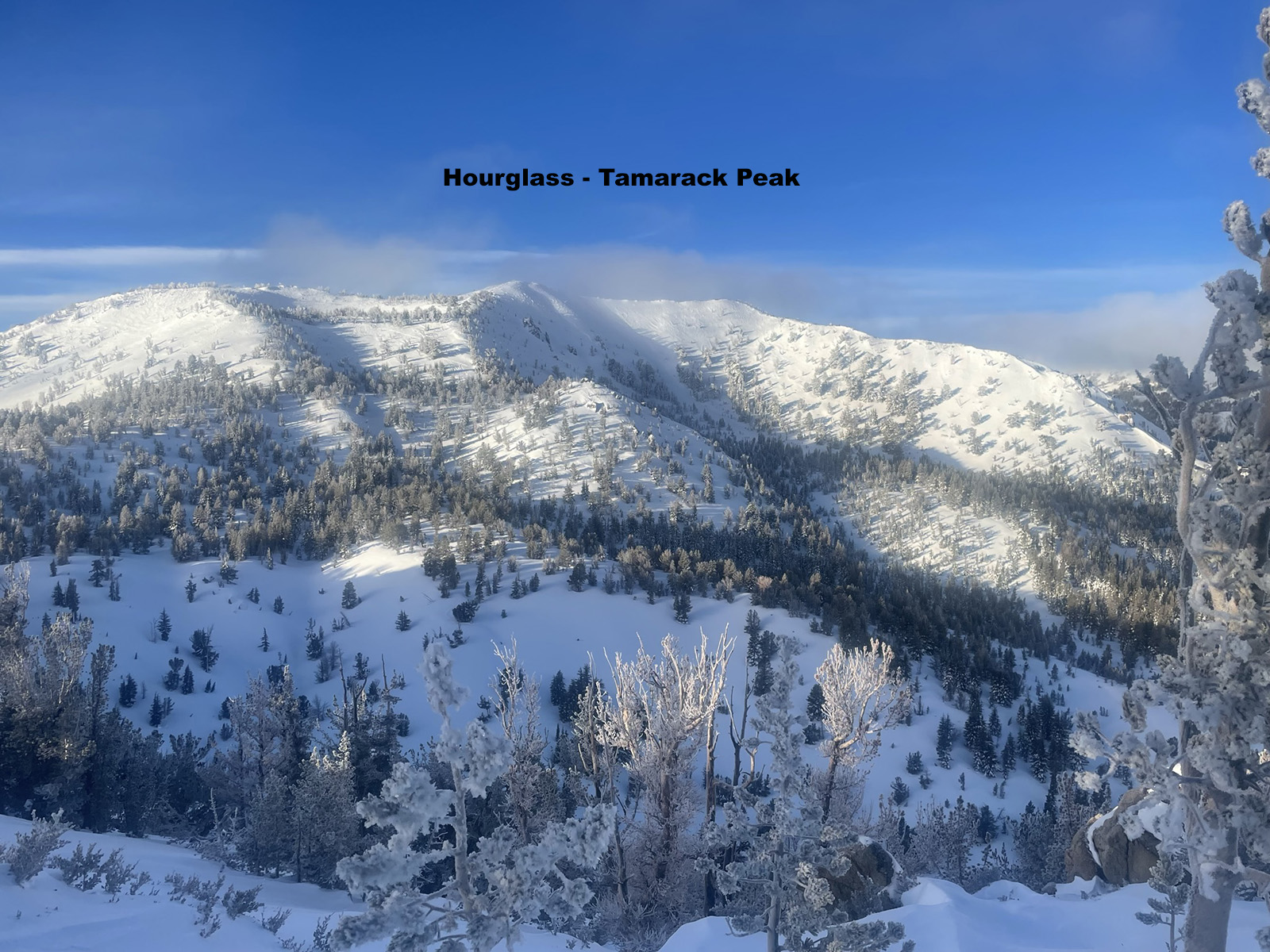
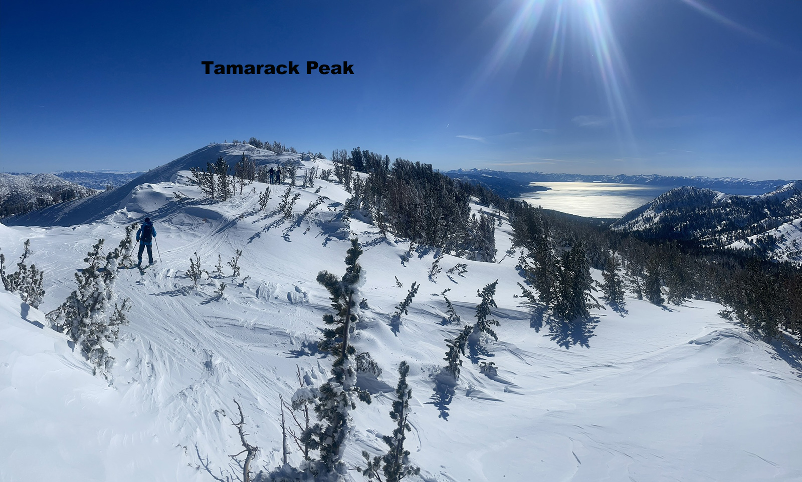
The most popular skiing in the Mount Rose Wilderness is Tamarack Peak. This easy 1000′ climb has great views back to Lake Tahoe. Tamarack offers excellent ski descents on all sides actually, including the popular Hourglass Bowl facing NE. This is the best bang for your buck and skied daily. Most skiers take at least one run down this avalanche path which goes big once or twice every season. Give steep treeless terrain like this some respect after storms or wind events. There is a nice, low angle cruise on the west slope of Tamarack Peak, and plenty of treed ridges in the area if you are not sure of avalanche danger. If you parked near Tamarack Lake, returning to your car may require a glance at a map. You can’t see the road at any point through the trees, but there are usually tracks to follow. Listen for road noise. Or use your phone to locate your car. I like the Gaia app but there are so many that will get the job done.
Little Incline Peak is right above the parking area and Incline Lake, offering possibly the best view of Tahoe in the Mt. Rose Area, and takes only 30 minutes to skin up. This east facing terrain is steep enough to make nice turns before exploring further up the ridge towards the Relay Peak Cell towers or popping over to Tamarack Peak.
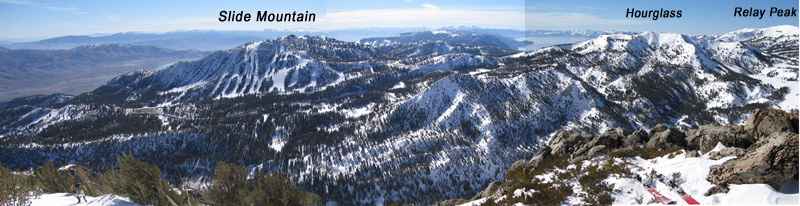
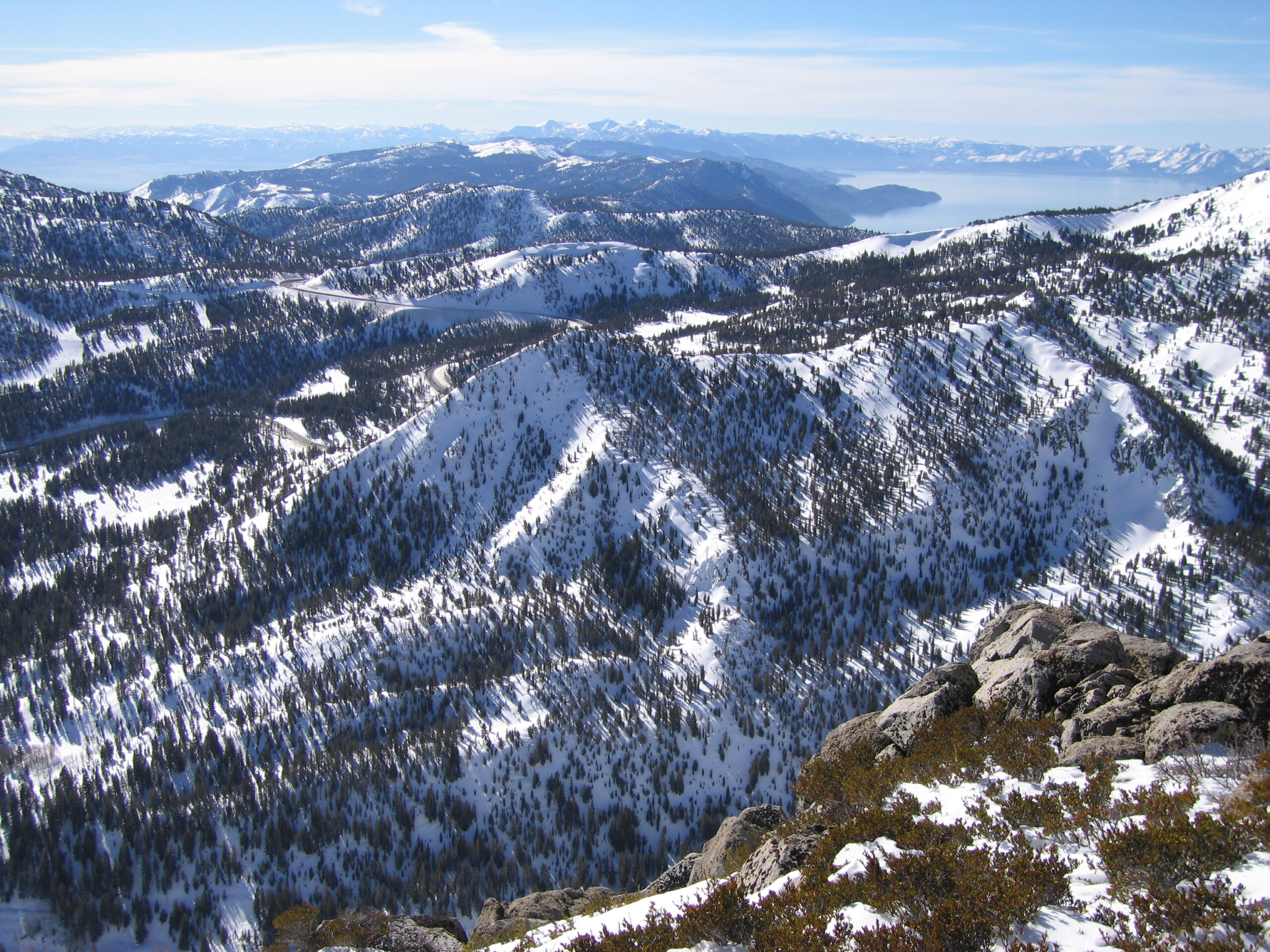
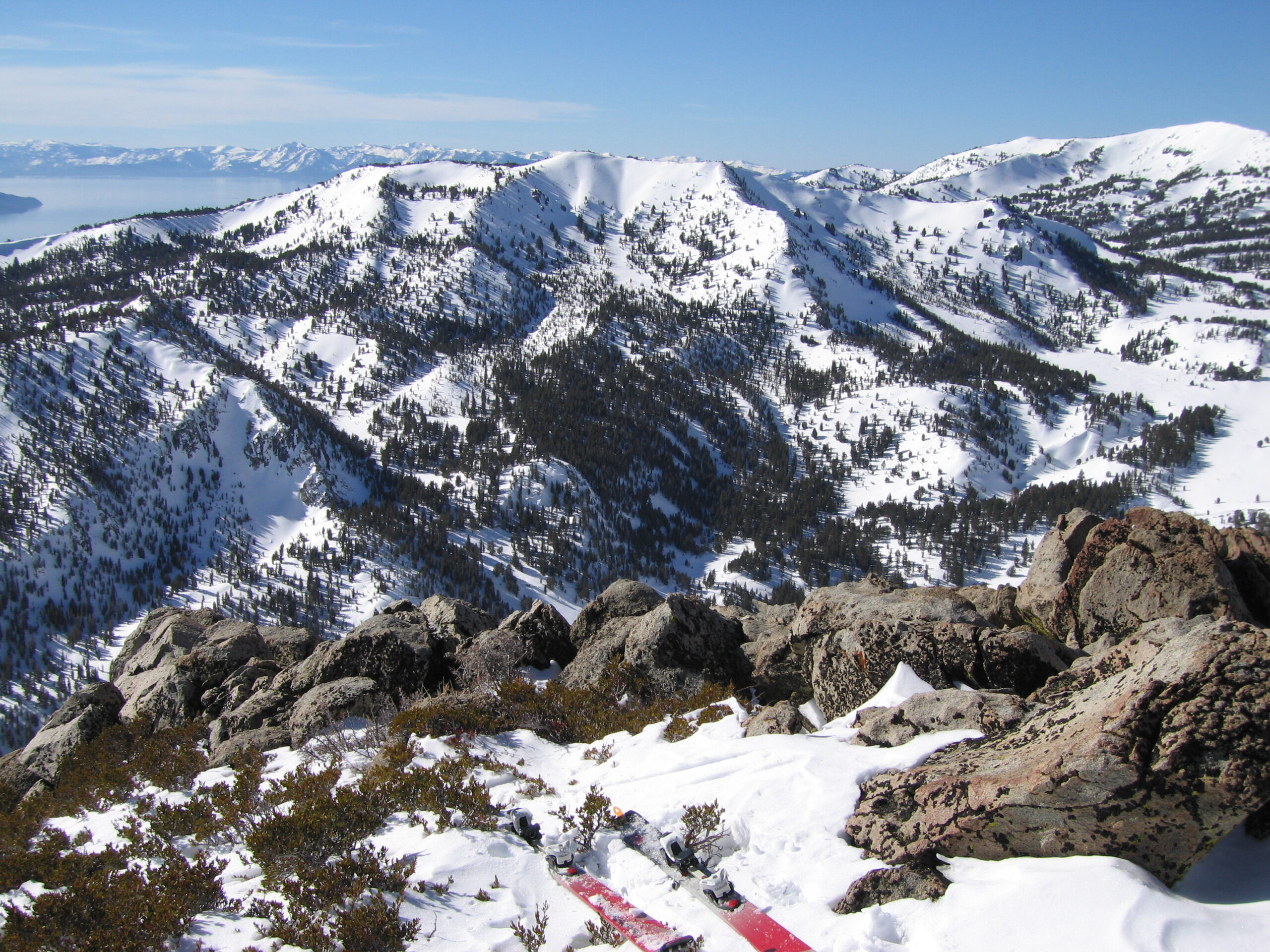
For a really long and low angle ski tour, skin from the hwy 431 Tahoe Meadows area to Relay Peak. Your hard work will earn you a huge view of Lake Tahoe, and most of it’s surrounding mountains. Look to the East for another awesome view of the greater Mt. Rose area. You will have to share this zone with snowmobiles, so you might want to avoid going on the weekend. Locals ski off the north side of Relay Peak and find powder weeks after storms, but you’ll have to skin back up of course.
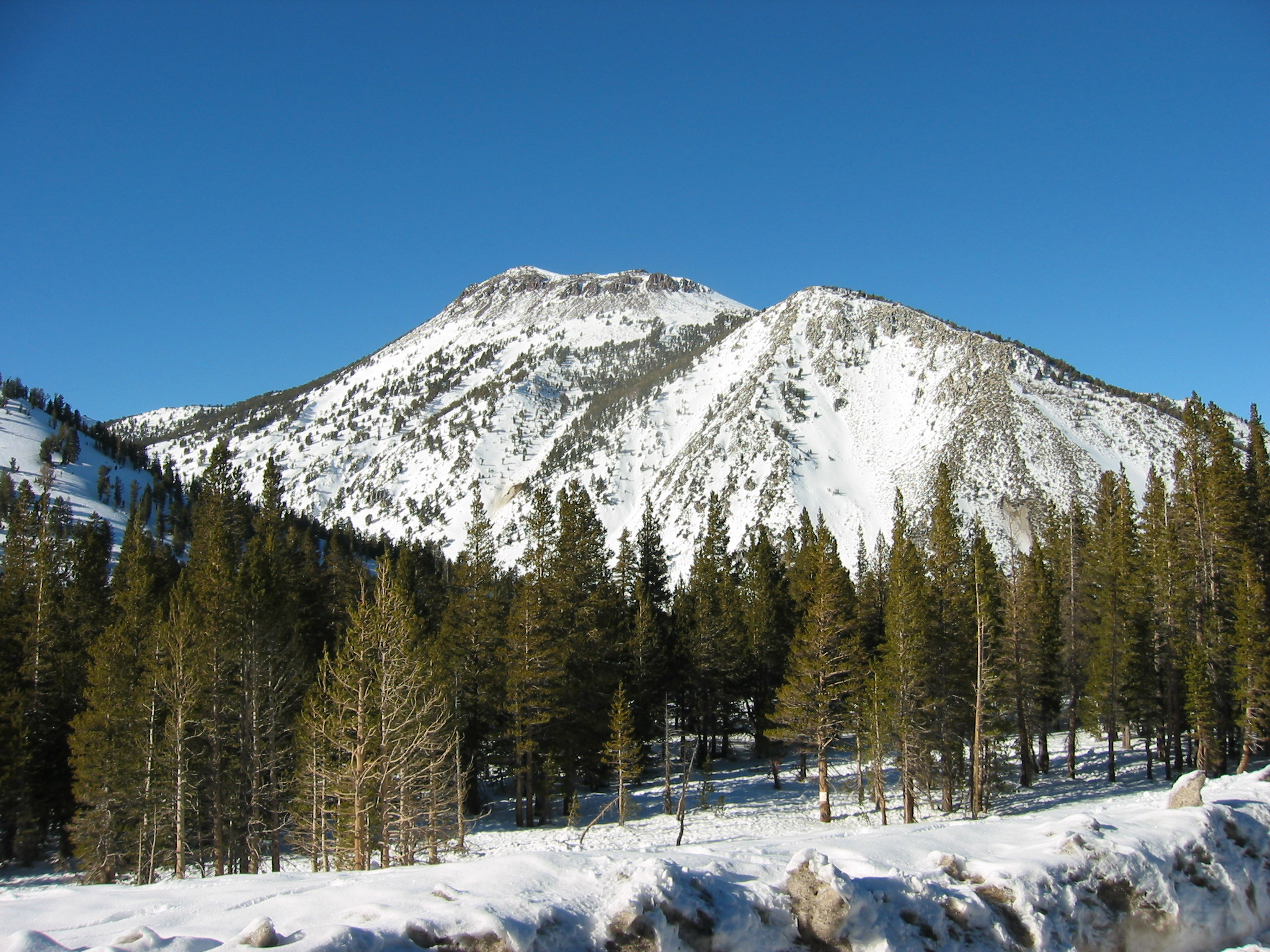
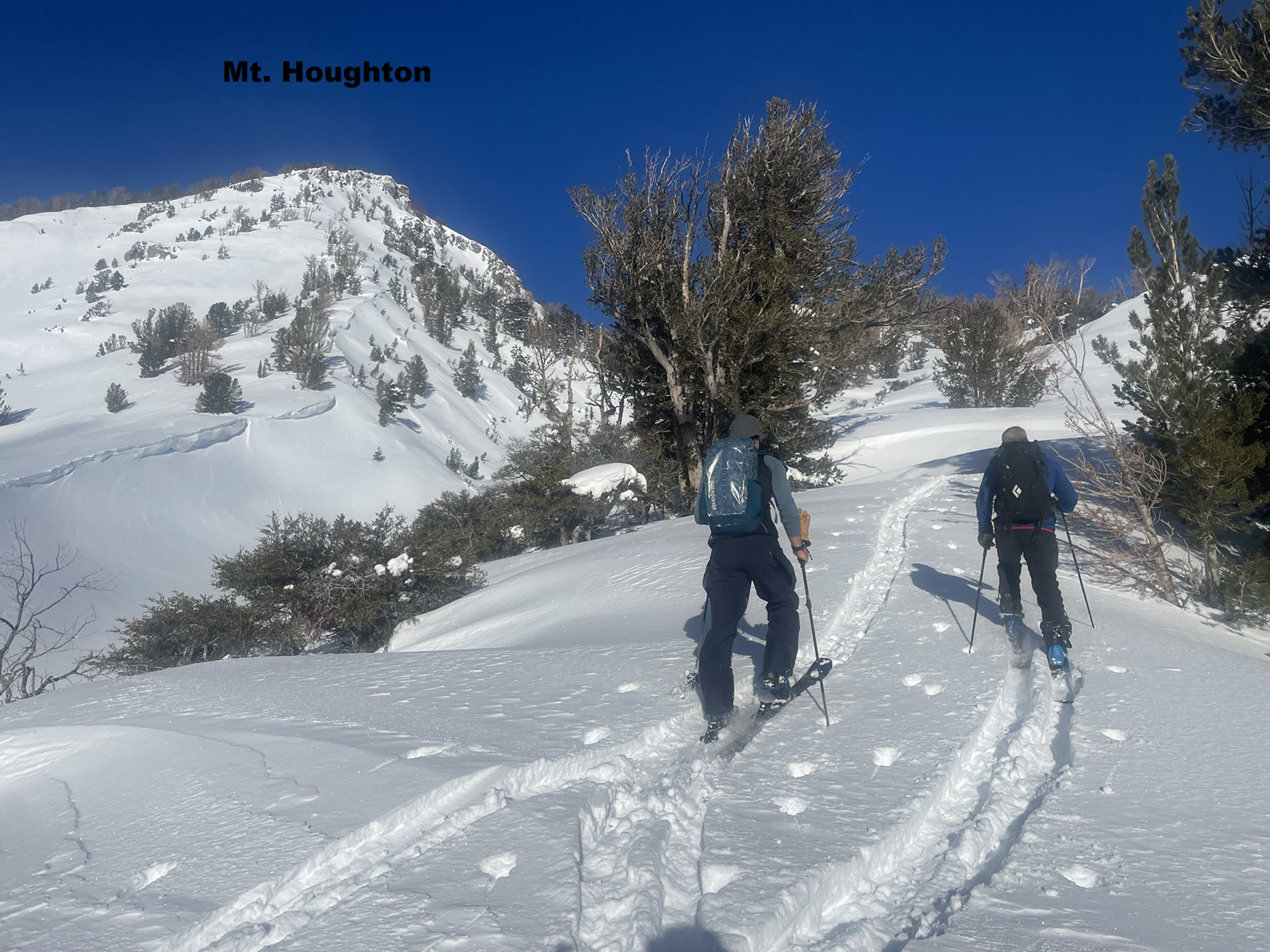
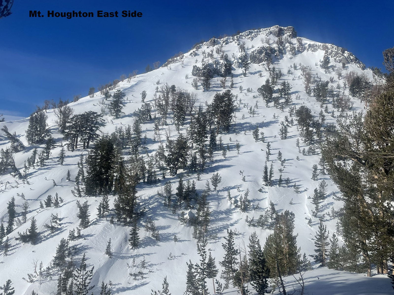
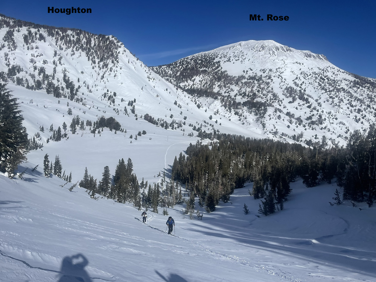
Mt. Houghton is a bump on the ridge between Rela y Peak and Mt. Rose Peak. This guy has a nice south face and some short steep east facing terrain which holds powder in a wind protected little gully. I don’t like the how the bottom of the gully is a terrain trap if you got in a small slide. I usually ski Houghton by starting on 431 and skiing over a little ridge right in front of you, and down 1200′ to the creek. At that point you are at the base of Houghton. Or start from the Mt. Rose Ski Area parking lot and tour into the valley below Houghton.
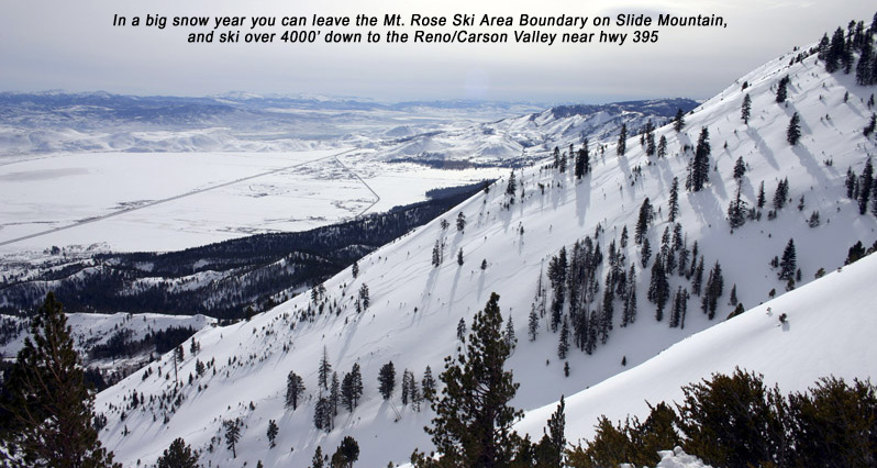
In early 2022 Jehren “Code blue” Bohem took me on his 10th traverse from Relay Peak to I-80. Maybe you can get him to take you on the next one. I got our GPX tracks. We skied 4500′ up and 7500′ down, in 13 miles. All the descents were fun north facing shots that he figured over the years to work out in a great route. There is no parking though so it’s hard to explain how you would get out to I-80 without approaching private property. Next time I try this I would skip the last descent and aim for the neighborhood in East Glenshire. Figuring out where to park at the end is the crux.
Skiing the Mt. Rose area sometimes means exploring Chickadee Ridge on the south side of hwy 431. There is a great low angle south facing tree run a friend showed me a few years ago. Another Rose Area tour we have done many times is to skin beside the Ski Lift at the upper parking lot for 5 minutes and drop 4000′ into Davis Creek to a car shuttle down in the Valley. Finally, some of my Mt. Rose Backcountry ski days involve just winging it. Just drive over there and ski what you see. The land managers are friendly towards road-side recreation as you are outside of TRPA’s area.

Looking for awesome ski and splitboard tours in the Sierras? We’ve got write ups on many common and uncommon tours curated by the owner of the BackCountry, Mike Schwartz.


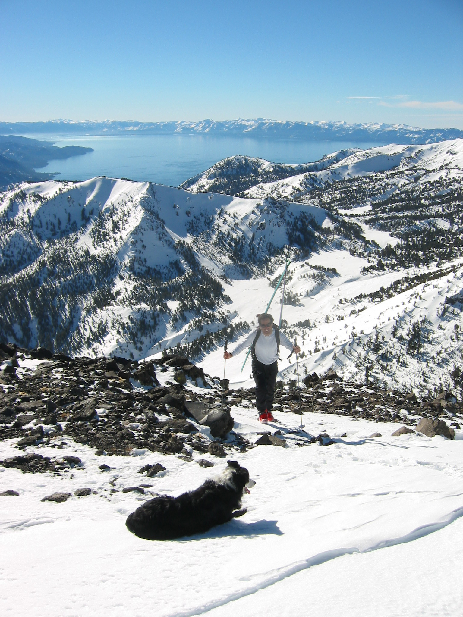
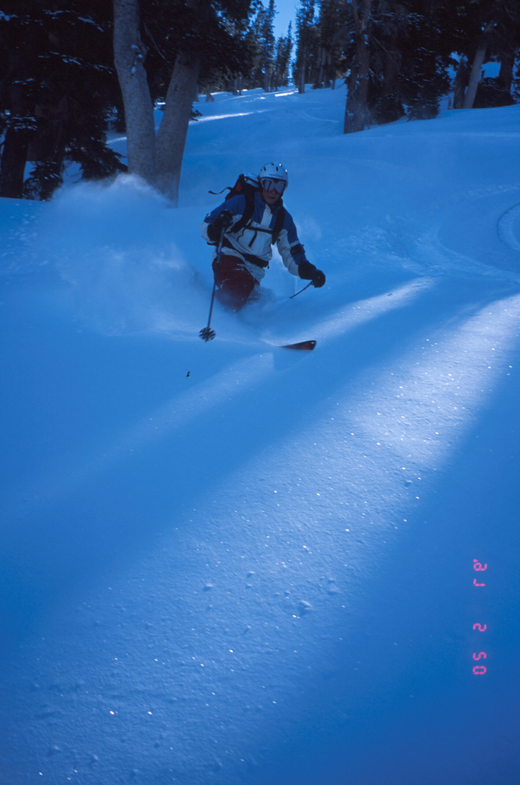
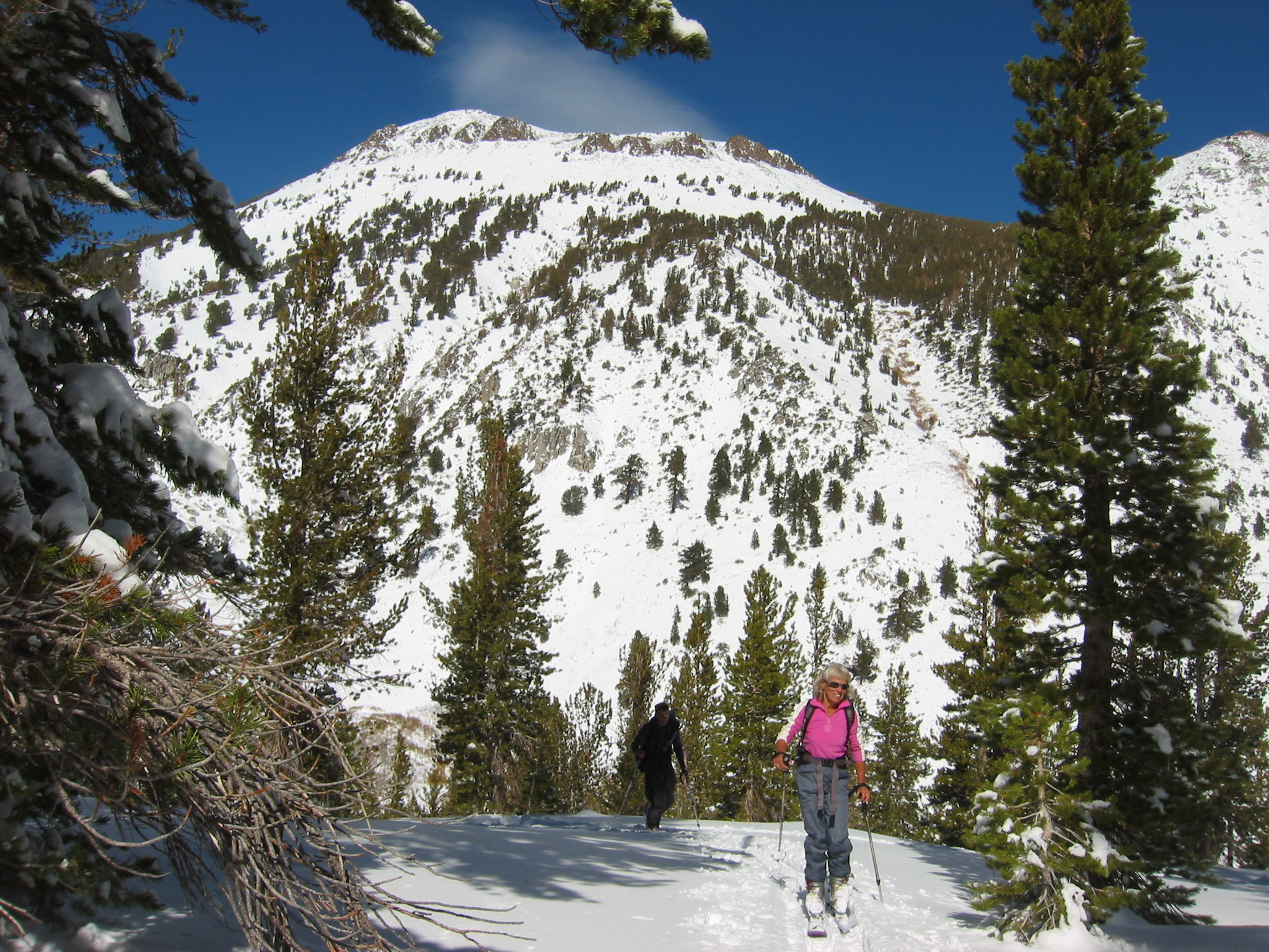
Here are some pics from 12/13/17. Chester and I skied N side of Tamarack Peak and South side of Houghton. Smooth Corn in the sun and fairly firm tracked out on Tamarack as expected of course. Only one other party on the hill and some cool clouds over the lake. Chester is 9 and this is probably his last say ski touring with me.