

Rubicon Peak 9183′
Location: West Shore – Lake Tahoe, CA
Duration: 1-2 hours
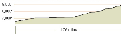
Elevation Change: 2,200′ – from 6,800′ to 9,000′
Recommended Map: Rockbound Valley & Meeks Bay, California
Elevation Profile:
Map of General Route:
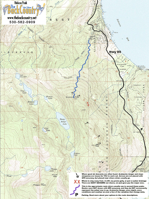
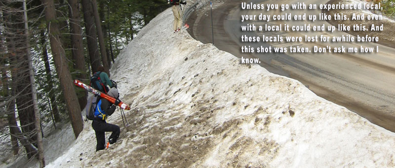
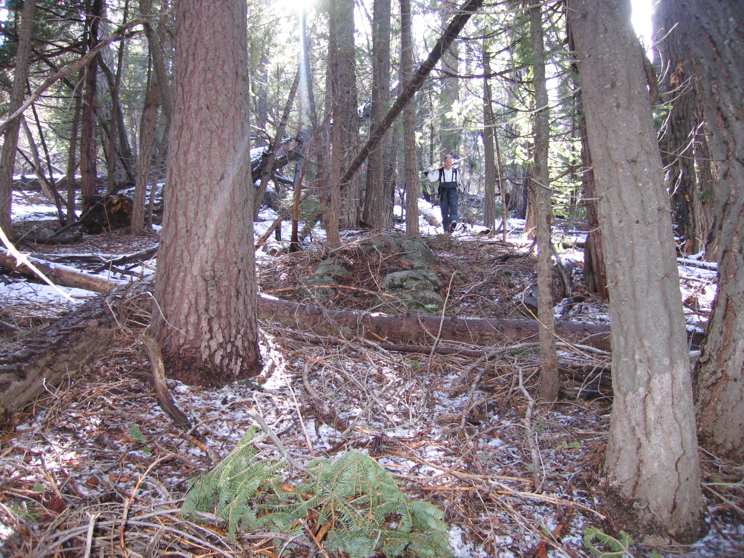
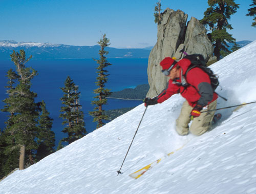
A Tahoe classic, this is the peak you can’t take your eyes off when you look toward the Sierra Crest above the west shore. The crux is figuring out where to park, since a few homeowners influence parking ticketing. I got towed one time to Truckee when I was dumb enough to park in a totally abandoned old house driveway. The plow guy taught me a lesson. Take a uber (there aren’t any I’m sure). CARPOOL. Get invited by a local. Show up early and don’t bleed into the streets where residents can see your car. There is room for about 10 cars completely out of sight. Rubicon Peak has been skied by locals before anyone ever lived in this neighborhood. It is a beautiful old-growth forest cruise in a fairly avalanche free zone.
I have tried to influence new parking on hwy 89 where a great flat parking area could be constructed across from 4 ring road. Our local BC ski advocacy group Tahoe Backcountry Alliance has tried to convince USFS and El Dorado County to open the locked gate up high in the neighborhood, where there is plenty of room to park near the water tower. Please call USFS, El Dorado’s Sue Novasel and ask for access to our mountains in the winter! Last I heard was they wanted the skiers to design, construct, plow, and insure our own parking lot. Seriously? And I bet if we figured all that out, they wouldn’t let it go through. One more note about driving up to the water tower and parking on Highview ct. These roads are crazy steep. Don’t go if it’s icy, like when the plows scrape the roads immediately after a storm. And definitely don’t drive up there with 2wd or bad tires if the roads are snow covered.
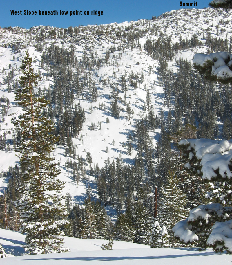
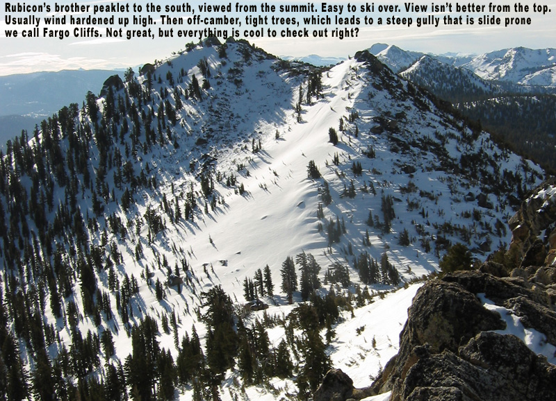
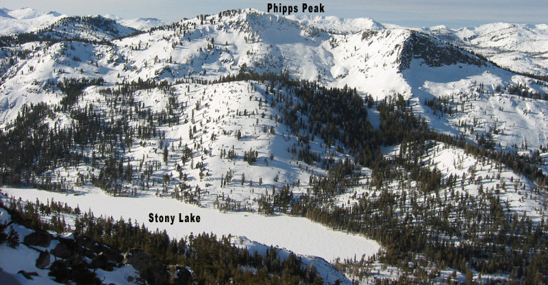
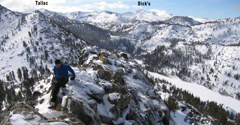
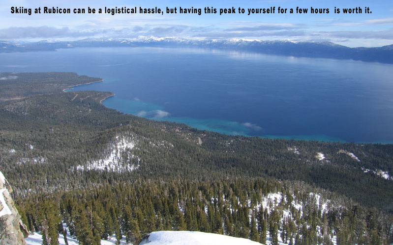
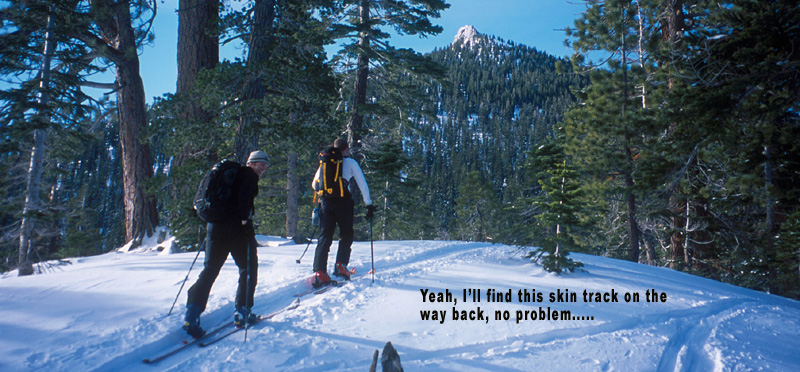
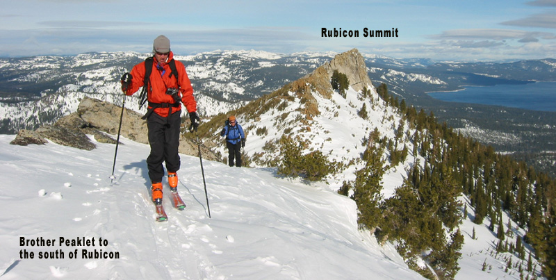
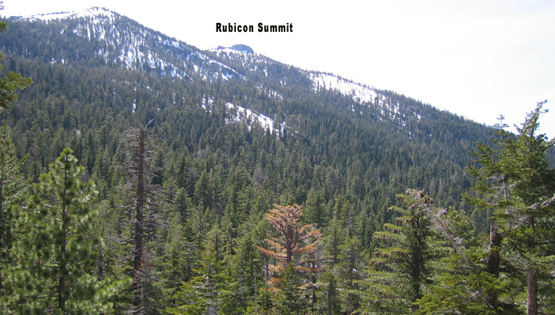
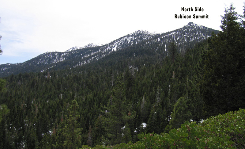
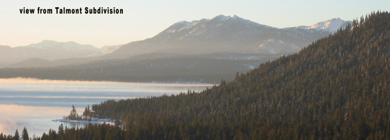
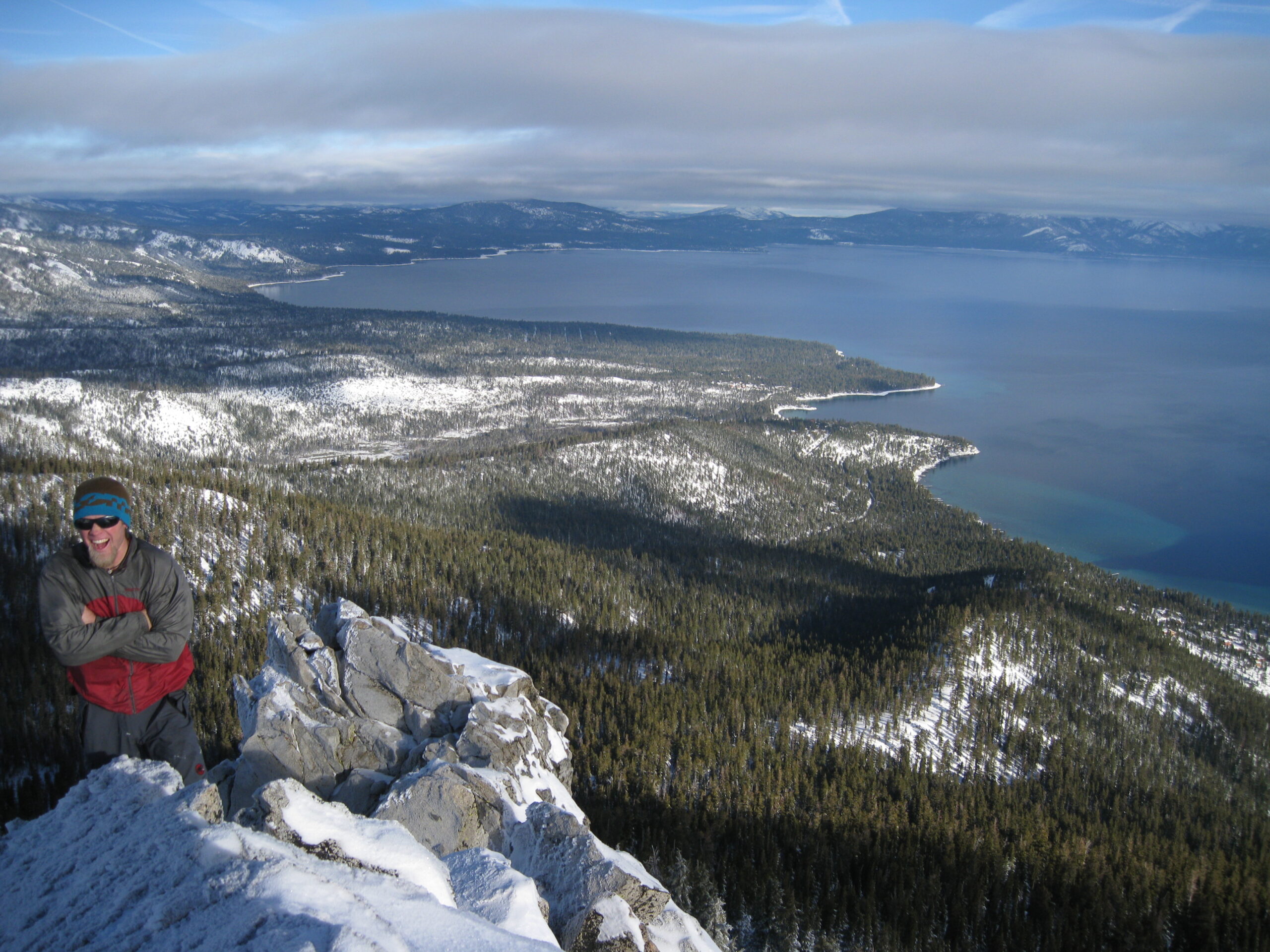
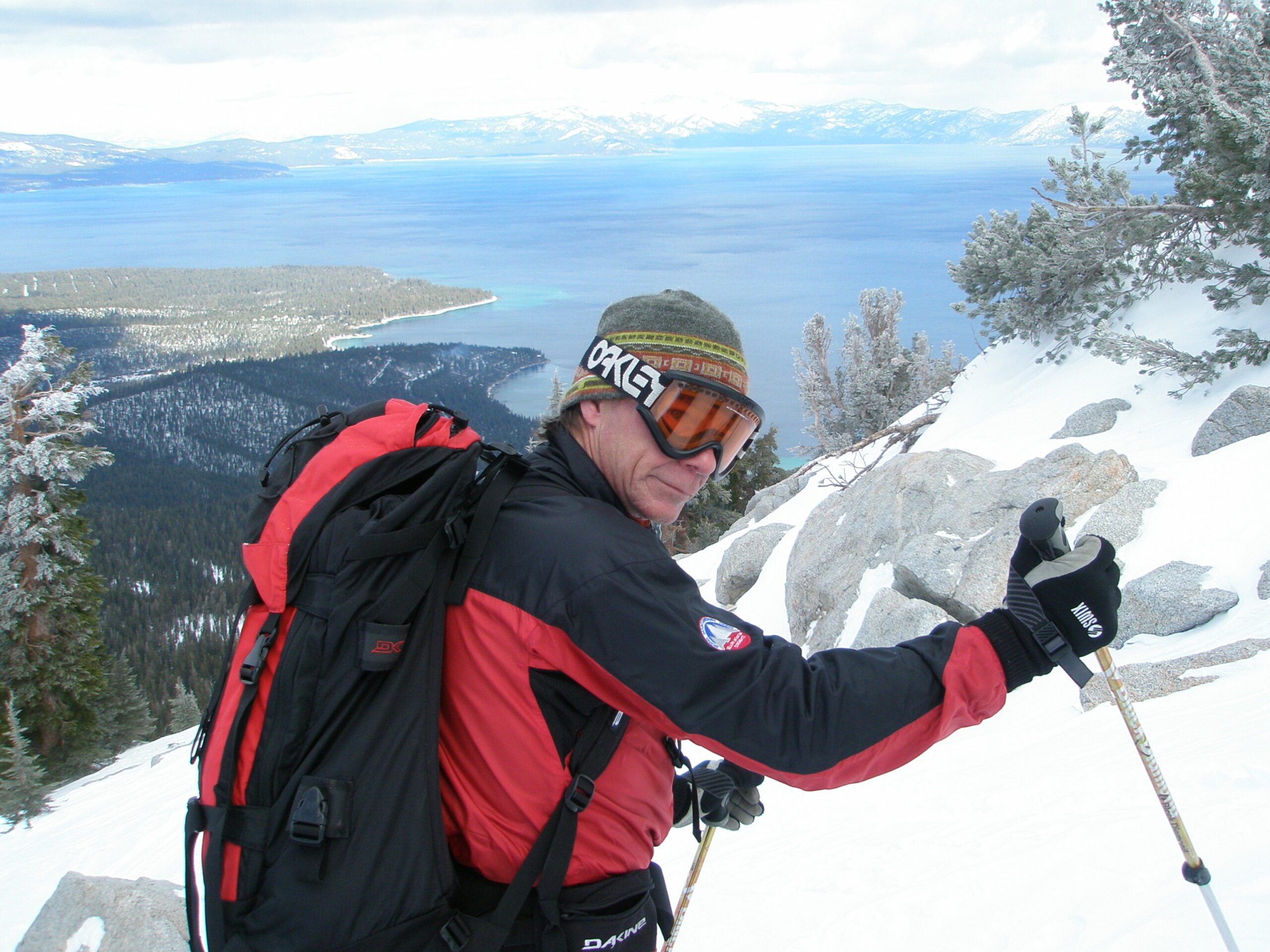
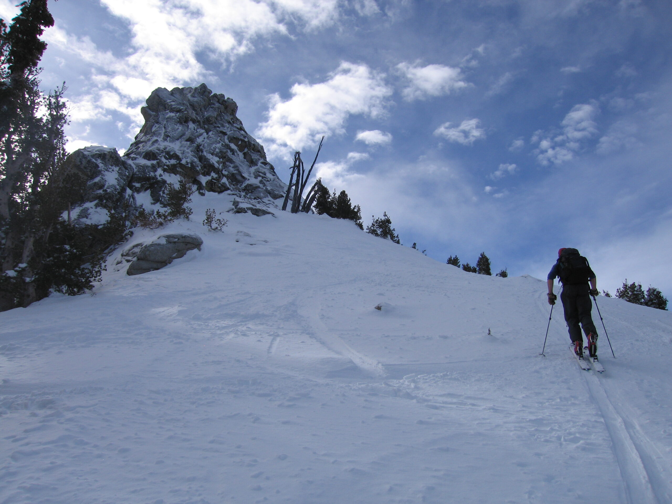
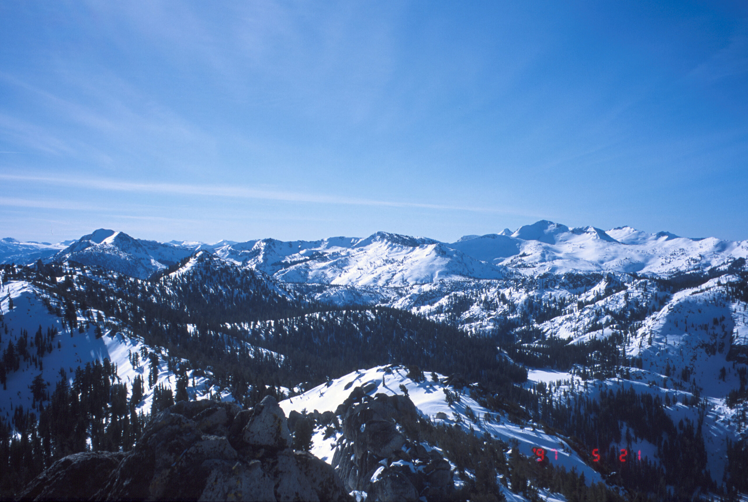
The view from the top of its 100’ Class 3 summit scramble is not to be missed if you are a rock climber. You could make class 5 moves if you aren’t careful, and only 2-3 people fit on top. I usually go up the north side, but it is possible on the west side too. The view is ok if you don’t climb the sketchy rock peak up there, don’t get into trouble. Finding the summit of this cone-shaped mountain is easy. Finding your start location is very difficult with the tree cover. The upper North and East aspects are excellent. There’s also a nice quiet west side to ski down to Stony Ridge Lake in times of deep snowpack.
A few people will hike up to Rubicon Peak each day in the summer on an old user created trail. Drive up to the same spot and follow a faint trail up the north ridge. It gets steep but has secure footing and even a spring for your dog at about the mid- point in the hike. Climb to the top if you are a climber, it’s the most exhilarating summit in Tahoe.
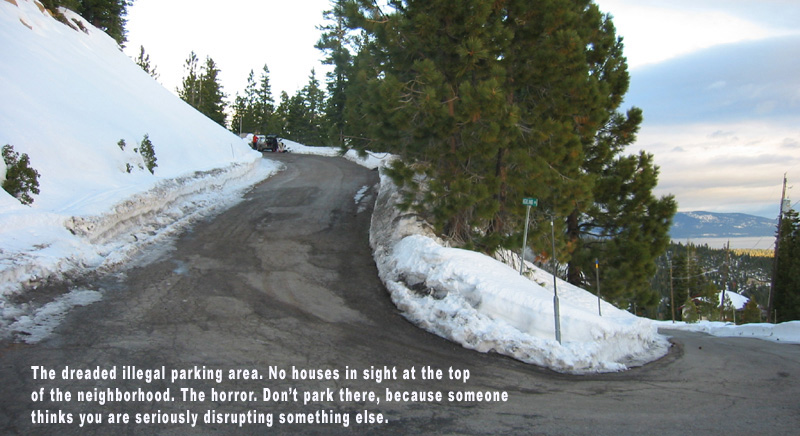
To reach the historic, year-round Rubicon Peak starting spot, Turn off of hwy 89 onto Scenic Drive, 14 miles south of Tahoe City. Then go left on county road 2538, right on Woodland, left on Manzanita, right on Lakeview, Right on Crest, left on Forest View, left on Highview, and right onto a steep dead end street. If you forget to bring these notes, just drive as high as you can in the neighborhood and look for the water tower and gated dead-end road. I park backwards so I can get out of there when it gets crowded. There are sometimes a few spots to park down lower on the west side of Hwy 89, just south of this neighborhood. You probably won’t get there first, and they are not technically legal. You are more likely to get a ticket right after new snow. Damn, just when you want to go there!
Here’s the parking deal according to Eldorado and Placer County. You can’t park anywhere but your own driveway from Nov 1 to May 1, unless you are off the highway BEYOND the snow stakes. The rule was pushed into place by the Meeks Bay Fire Department in 1982 when we had a record winter snowfall. Cal trans probably agreed quickly, as there was less chance for having to call tow trucks when cars were abandoned during snowstorms. Police use this rule to ticket us all around Lake Tahoe when there isn’t any snow plowing left to do. I have received tickets for parking on the side of roads in neighborhoods and in town when it hadn’t snowed in a month. I wrote in and got out of those tickets. I have always found Law enforcement and judges are very flexible and understanding around Tahoe. But the ticket writing is BS.
Here’s the solution. Put more of these signs “no parking when snow removal conditions exist” signs up and add more details if necessary. Let people get ticketed or towed if they mis-judge the potential for snowplowing, or block the road based the biggest possible measurement of an emergency vehicle. For the rest of us, please allow us access to our hometown public lands from these quiet little pullouts. Or, build more parking, which I’ve been told point blank, is very out of the question. Designated parking lots have certainly been built for smaller user groups. Contact USFS, Placer County and Eldorado County Supervisors and tell them you want access to your Lake Tahoe’s Wilderness in the winter too. Not everyone wants to go to a ski area. These days you can’t. It costs too much and there is grid lock traffic. Plus there are those mean icy moguls there.
Back to Rubicon Peak. This was one of the first popular backcountry ski destinations due to reliable powder, awesome views, and relative safety. Locals parked on this high, lonely dead end road for decades, bothering and blocking no one. No neighbors can even see the parked cars. In one recent year this neighborhood seemed to be patrolled daily by the local sheriff. I asked what the real problem is, but just got the Nov to May rule answer.
Oh, and if you are a local getting angry that Rubicon Peak skiing is explained on my website, I’ll say that when I moved here in 1992 I knew about Rubicon Peak from two other similar sources. Alpenglow Sports in Tahoe City literally handed out a hand made map and description of skiing Rubicon, Silver, and maybe Tallac if I remember. And there was a hardcover classic ski touring guidebook which highlighted Rubicon. The good thing I hate to admit about the lame stance our land managers have in the Tahoe Basin regarding wintertime access to public lands, is that it keeps the crowds consistently manageable. Rubicon isn’t more tracked out today then it was in 1992 when I first skied up there.

Looking for awesome ski and splitboard tours in the Sierras? We’ve got write ups on many common and uncommon tours curated by the owner of the BackCountry, Mike Schwartz.


Our new REPLY with PHOTO works! Here are some shots of me and Marty from Feb 21, 2021.