Location: West Shore – Lake Tahoe, CA
Duration: 1.5-2 hours
Elevation Change: 2,400′ – from 6,600′ to 9,000′
Recommended Map: Emerald Bay, California & Rockbound Valley, California
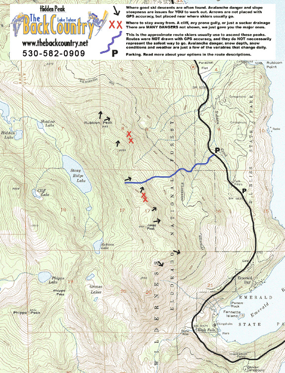
Map of General Route:
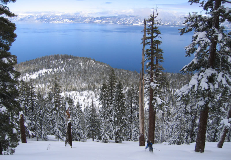
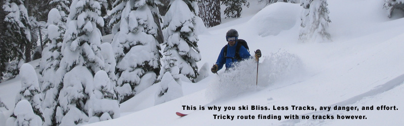
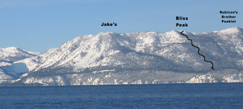
Bliss Peak, also known as Hidden Peak, is the short tour Tahoe City locals hit before work, or if Jake’s Peak is crowded. Bliss Peak offers nice views and enjoyable mellow tree skiing, but the terrain is limited and gets tracked out in a day or two. There is no mountain top sensation at the end of your climb either. Consistent mature tree cover in this zone lends to relatively less avalanche danger. The powder stays good for a long time. I consider this the beginner area, but some diehard locals go there too. They must have found some cool loops into better terrain that I don’t know about. Bet they won’t post it up here!
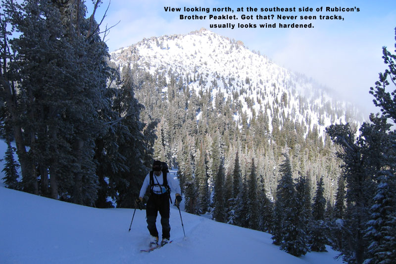
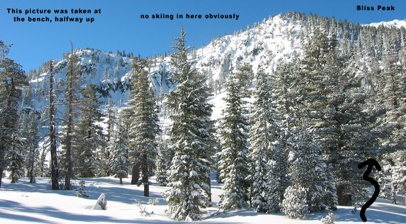
Parking for Bliss Peak is found in a NOW TINY, paved, pull out on the east side of hwy 89. CALL TRPA who oddly has been reducing backcountry ski access parking since 2015, claiming they need to manage erosion such that parking is just over. Um….seriously? TRPA is charged with restoring lake clarity and ALSO improving and enhancing recreation opportunities. They even claim there are many backcountry skiers working there. I found none. There was an important skier paved pullout for 20 cars forever, and in 2016 they had Cal Trans reduce it to about 5 tight parallel parking spots. Ask them to replace the asphalt here, and figure out the water runoff issue that I doubt existed. This asphalt removal was part of a huge hwy 89 pullout reduction project, with no regard to the few important recreation access needs here and there. You can drive by this parking spot without notice. It is in a windy part of the road, and just north of the Bliss State Park Headquarters. Cal Trans and local law enforcement has told us that we can park here, and I haven’t heard of anyone receiving a ticket. Walk across the street and follow the skin track up to the Sierra Crest. Half way up, you will spot some steep cliffs from a bench. Stay away from this steep area along the descent. Your route up and down lies in the trees next to these cliffs.
You can also go for neighboring Rubicon or Jake’s Peaks from this parking spot with some creative route selection. Tree cover is thick down low, and you really need to know these peaks a bit before attempting this. If you go for Rubicon peak, avoid the steep gully shown with XX on our map. You won’t be able to climb the south side of Rubicon Peak either.

Looking for awesome ski and splitboard tours in the Sierras? We’ve got write ups on many common and uncommon tours curated by the owner of the BackCountry, Mike Schwartz.


