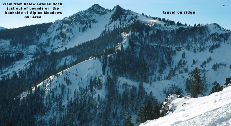

The the skiTwin Peaks/Grouse Rock
Location: West Shore – Lake Tahoe, CA
Duration: 1 – 2 hours
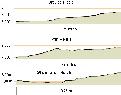
Elevation Change: 1,678′ – from 7,200′ to 8,878′
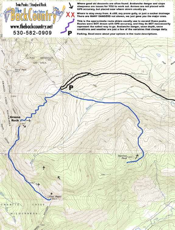
Recommended Map: Ward Peak & Sunnyside, California
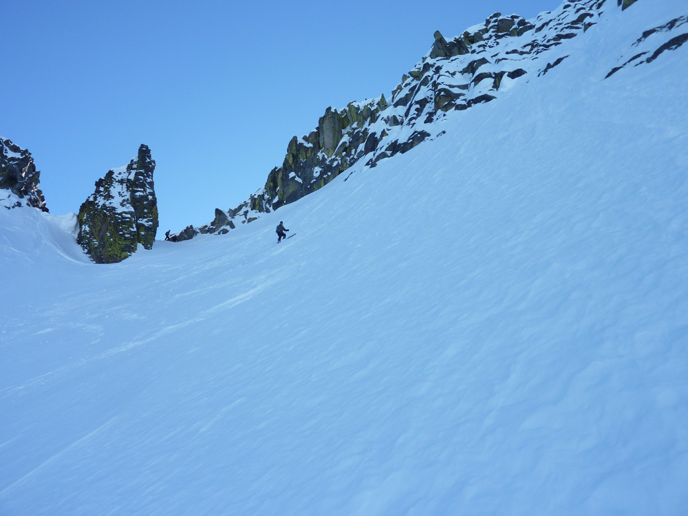
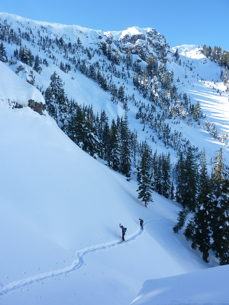
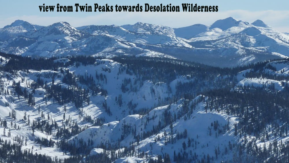
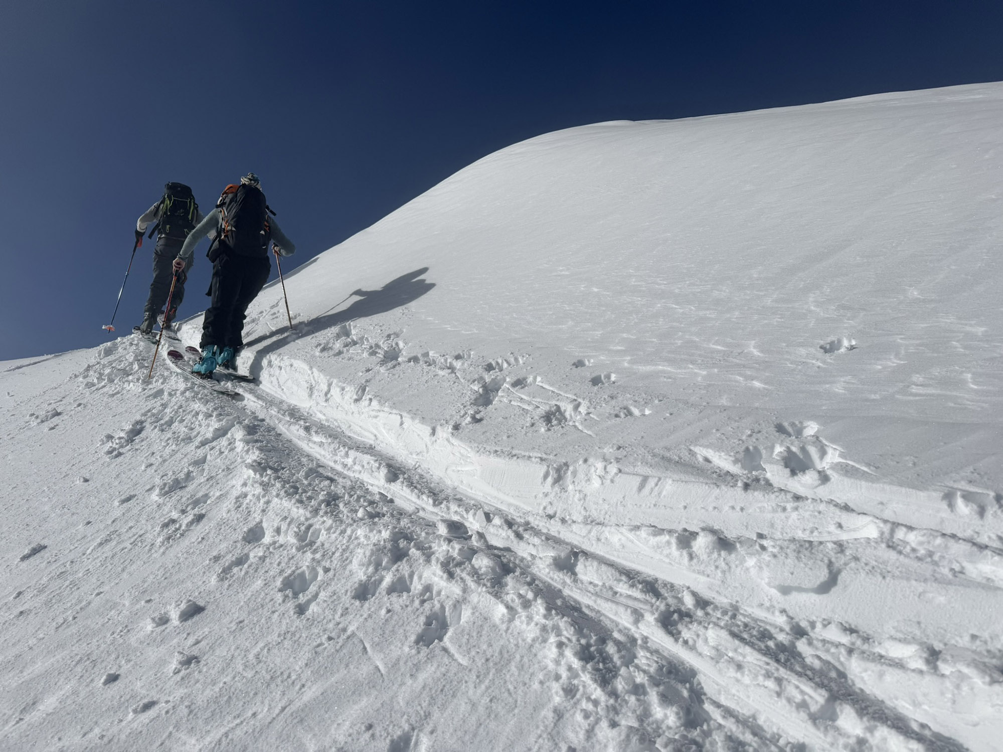
If you’ve skied Alpine Meadows, you may have wondered how to get over to this nearby backcountry beauty. The summit has amazing views of Lake Tahoe and Desolation Wilderness, and a bit of rock scrambling to reach the top. Stepping down into the notch between the two peaks is also a bit unnerving as you pass your skis to your partner. Don’t drop them! The top few turns are about 45 degrees. Obviously a ski descent like Twin Peaks is not for beginners. I guess you could ski back the way you came up if you don’t want to drop the main line. Or just get lost in the hills surrounding the peak for some short exploration runs.
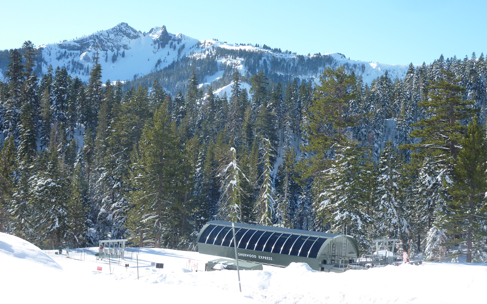
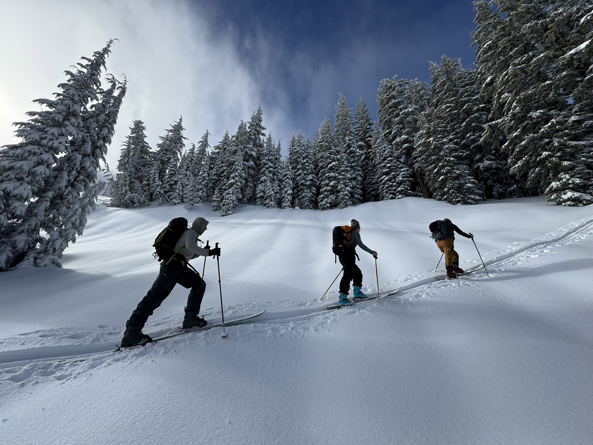
Your choices are either to skin a long and sometimes icy 1000’ to the top of Twin Peaks from the edge of the Alpine Meadows Ski Area, which also involves navigating your way up to the Sierra Crest from the top of Ward Canyon, near the Sherwood Chair. Or ride the chairlift up to the crest. If you want to earn your turns without a lift ticket dangling from your jacket, park at the end of Ward Creek Road; a 5-mile drive from the Sunnyside area on the West Shore. The privately owned parking area at top is maintained for Ward Canyon residents, for accessing the Sherwood Chairlift. They have been friendly towards skiers going for early season powder, or anytime this backside lift isn’t running. Don’t park here when the chairlift is in operation, as you will be competing with homeowners that have a parking pass. The backside of the ski area usually opens around Christmas, just in time for you to graduate to bigger Tahoe ski tours anyway. The ski area management changes so often that I don’t know anymore how they interact with backcountry skiers leaving their boundaries. This is leased USFS land over here in the Sherwood area, so it’s probably grey area.
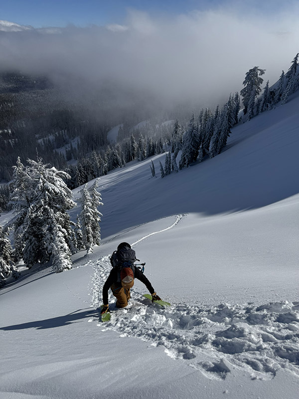
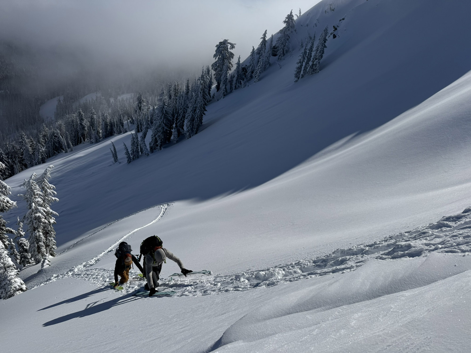
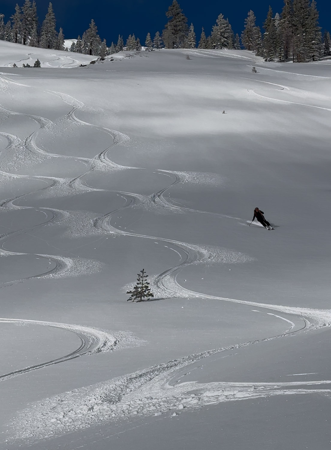
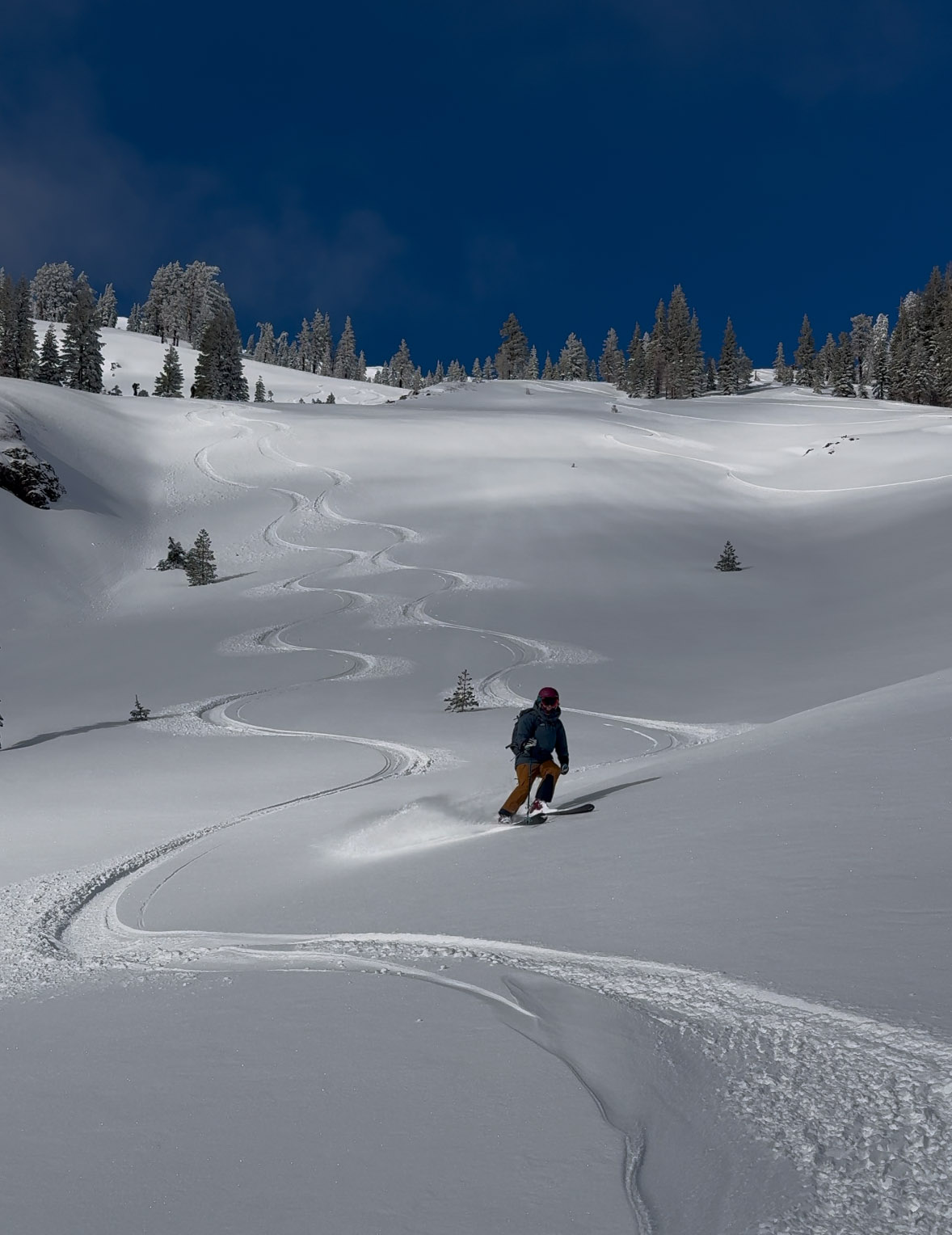
I like to skin up below the peak and just to the climber’s right side of the peak where you see a weakness in the terrain angle. This is a deep snowpack zone right at the Sierra Crest and may have wind deposited slab snow to evaluate. Twin Peaks doesn’t see much traffic because it’s a bit far to get a short run, and snowmobiles track out the lower slopes. If you find good snow on the way down, lap it again.
You’ll need skins to get back, as the terrain is quite flat below the Twin Peaks. And consider a lap below Stanford Rock, to the left of the peak. Skin up into those steep NW facing trees by first gliding downhill with skins off from the Sherwood Chair base area. The Grouse Rock backcountry ski terrain is a popular in early season. It doesn’t take much snow depth to cover the ground below the Sierra Crest right here. You will hit rocks up near the crest in early season however. Take it easy, you are probably skiing Grouse Rock or Standford Rock in early season just to get things going. People blow out their knees and wreck their skis in November. And you are skiing Twin Peaks later in the season when snowpack has proven stable, and you are ready for an exciting moment up top.
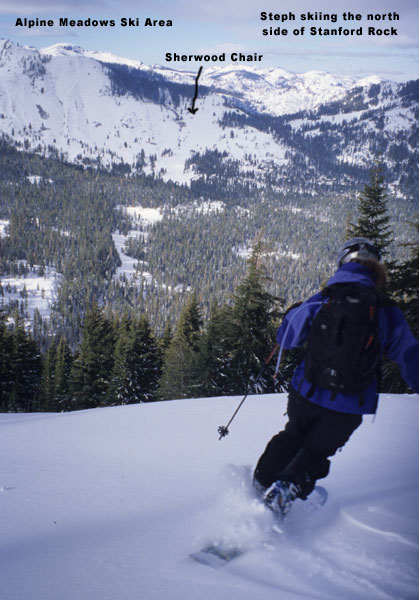
Stanford Rock
Location: West Shore – Lake Tahoe, CA
Duration: 1 hour or less
Elevation Change: 1,433′ – from 7,040′ to 8,473′
Recomended Map: Ward Peak & Sunnyside, California
Stanford Rock is a West Shore quickie you can hit from the bottom of Sherwood Chair, at Alpine Meadows Ski Area. Stanford Rock offers a short, moderately steep, treed slope, that holds winter powder for a long time. Climbing up to Stanford Rock is worthwhile just for the stunning and close range view of Twin Peaks. From the Sherwood Chair, head downhill unnaturally, and away from the lift. Find the base of the north facing treed slope you saw from you car, and pick the path of least resistance. You will often find a skin track here. Coming back can get a bit confusing, and requires putting your skins back on for a short stretch. Head over for a run below Grouse Rock if you still have time.
I’m not sure what Alpine Meadows stance is on ski touring in this area. USFS owns all the land, and you can’t accidentally lure the resort skiers up the hill and into trouble.
Park at the end of Ward Creek Road; a 5-mile drive from the Sunnyside area on the West Shore. The privately owned parking area at top is maintained for Ward Canyon residents, for accessing the Sherwood Chairlift. They have been friendly towards skiers going for early season powder, or anytime this backside lift isn’t running. Don’t park here when the chairlift is in operation. The backside of the ski area usually opens around Christmas, just in time for you to graduate to bigger Tahoe ski tours anyway.
Elevation Profiles:
Map of General Routes:

Looking for awesome ski and splitboard tours in the Sierras? We’ve got write ups on many common and uncommon tours curated by the owner of the BackCountry, Mike Schwartz.


I skied below Grouse Rock on 12-30-24 and found great snow coverage at the car. The parking area up at the top wasn’t plowed at all. I assume the homeowners would rather not have it available to to anyone if they have to share it. Bring a shovel and even a snowblower and get in there somewhere.. I found plenty of room for a plow or fire truck to pass my car in the circle up there, but you always risk getting some jerk who needs to have you ticketed or towed in Tahoe for trying to access public land in the winter.