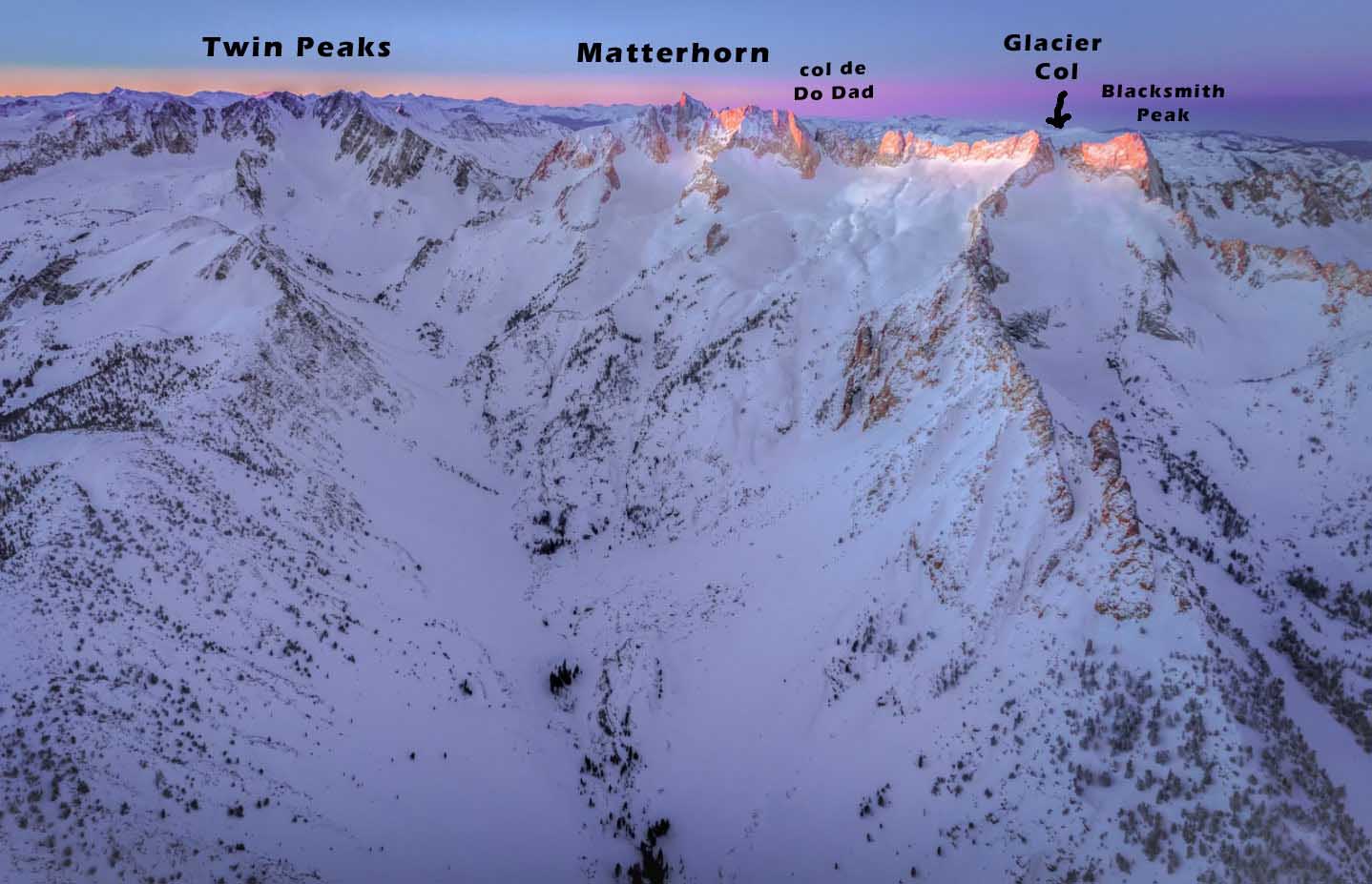

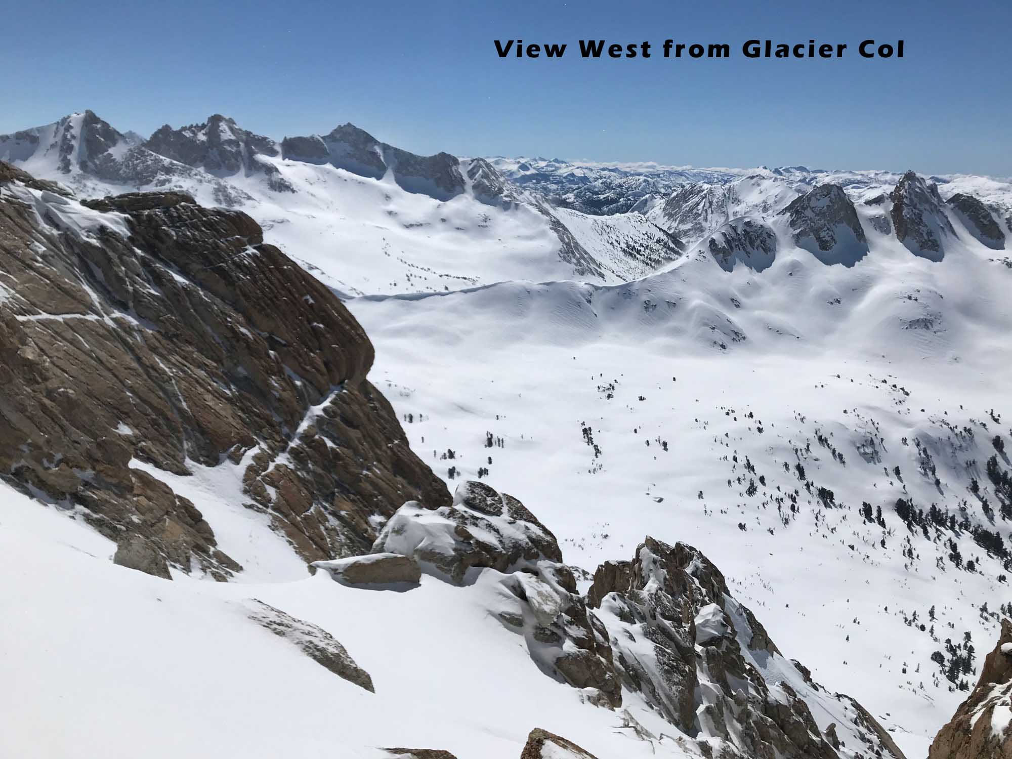
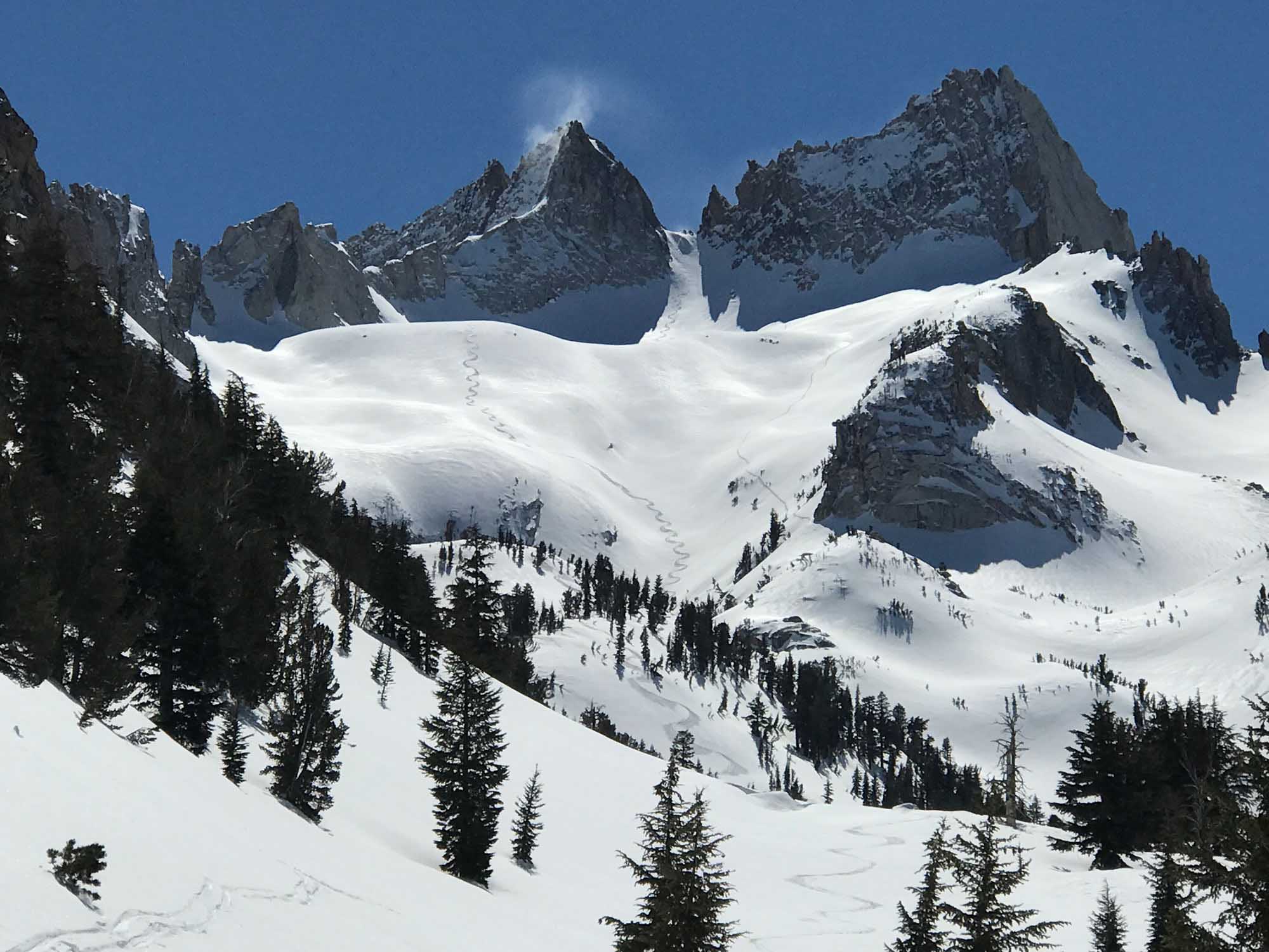
Glacier Col 11,560′
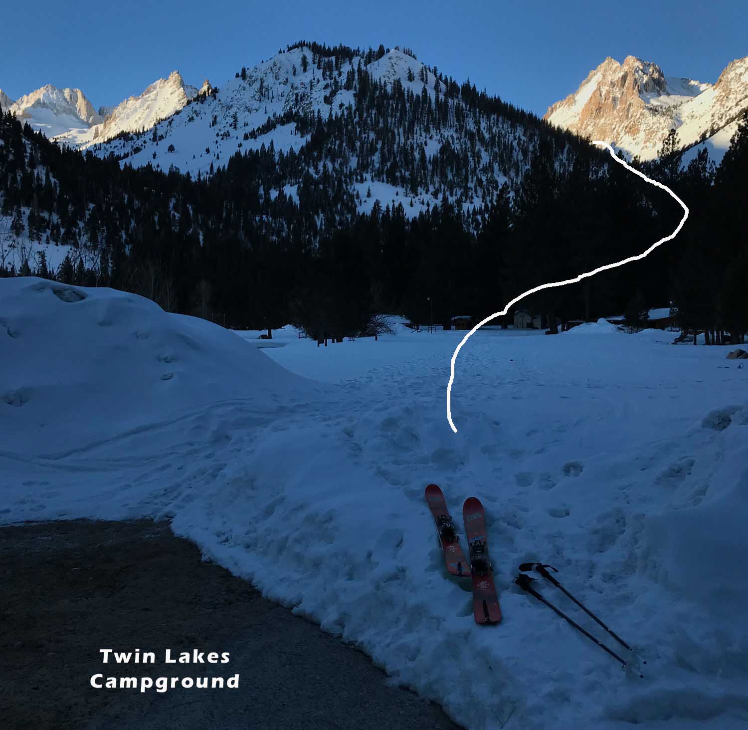
Location: Twin Lakes Campground – Bridgeport, CA
Elevation: 7,100 – 12,500′
Recommended Map: Hoover Wilderness – Tom Harrison
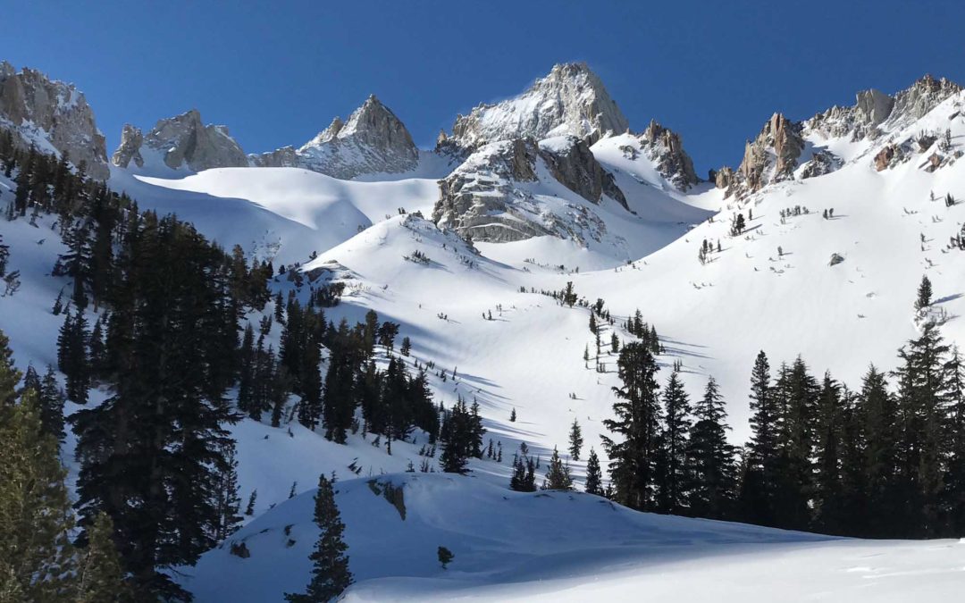
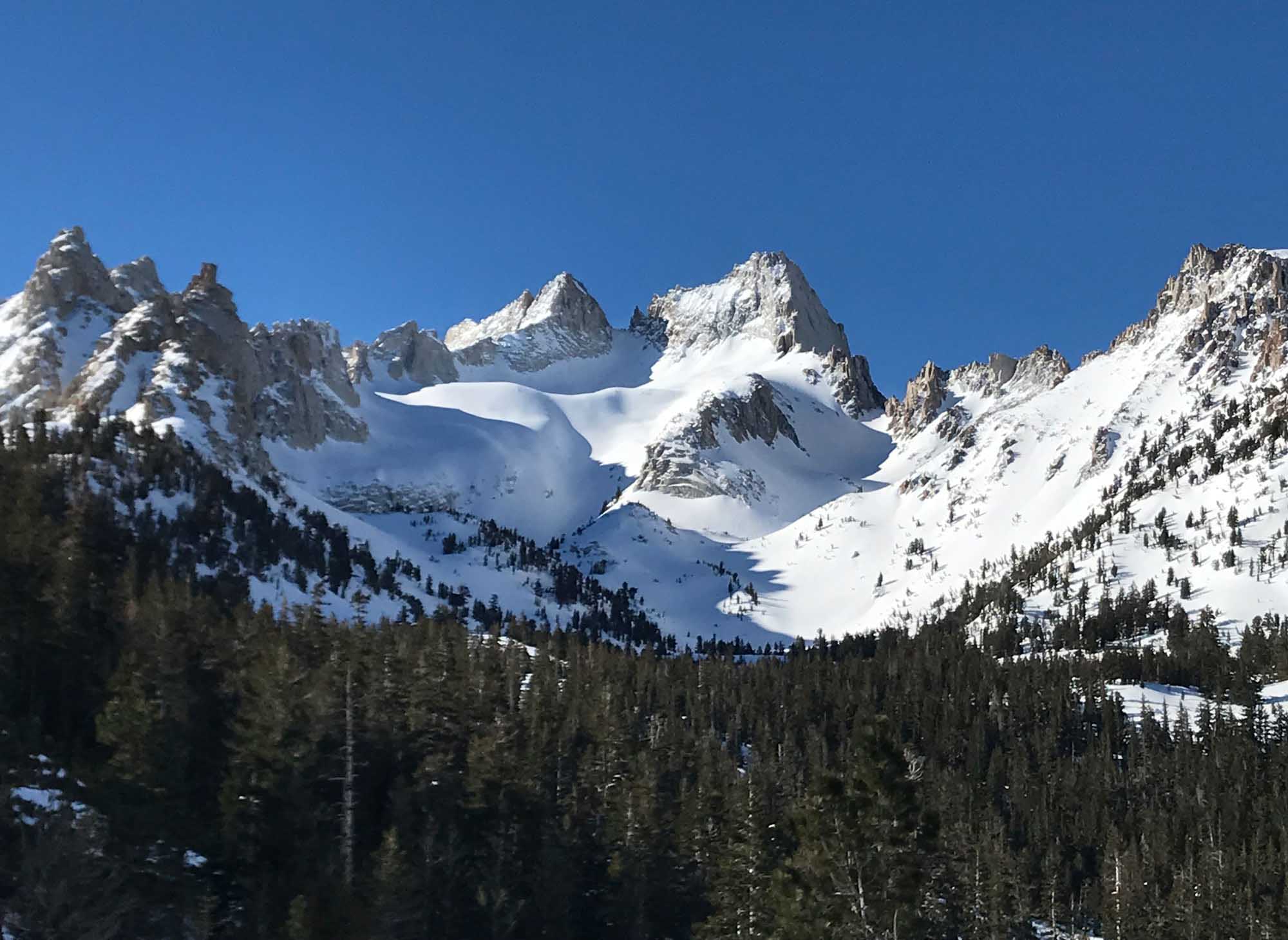
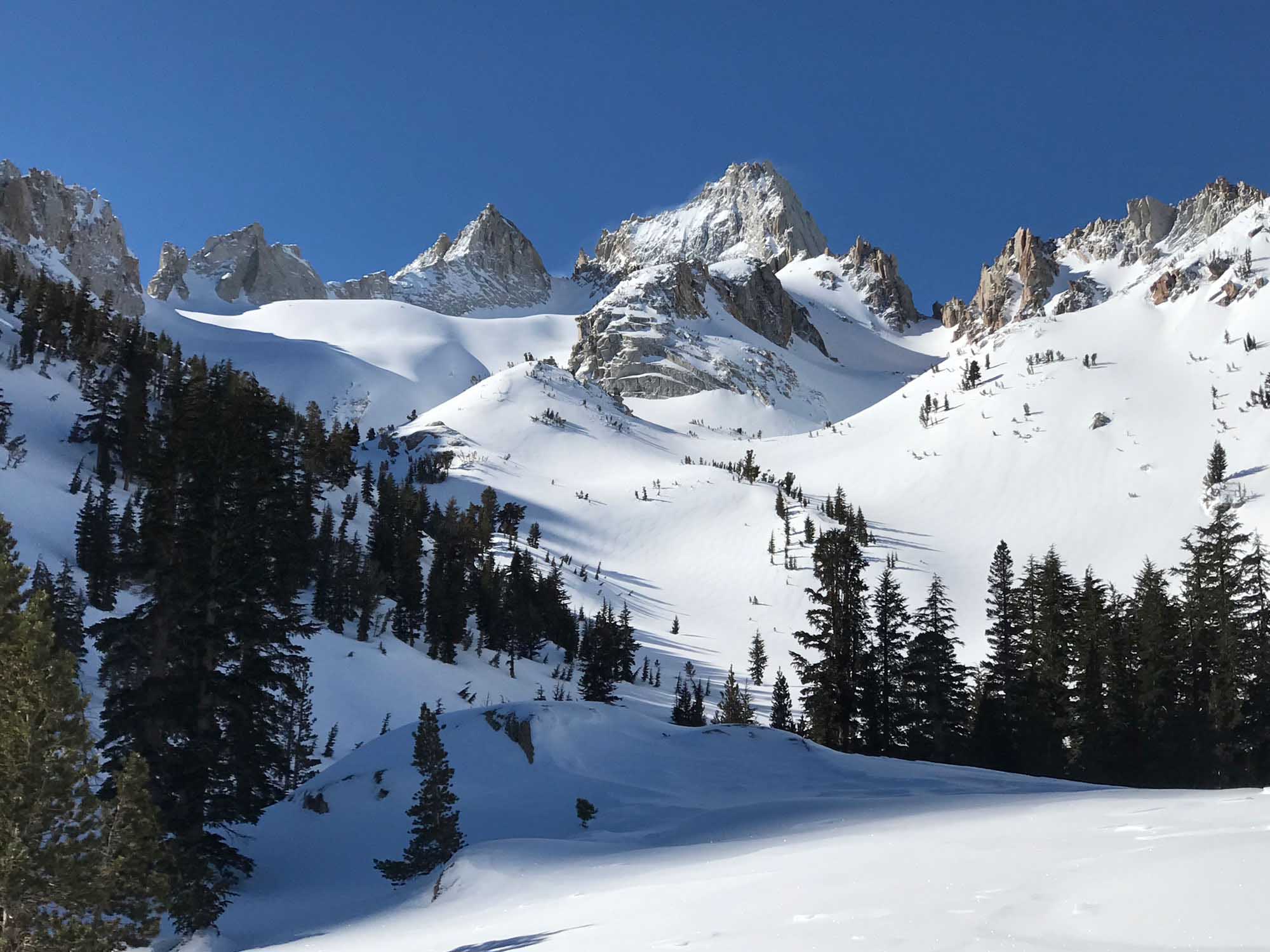
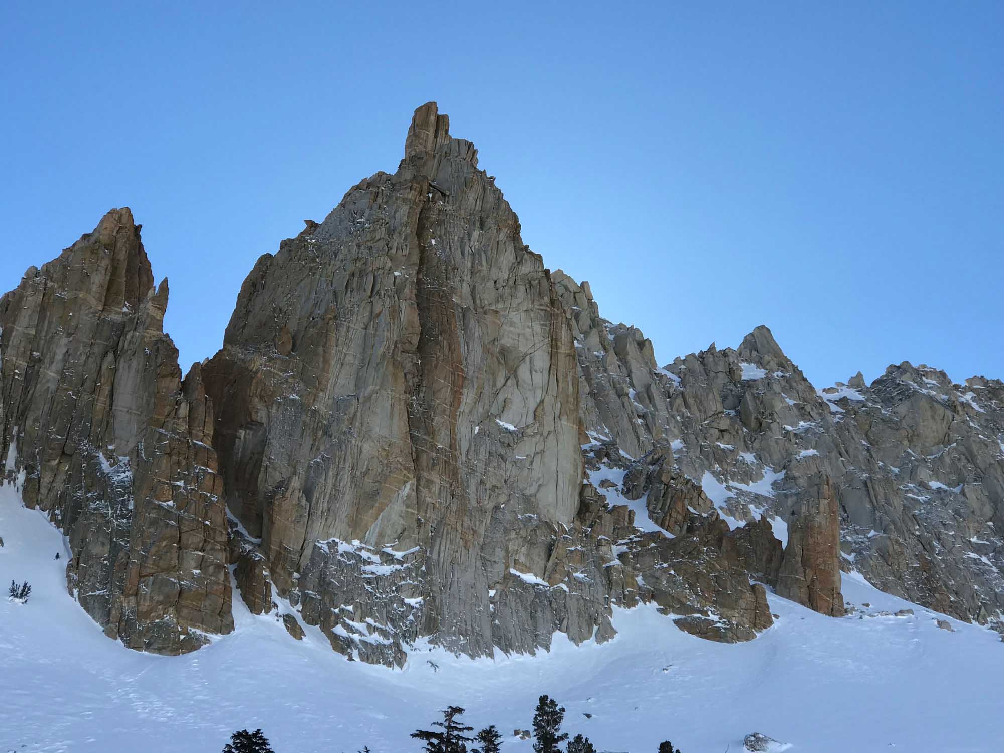
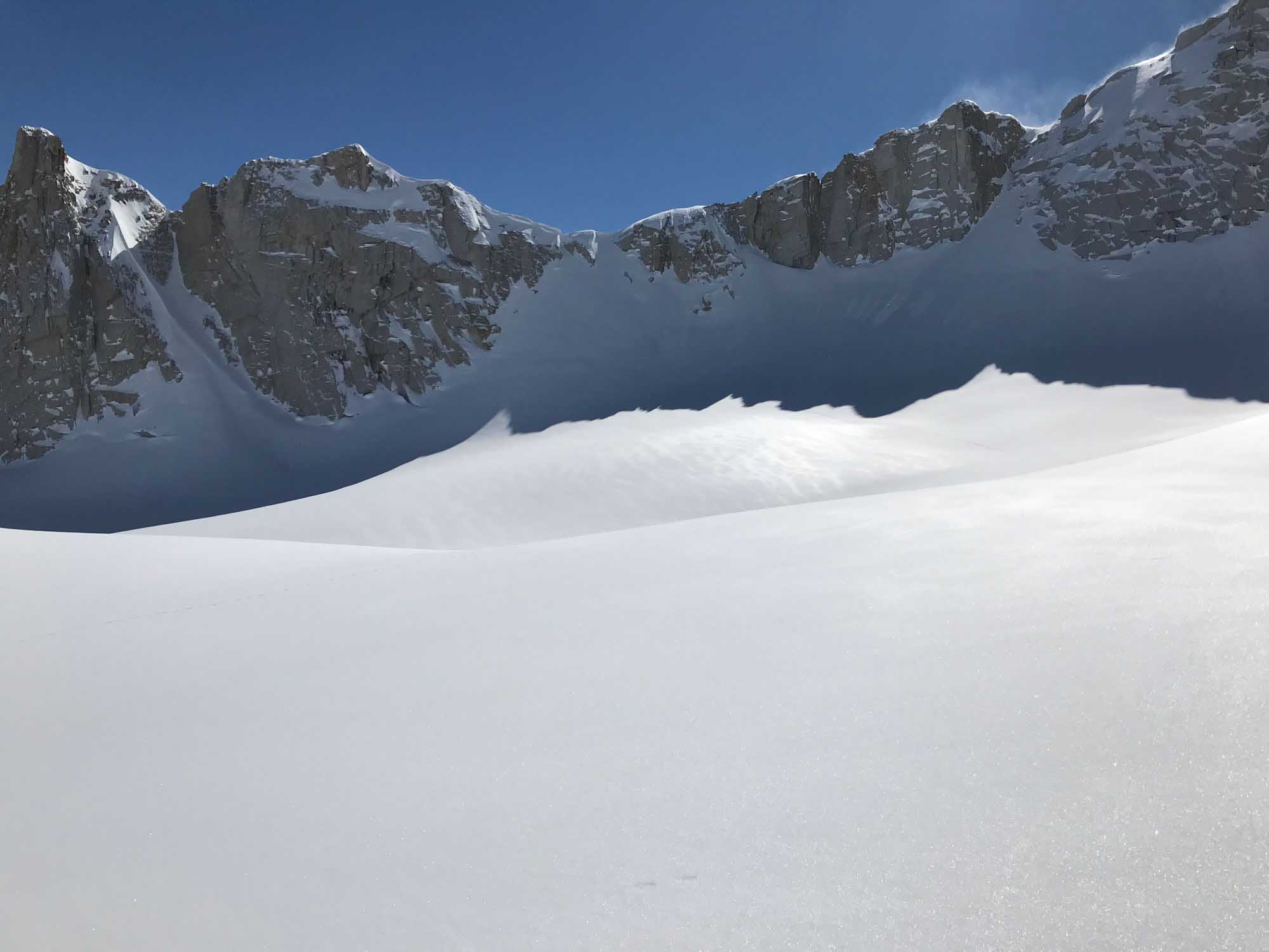
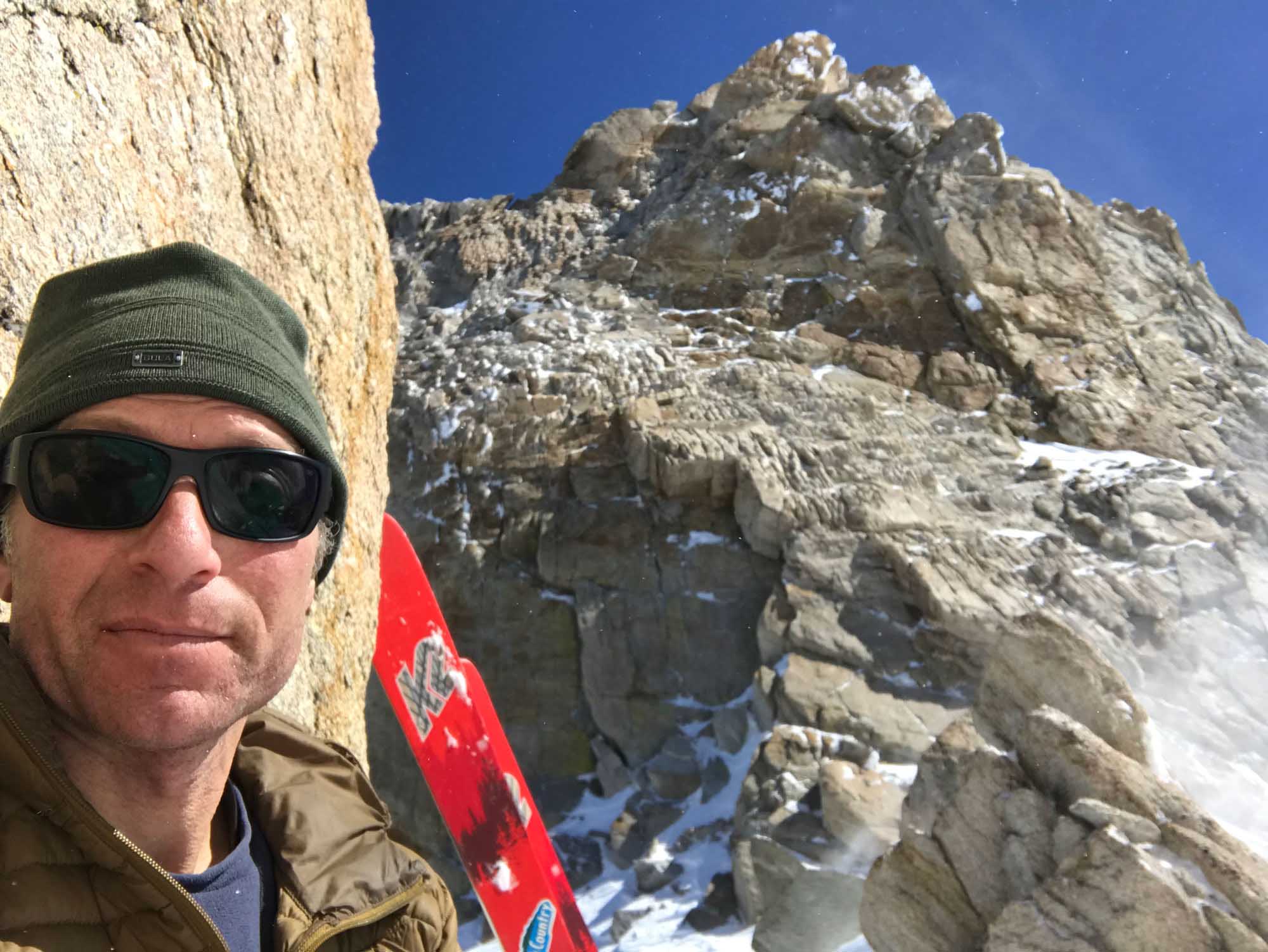
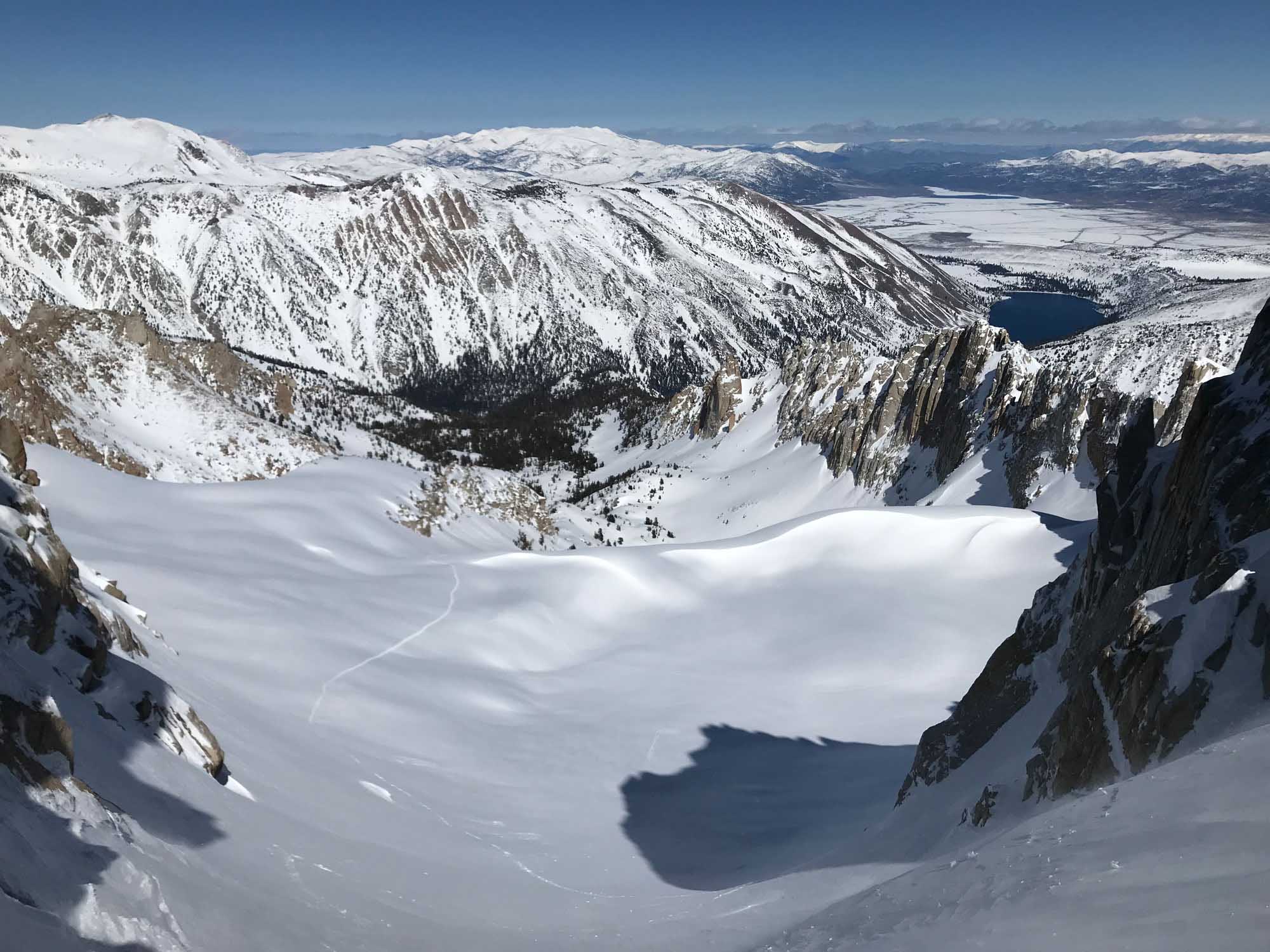
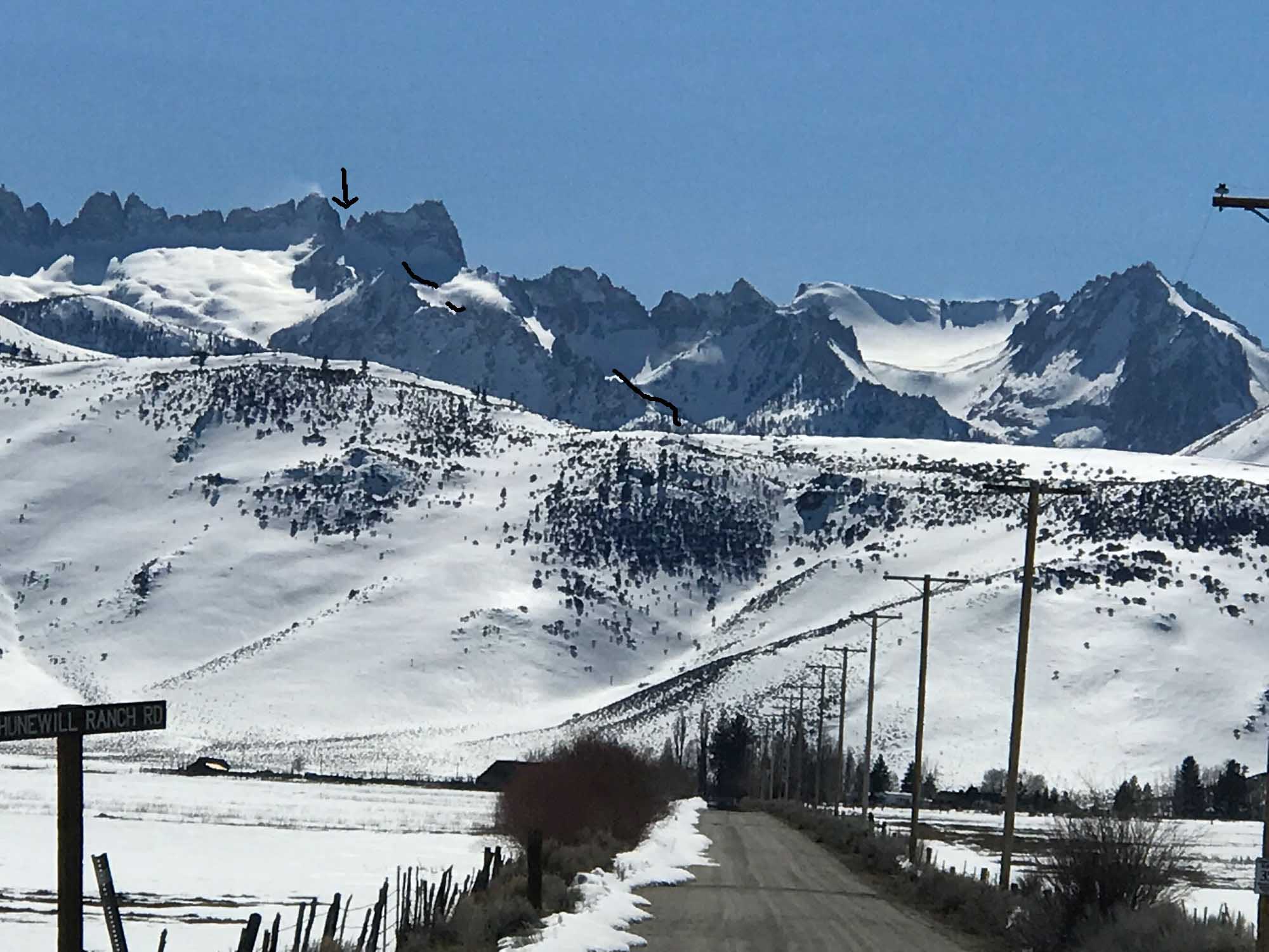
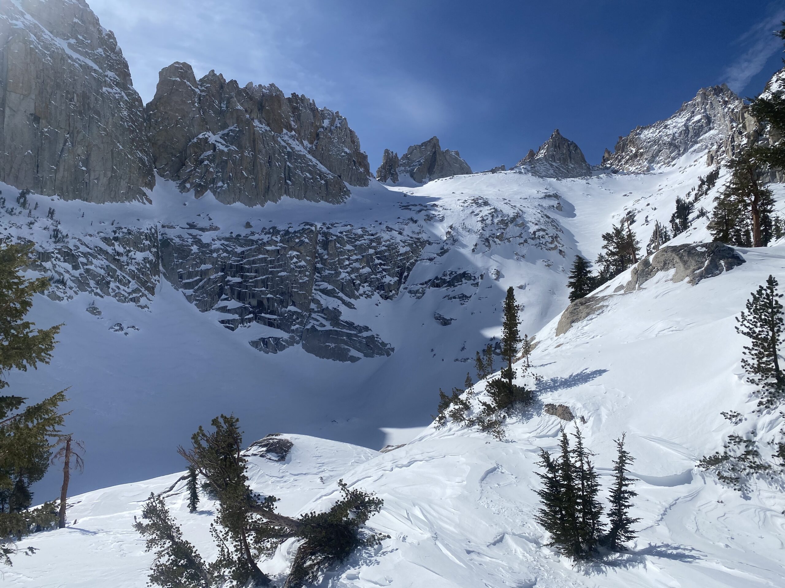
This was a new ski tour for me that I enjoyed checking out solo in mid March of 2019. I’ve done it a few more times now and have edited this toda 4-8-25. I have skied up Horse Creek towards Matterhorn many times, and also up the Blacksmith Creek Drain and Big slide Canyon. I had never noticed from any vantage point that there is one more narrow canyon that leads to the Sawtooth Crest, right above the car and in-between Horse Creek and Blacksmith Creek. Enter Aerial Photography! I have never met Ed Cesnalis of Mammoth, but I very much enjoy looking at his facebook posts of beautiful pictures he takes from his small plane flights. From this one picture you’ll notice in this post, there is a big snow patch beneath the crest on the right, which is above Avalanche Lake. The high obvious notch you’ll likely choose to ski is called Glacier Col. At the top of the col you could climb Cleaver Peak if you know what your doing, but it was way too windy for me to inspect the difficulty. Secor’s PPT guide calls the NE and NW faces of Cleaver Peak to be 3rd class. I would estimate it to be 300′, and not ski boot terrain. I hid from high winds in a small protected sunny spot at the top of the Col with a great view to the west and called that my high point at about 11,500′.
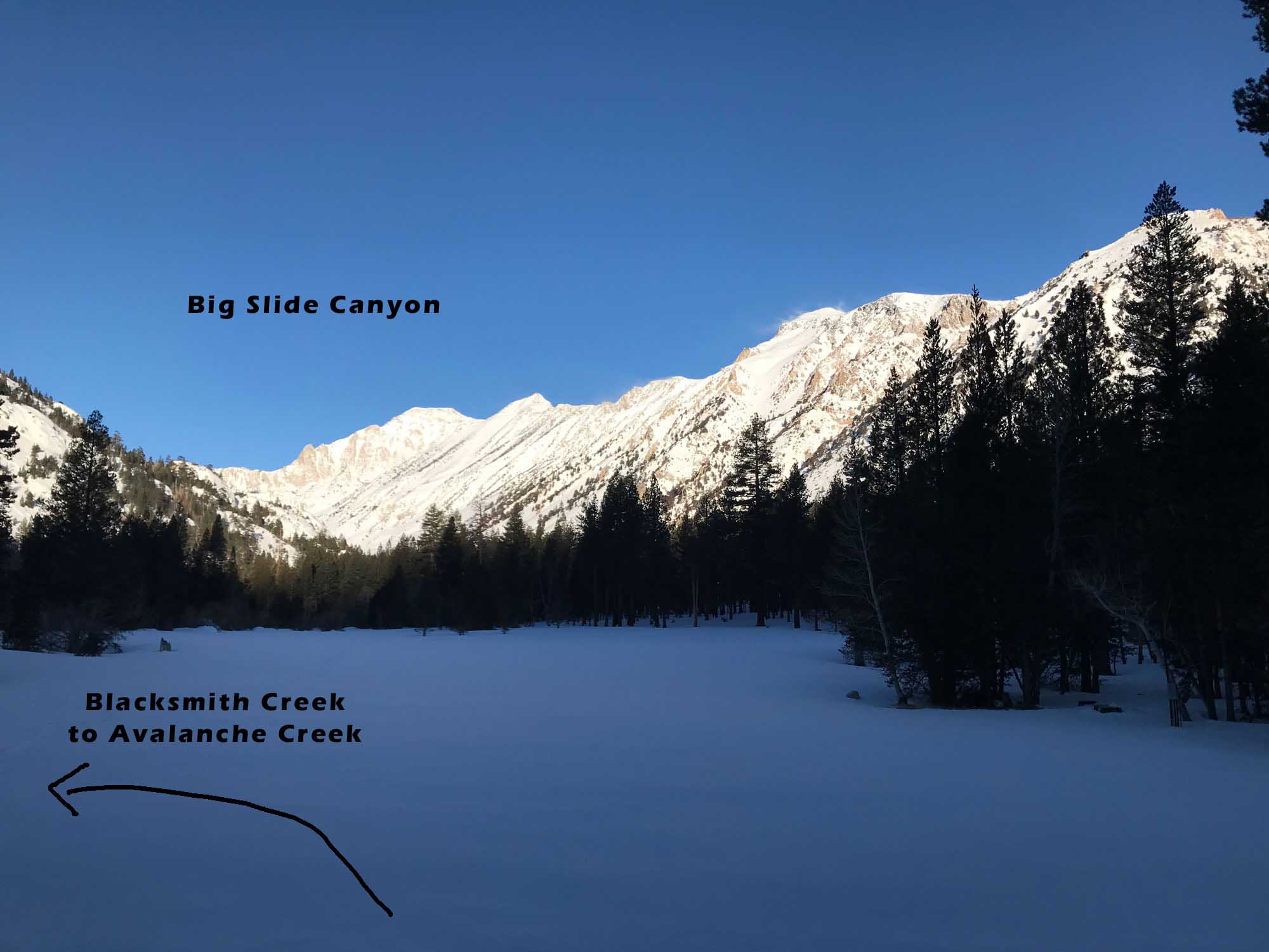
From your car at the Twin Lakes Campground gate, be courteous and quite when you ski through their closed concession campground. Find the bridge in the south end of the campground and start skiing north along Robinson Creek for about 10 minutes before angling up into the steep treed slope on your left. I have crossed a big log that across Robinson Creek at the edge of a big meadow but have recently located the Bridge thankfully. I am not suggesting crossing the bridge on the true south end of the campground, which provides access to the Horse Creek trail and Matterhorn Peak. They are near each other. The Bridge across Robinson Creek is a straight shot through the campground on a snow-covered dirt road heading west.
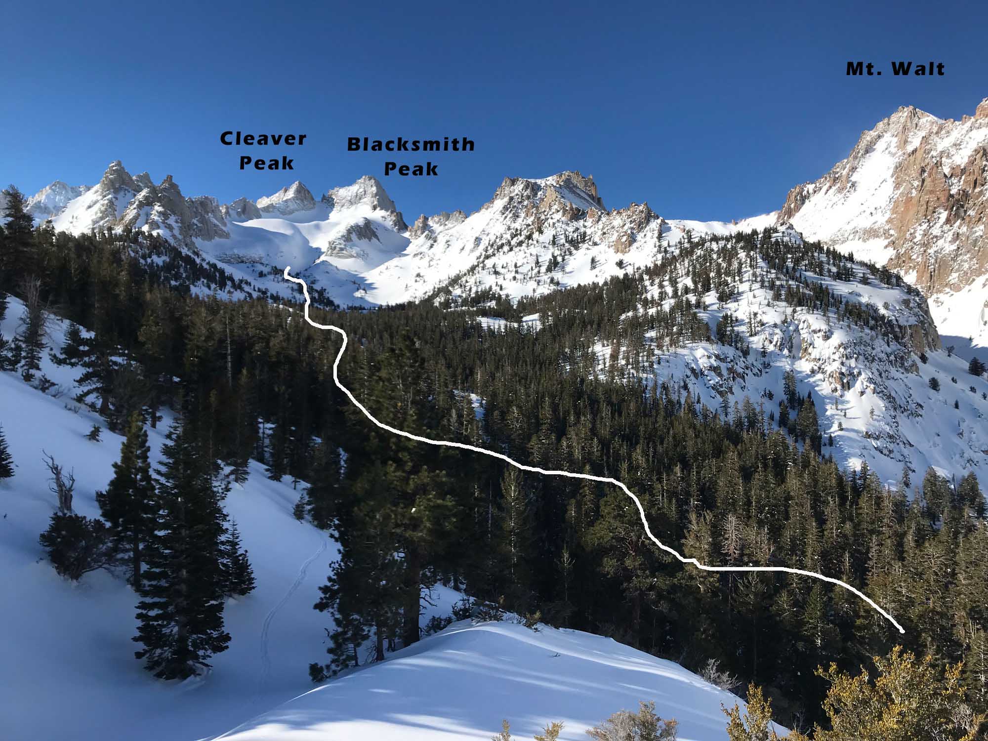
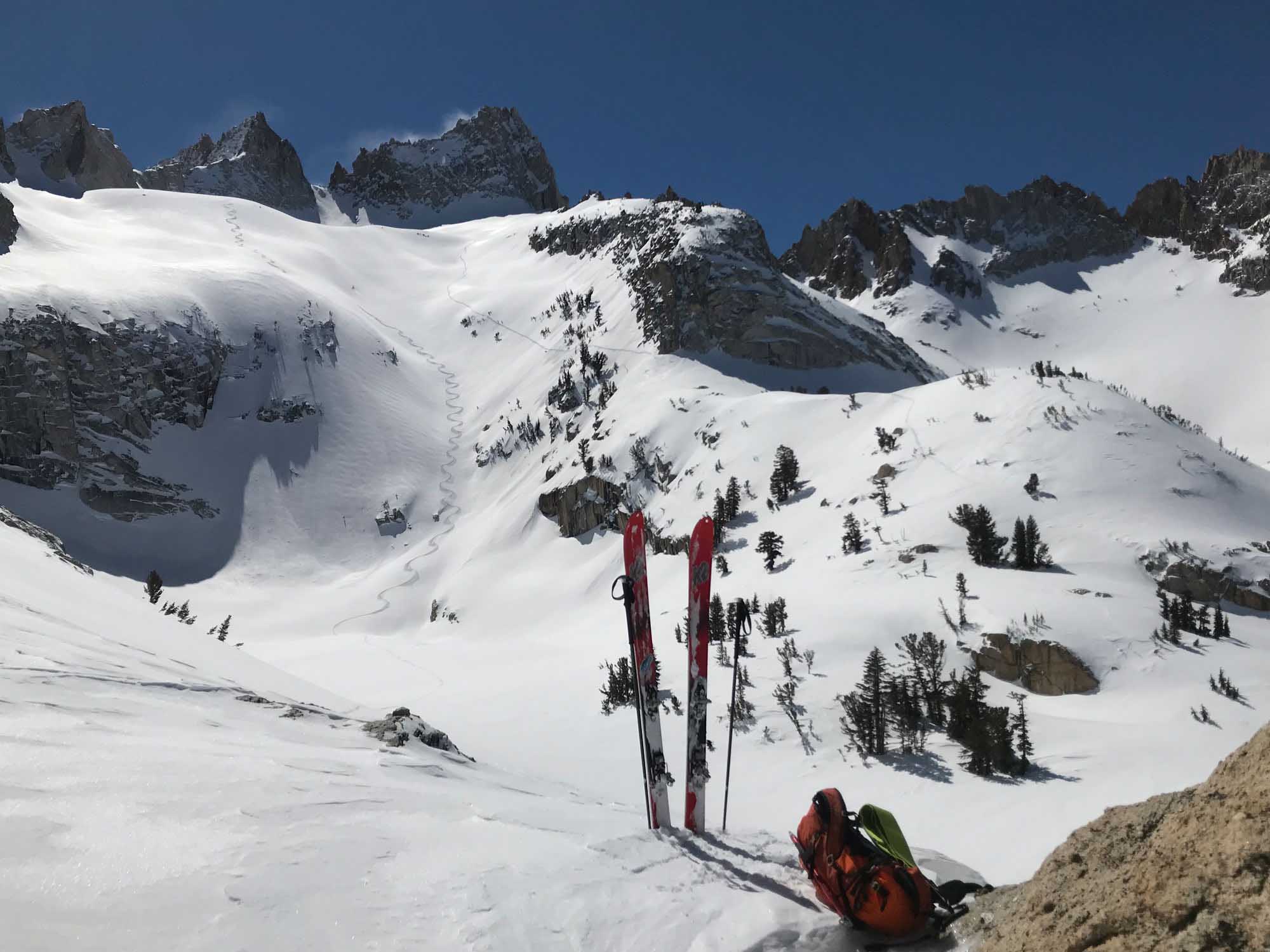
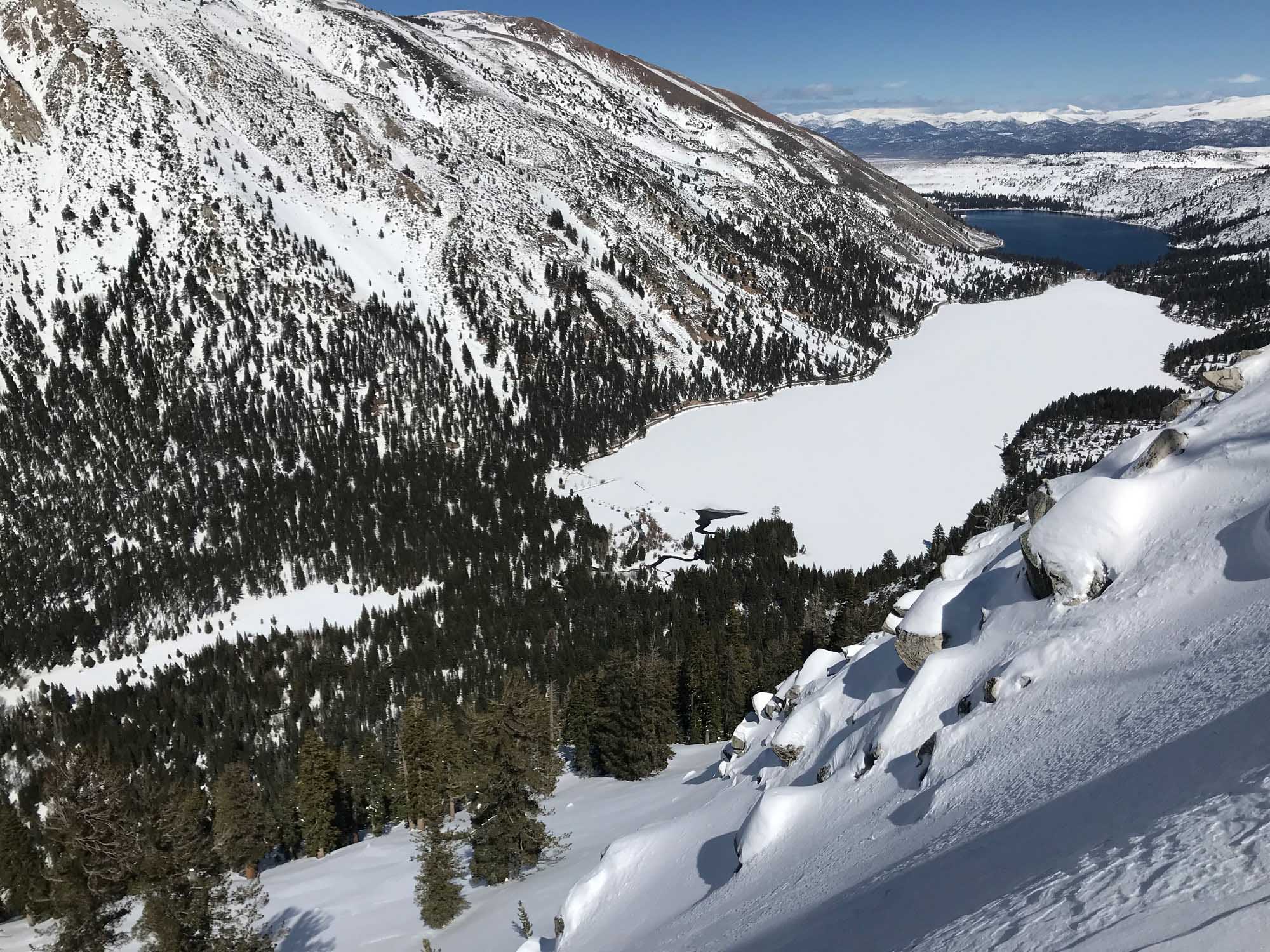
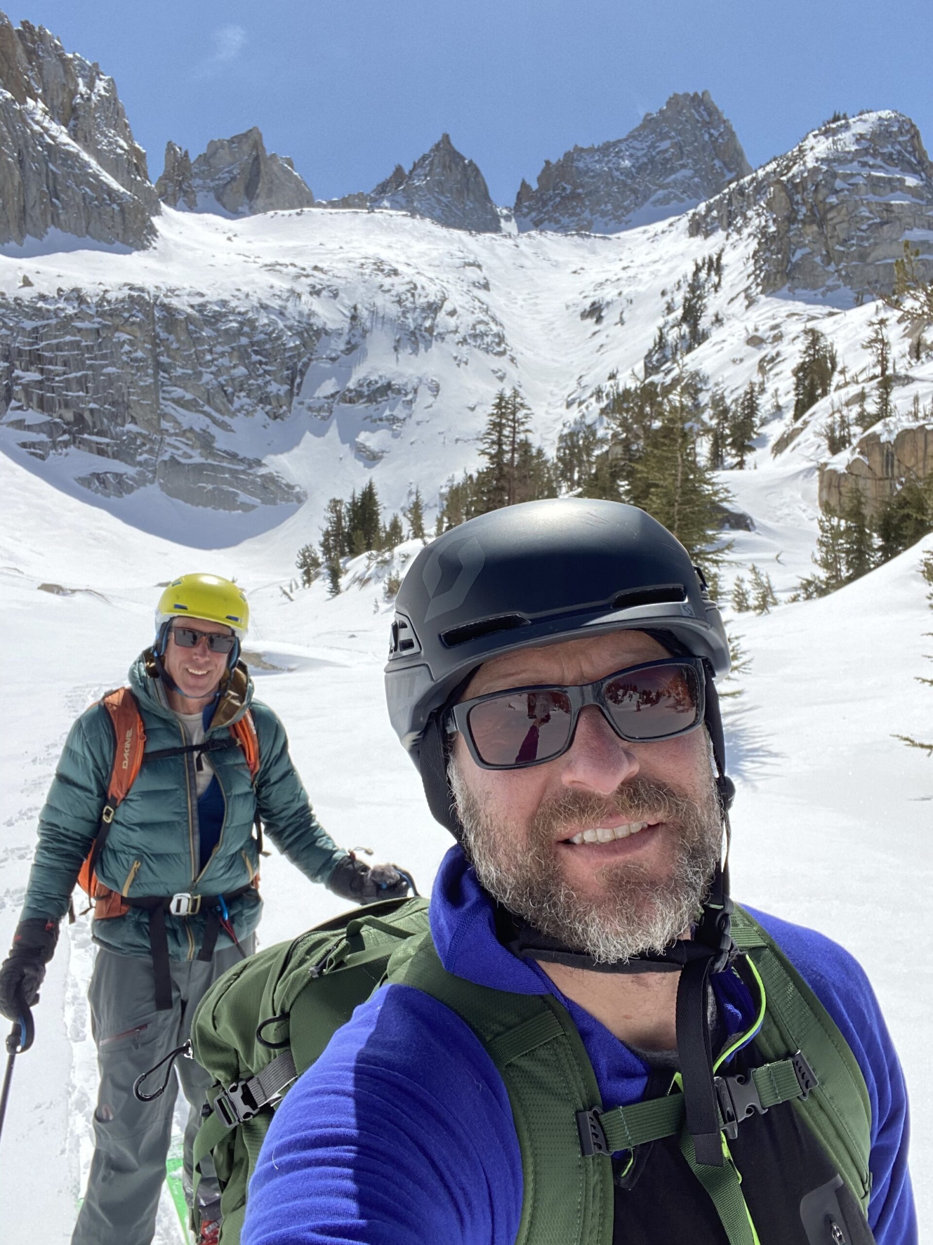
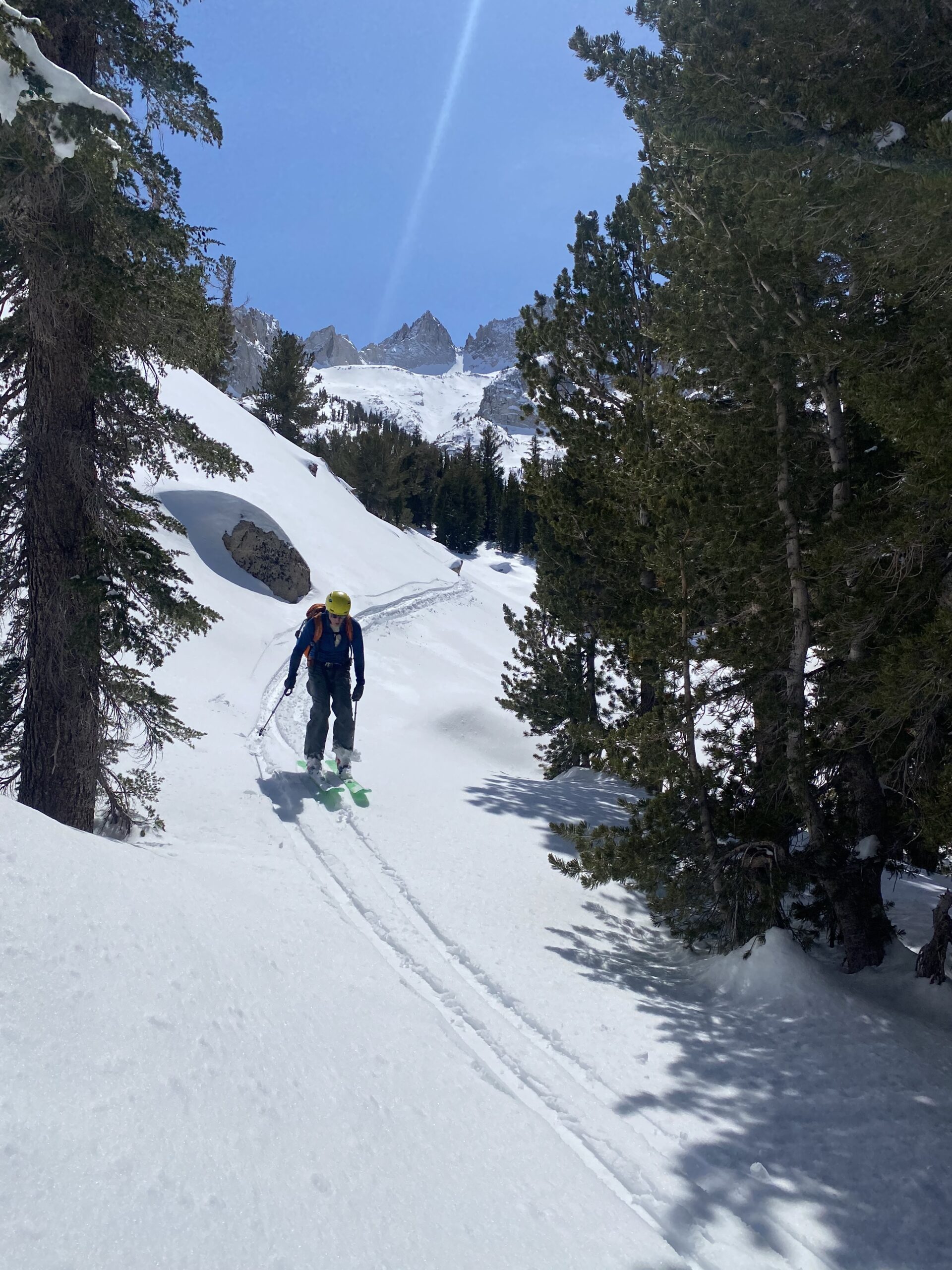
After crossing Robinson Creek Bridge and skinning up through really steep treed slope, just keep Blacksmith Creek on your right and you will eventually bend left into the hidden Avalanche Creek. Use your map as you may not notice this new drainage. Use your map to find Avalanche Lake. In my first tour up there I took a detour out left following some tracks I was curious about and found a really nice spot to view the entire area as you see in my pictures. These snowboarders skinned out to this point above the campground meadow for a fairly steep and fun NE descent back to the car. This detour was only about 10 minutes from Avalanche Creek and was worth the view for intel. On return I easily traversed without missing any good turns and found this point again to drop down steep open slopes above the campground meadow. This would be better than descending through the tight forest approach. Following the creeks will avoid avalanche danger at least until you reach Avalanche Lake.
An Alternative approach to Avalanche Lake is to head up Horse Creek Drainage en route to Matterhorn. when you get to the first bench about 700′ up, start skinning up the steep east facing and sparsly treed slop to the ridgetop. This should be nice and firm in the morning. You will need ski crampons early on an east slope like this. If it’s pow, deal with the dangers that come from steep open avalanche terrain you are venturing up into. The other way previously described would be safer. At the top of the ridge you will be crossing over into the proper Avalanche col drainage beneath the lake. Check out your mapping software and you’ll get it. I just did a loop yesterday where I came down this way. Kind of neat to see more terrain and go up or down each variation of approach and descent to Avalanche Lake, depending on your comfort with snow stability at the time you are there.
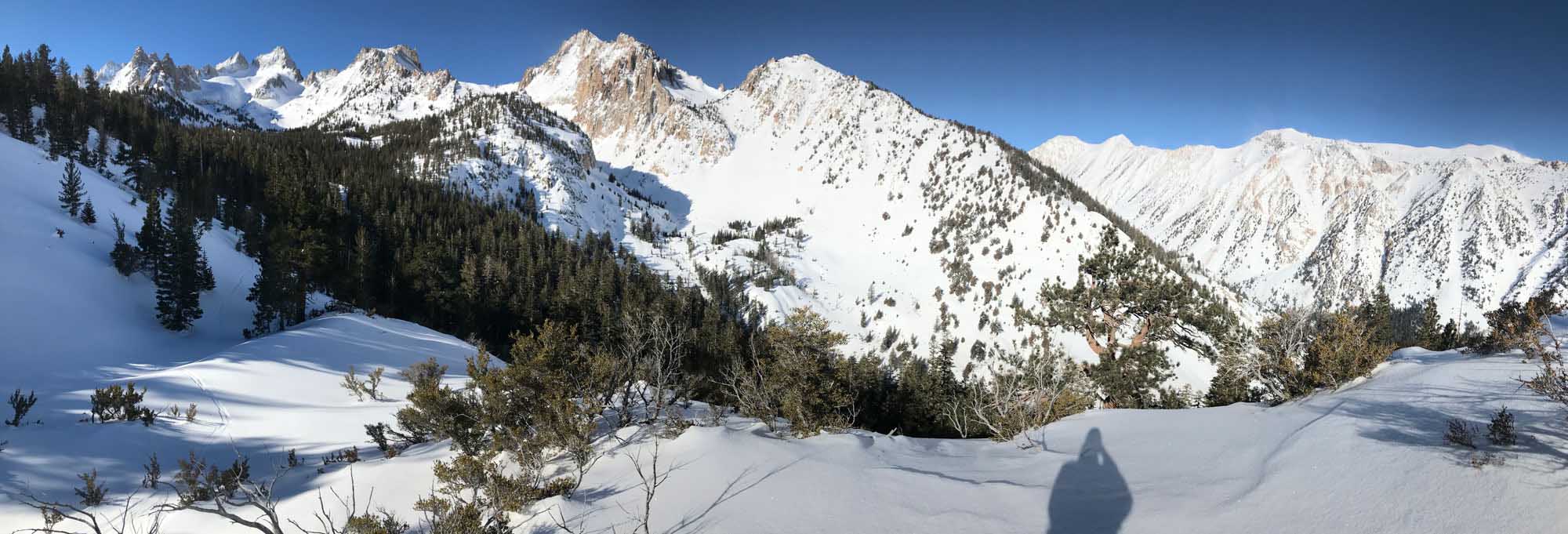
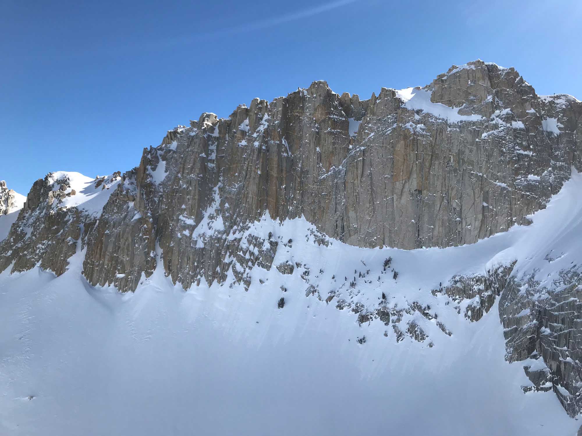
The terrain above Avalanche Lake is quite intimidating from a snow stability perspective. Since I was alone skiing less than a week after new snowfall on my first ascent, I skinned up along a ridge to avoid testing the slopes above the lake. This got a bit hairball but nothing ski crampons couldn’t solve. Going back again I might skin up the gully from Avalanche Lake to the Glacier. That tracks up your path back however, and we don’t want to be crossing tracks out there now….. If you take this high traverse above the north side of Avalanche Lake, you want it to be cold and firm snow. You are above cliffs for 20 nerve wracking minutes and the solar is intense by the time you arrive. If you find an ice axe would be useless due to soft snow, you are close to wet slide danger. Even a small roller ball party could push you over the steep cliffs. I don’t think I’ll go this way again unless it’s firm to crampon across. Boot crampons! Ski crampons are cool but this is a seriously exposed traverse. It’s the direct line though, so it can work in the right conditions. I have since found 2 safer routes to avoid the steep terrain around Avalanche Lake. The first one is to go into the drainage to the north and wrap back around below the Glacier Col up higher. I haven’t done it yet, and you can’t see it working out from any line of sight, but it goes. I’ll do that one next time. And another way to avoid Avalanche Lake would be to make a full loop tour up horse Creek towards Cleaver Peak, drop through Cleaver Col into Avalanche Cirque, and then ski down Avalanche Canyon. I haven’t done this yet either, but it goes for sure. Downside is you don’t see where you are going on the ski descent. You’ll need to use your map and also screenshot some of my pictures. Avalanche Lake has steep cliffs that don’t get snow coverage on the NW and West side.
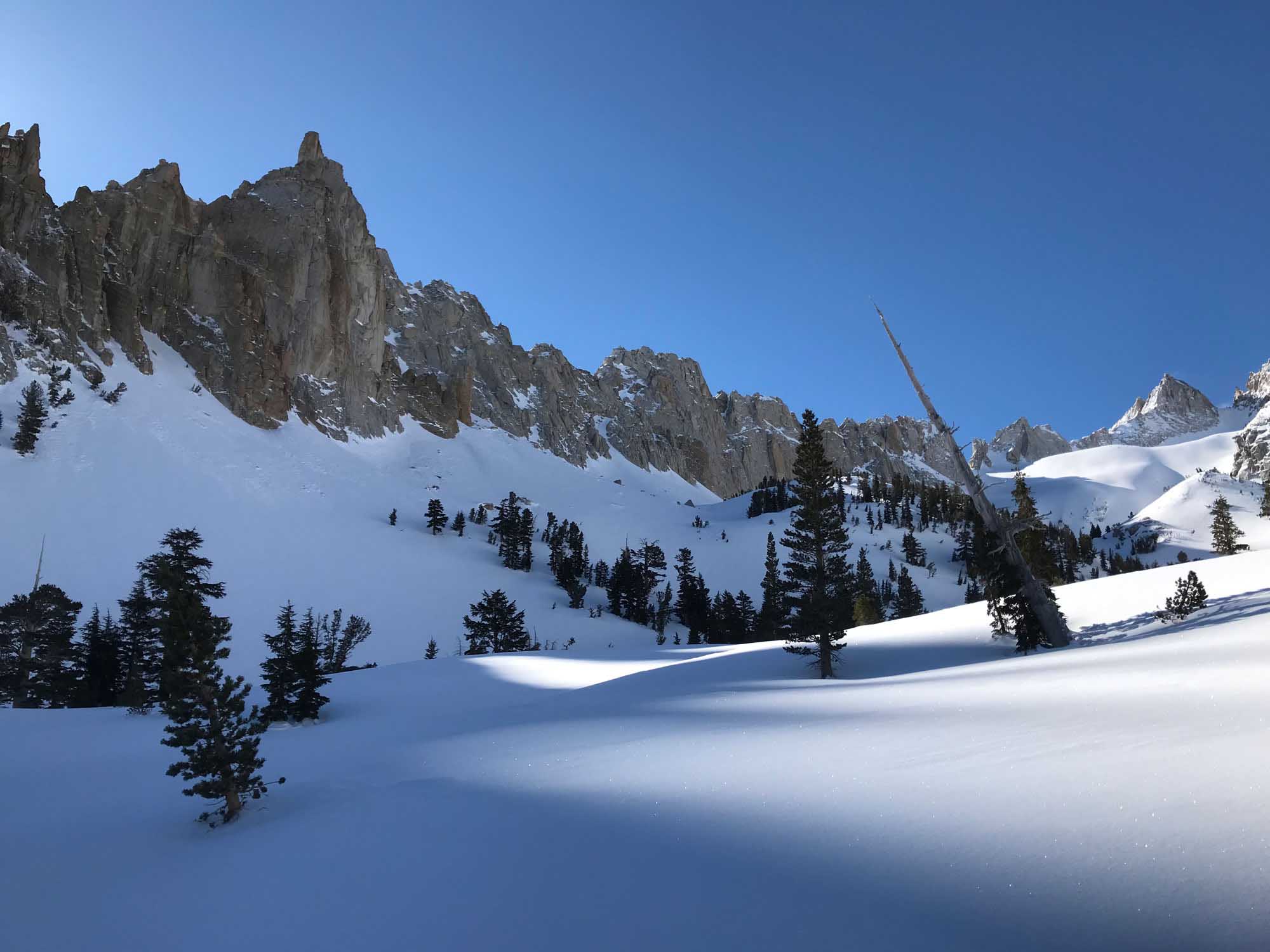
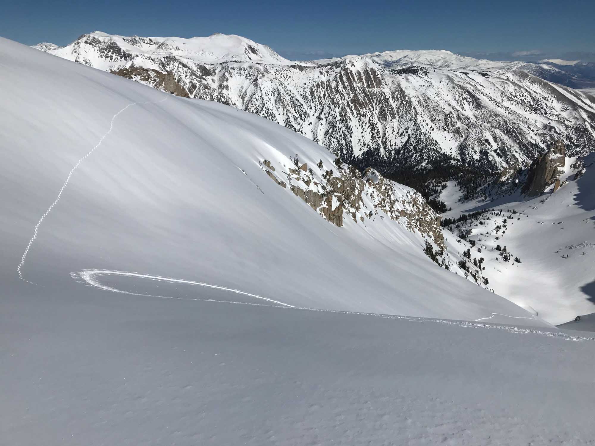
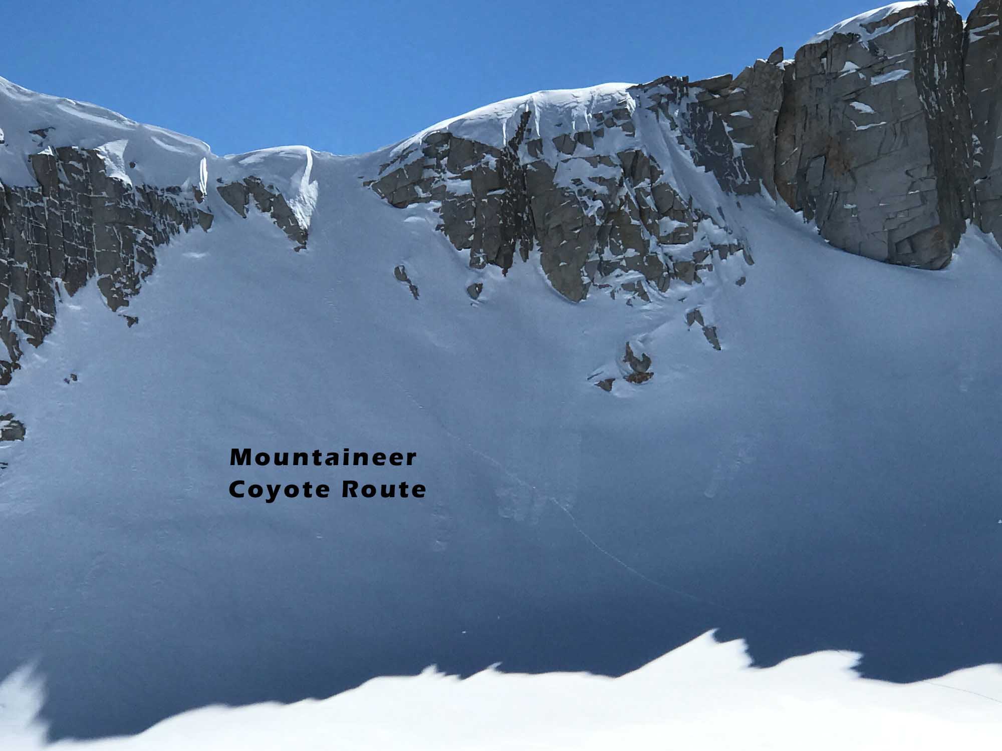
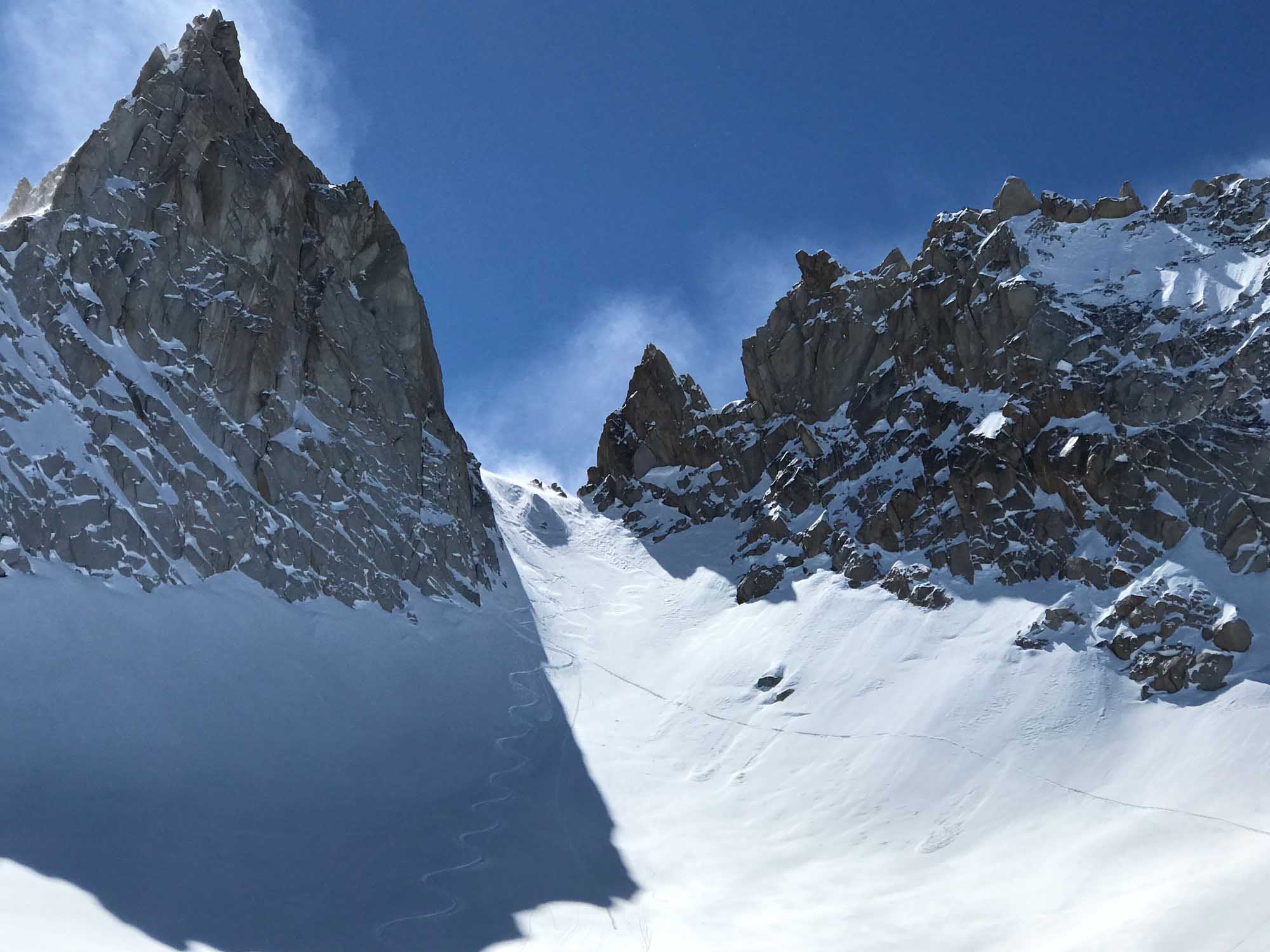
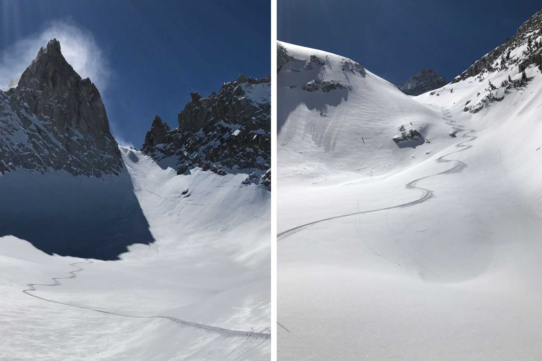
In all three ascents of Glacier Notch I have skinned up most of the couloir and booted the top 200′ without boot crampons, holding skis in my hands. The wind can blast it firm so make sure to bring boot crampons and axe if you really want to ensure your success. I estimate this final couloir climb to be around 35 degrees until ramping up to 45 degrees at the final 200′. I didn’t notice much of a Bergstrom but I assume there is one. In all 3 visits I did not see enough snow to ski down the west side of Glacier Col towards Finger Peaks, and it was a bit steep for ski boots. That might provide a really cool loop and is worth looking into for confident climbers to walk down carefully or on belay and find the west slope for an afternoon corn run to a camp. I don’t think you’ll want to ski down the west side and go back to the car in the same day. That would be a long and low angle journey around to ice Lake Pass and Big Slide Canyon. But if you want a huge day, go for it!
If you just tour up to Glacier Lake, you will be psyched. This is unreal beautiful terrain right above your car with likely no tracks. I’ll go up there in the summer as well, assuming there is a user created trail of some sort. Some maps show an old trail.
This ski tour is likely to be all yours. Blacksmith Canyon sees a few people each week In ski touring season at best. Heading up to Glacier Col might get done a few times each winter? I’ve never heard of anyone going up there and didn’t even know about it until I saw the terrain from an airplane photo. And reaching the col requires some understanding of all the jarble I just wrote about the terrain. God forbid I draw the routes on a map for you. Sorry!
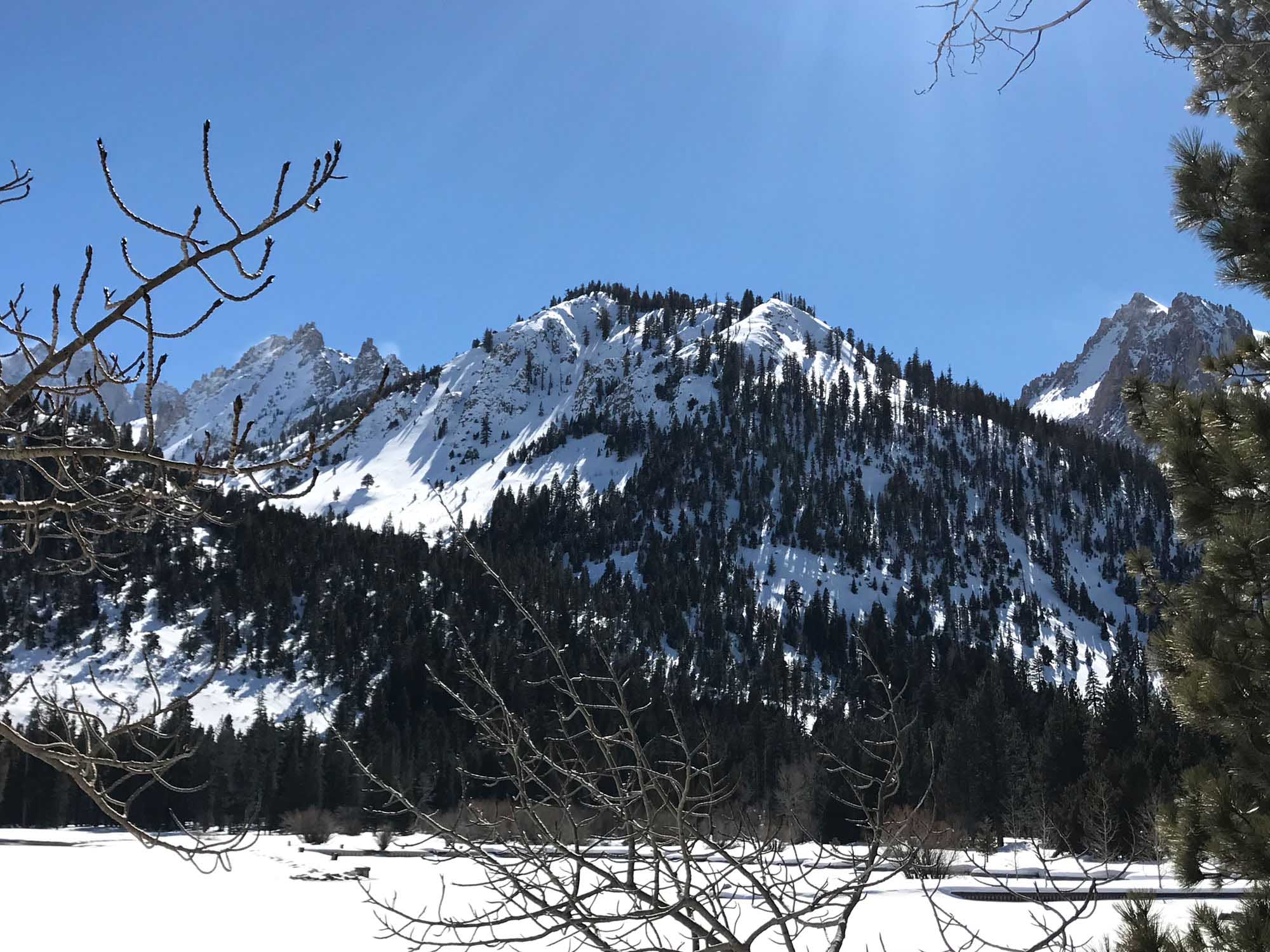
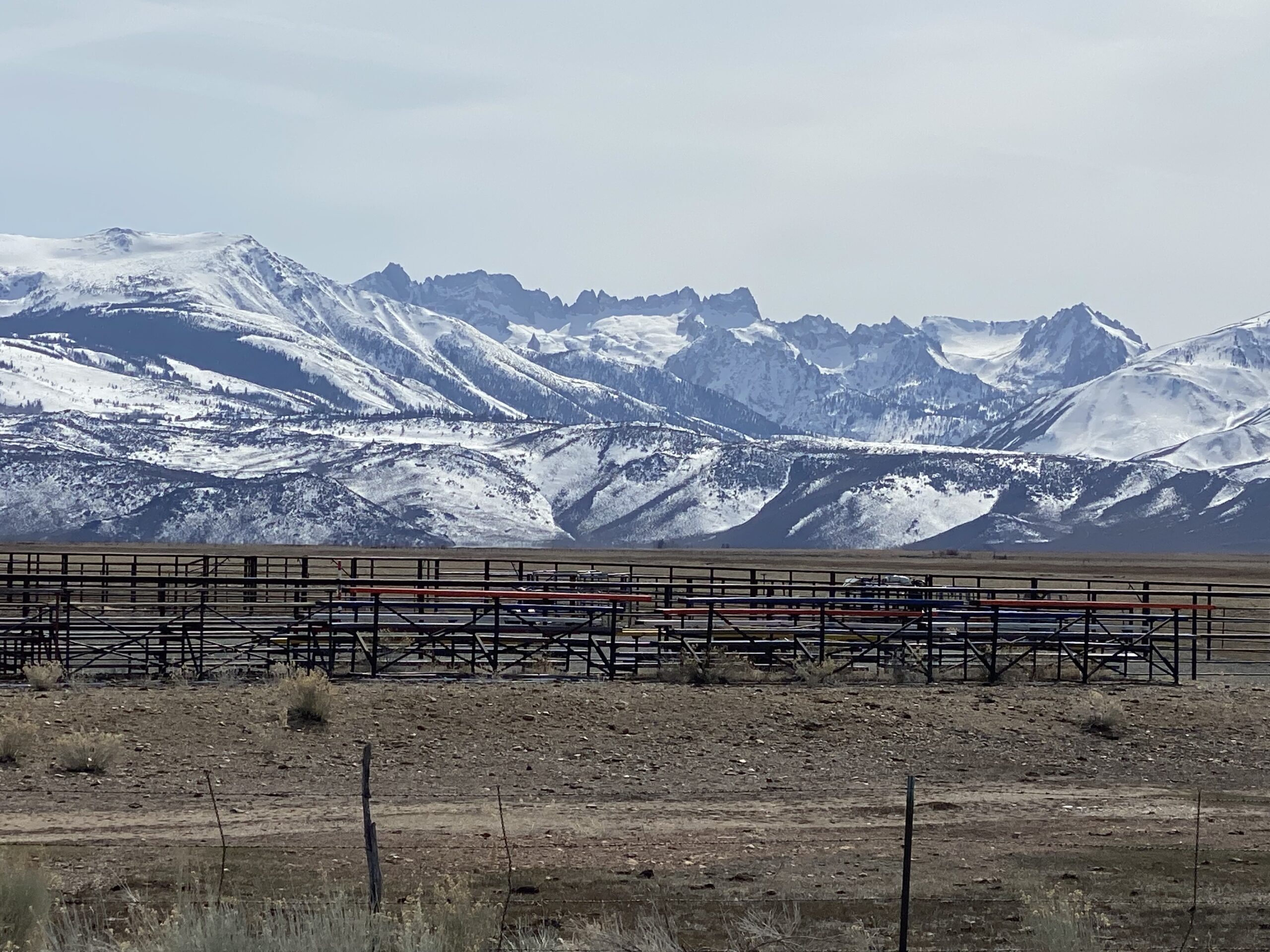
Most people are after Matterhorn Peak, Crater Crest, or skiing one of the couloirs in Little Slide Canyon just to gawk at the Hulk Rock Climbs. After you ski those, you’ll probably ski Monument Peak, Mt. Walt, maybe Twin Peaks or Eocene. And then there is the huge South-ish slopes of Victoria and Hunewill Peak looming above Big Slide Canyon. And there are many more worthy ski touring objectives in the Sawtooths. Well now add this one to your tick list for north facing terrain that you can track up all by yourself! Upload a few pics and tell us how it went for you below.

Looking for awesome ski and splitboard tours in the Sierras? We’ve got write ups on many common and uncommon tours curated by the owner of the BackCountry, Mike Schwartz.


Unbelievable winter snow in the Glacier Col couloir. Almost got shut down by a massive wet slide in the tight gully below, so I had to back off. Skiing into the slot canyon just to the west, I spotted a safer ridge-line couloir as a reasonable consolation to make a successful day. Then suddenly as I crested it, behold, a ski traverse into the bowl below the col notch. It would bring me to the base of the col. A hearty boot pack put me on the top with stealer views. Skiing the deep snow down was unforgettable. Now it was decision time. The slide below had played itself out to level ground, so the bowl and its perfect corn was mine to sign. The final ski down through the trees was nothing but challenging. Thanks Mike.