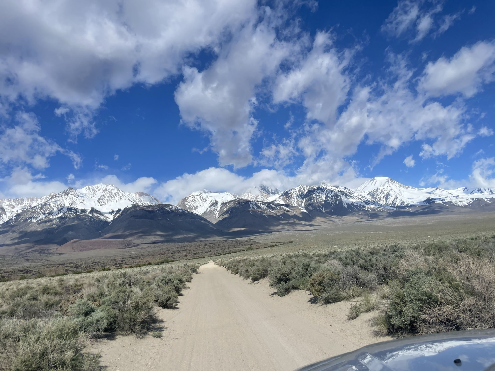
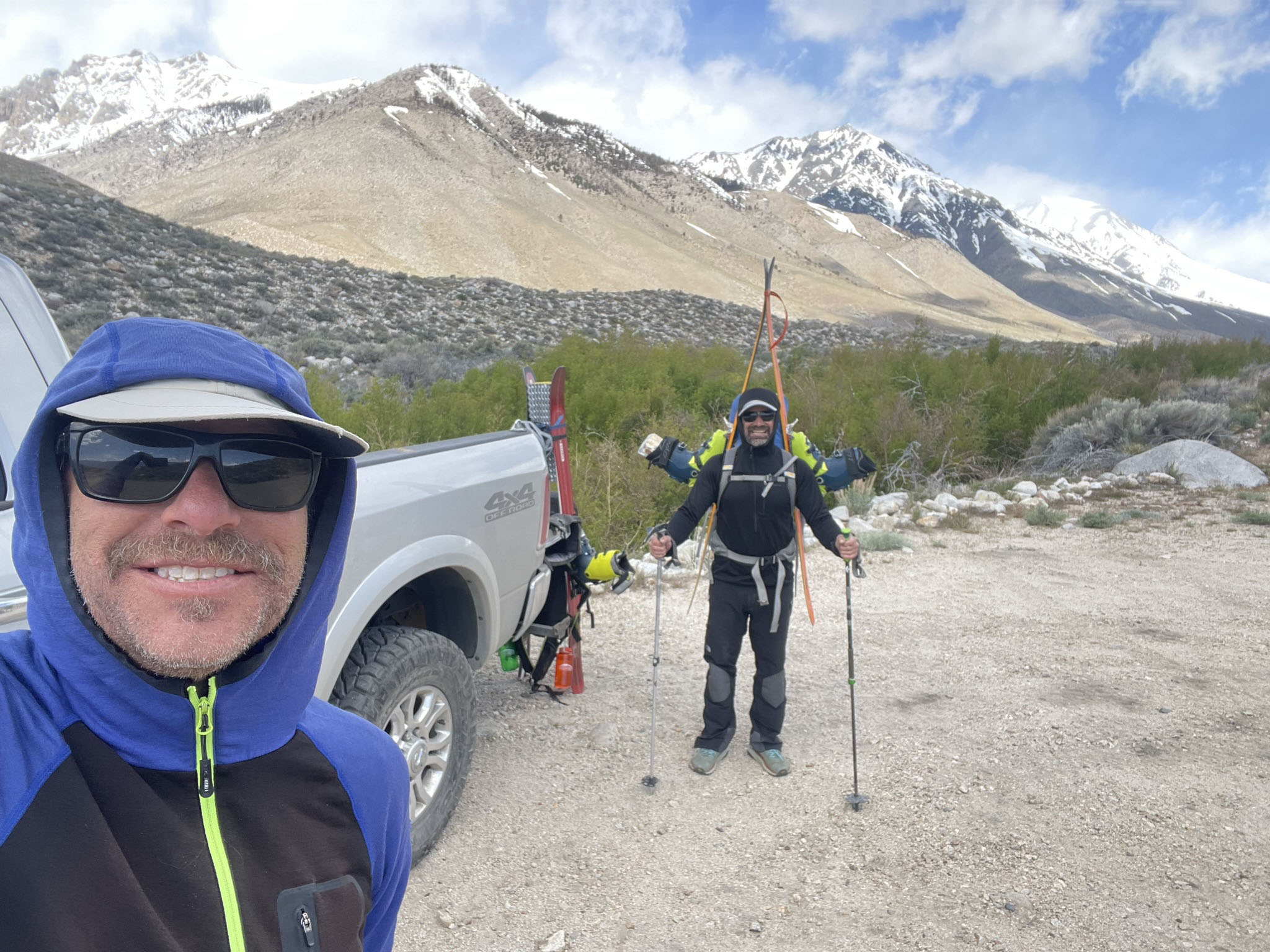
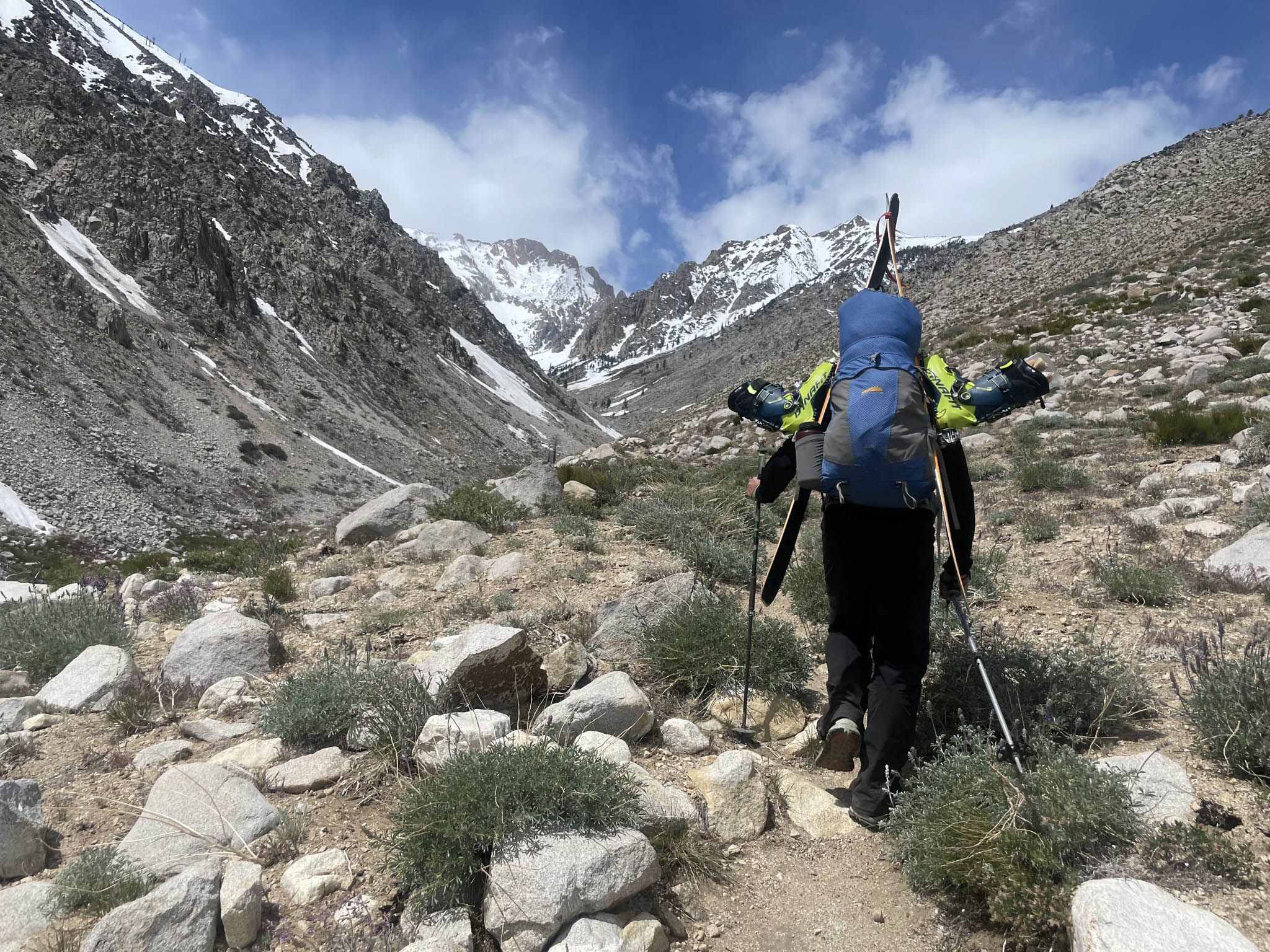
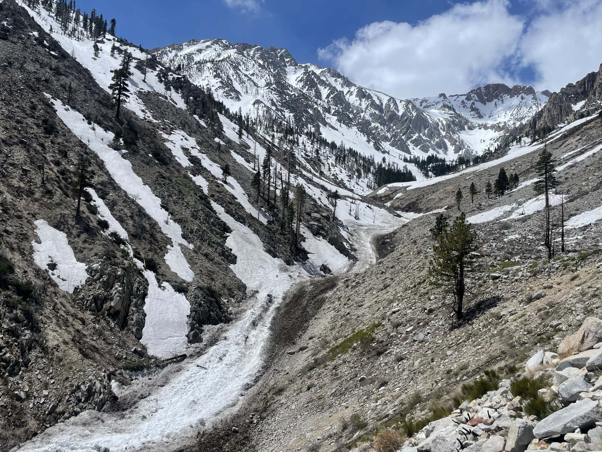

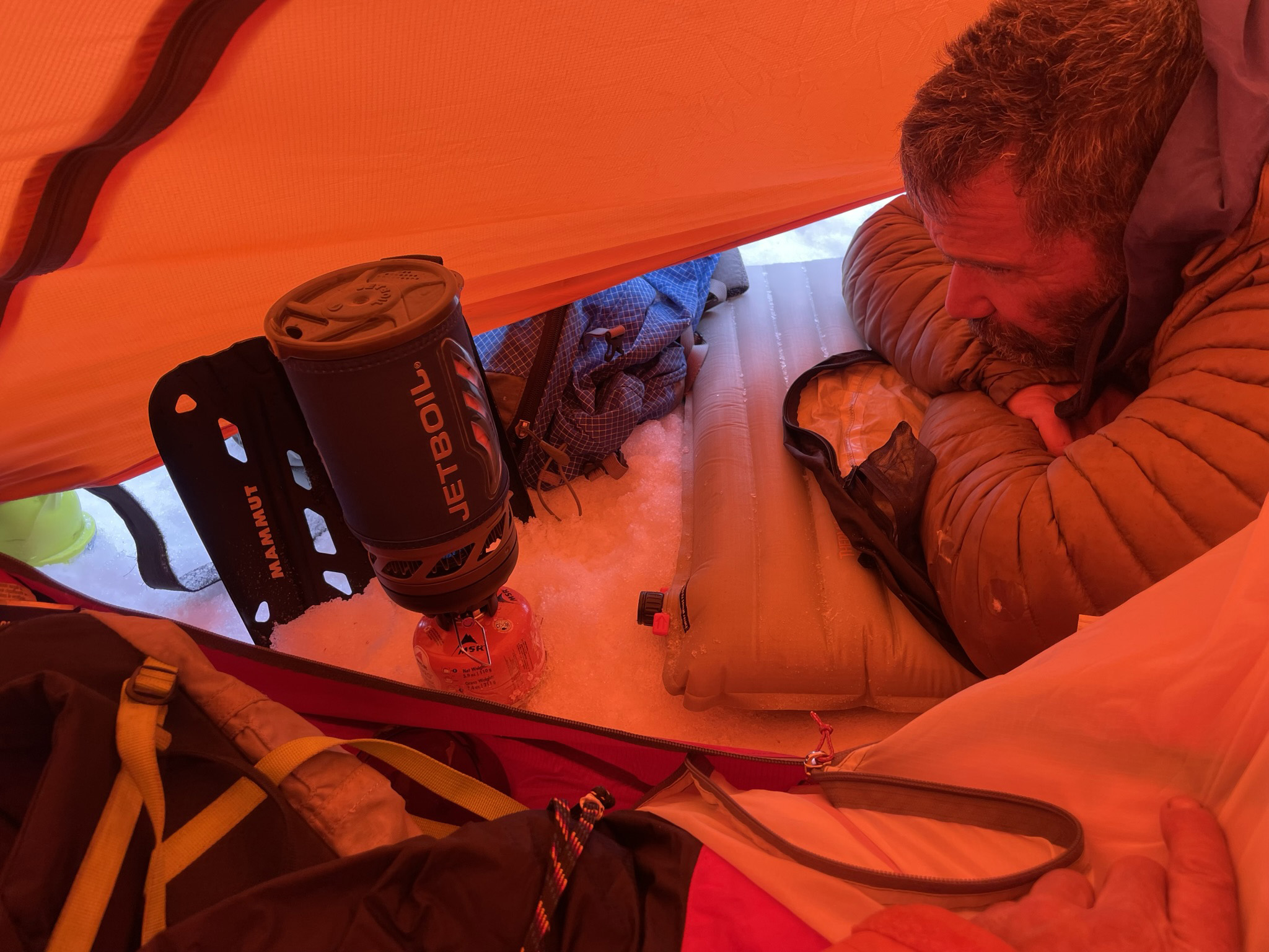
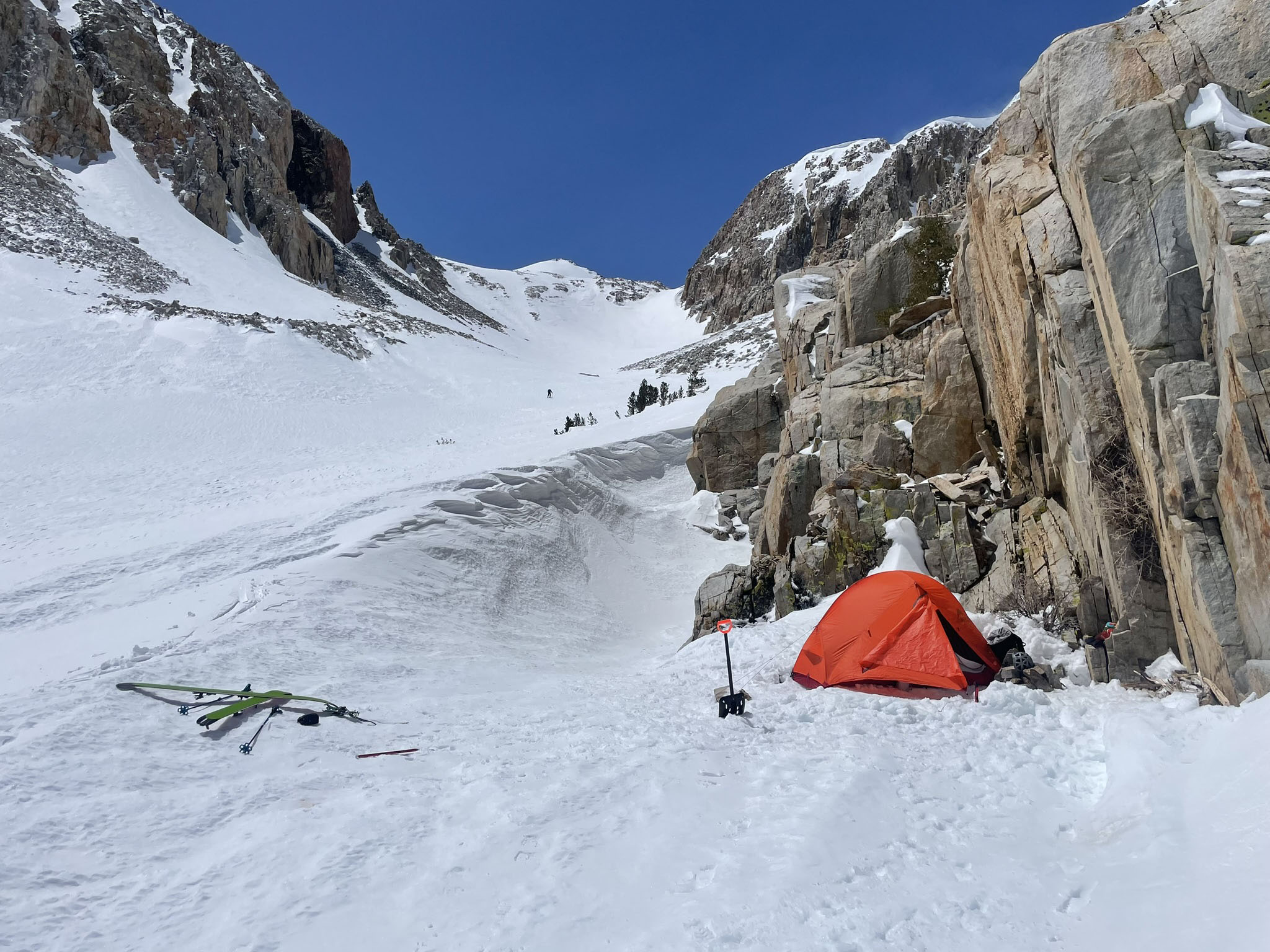
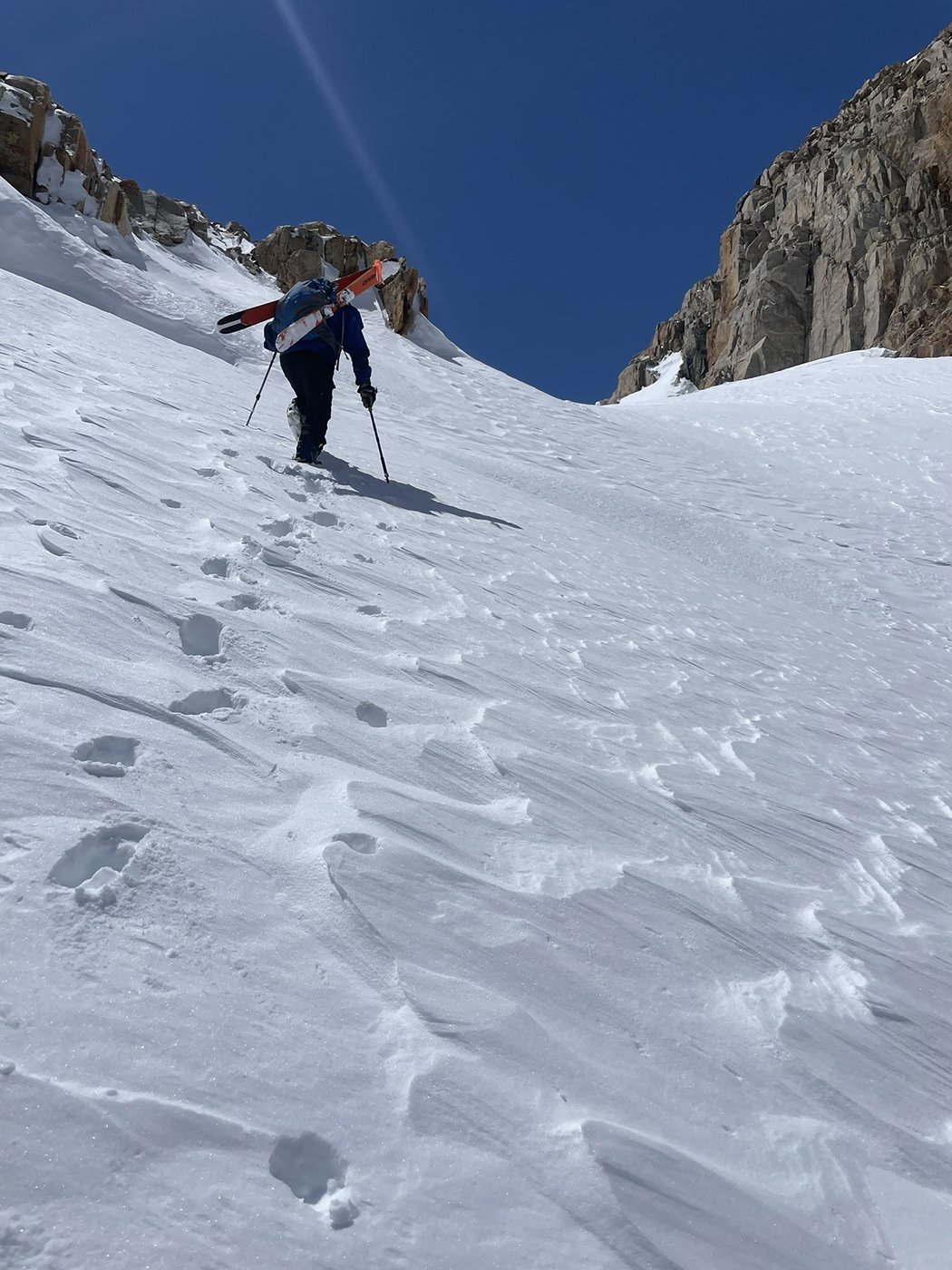
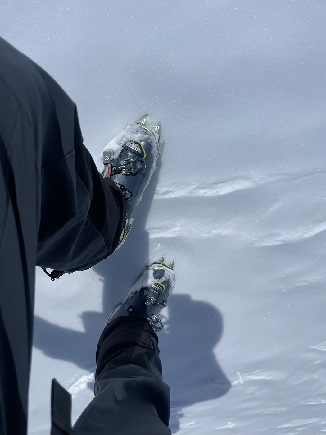
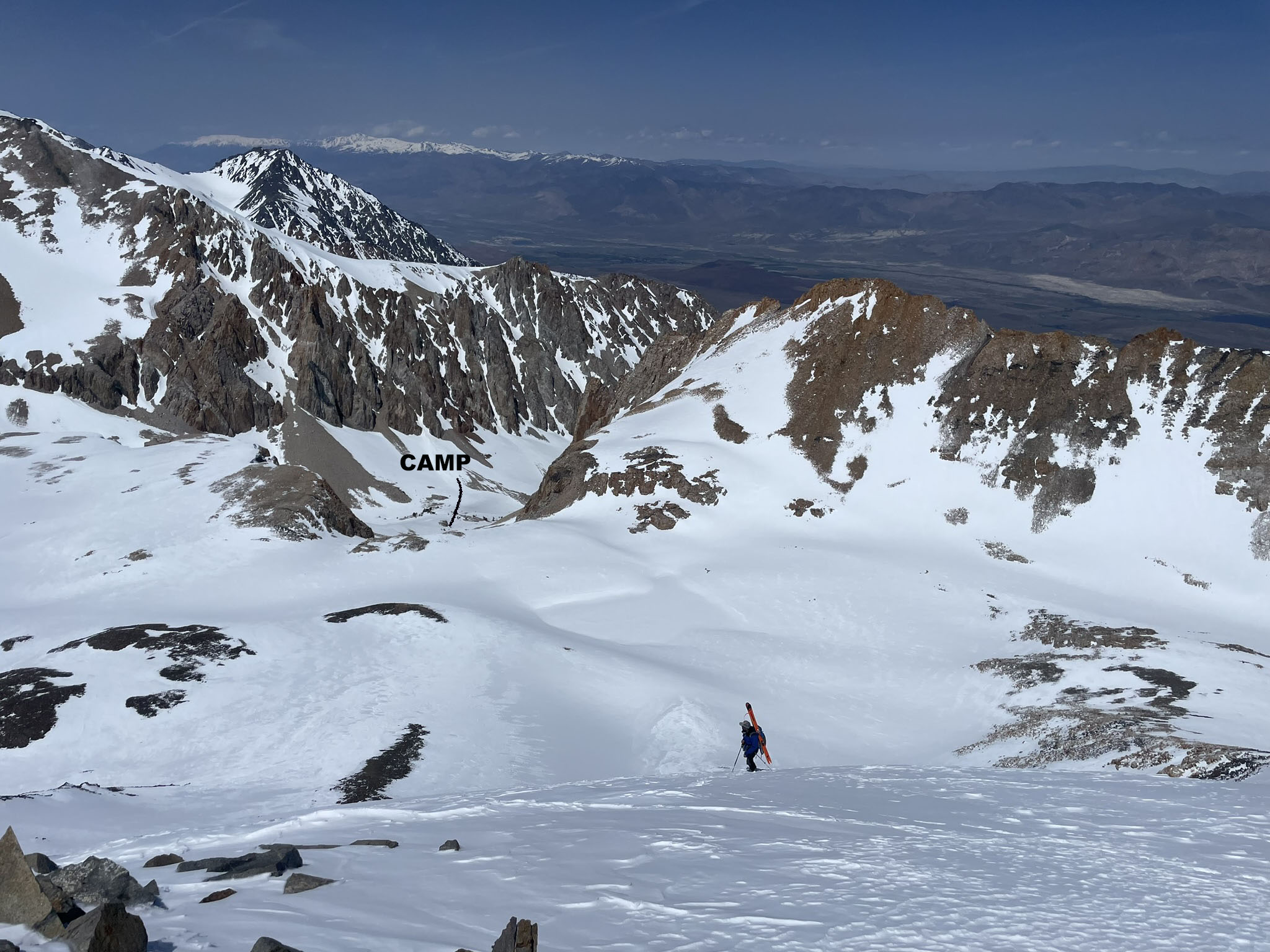
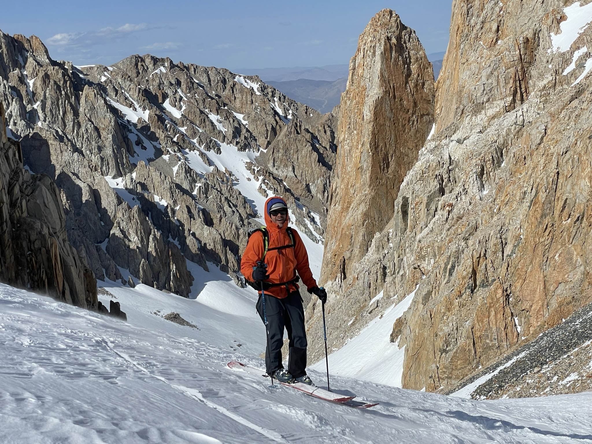
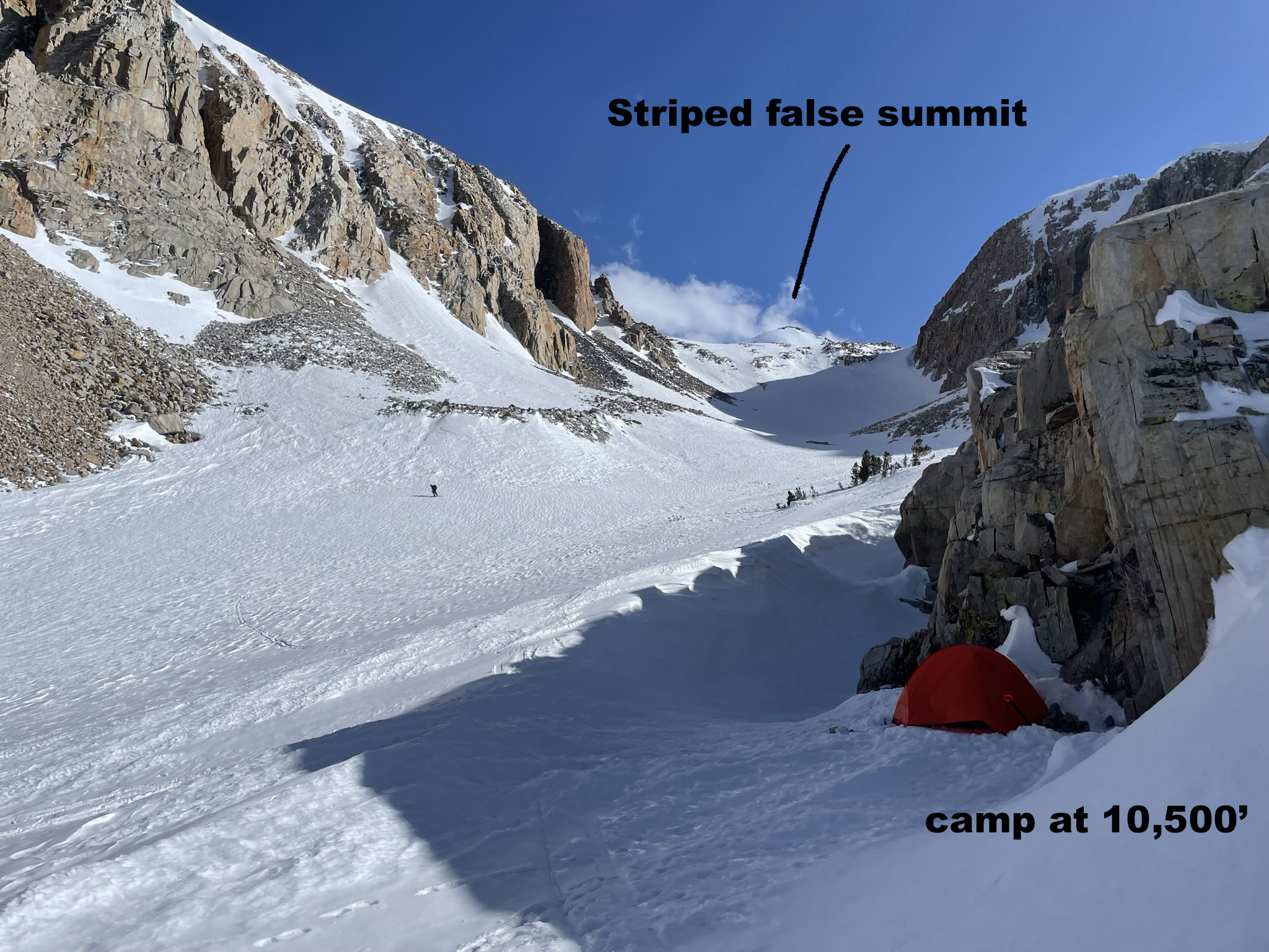
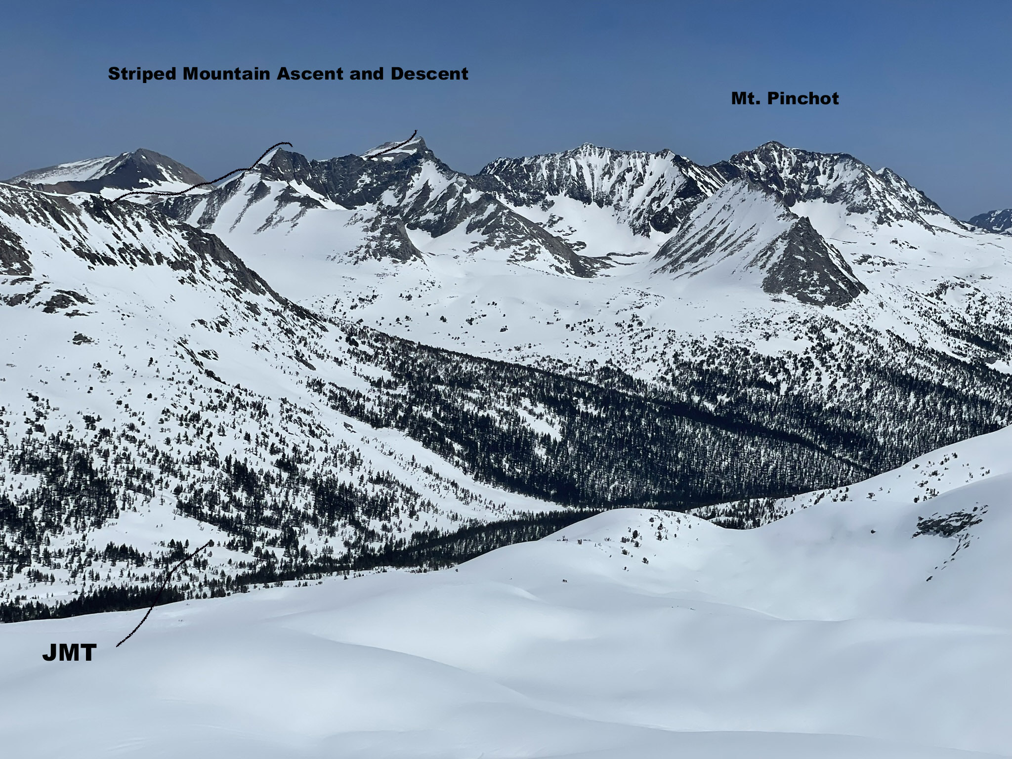
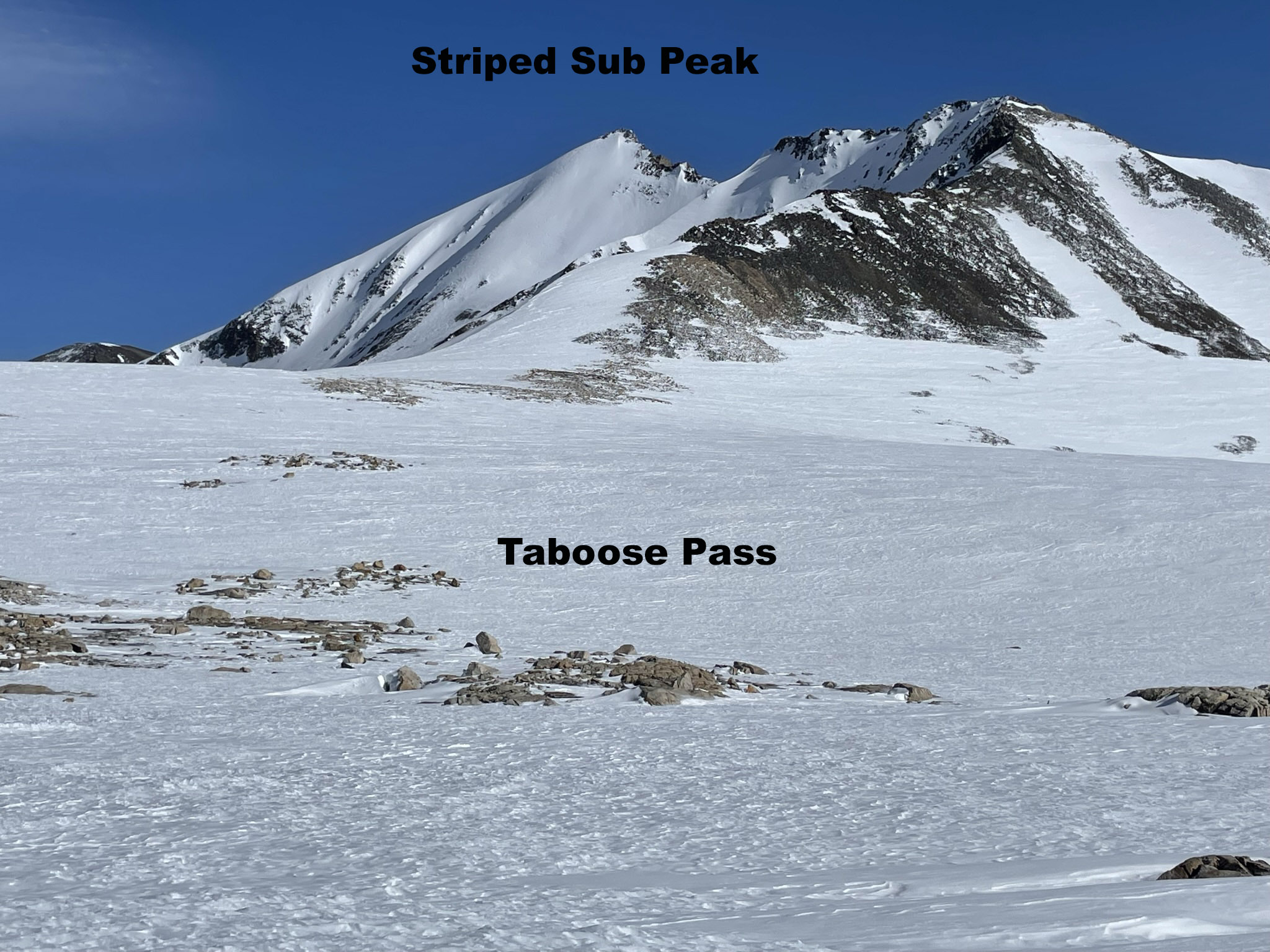
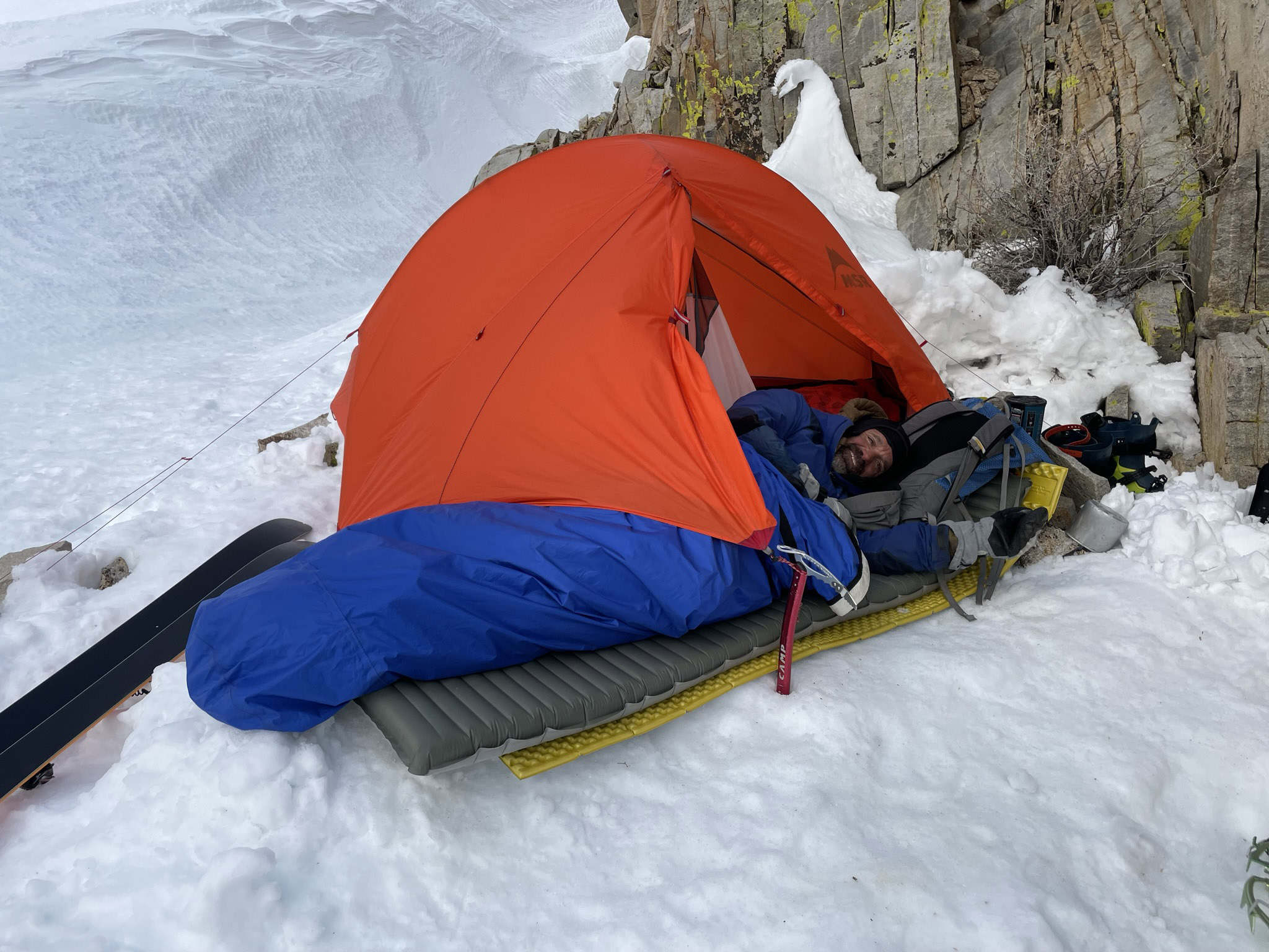
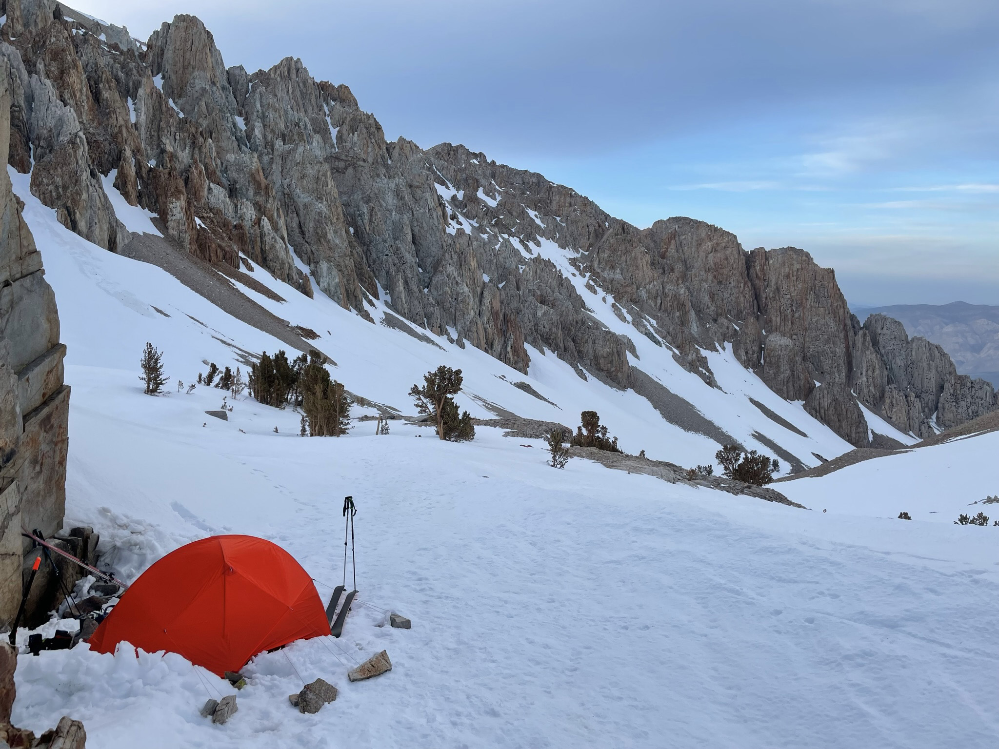
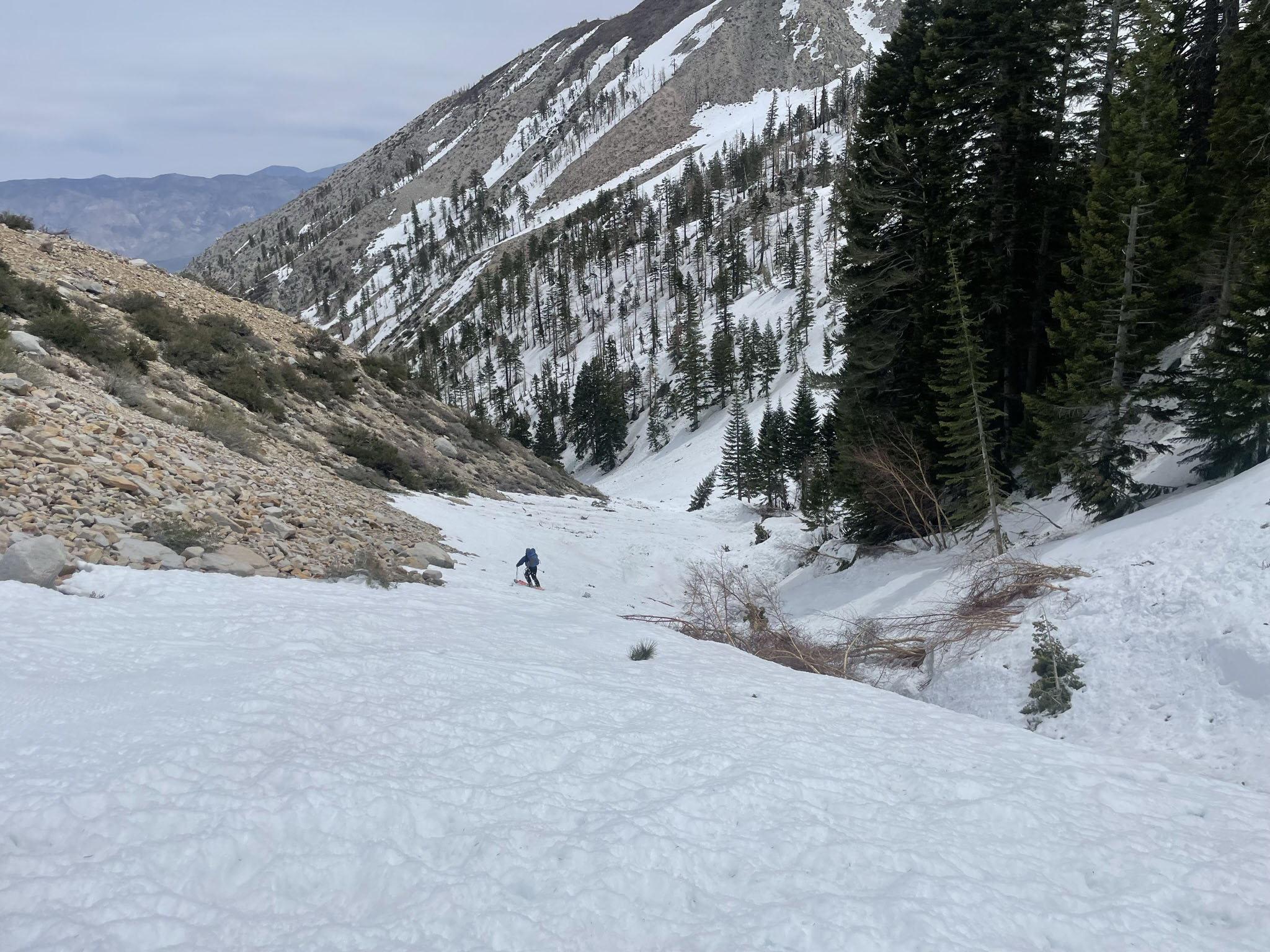
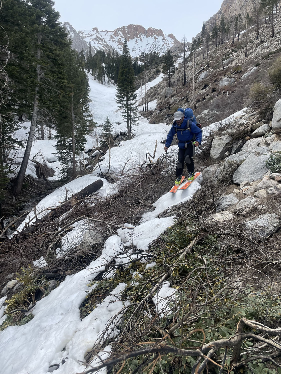
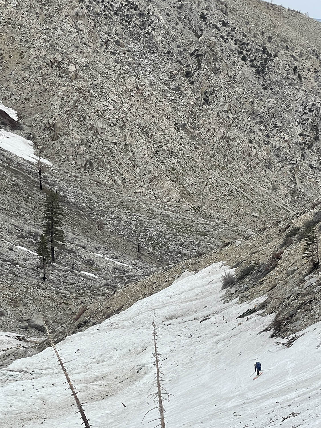
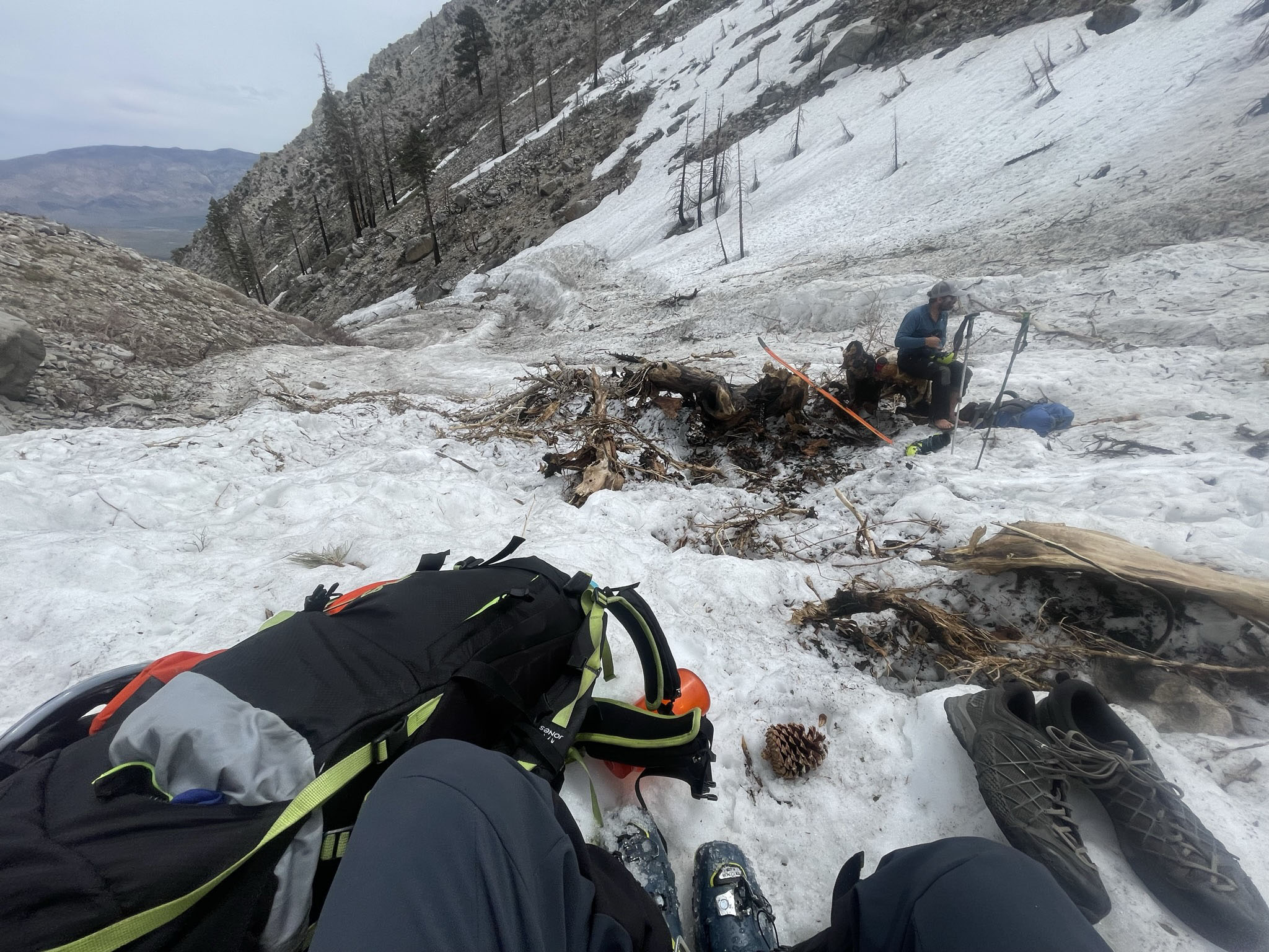
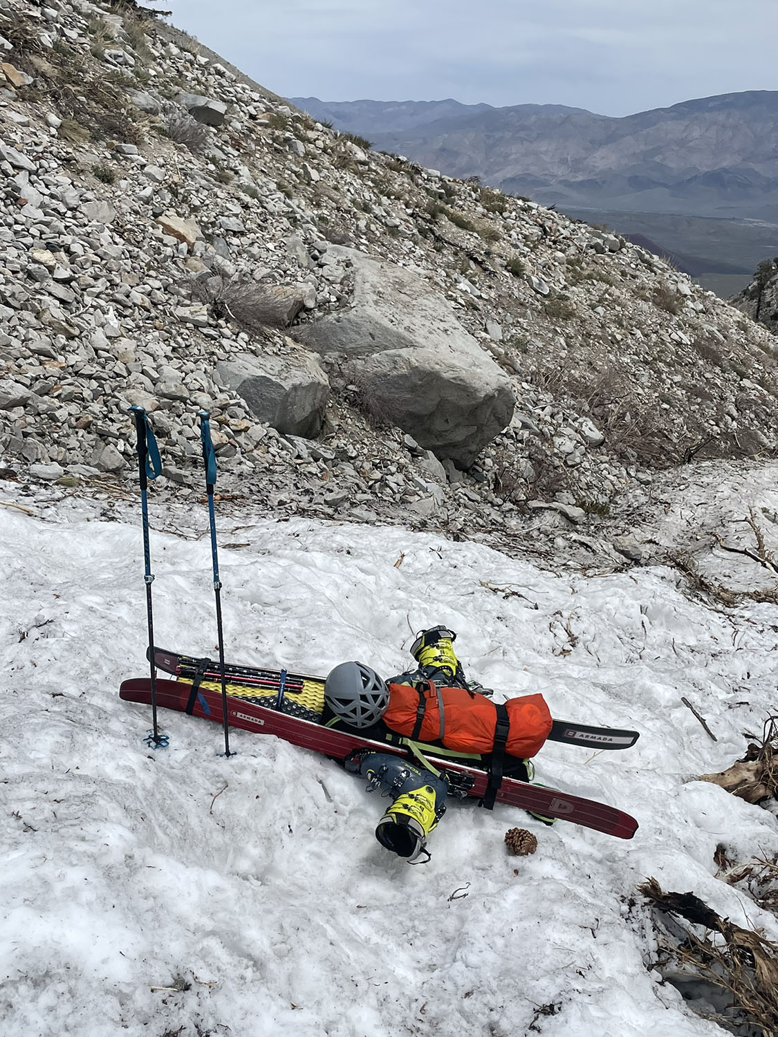
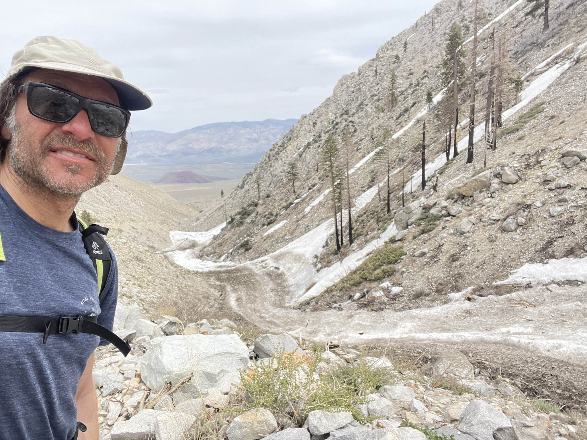
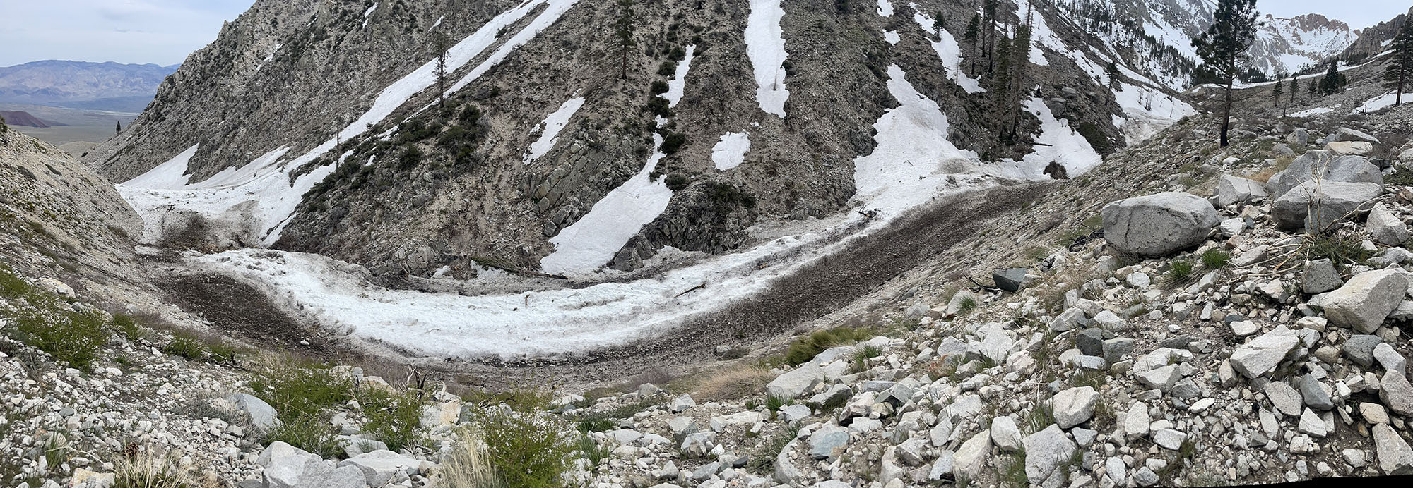
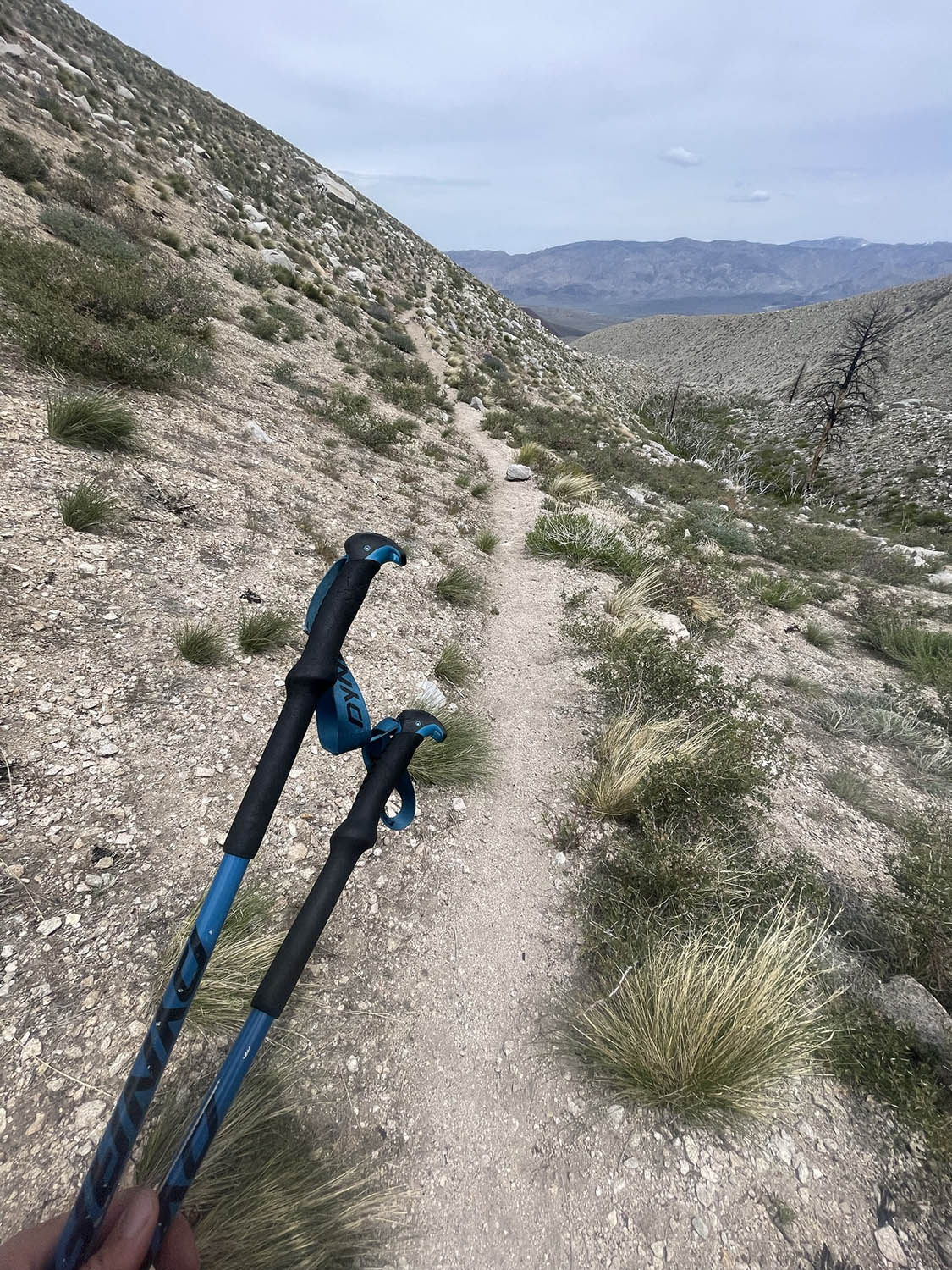
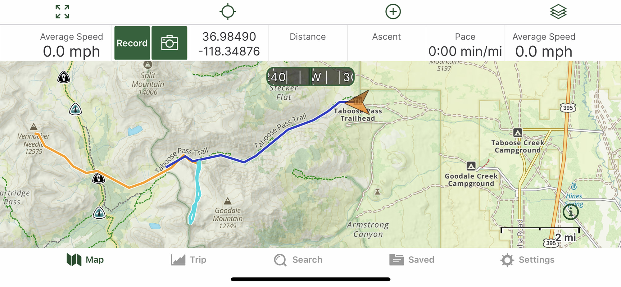
The Taboose Creek Trail starts at 5600′. Ouch. that’s the lowest trailhead. Even though the snowpack was generally record breaking this season, the snowline was around 7000′ and higher depending on aspect. The trail is easy to walk on, and we marched for a few hours in our hiking shoes in nice temps. When we got to snow, we found old slide debris and broken tree parts for the next 2000′. This was kind of fun to skin up, and gnarly to ski down a few days later Character building for sure. There was some good smooth snow higher up in the journey to the pass, and we eventually got stopped by a windstorm and setup the tent a bit lower than expected around 9500′. The next morning, we discussed bailing, as the wind was strong through 10am waiting it out. Luckily it did die down, and we bumped the camp up to 10,400′ as described in the Richins Book. This is where a side drainage leads up to the North Side of Striped Mountain. At around noon we setup the tent and stuffed it with the camping gear, and headed up to summit of Striped. I used ski crampons and we both used boot crampons on the steep sub-Peak of Striped.
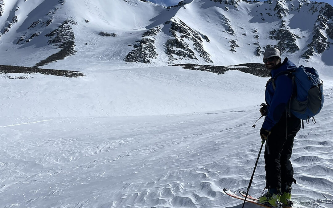
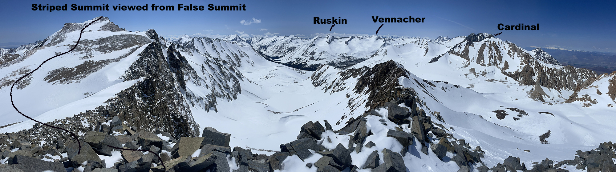
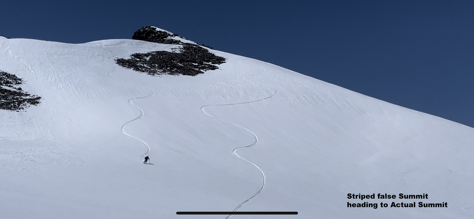
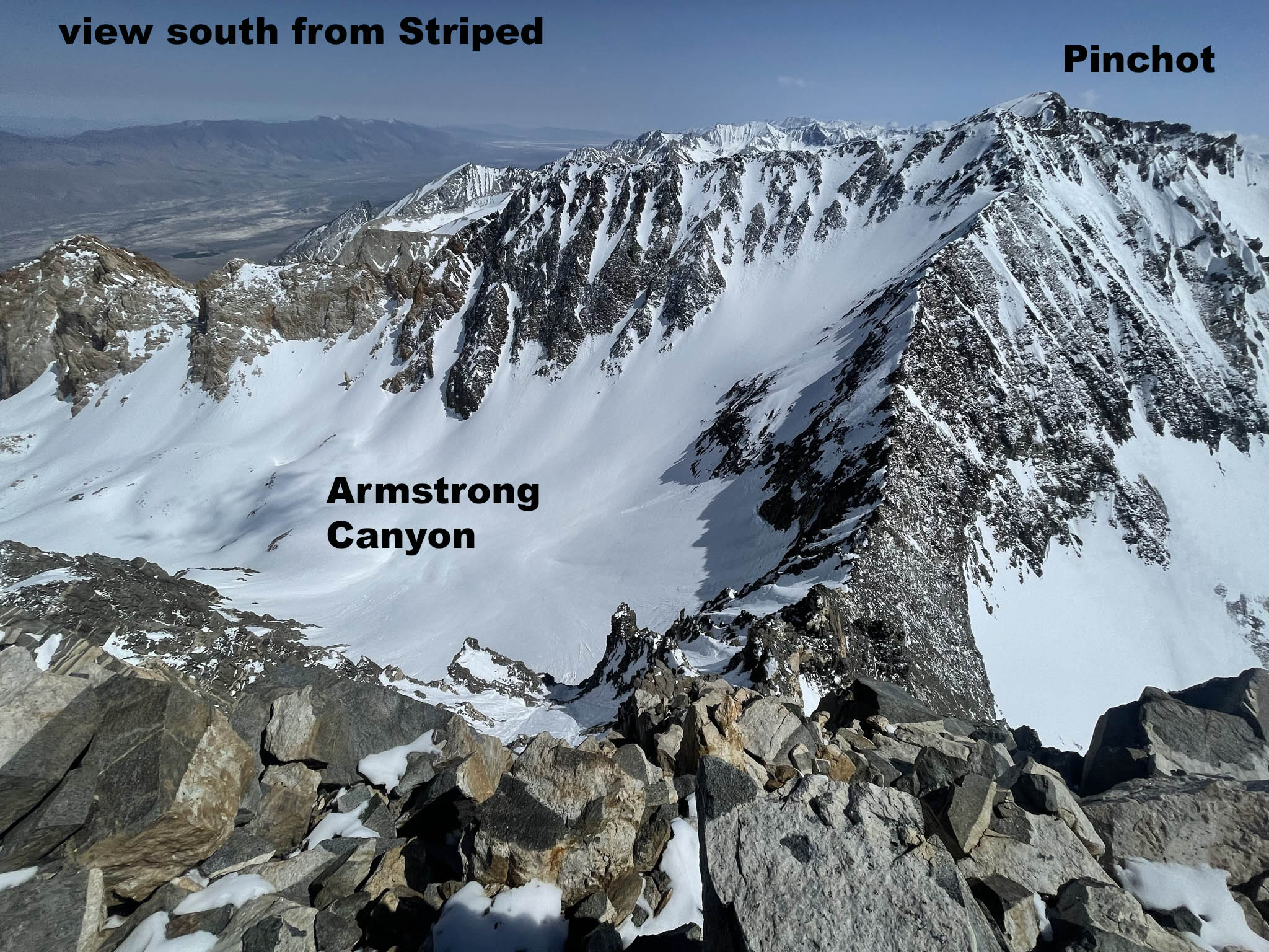
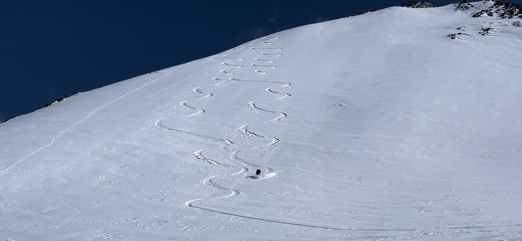
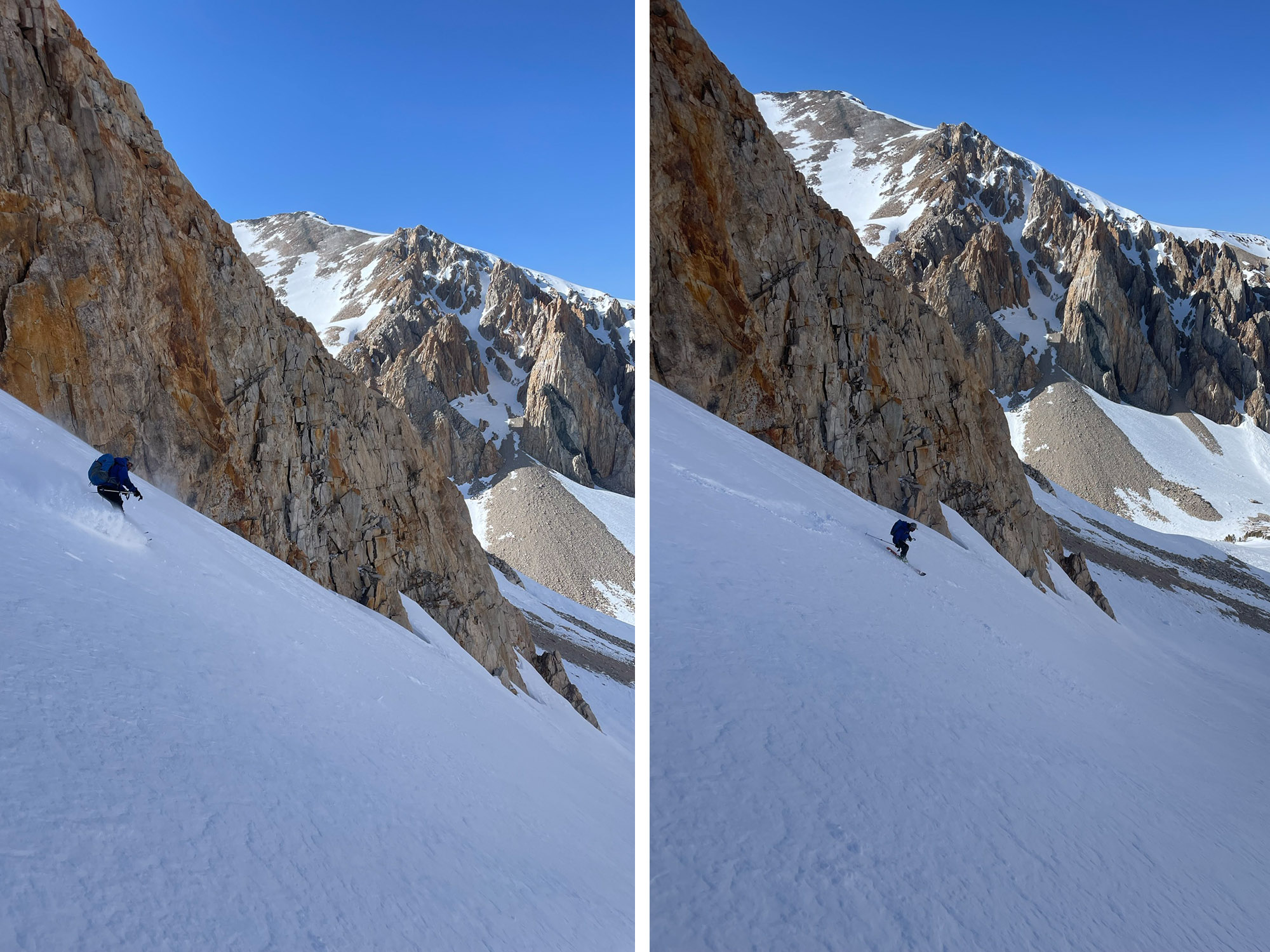
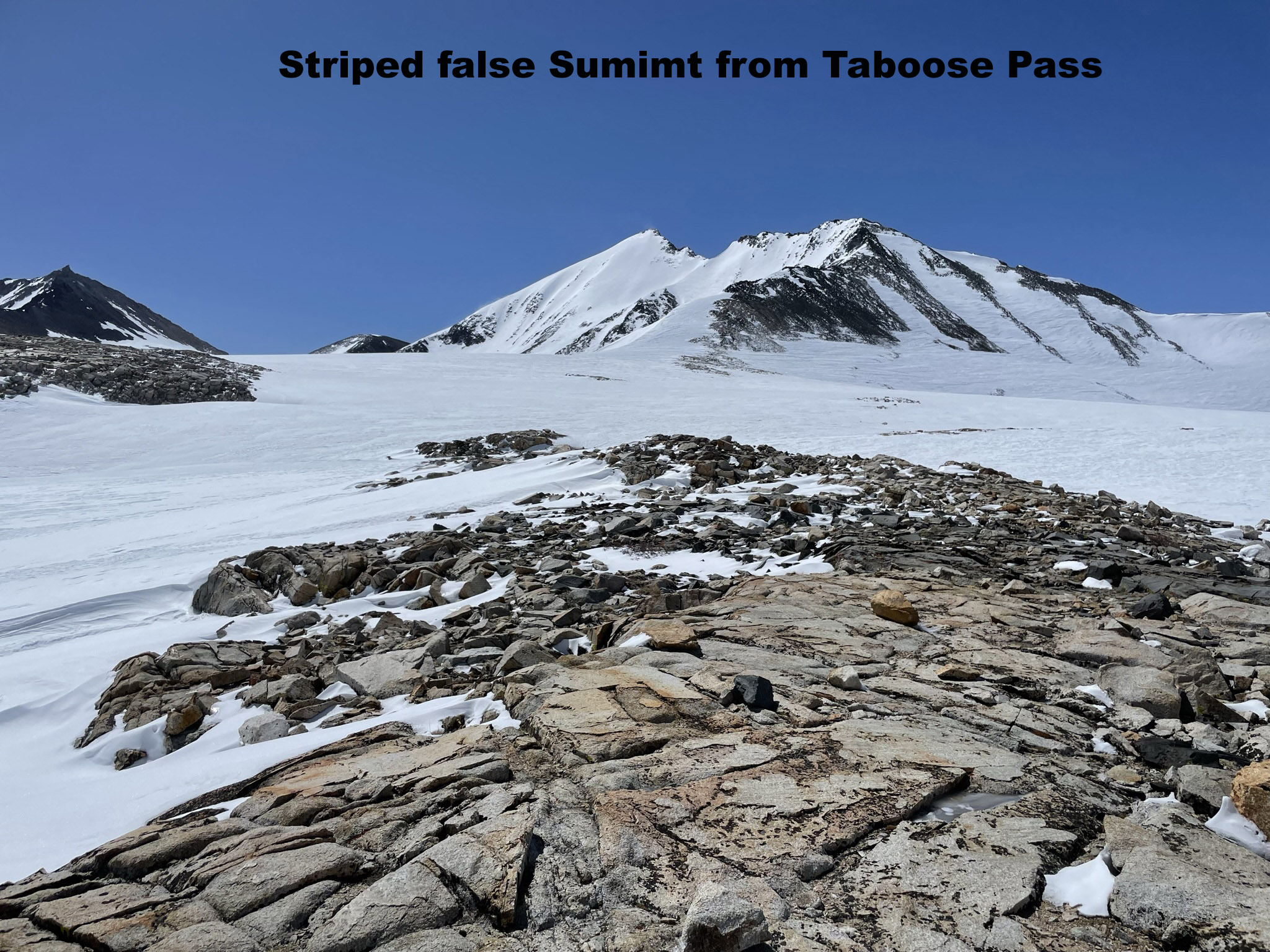
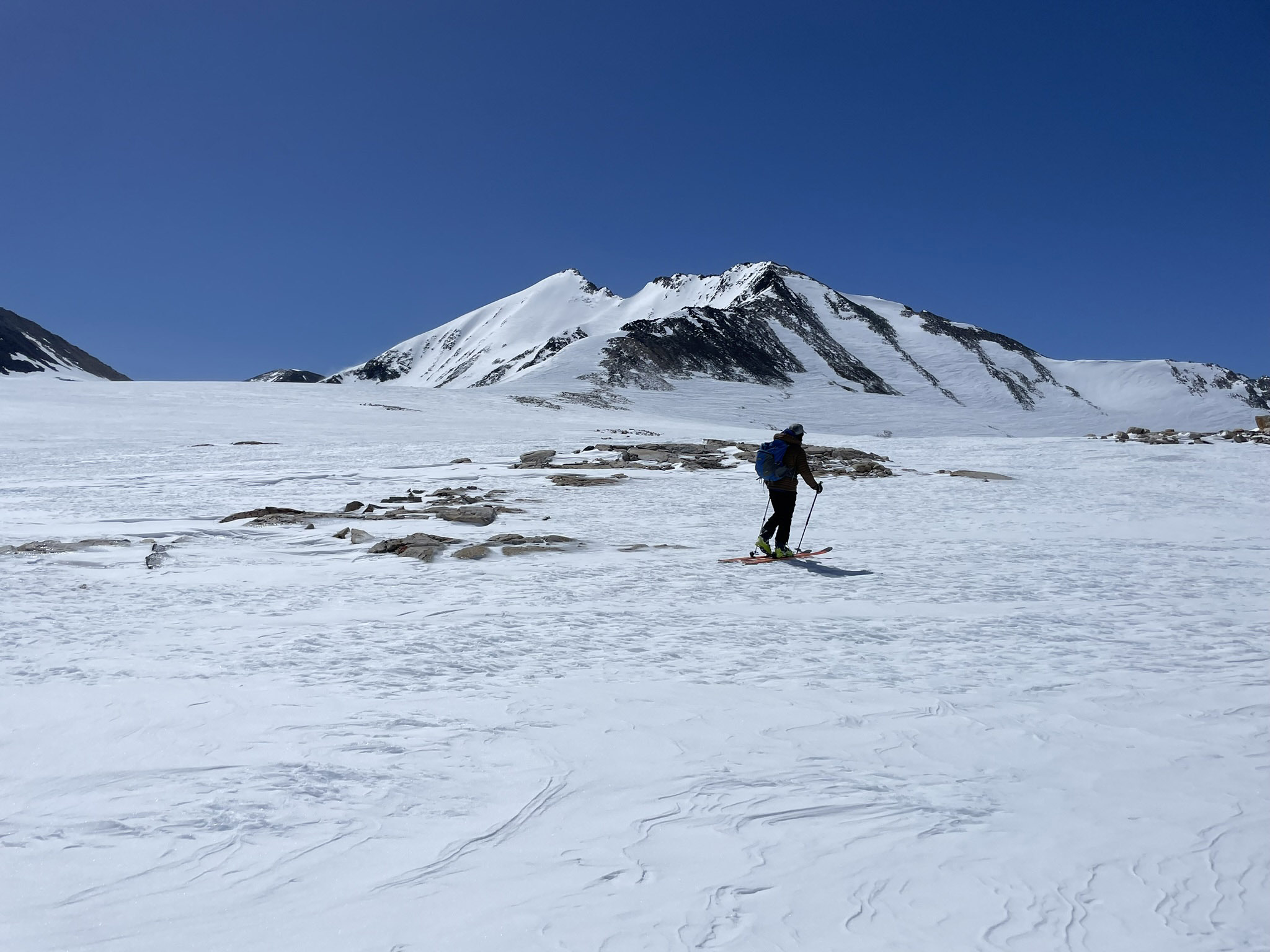
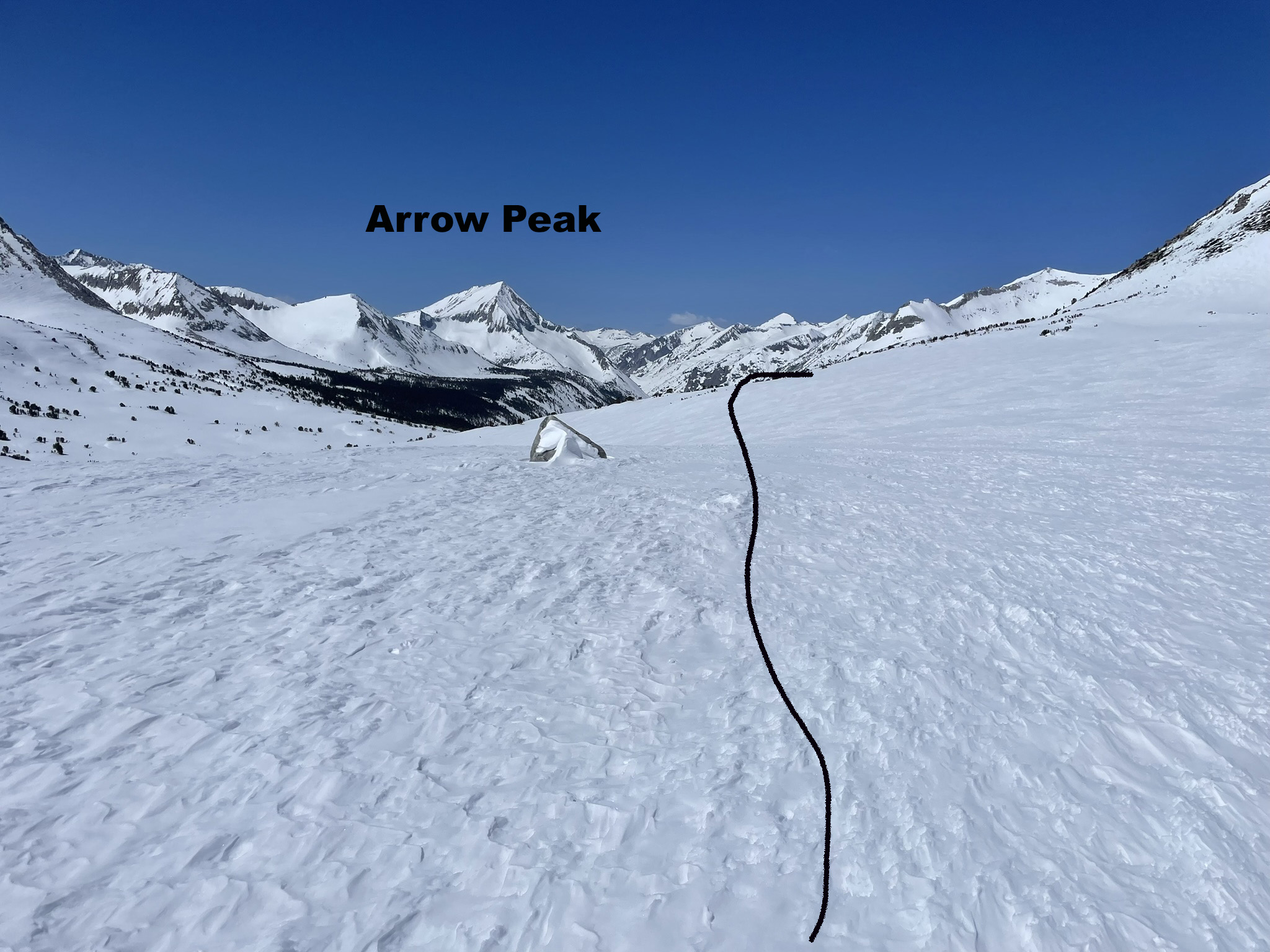
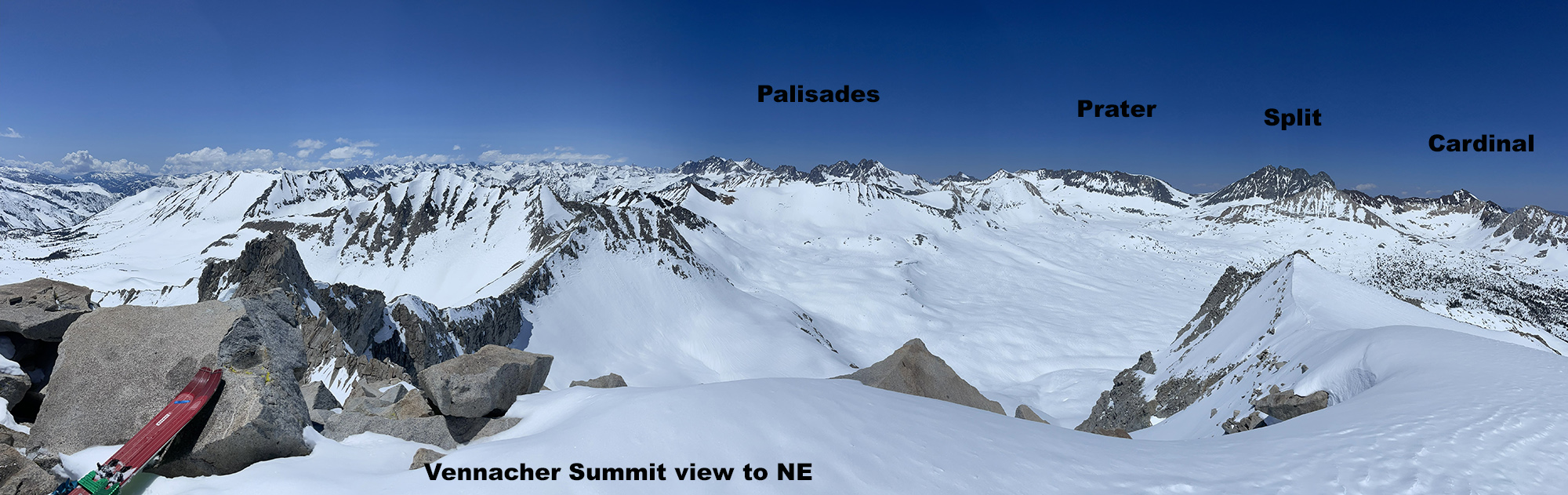
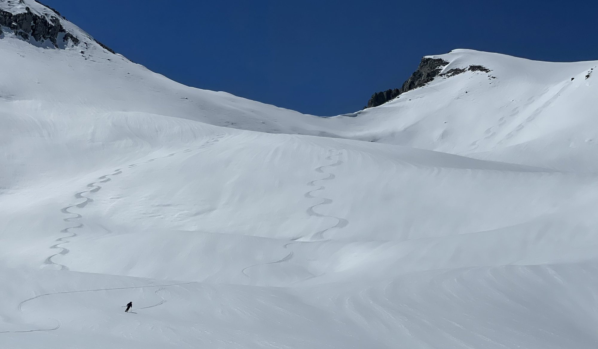
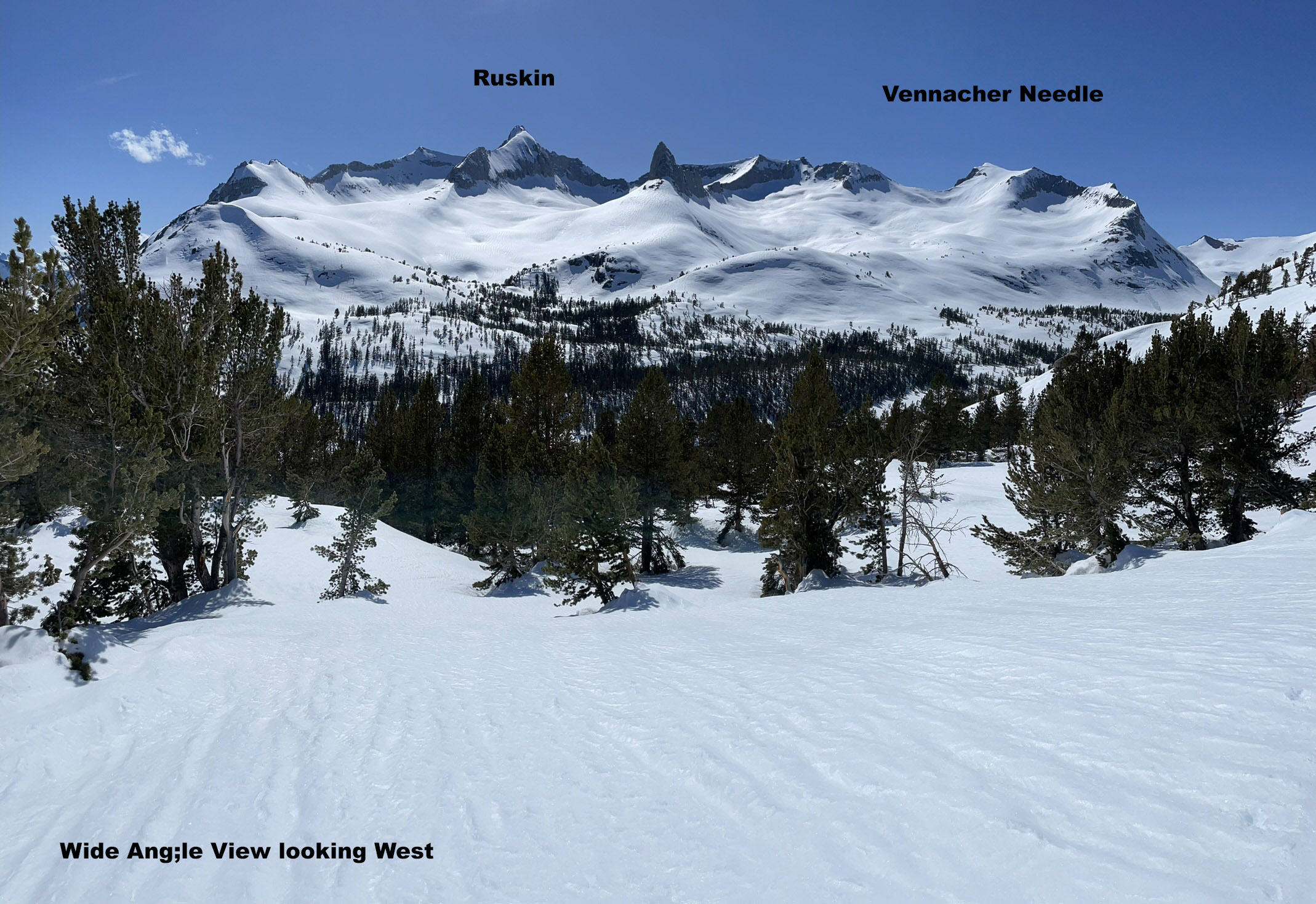
Striped Mountain has a broad sub peak that sure looks like the summit, reaches maybe 40 degrees for 1000′. You can also go around this north face on a longer and lower angle journey up the NE side. I decided to just boot up the face, which got pretty deep from recent wind deposited snow. The bond felt good to me on the way up. It wasn’t really a thick slab and blew up the slope by the look of the surface scalloping. it felt familiar and turned out to be pretty good powder skiing on the way back. The view for this sub peak of Striped was amazing, and the actual summit looked far away and terrible for skiing. So of course, we went over there! We couldn’t just almost ski the peak. Skiing down a few hundred vert on the south side of the sub peak was great actually, and we needed that smile by this point in the trip. 5 turns is all you got before scraping our way up for an hour on wind board and around rocks to the true summit of Striped Mountain. The view at the top is incredible. You can see down into Armstrong Canyon, which leads back to the desert and a nearby trailhead. You can see the Ruskin and Vennacher area clearly as a ski touring zone that looks too good to be true. And you can see down the south fork of the Kings River, with huge peaks above it like Arrow Peak, State, and Marion. You could certainly ski Striped Mountain in a big day from the car, and possibly at any point in the season. The canyon is narrow with avy paths everywhere, however. Time your Taboose Creek travel with some strategy to avoid avalanche danger. In our case, the snow was mostly gone by now, and firm in the upper half.
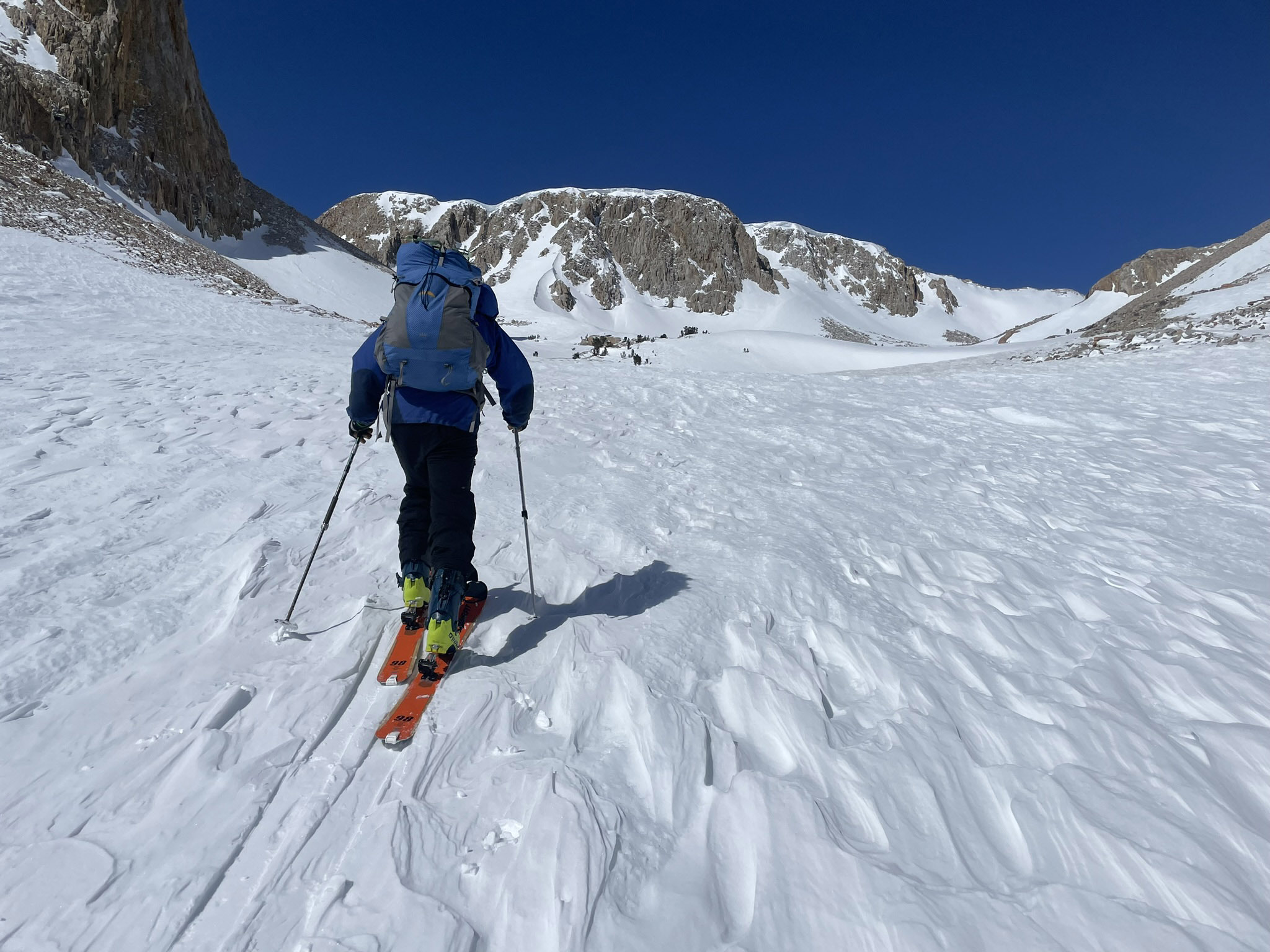
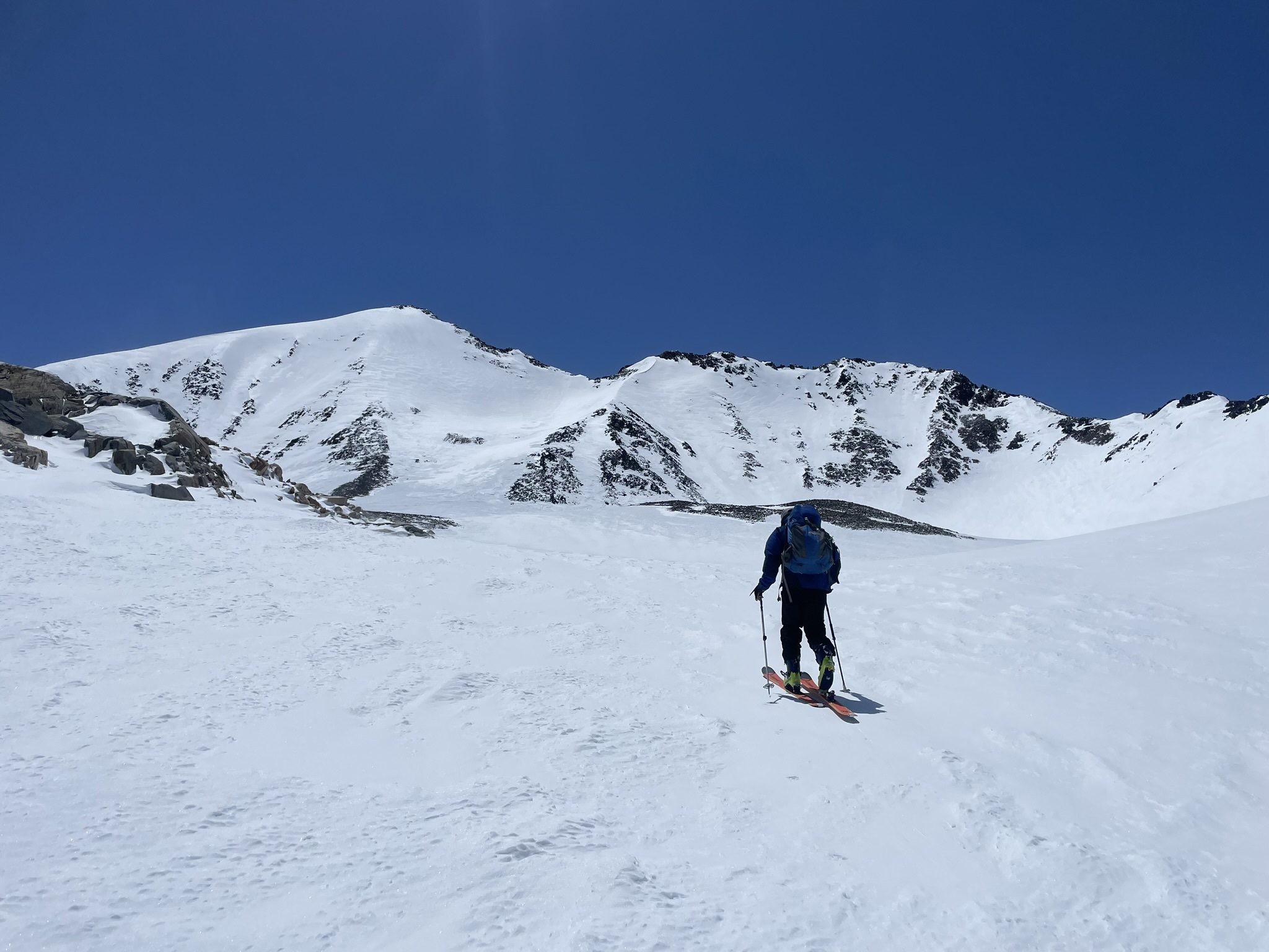
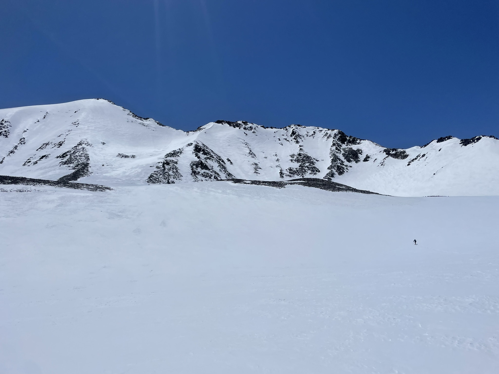
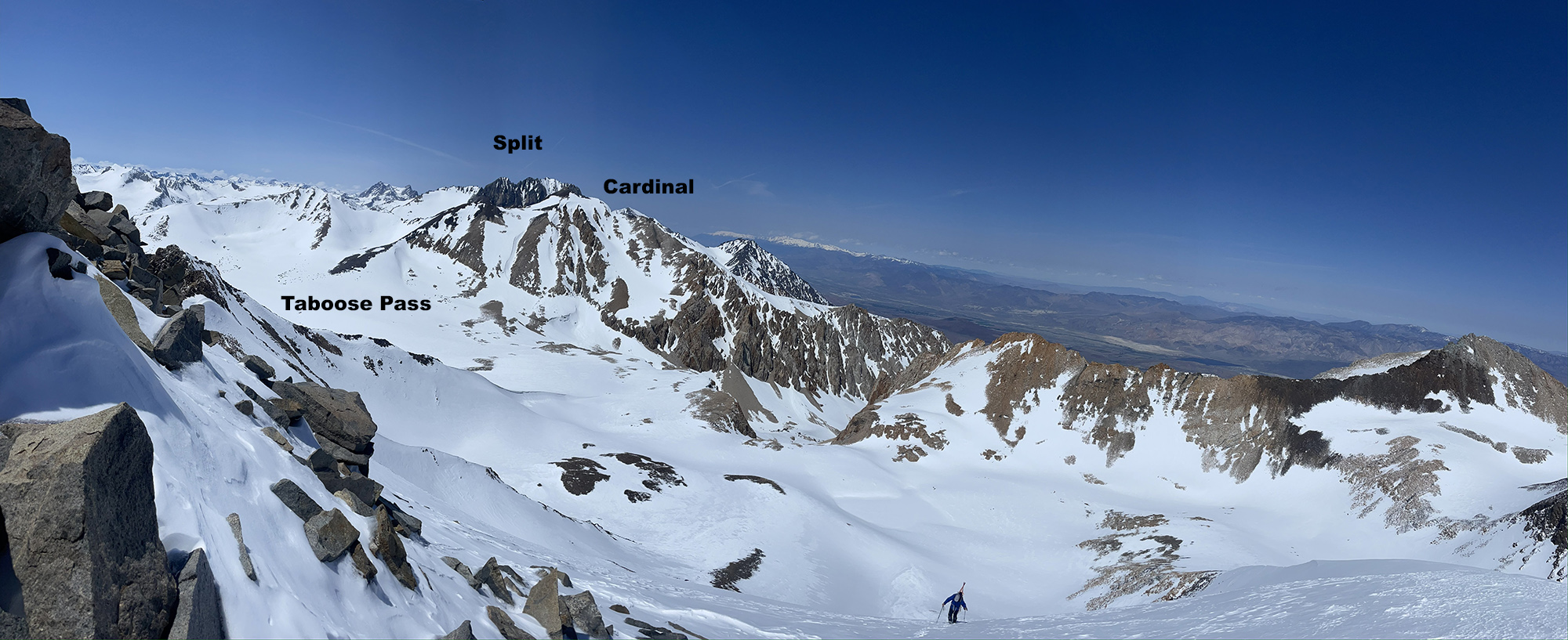
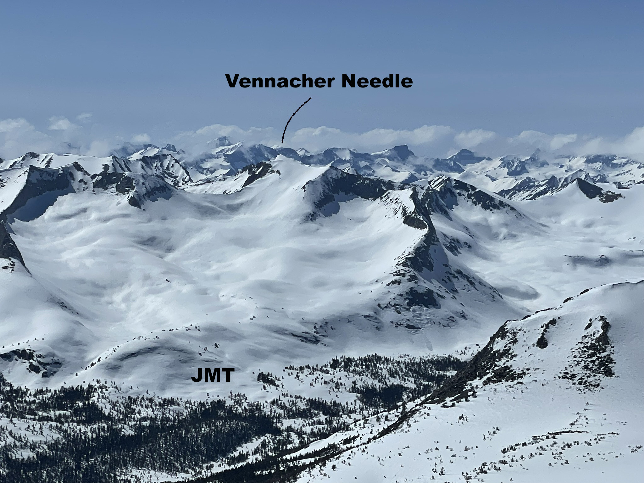
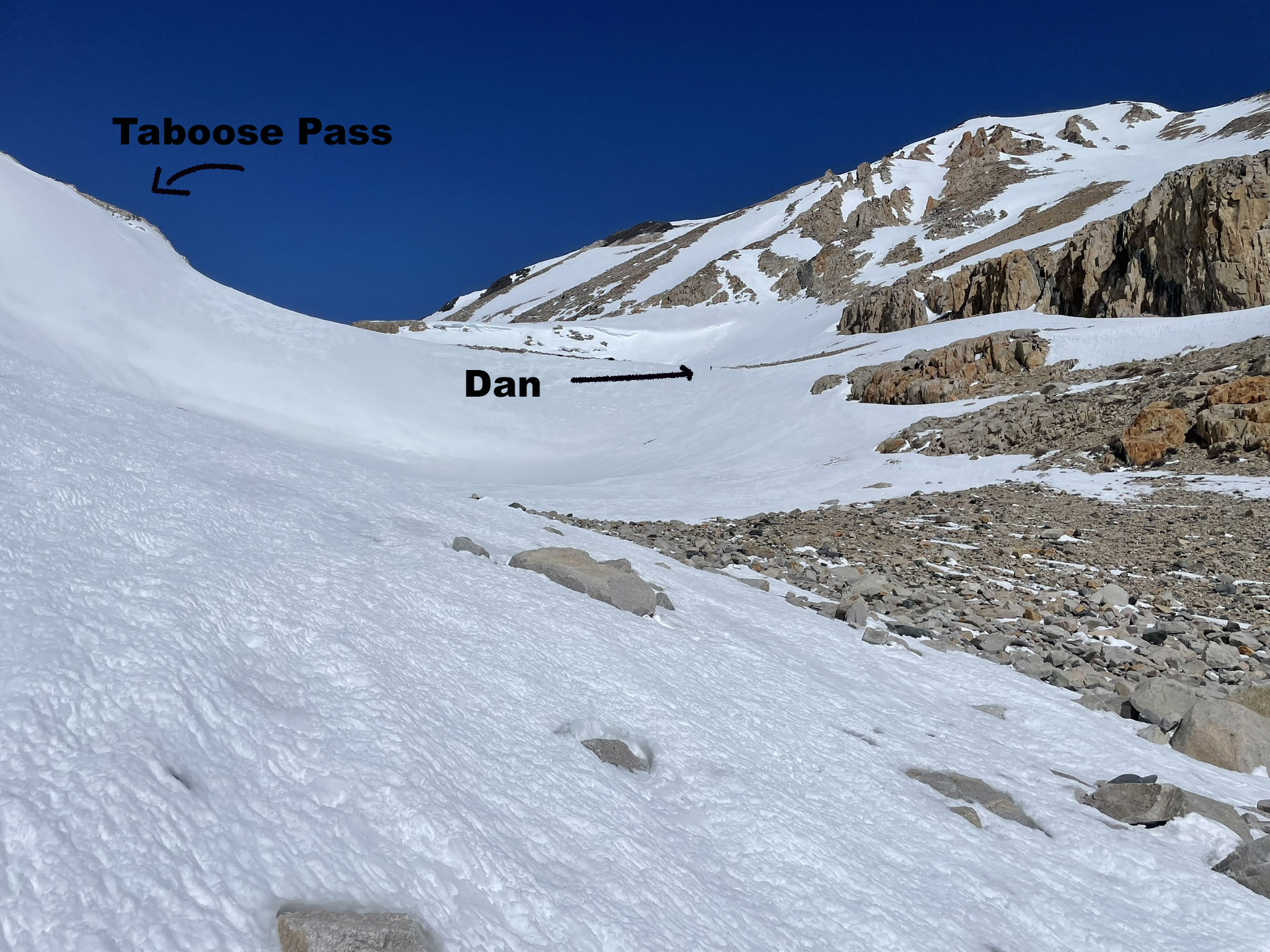
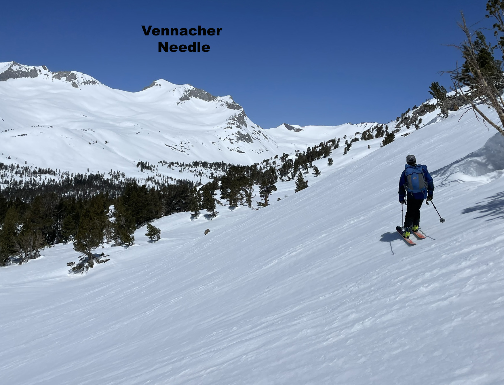
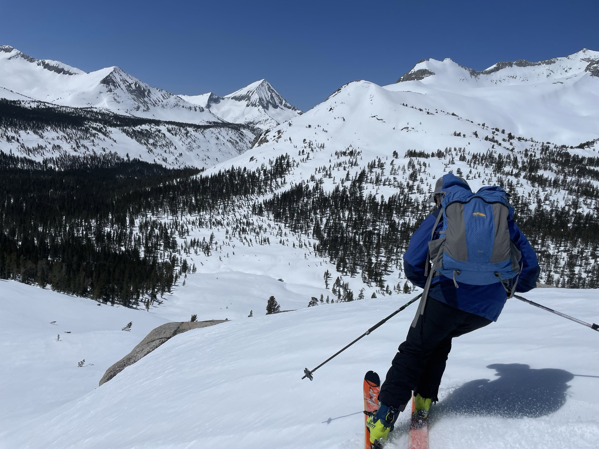
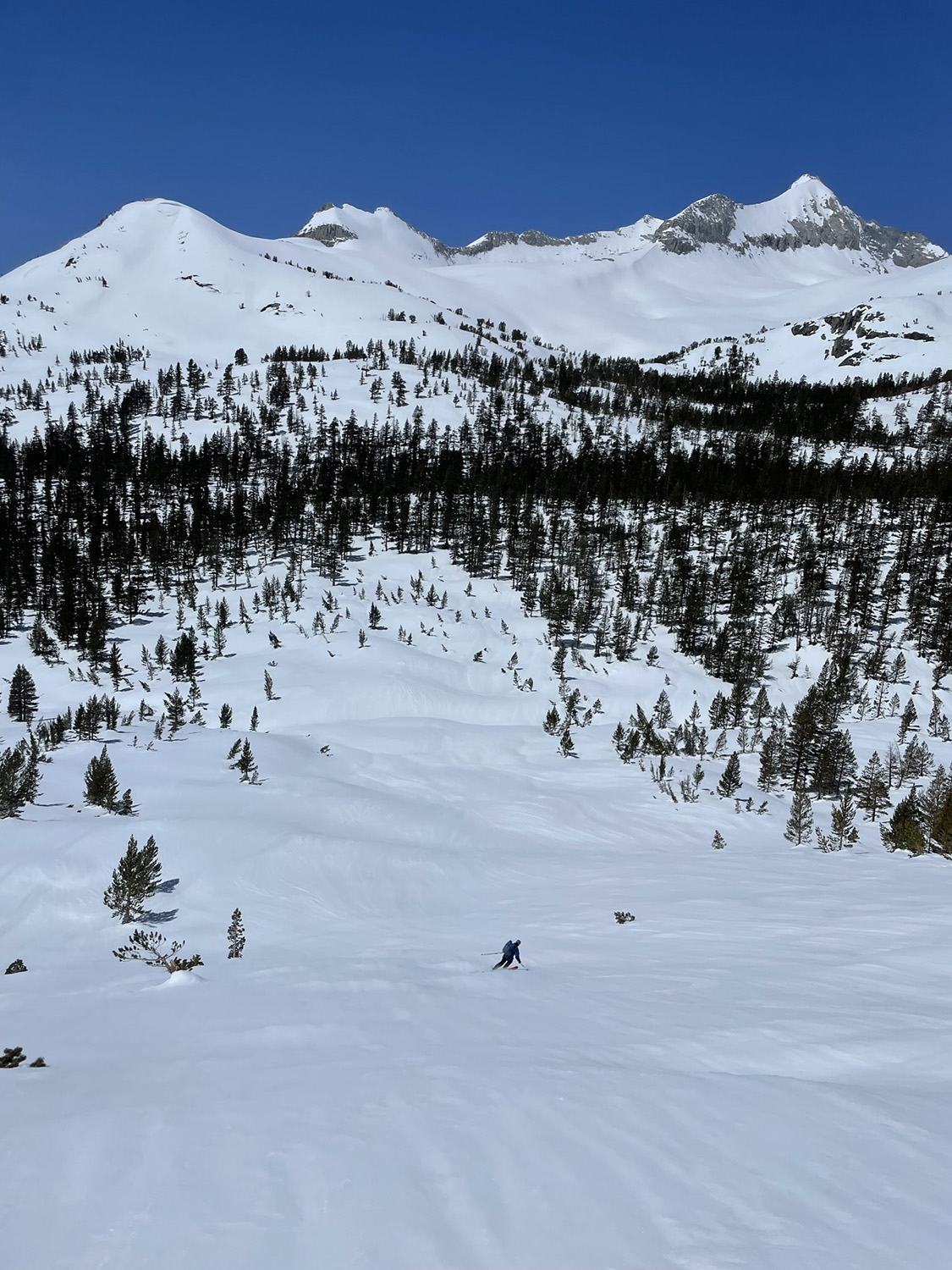
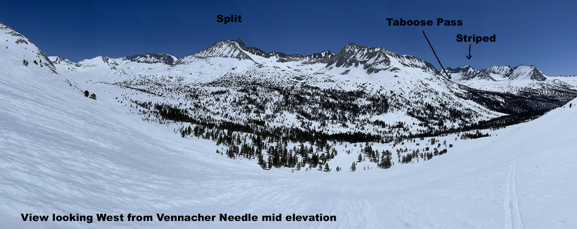
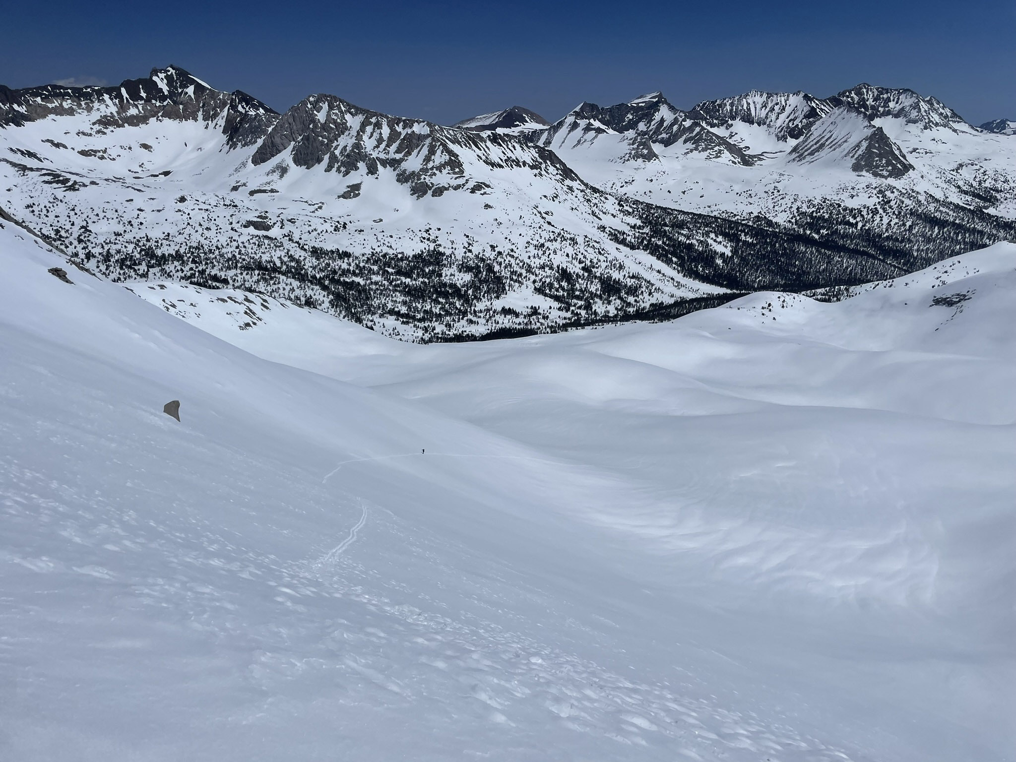
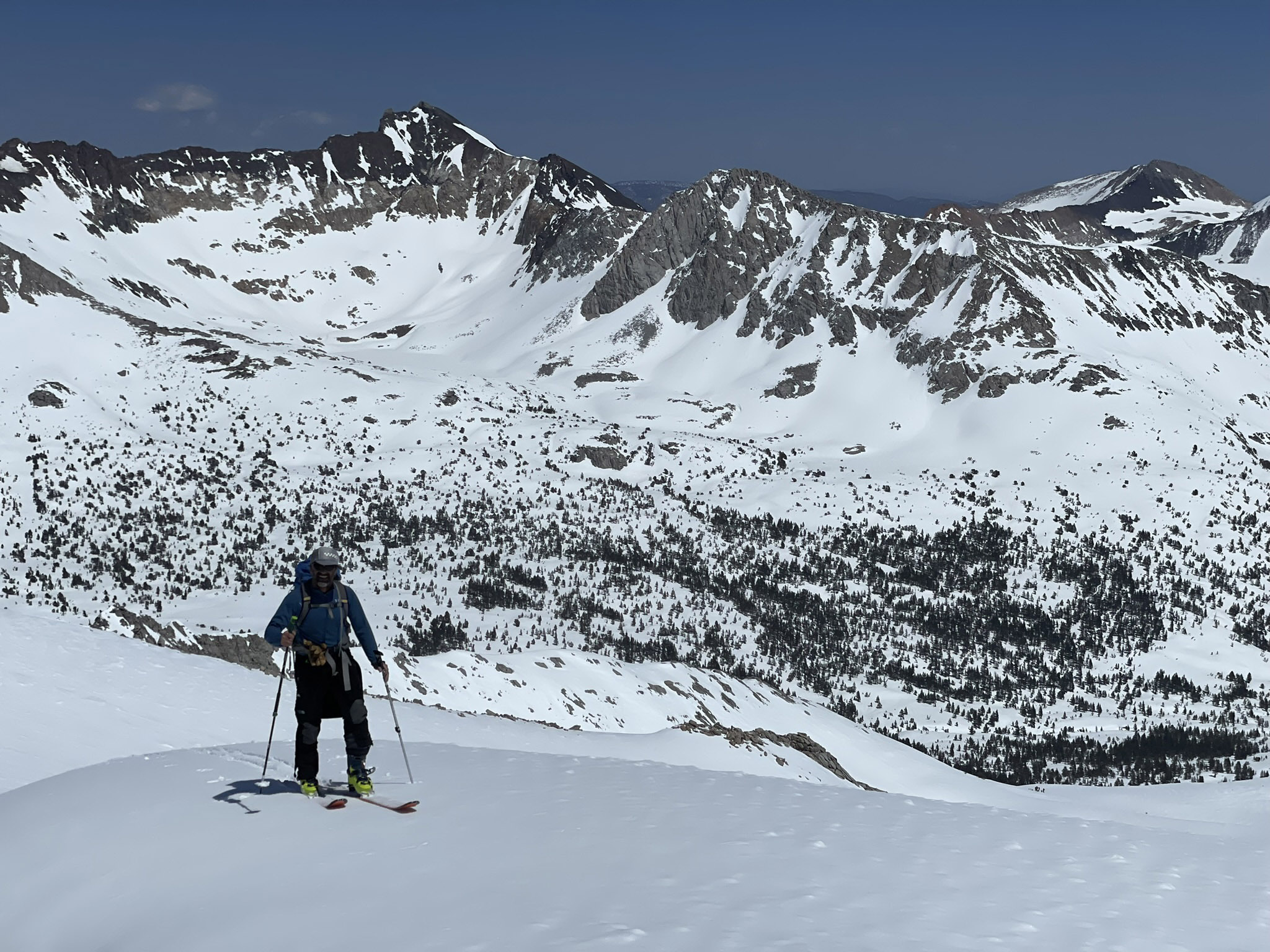
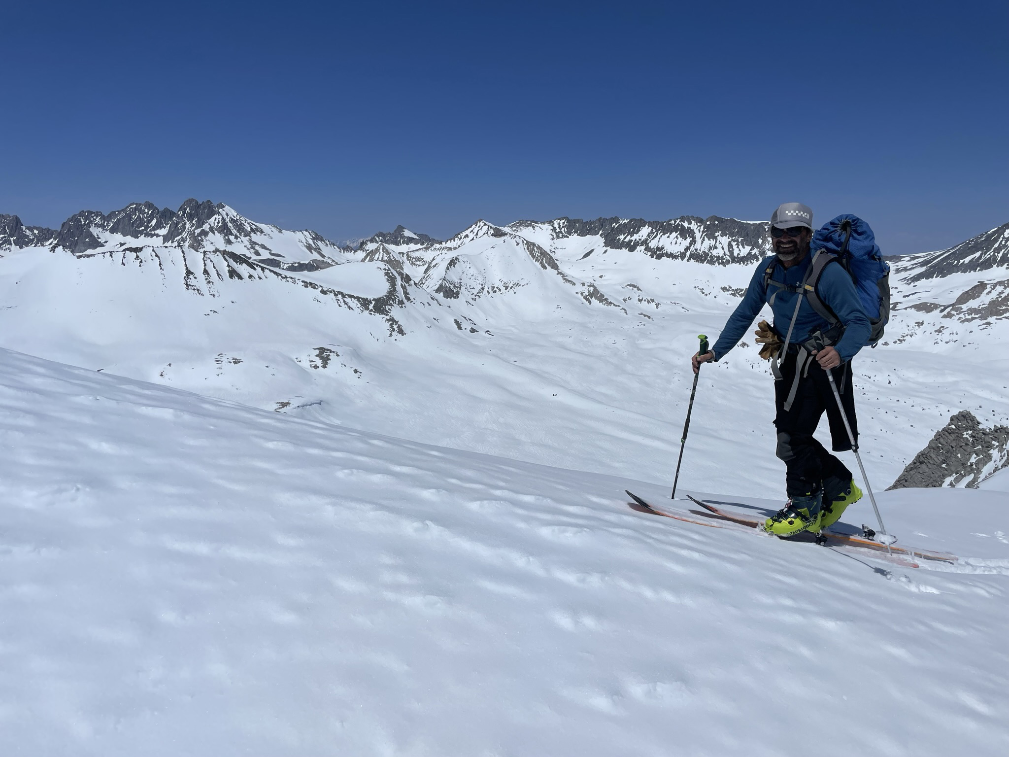
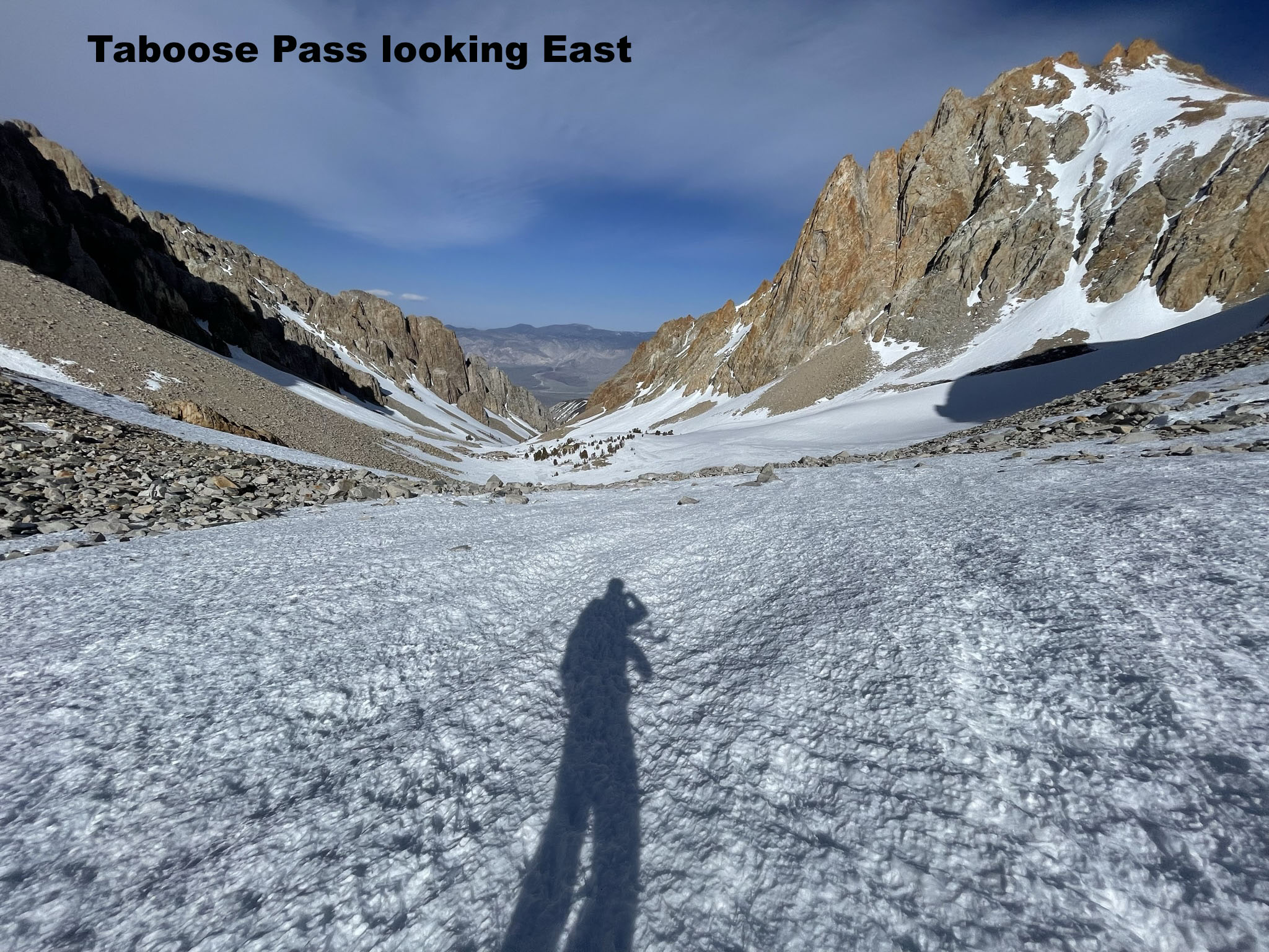
On Day 3 we launched up and over Taboose Pass, which is a huge area. The snow was gnarly sun cupped and rock hard going in both directions near the pass, plus is a mile of flat terrain to traverse on top. When we got through some trees on the far west side of the pass to actually see Vennacher in the distance, the weather got super nice, and we were psyched. On Gaia I measured our route from our 10,400′ camp to be around 10 miles round trip and 4500;’ of climbing to reach Vennacher. So that didn’t seem like a big deal. We were beat when we finally got back to the tent though. Partially from pressing the “take photo” button so many times on my phone. Partly from the strong sun and smiles. And also, a bit from the anxiety of venturing out into unknown terrain without the camping gear, on the back side of the crest, with our recent windstorm experience still on our minds.
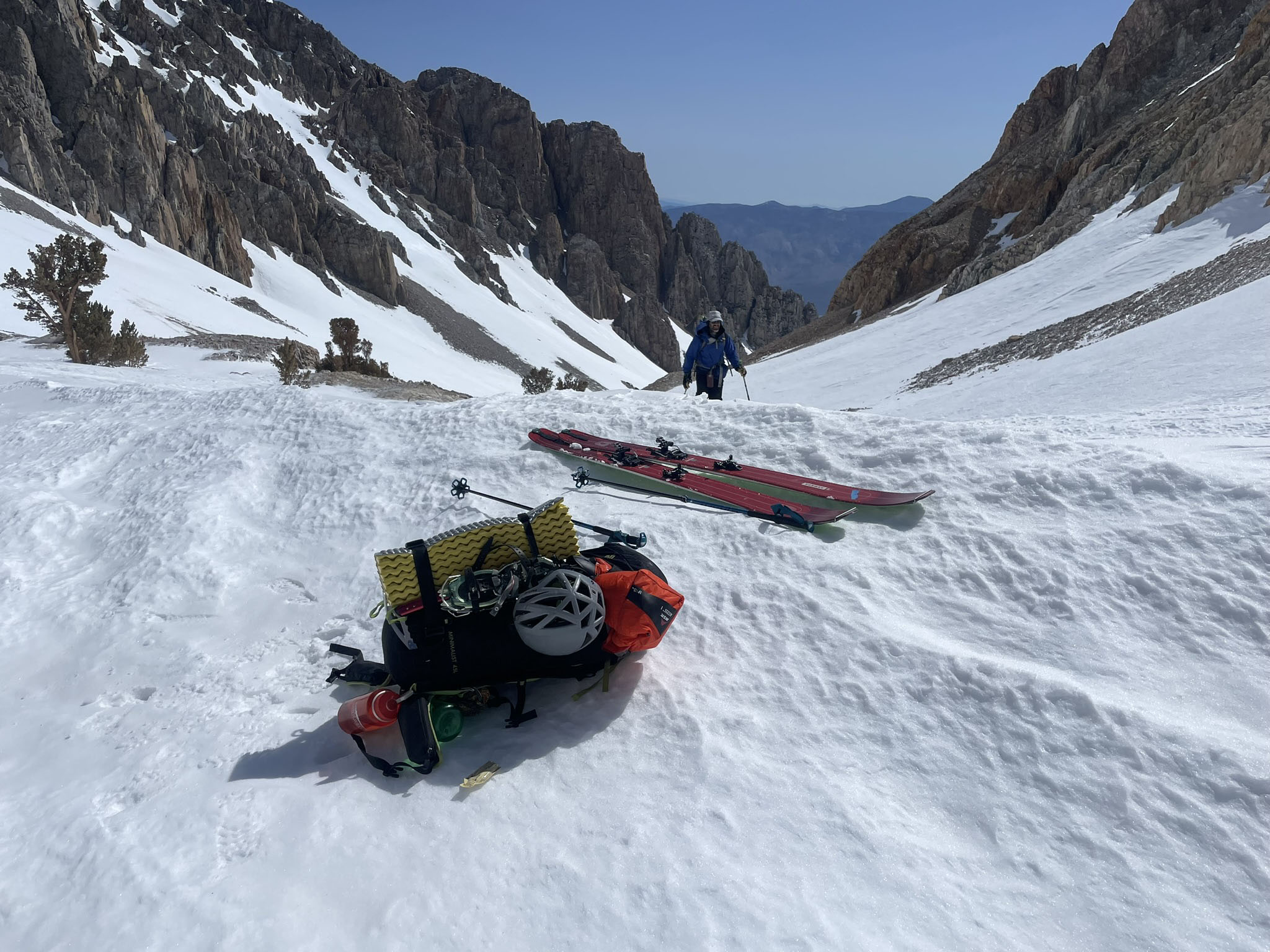
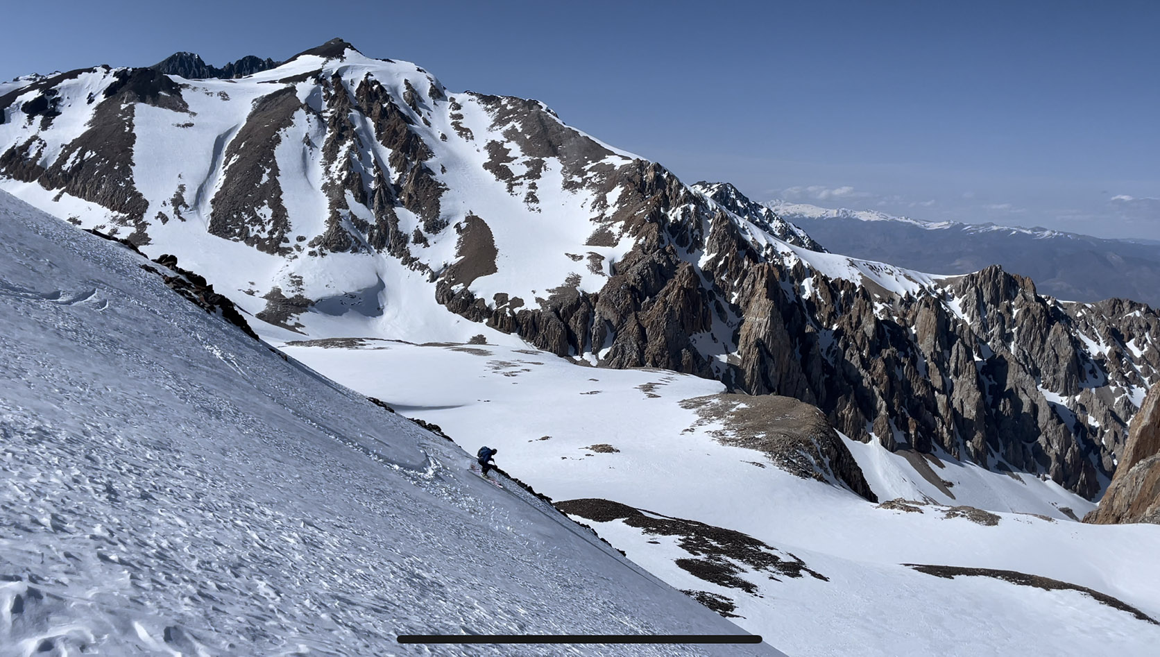
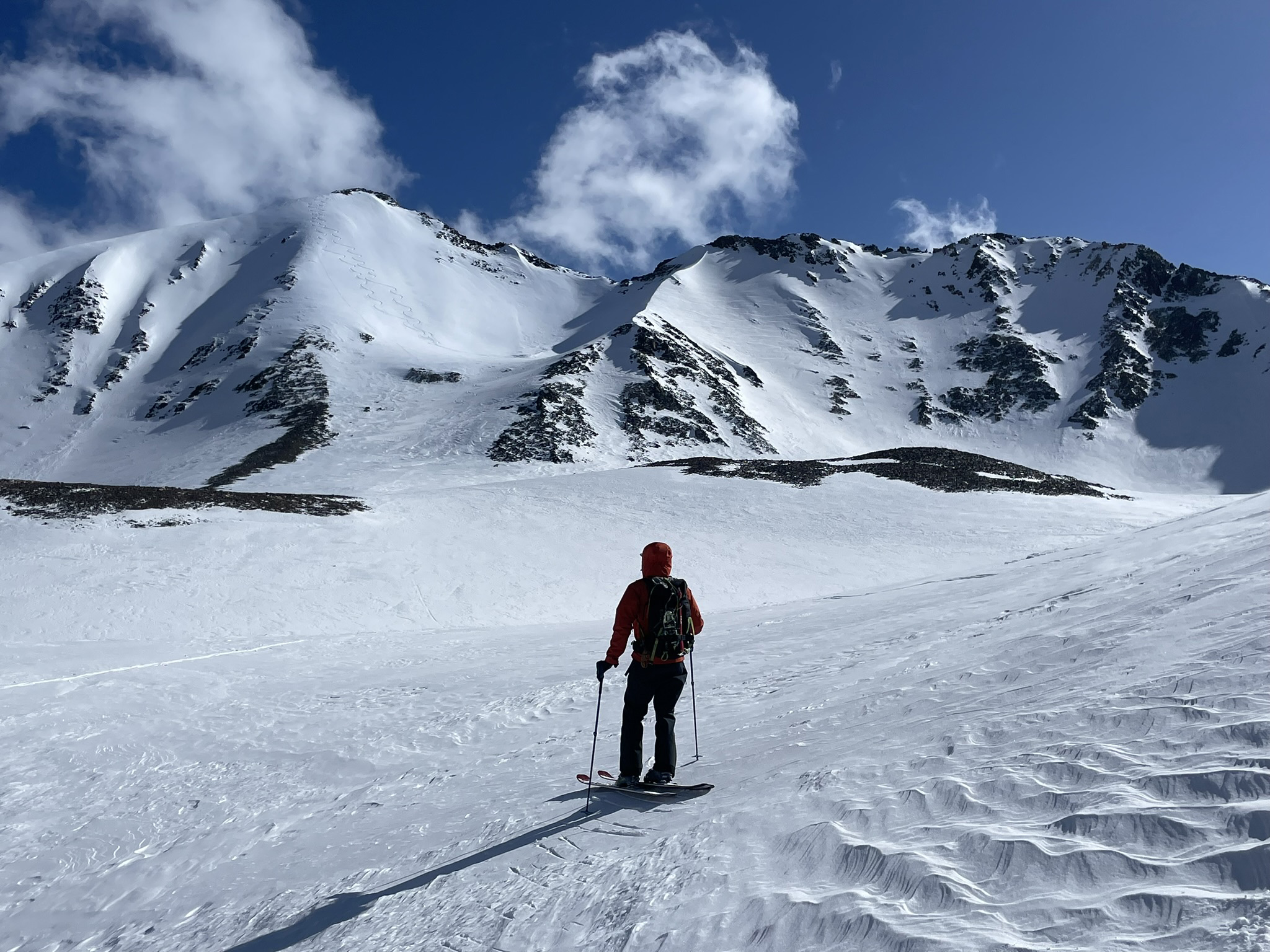
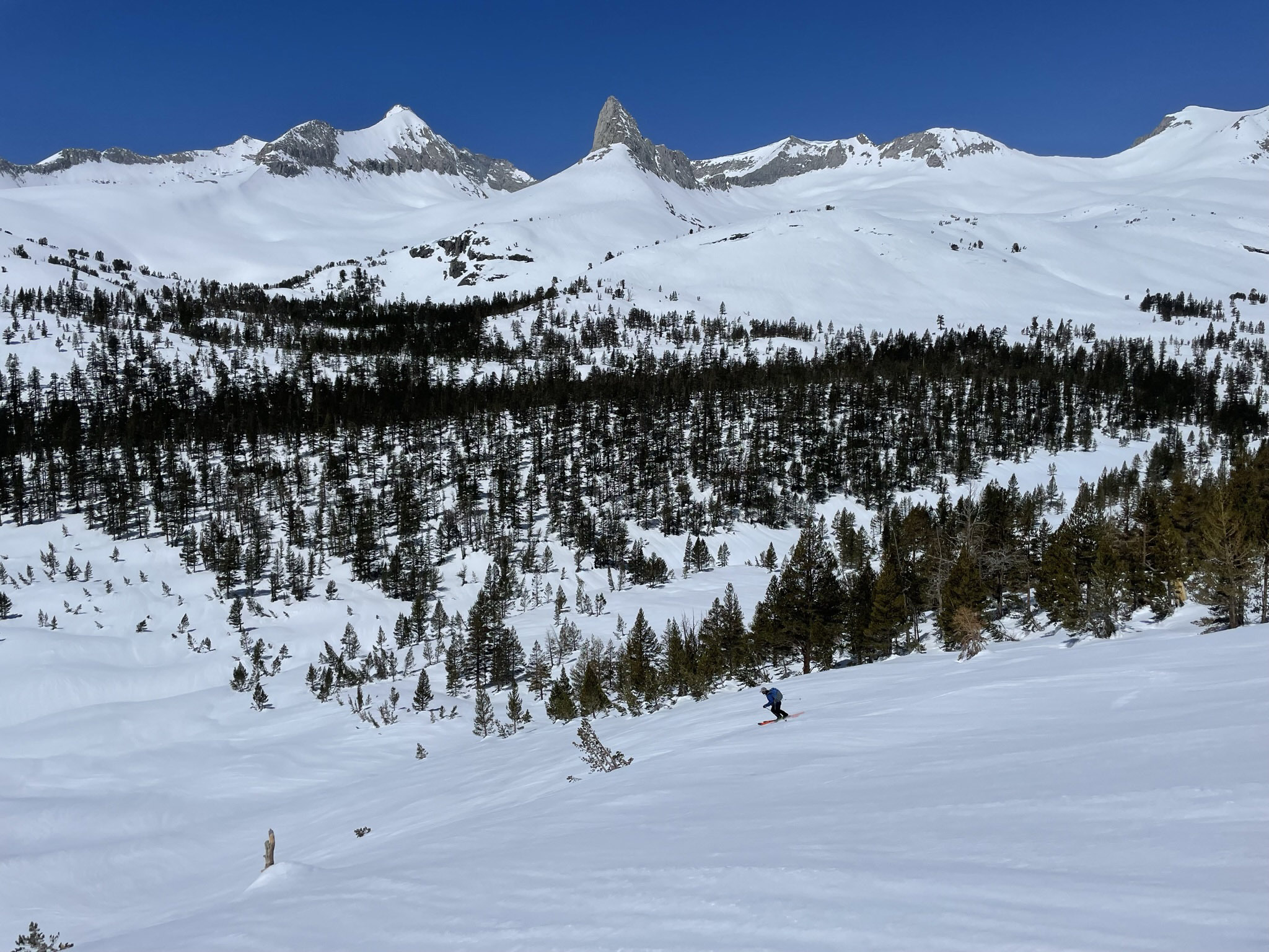
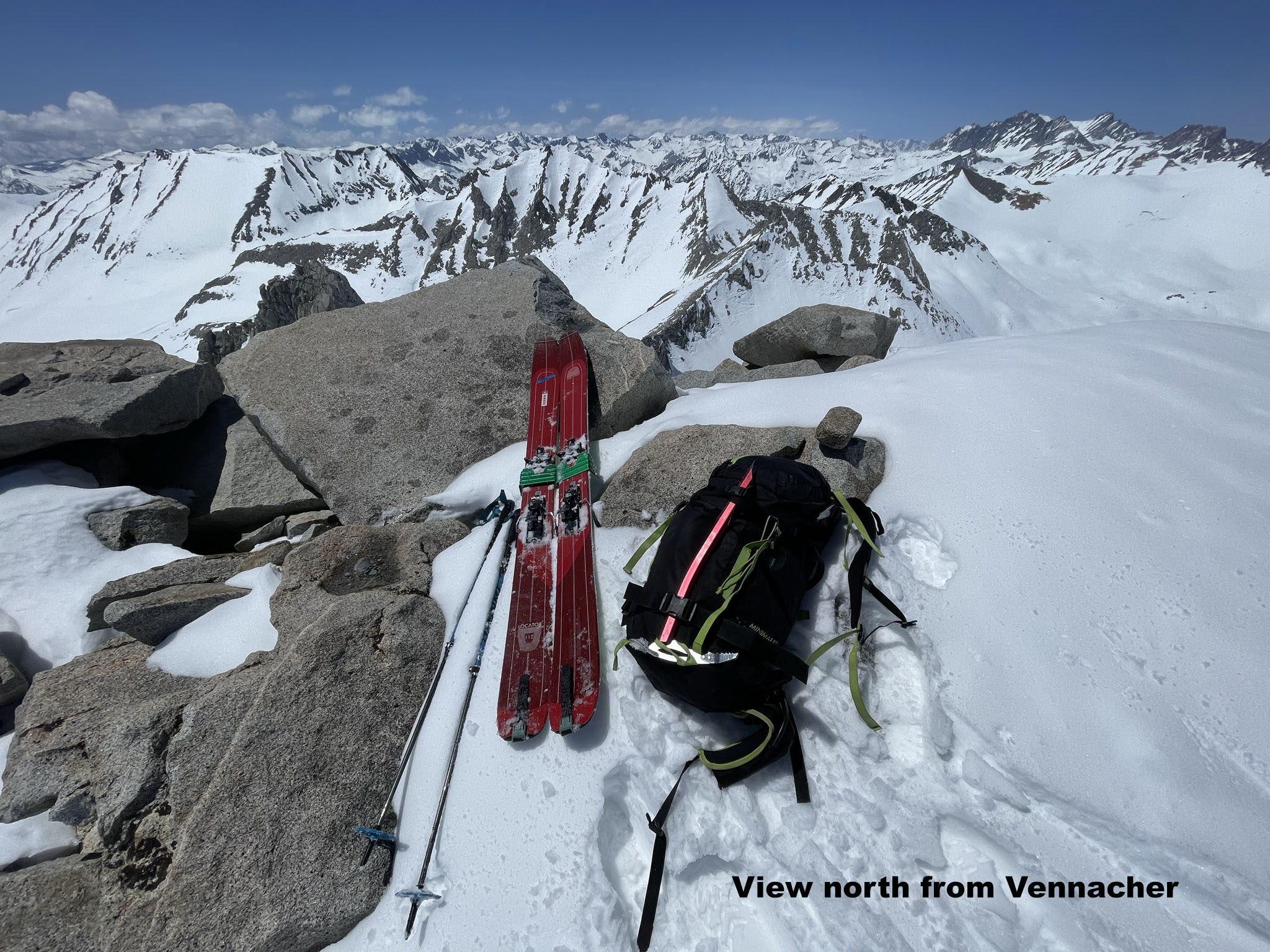
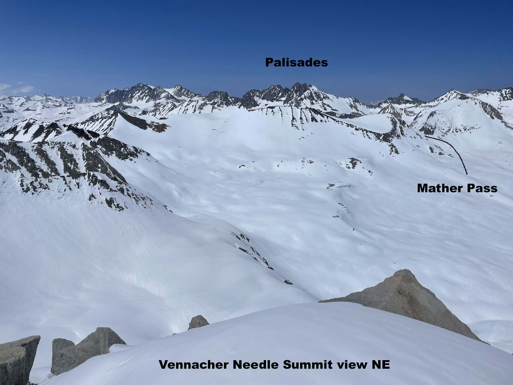
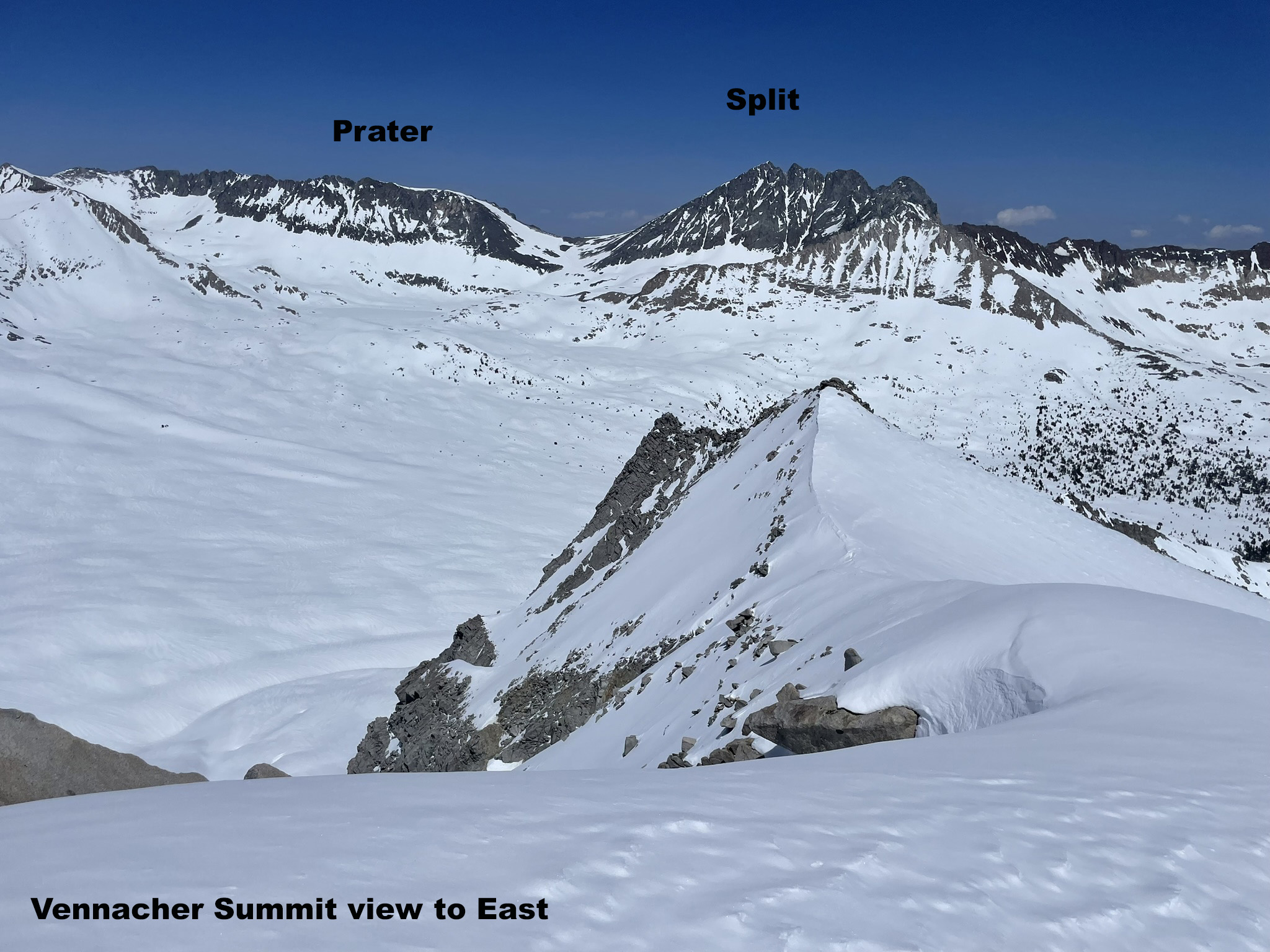
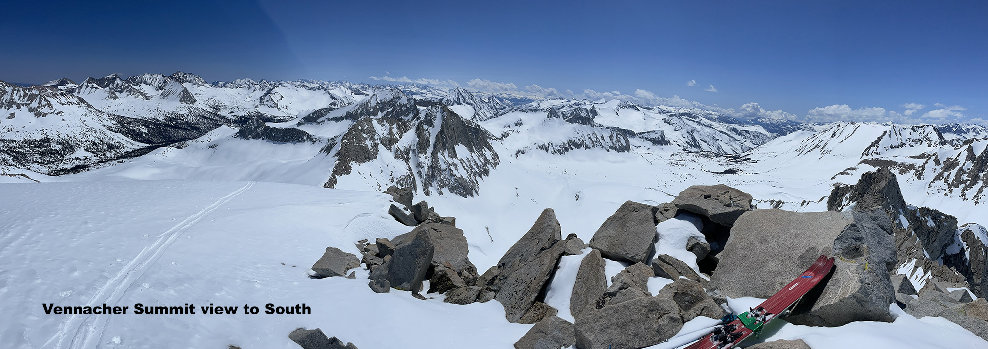
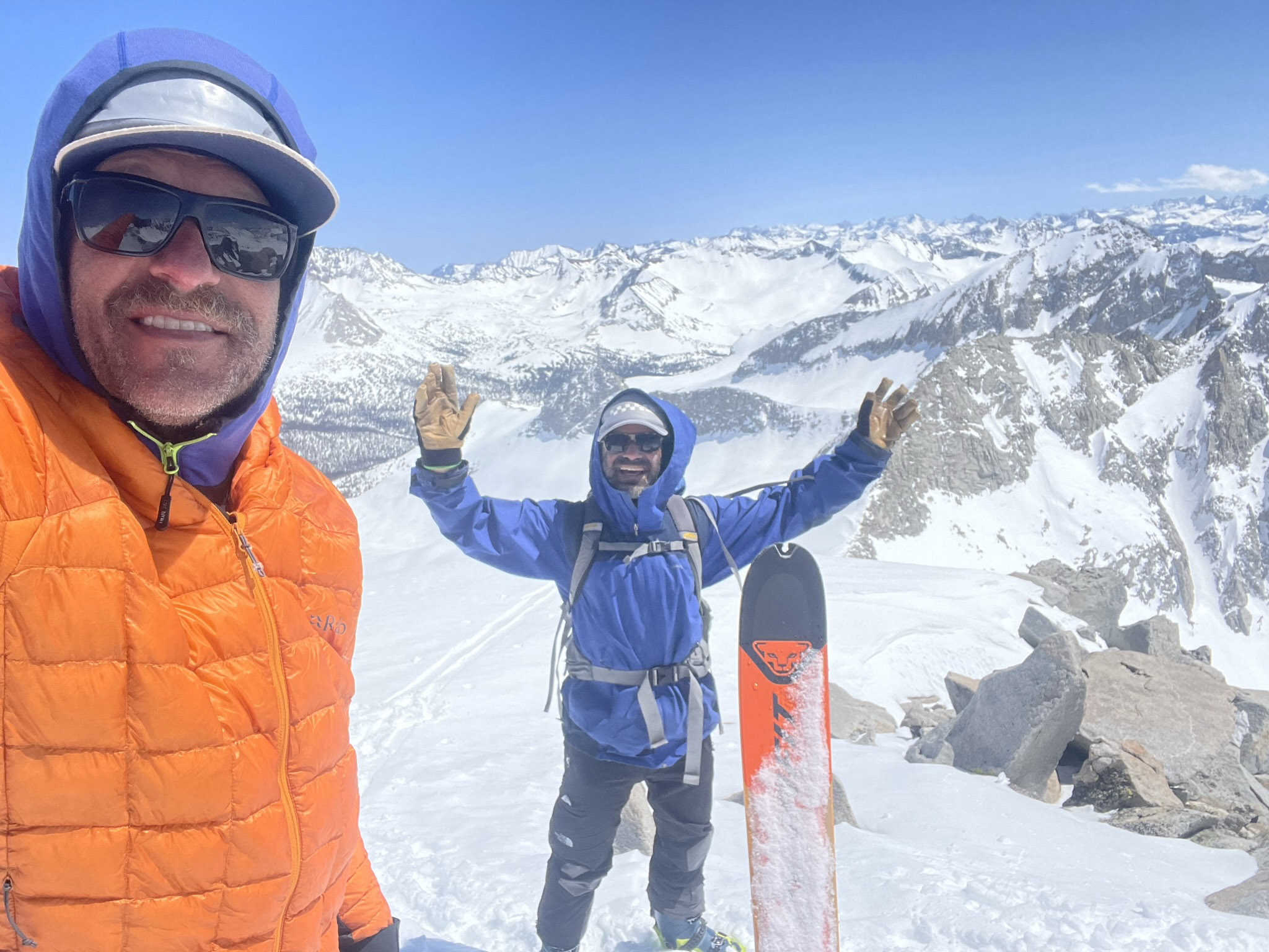
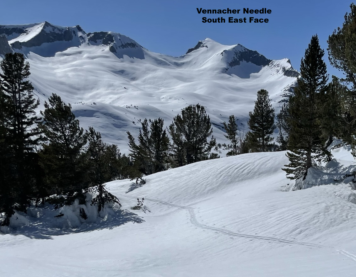
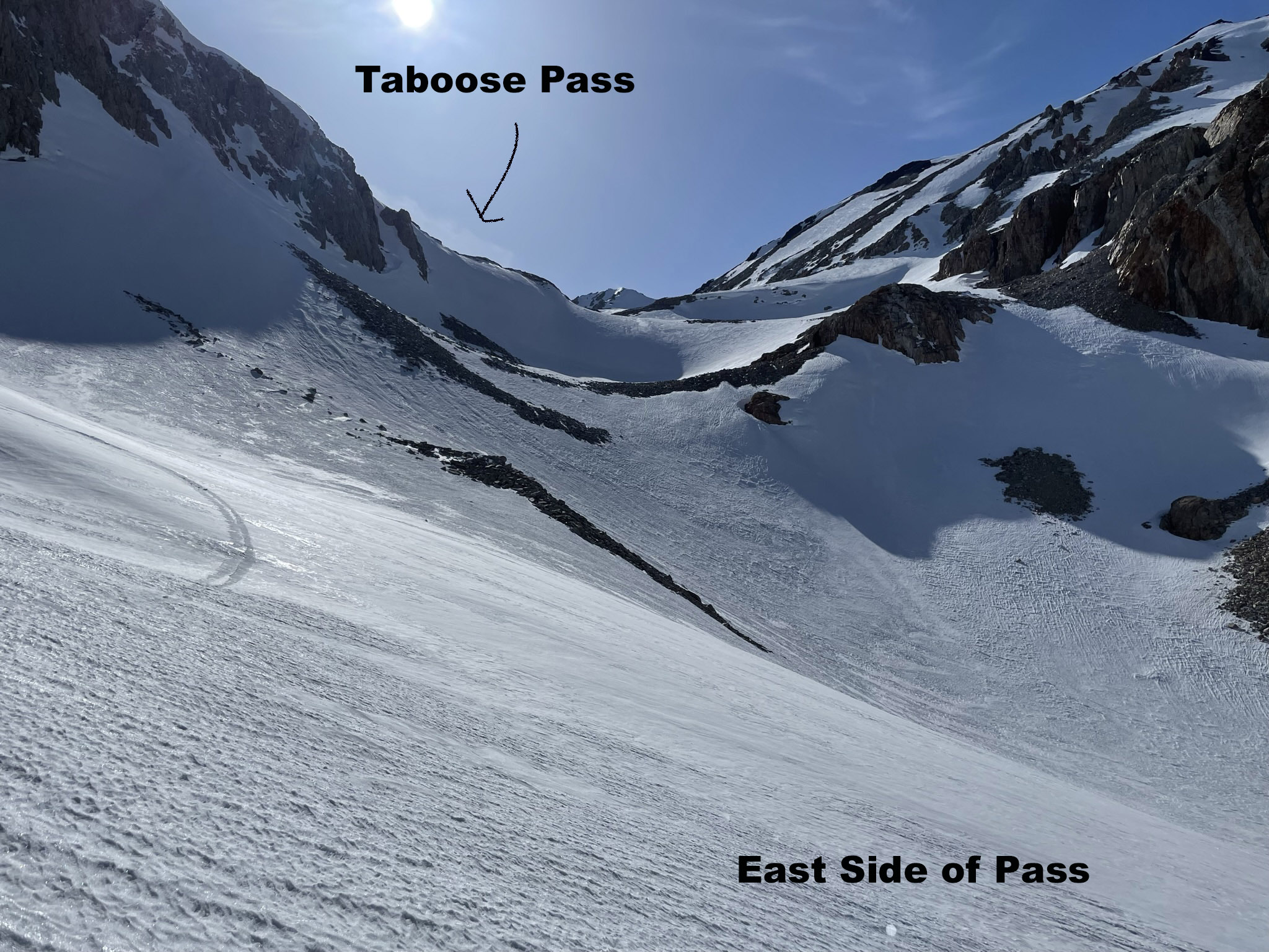
I haven’t seen the Vennacher Needle Peak from other sides. There is no needle formation on the SE side, it’s all very pleasant and rollie. The North side is steep rock but has no Needle. I just read online people talking about nearby Saddle Peak being the “needle”, and Vennacher’s name being mis placed. You can see this amazing rock formation in my photos in-between Vennacher and Ruskin. The top 1000′ of Vennacher was steep enough for some exciting and quality turns, but not quite as steep as Striped Sub Peak. Striped Sub Peak might have reached 40 degrees, while Vennacher SE Face maybe 35 at the top and 25 in the lower half. The summit of Vennacher Needle is 12,995′, and the JMT Trail in the valley is 10,400′. so this is only a 2600′ climb from the valley. We were still breathing hard at that elevation and working for it to get up there. After a great post descent hang out session, we started the 1000′ climb back up to the pass and soaked in the beauty by turning around often. At the pass we found the snow to be rock hard and really bumpy. This is a windy spot for sure and now it was all in the shade around 5pm, We really had to dig deep and concentrate to skidder down off the east side to reach our camp safely. At one point I just took off the skis to get off the snow and walk across on scree rock to reach smoother north facing windboard snow. By the time we got back to camp it was a bit late to pack up and head down another 5000′ to the car, so we stayed another night up there.
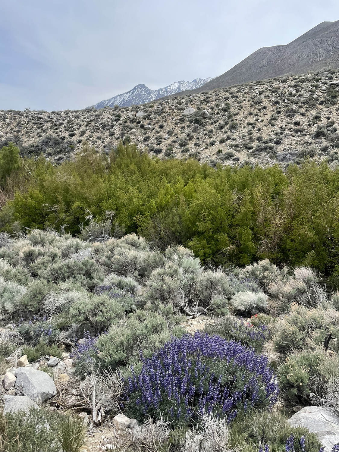
Skiing down Taboose Pass from 10,500′ started really good. We even hiked up higher to get more turns. Corn was perfect and my pack didn’t seem too bad at around 35 lbs. My pack was 50 lbs on the walk up a few days earlier, due to the ski boots and skis on there. At around 9000′ the snow got too bumpy for turns, and soon got so bad from slide debris. The snow was dirty enough to prevent our skis from sliding, which was welcome. Walking would have been easier, but our packs where heavy enough without skis going on there again. We found our hiking shoes at around 8000′ and strolled down the nice trail and enjoyed full bloom Lupin and the last few hours of still quiet desert. I commented a few times on the saying I loved in an old sticker I believe Metolius put out that said “My vacation is your worst nightmare”. This was a type 2 fun trip for sure, and I was scheming the next one as soon as I got to the car. This spring has been too warm for safe fun ski touring, and we were lucky to get out there in one of the few cold snaps. Standing on those peaks with a good friend will be a treasured memory forever, so again, I totally recommend you haul your asses up there to those two peaks. Maybe don’t wait until May though, and don’t go up Taboose Creek with any avy concerns.

Looking for awesome ski and splitboard tours in the Sierras? We’ve got write ups on many common and uncommon tours curated by the owner of the BackCountry, Mike Schwartz.


