


Location: Near Bishop, CA – East Side of the Sierras
Elevation Change: 3726′
Recomended Map: Tom Harrison Maps – Bishop Pass
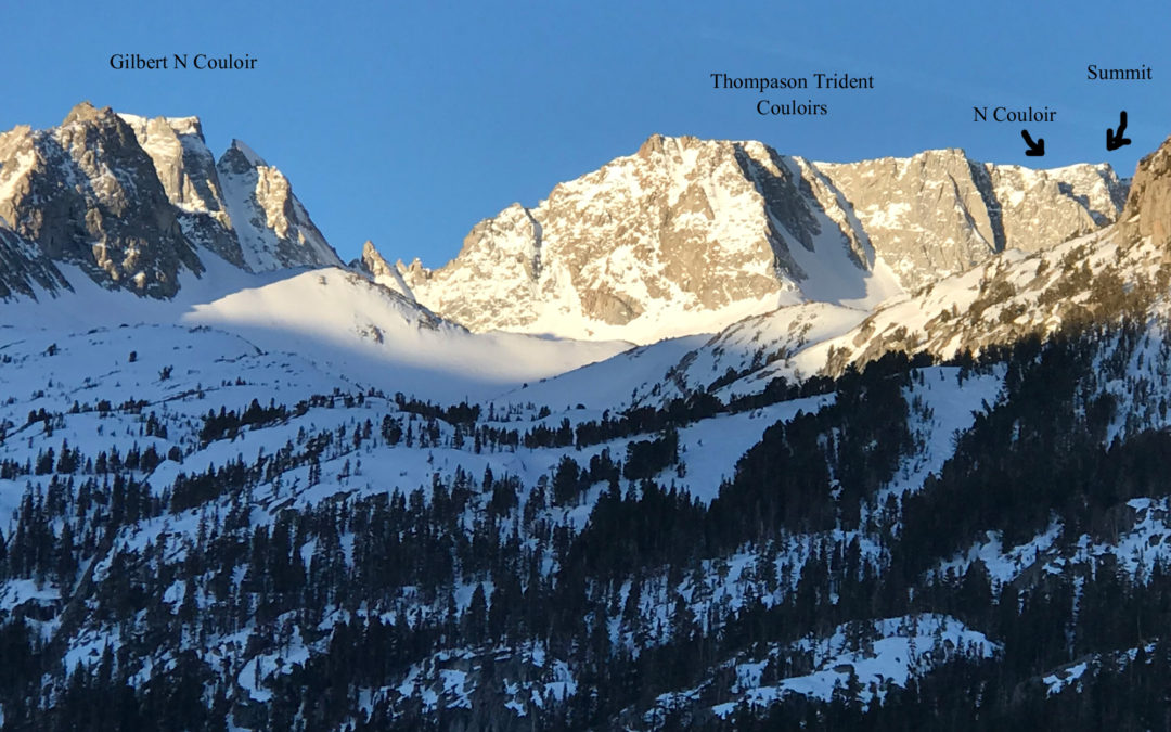
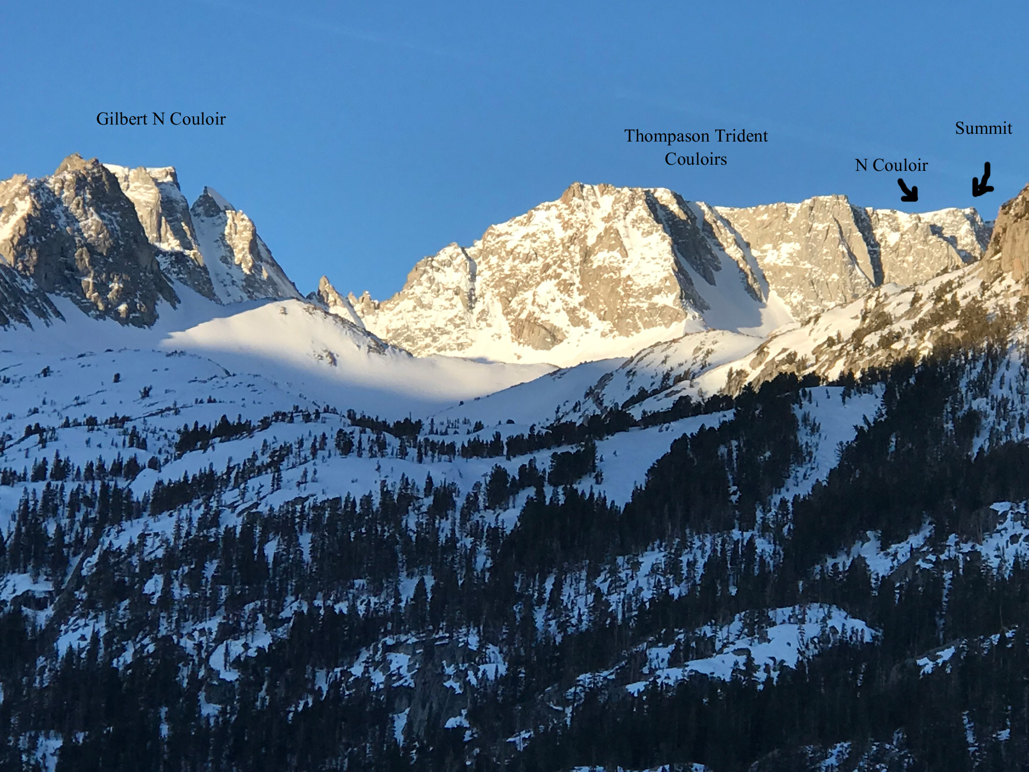
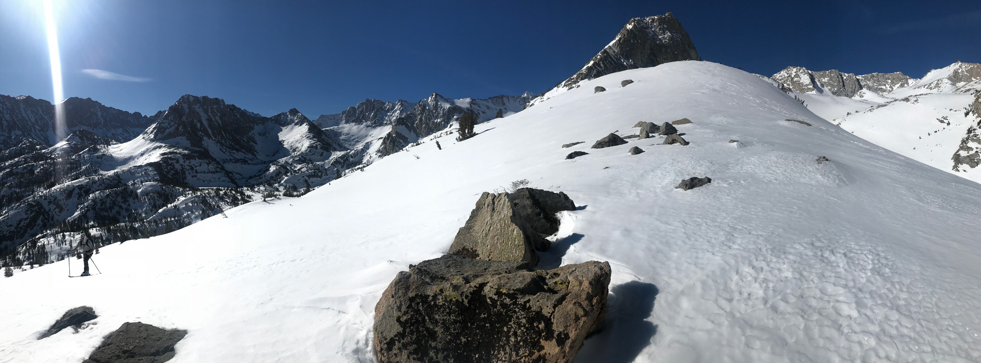
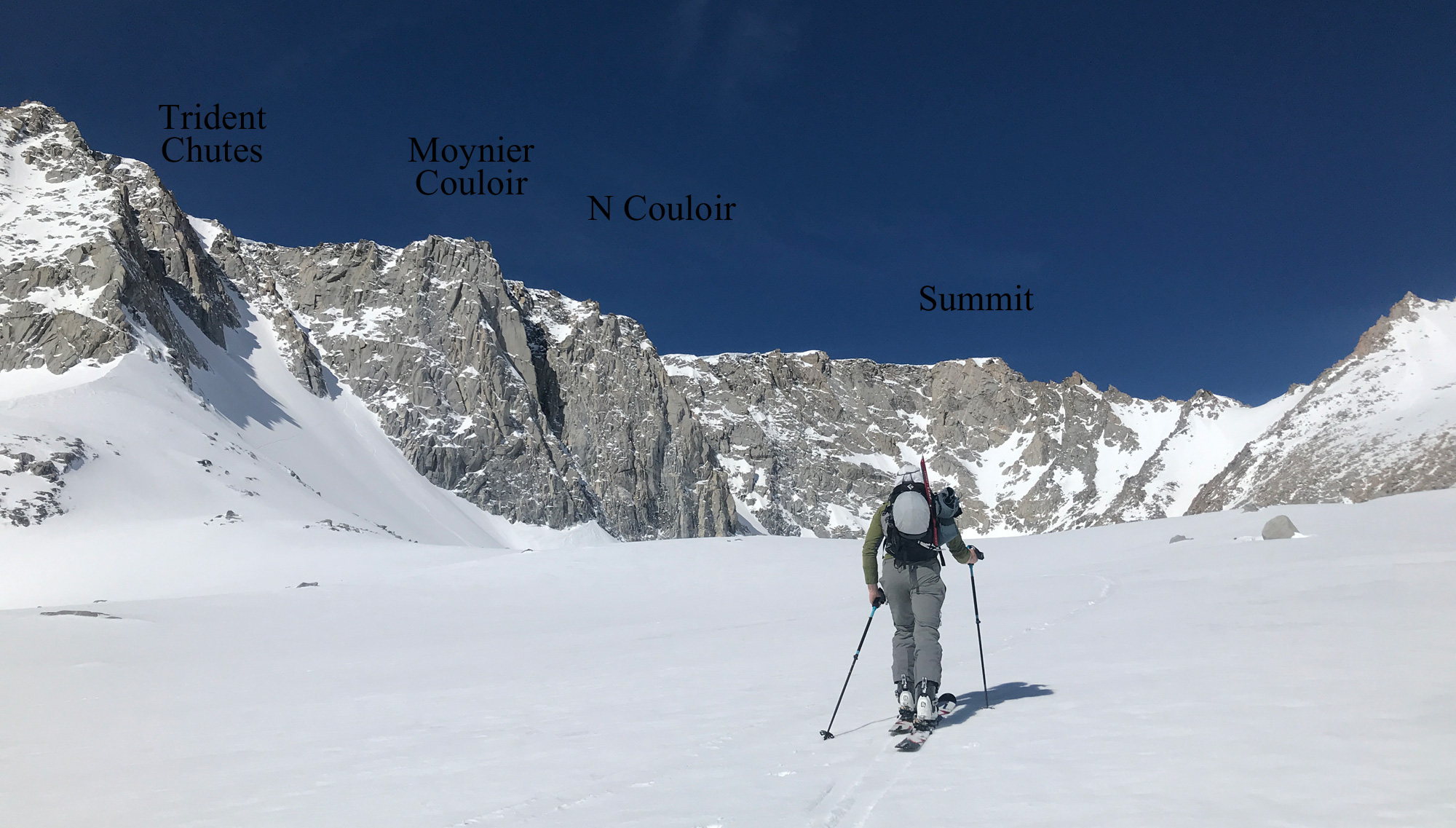
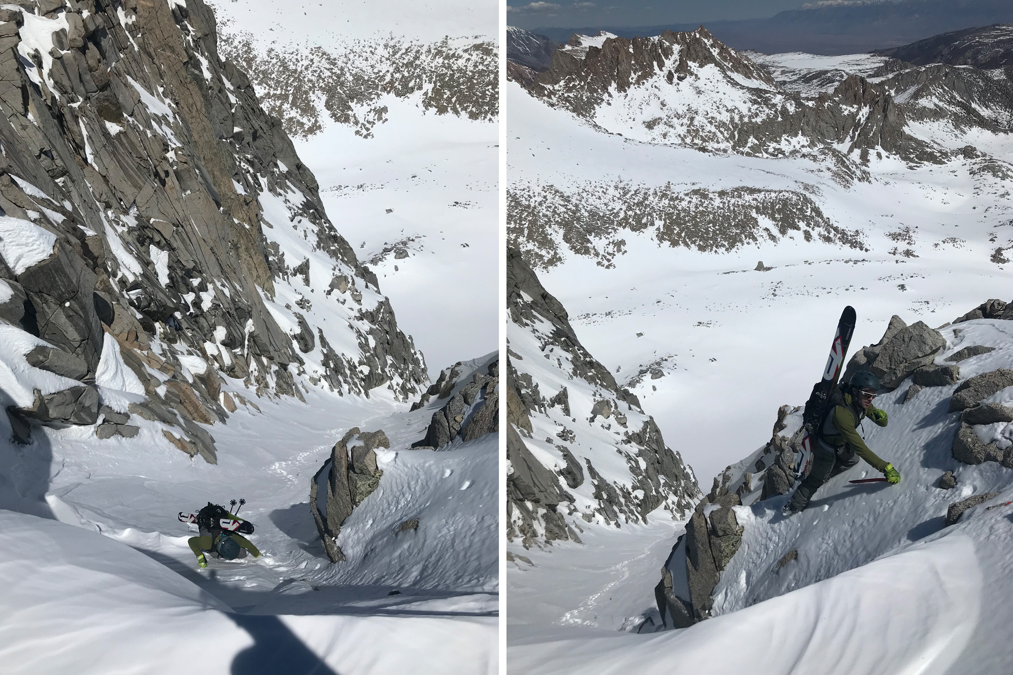
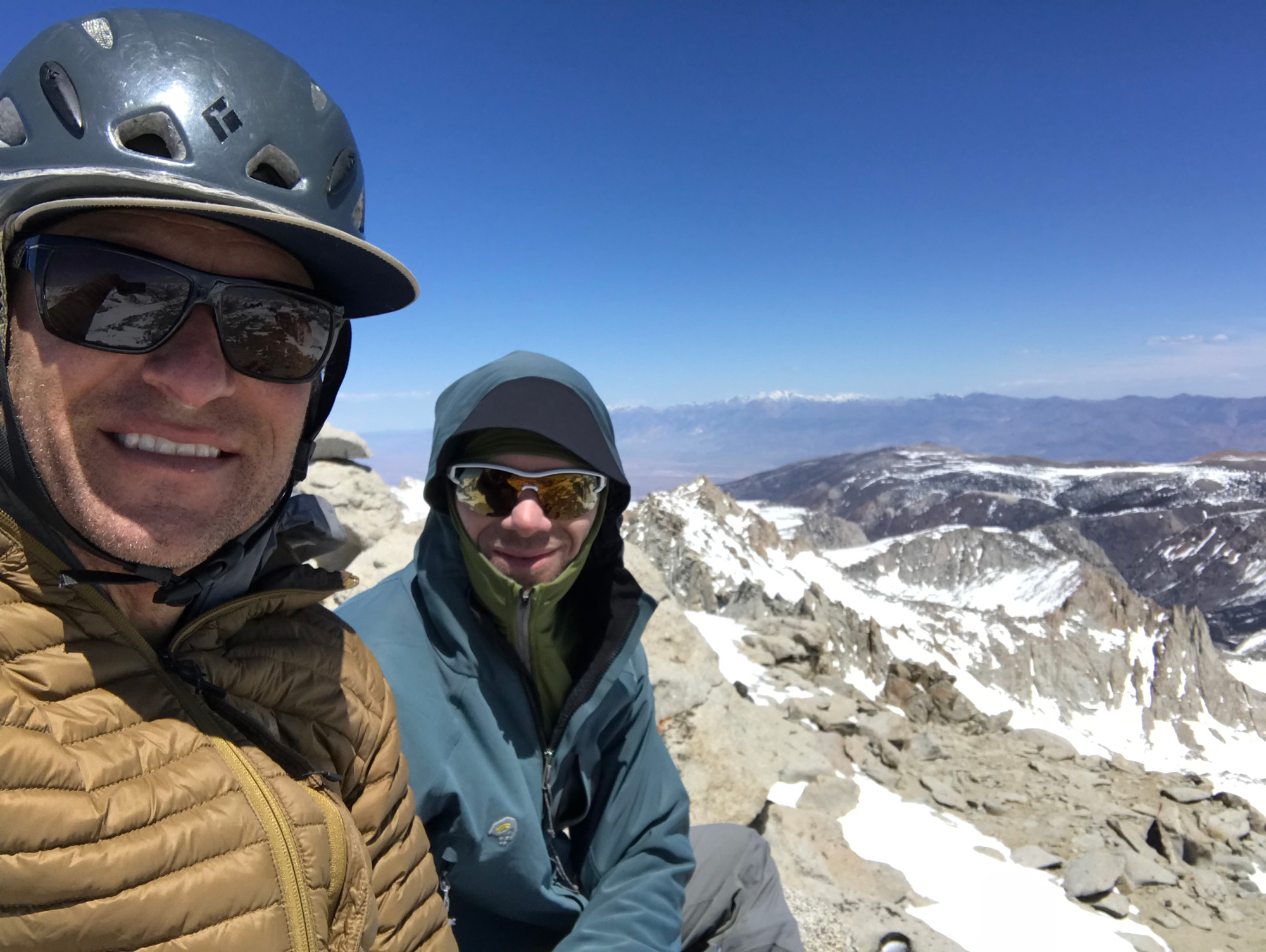
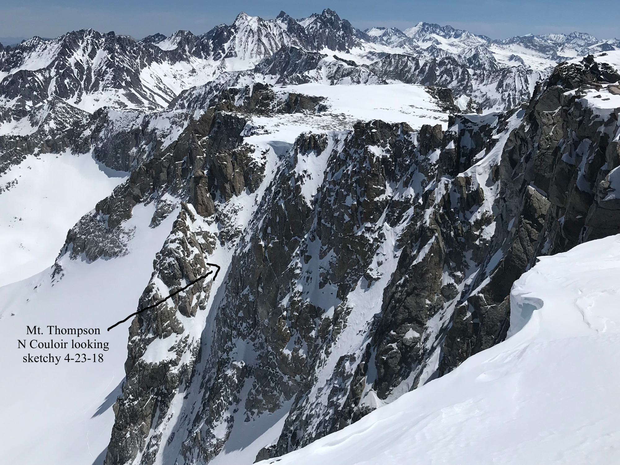
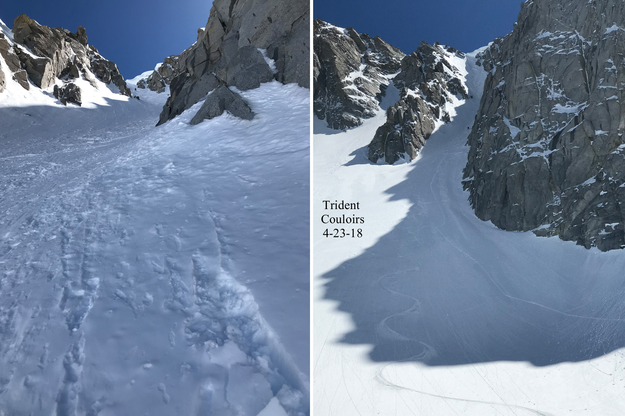
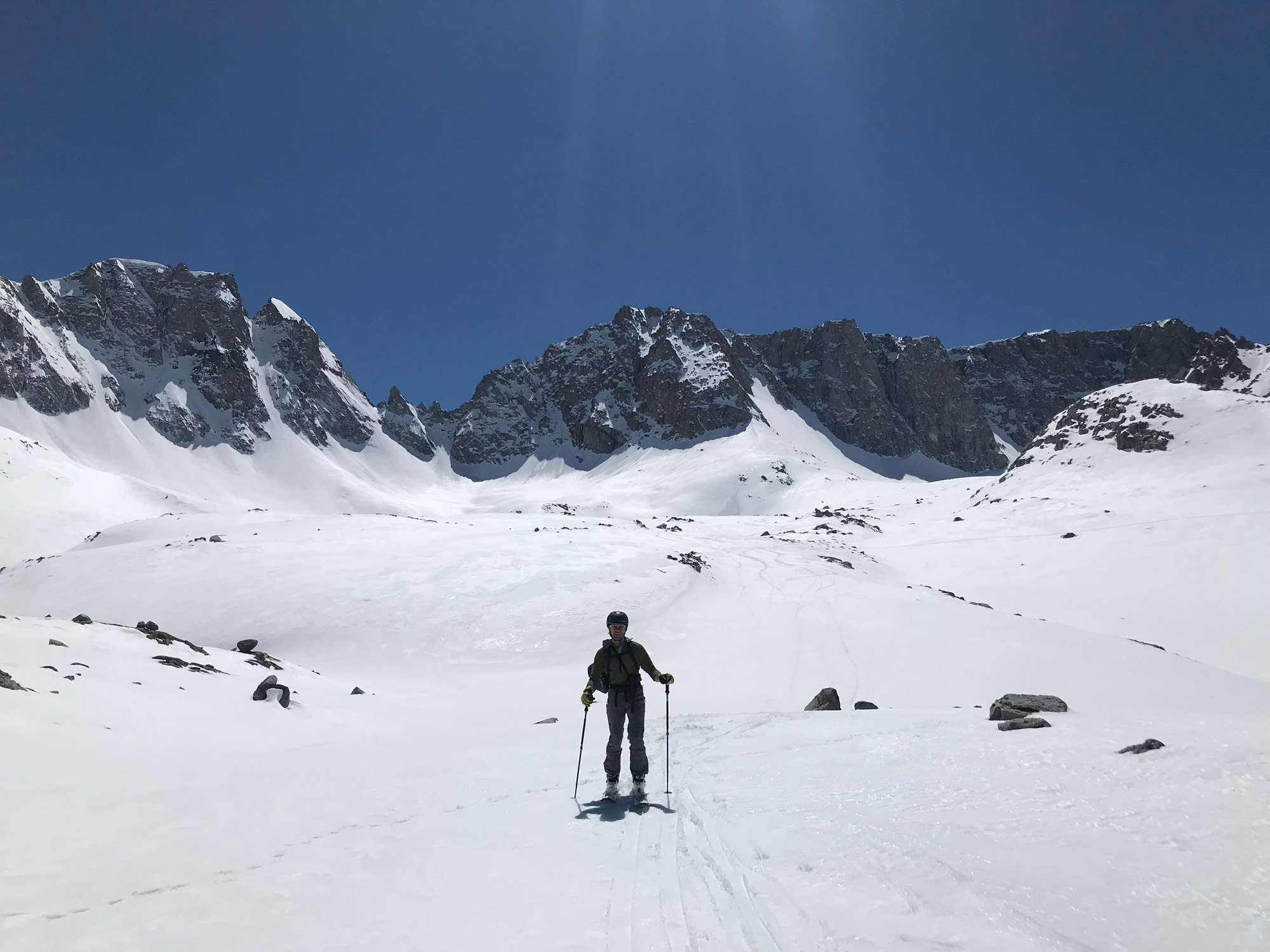
Mt. Thompson 13,494’ – Be prepared for steep couloirs with potential cornices to navigate if you want to ski Mt. Thompson. This beautiful ski tour is really a half day jaunt from the South Lake Parking Lot 9768’ above Bishop. However I do not know of an easy way off the summit after looking around quite a bit. These pics are from 4-23-18 with Gabe Metzger. I went to ski the N. Couloir, also called the Non-Moynier Couloir in Mingori/Greenberg Guidebook. I had skied that steep and narrow line with a friend 20 years ago on tele gear, so I figured I could repeat it. Well, there must have been a lot more snow that winter. This winter was a very low snow year, with only a few storms to stick some layers in these hidden places. We choose the only line we saw connecting to the summit plateau, which is the main Trident Couloir. I had to shovel out the cornice a bit to slide back in on the descent, and found rain crust on both sides. Oh well, side slip and hop turns are sure easier with the heel locked down! I will add some pics I love soon from previous trips in the REPLY if I can find and scan my old slide film …cough cough…. Leave your own reply beta, stoke, and pictures on this website please!
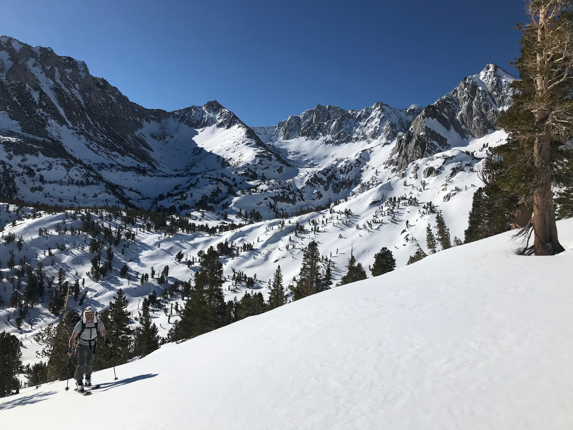
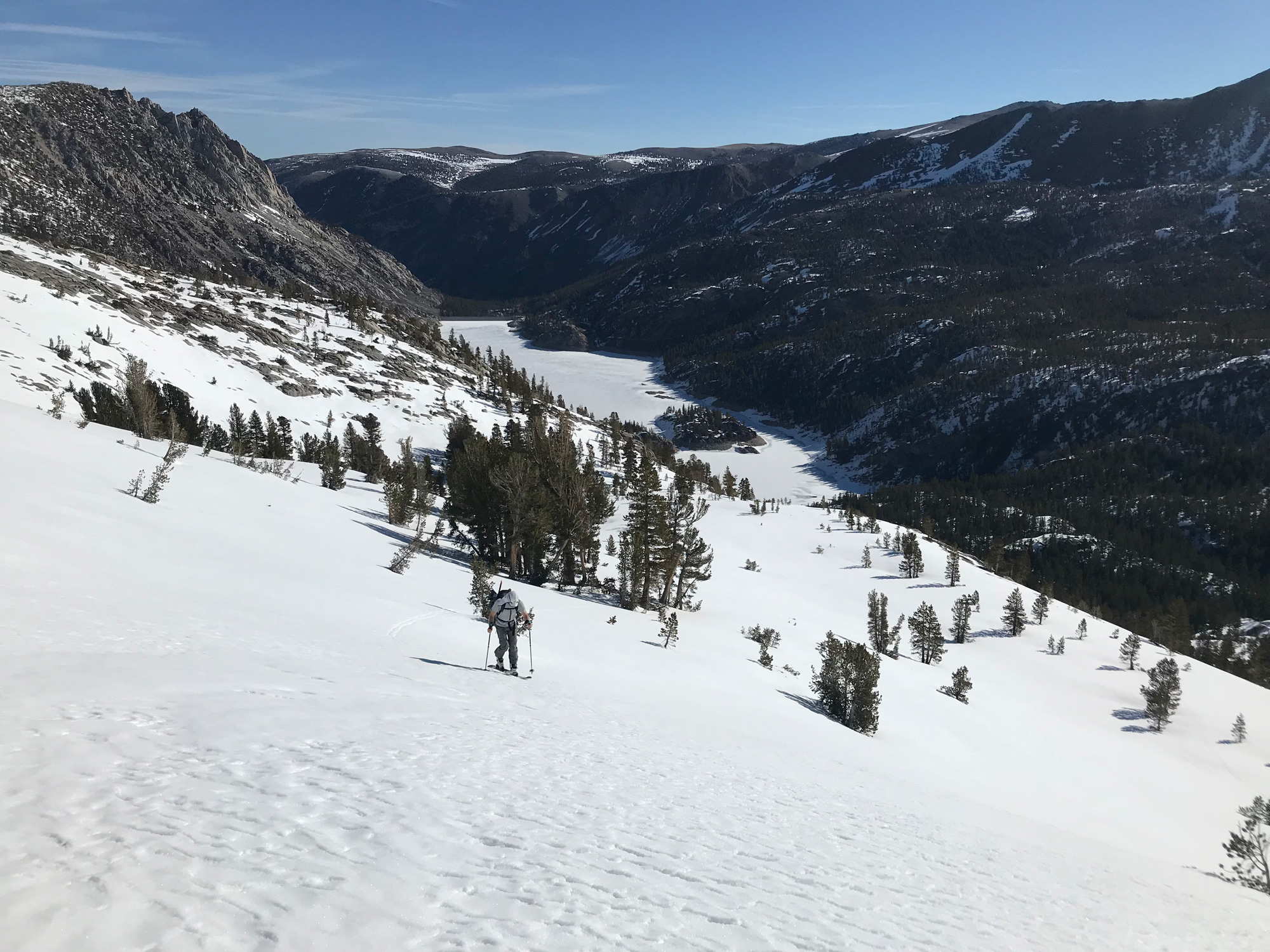
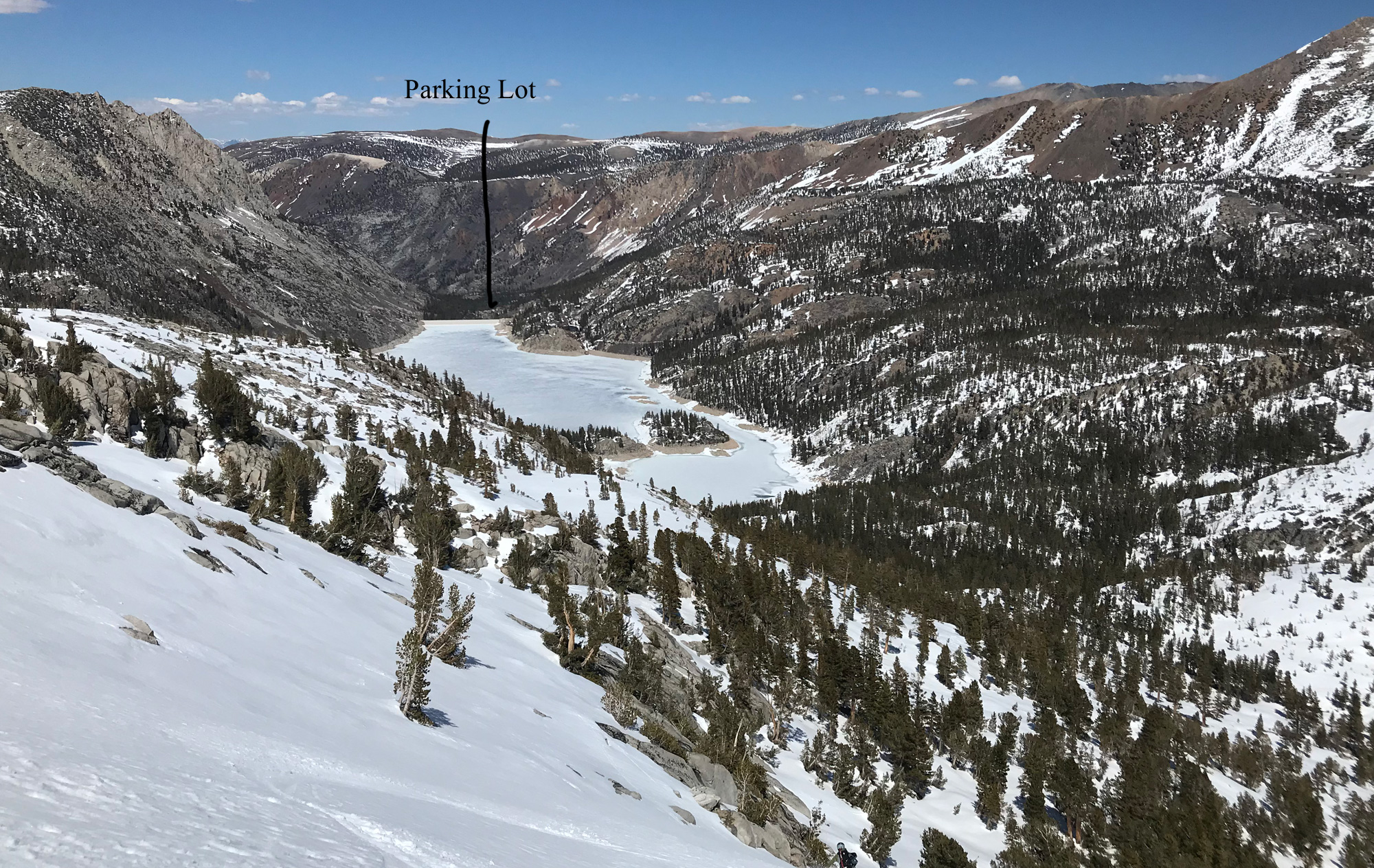
The South Lake Parking lot is one of 3 dream backcountry skier trailheads at the end of 20 mile long hwy 158, which sits over 5000’ above Bishop, CA. Lake Sabrina and South Lake trailheads are stunning, with huge peaks and great multi-day tours you can launch into. The 3rd trailhead up there is North Lake, which has a very late gate opening date, so you’ll be walking up that steep 2 mile road if you want to go ski Lamarck or Darwin. These high trailheads of the Eastern Sierra are opened to the public for the start of fishing season, and/or when they can plow the roads. That will be Mid April – Mid May on average. I’ve skied from this amazing South Lake Trailhead many times before the road is fully opened to the trailhead, usually back a mile or two at a county road closure.
The Mingori/Greenberg guidebook is awesome. We sell a lot of them at the shop. But I think they have an error on this peak. They suggest approaching Mt. Thompson via the right (north) side of South Lake, and angling up on a direct line towards the Thompson Cirque. I have skied from this trailhead at least 10 times, and have not seen enough snow on the steep, cliffy south facing terrain above the Lake to do this. These guys may have done this earlier in the winter or in a deep snowpack. I have found that you aren’t going out of the way to approach Mt. Thompson by using the same lower half of the Mt. Gilbert approach. Just bang a right when you break out of the trees and traverse below what I think is called Treasure Peak….the big pyramid rock monolith.
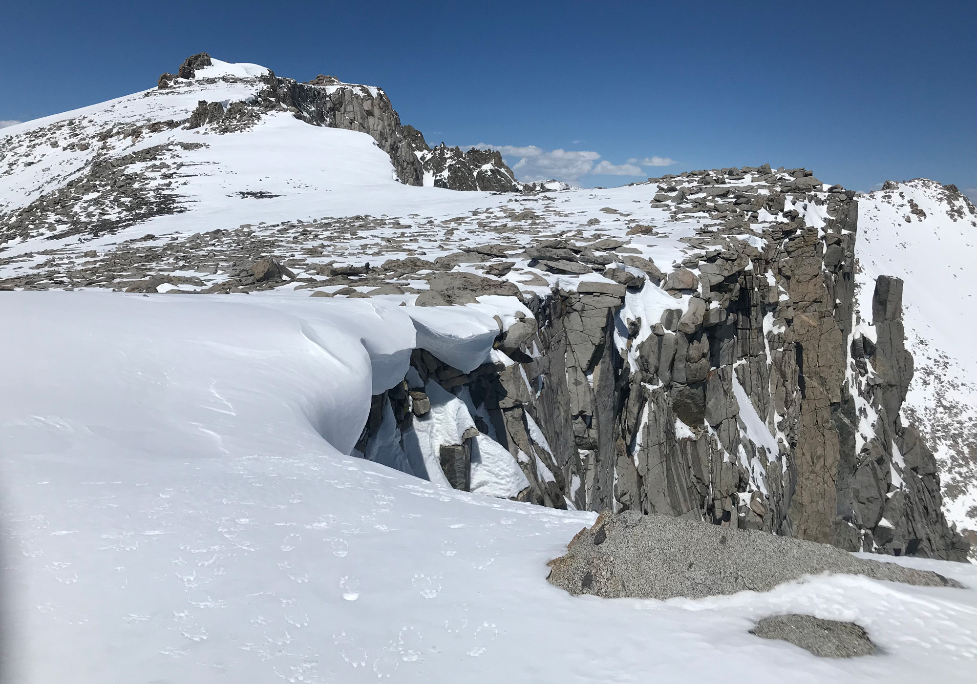
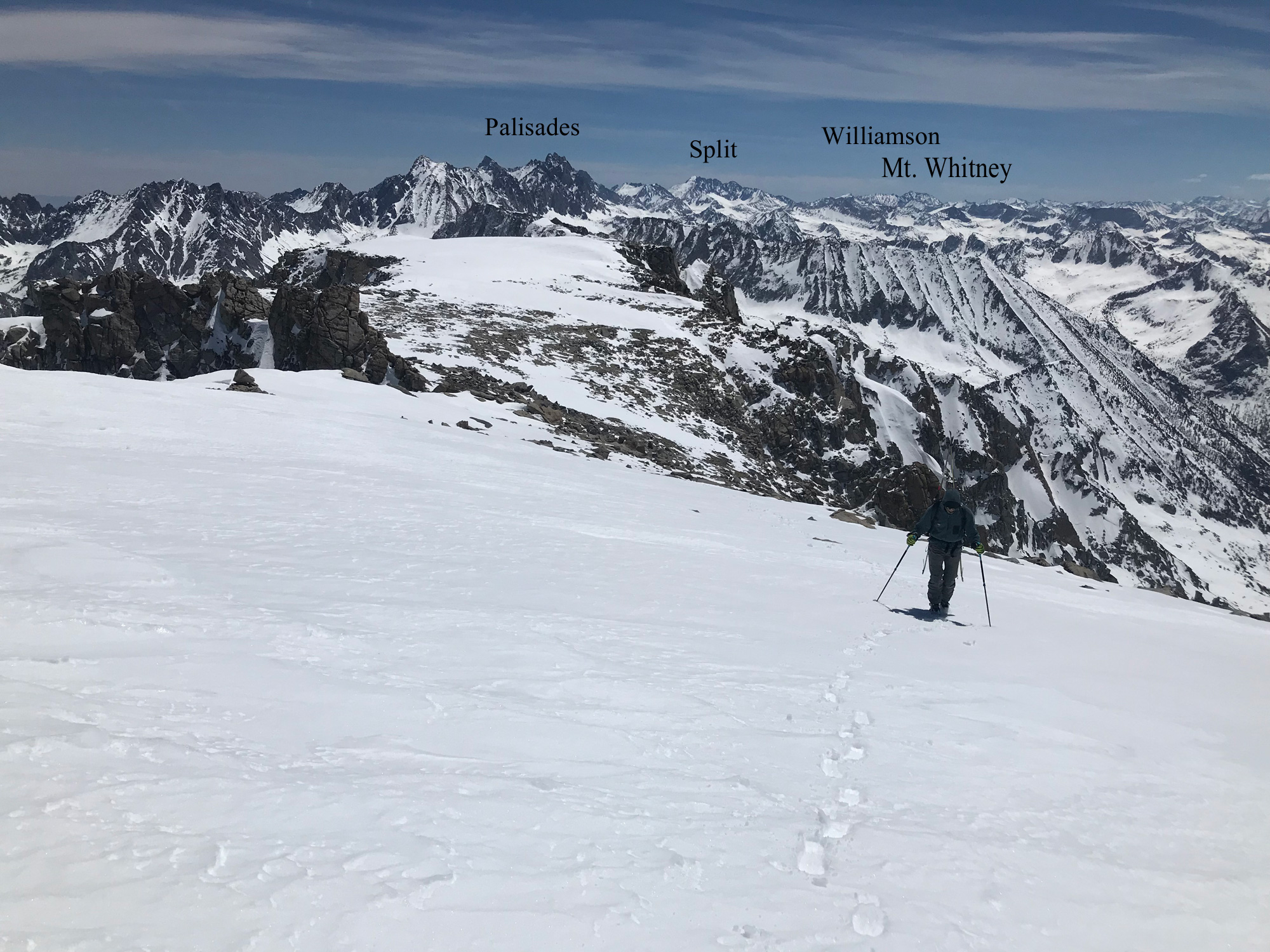
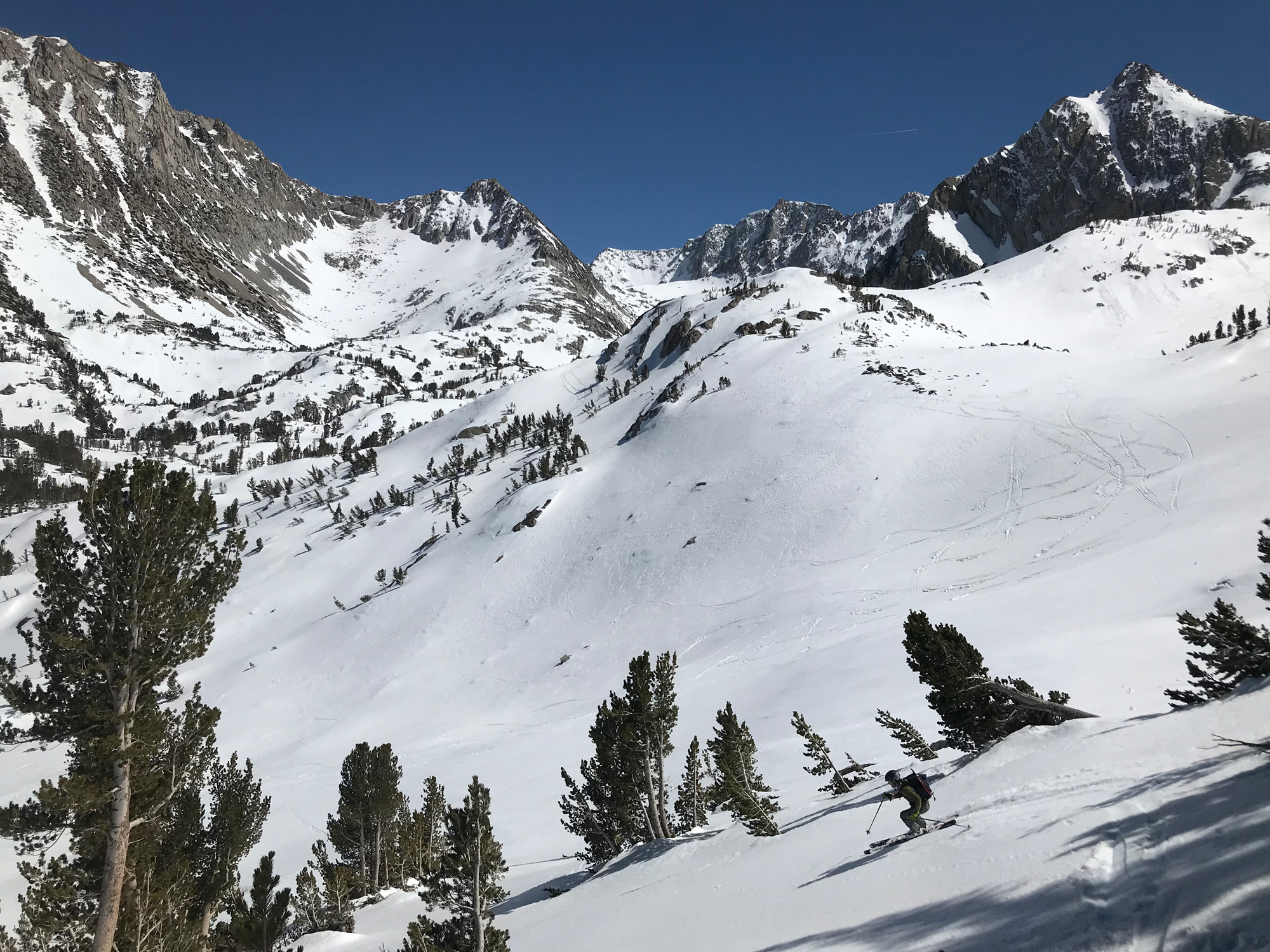
The terrain below the Thompson Couloirs is mellow and fun to navigate, with a variety of gullies and terrain features to navigate. You do travel some south facing slopes down lower which can get rotten if you return too late in the day, so watch for wet slide danger. The Couloirs are fairly steep and can have cornices as mentioned. The summit plateau walk is easy but will take you 30-60 minutes depending on how your feeling after steep crampon and ice axe work at 13,000’. The summit is amazing at 13,494’. You can see Mt. Goddard and Black Giant to the west, and Mt. Aggasiz, Thunderbolt, Mt. Sill to the south. From the summit of Mt. Thompson you can look back to town in a straight line along the steep and technical Thompson Ridge. This long spine separates two huge ski touring drainages of the two major trailheads up there, Lake Sabrina and South Lake. Choose one. I didn’t see a way to go up one and ski down to the other via car shuttle. There may be skiable terrain on the north side of Mt. Thompson, accessed from Lake Sabrina…I’ll have to study some old ski tour pictures and get back to you.
I liked the look of a no name peak immediately east of the Mt. Thompson Cirque and summit. It was a bit lower and had a nice south face leading back into the same approach path. This could be a consolation ski descent summit if you don’t like what you see in the Thompson Couloirs. Mt. Gilbert is just next door to the south, and we skied this the next day. Thompson and Gilbert are the two biggest peaks near the car and you’ll want to hit both of them if you drive all the way to the South Lake Trailhead. Other ski descents accessed from the parking lot are Hurd Peak, Mt. Johnson, Mt. Goode, and Mt. Aggasiz. I will will get them onto this ski guide soon, as I am re-building from my old broken online ski guide. They are all very worthy.
The South Lake Trailhead has an overnight backpacker paved parking area. You aren’t supposed to camp out there in your cars, but no one bothers spring skiers doing it. The hikers aren’t there yet. Finding out if the road is open to or near the trailhead can be tricky. I guess you could call the county road office, but it’s a moving target. The trailhead has bathrooms and bear bins.

Looking for awesome ski and splitboard tours in the Sierras? We’ve got write ups on many common and uncommon tours curated by the owner of the BackCountry, Mike Schwartz.


Thanks Mike!
This is great info. I am headed down in a few days to see what decents still have snow.
Cheers