

Location: Mt. Brewer
Summit Elevation: 13,570
Base Elevation: 6,370
Elevation Change: 7,200
Recommended Map: Kearsarge Pass/Rae Lake & Mt. Whitney High Country by Tom Harrison
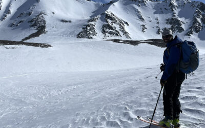
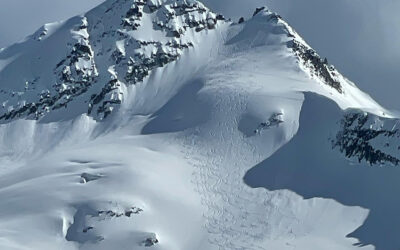
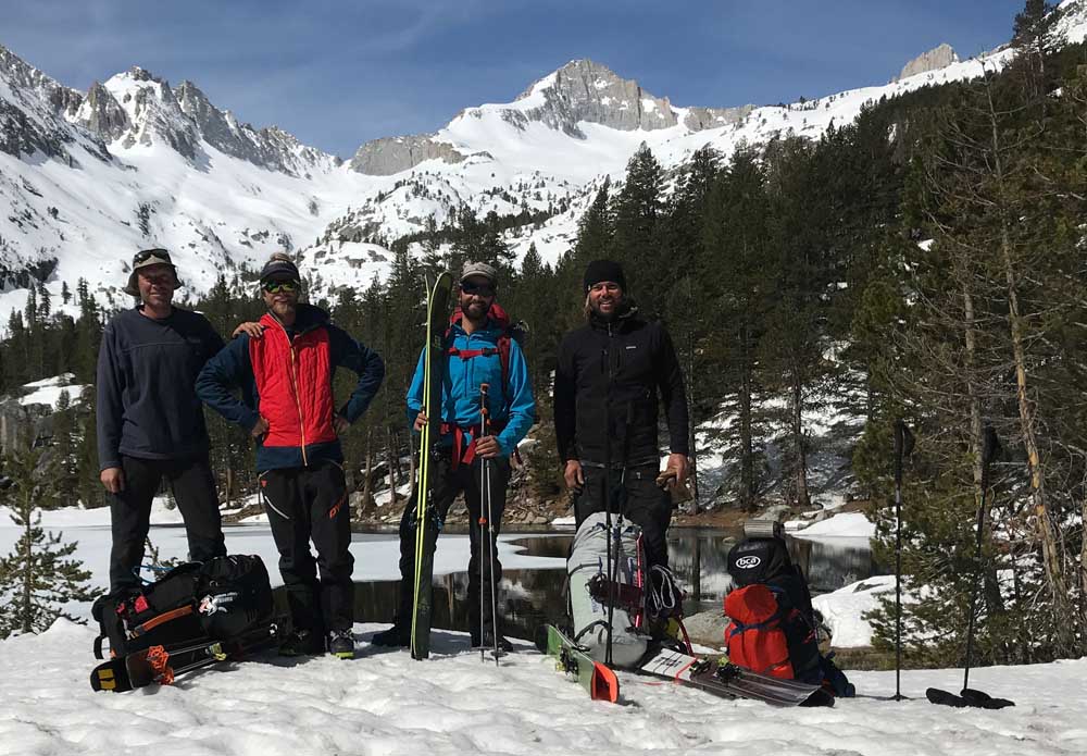
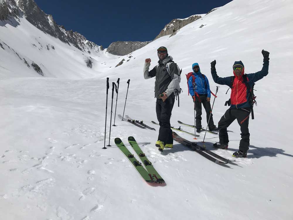
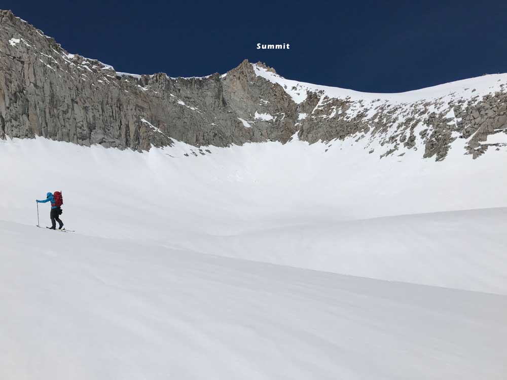
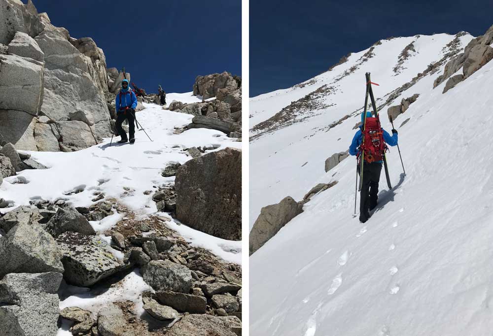
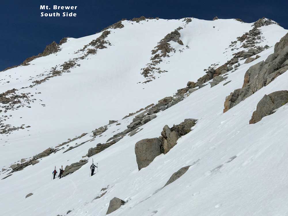
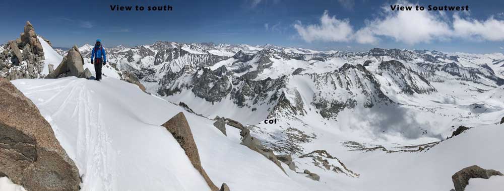
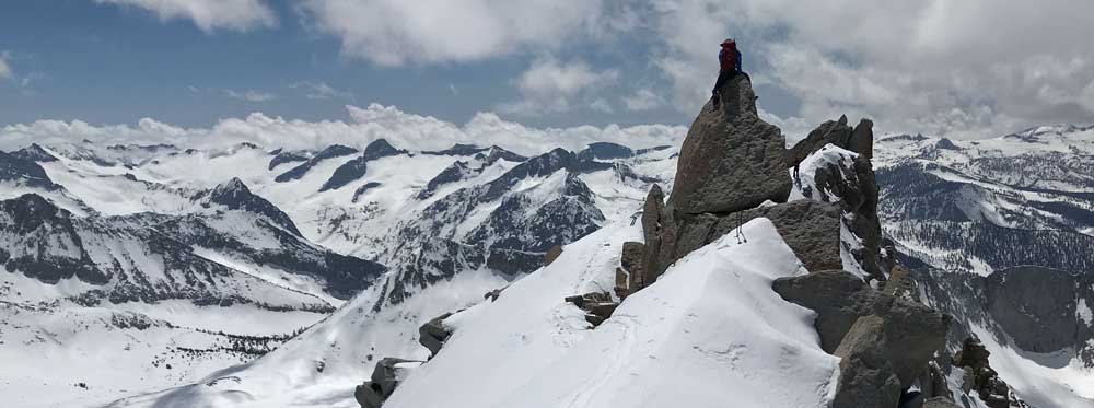
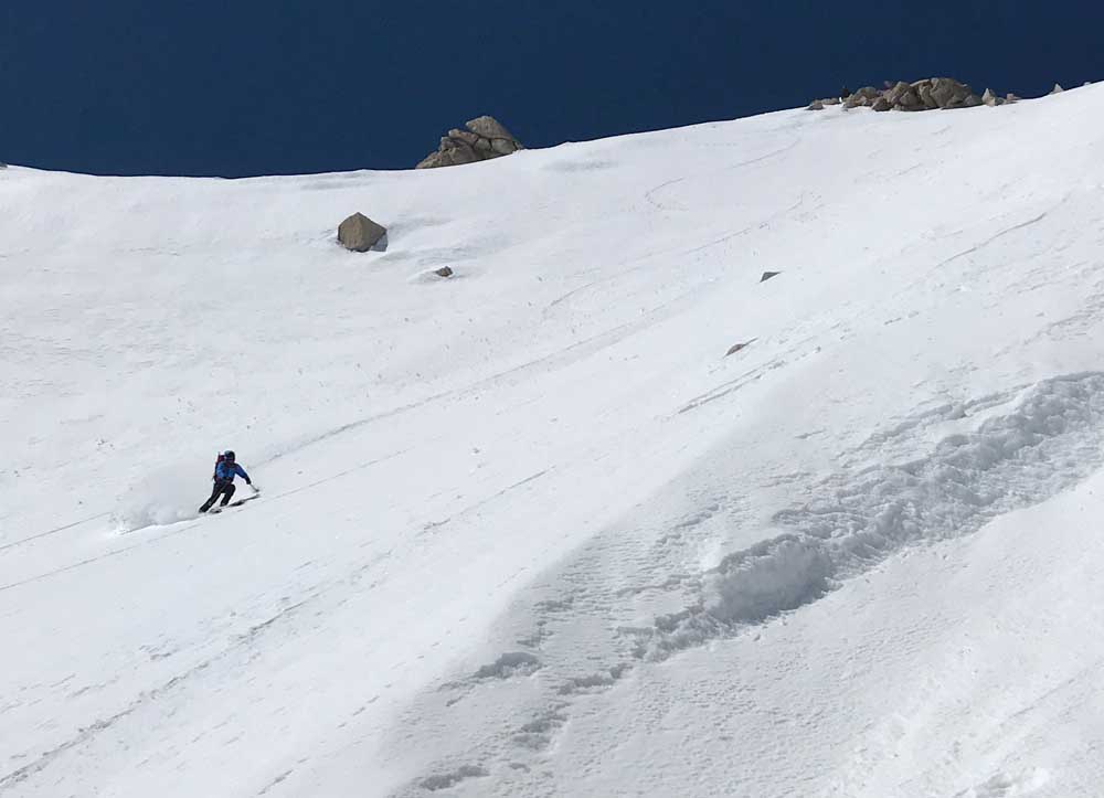
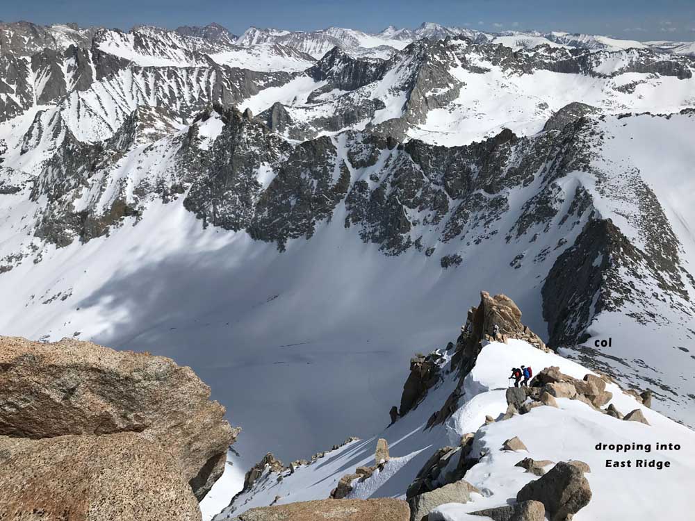
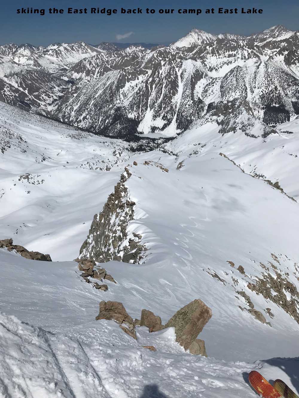
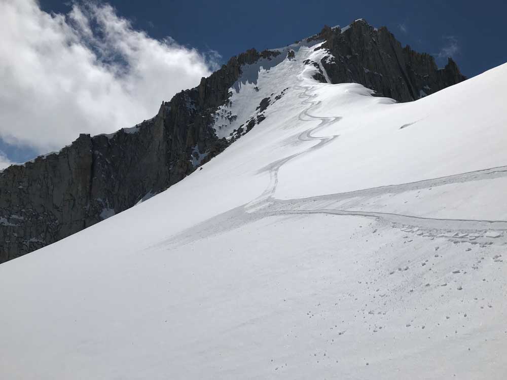
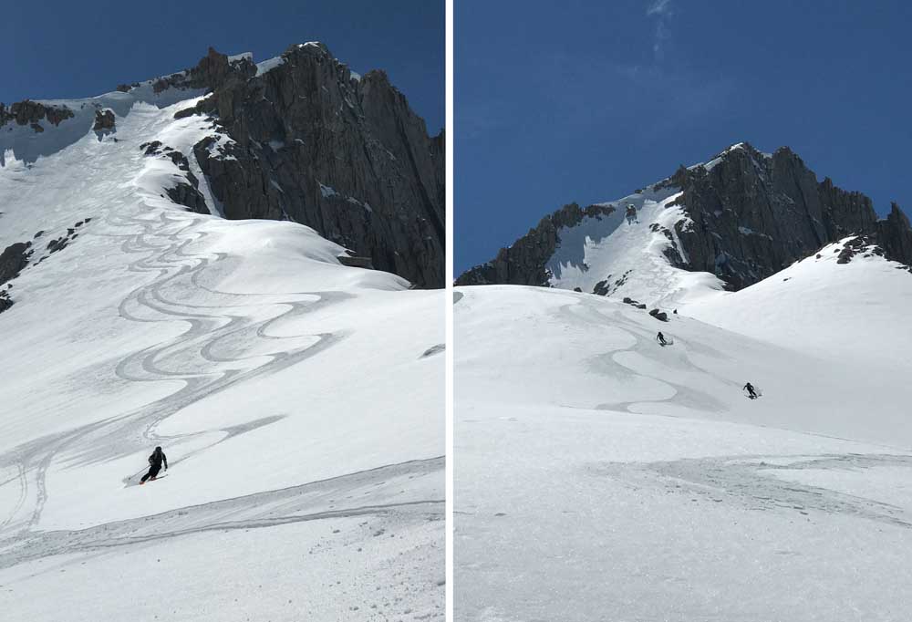
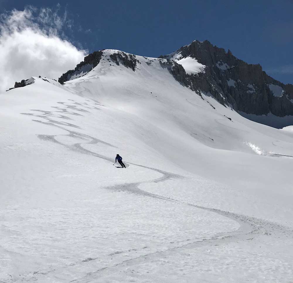
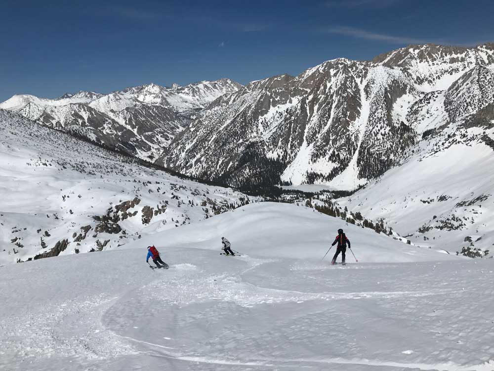
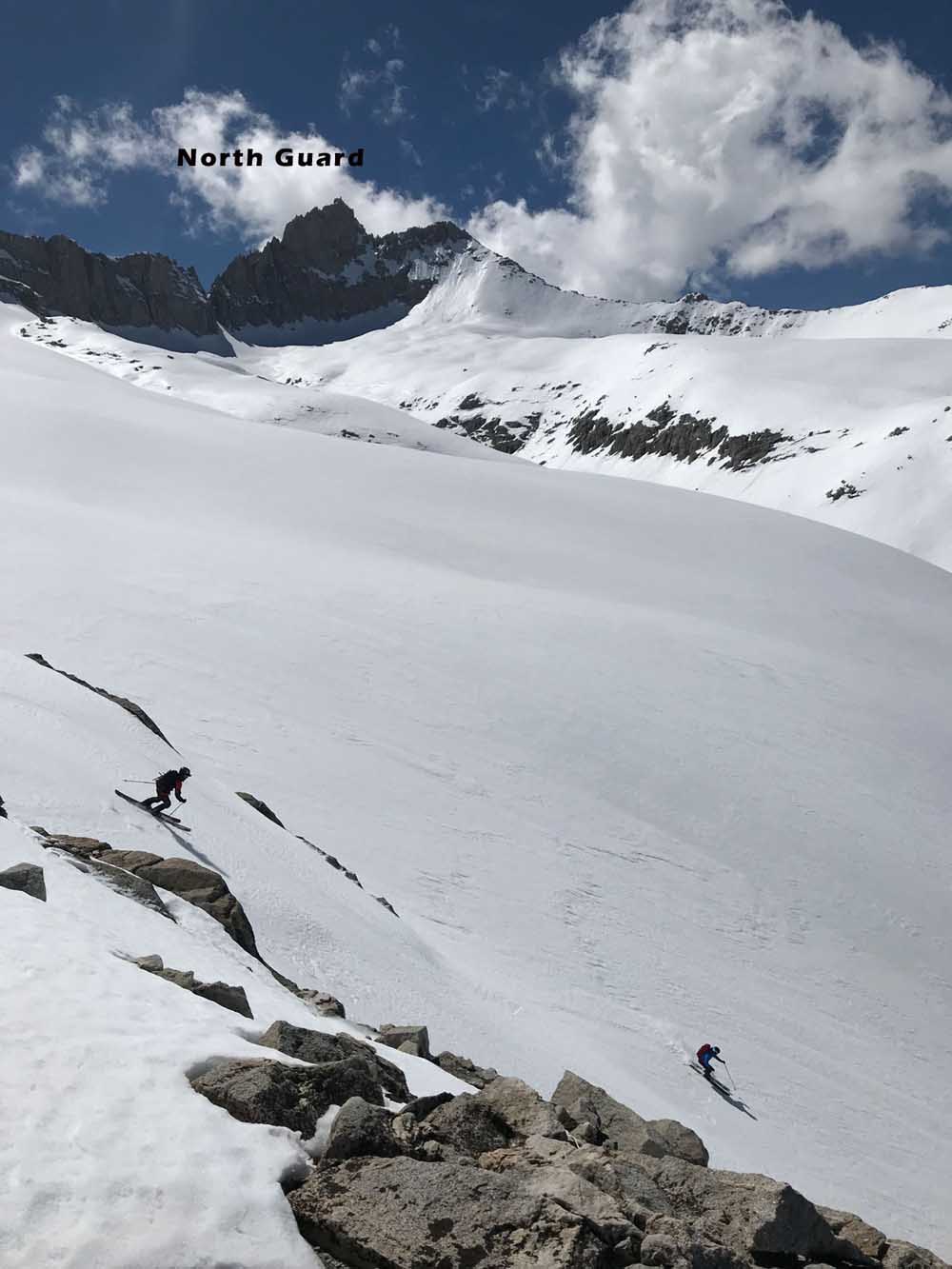
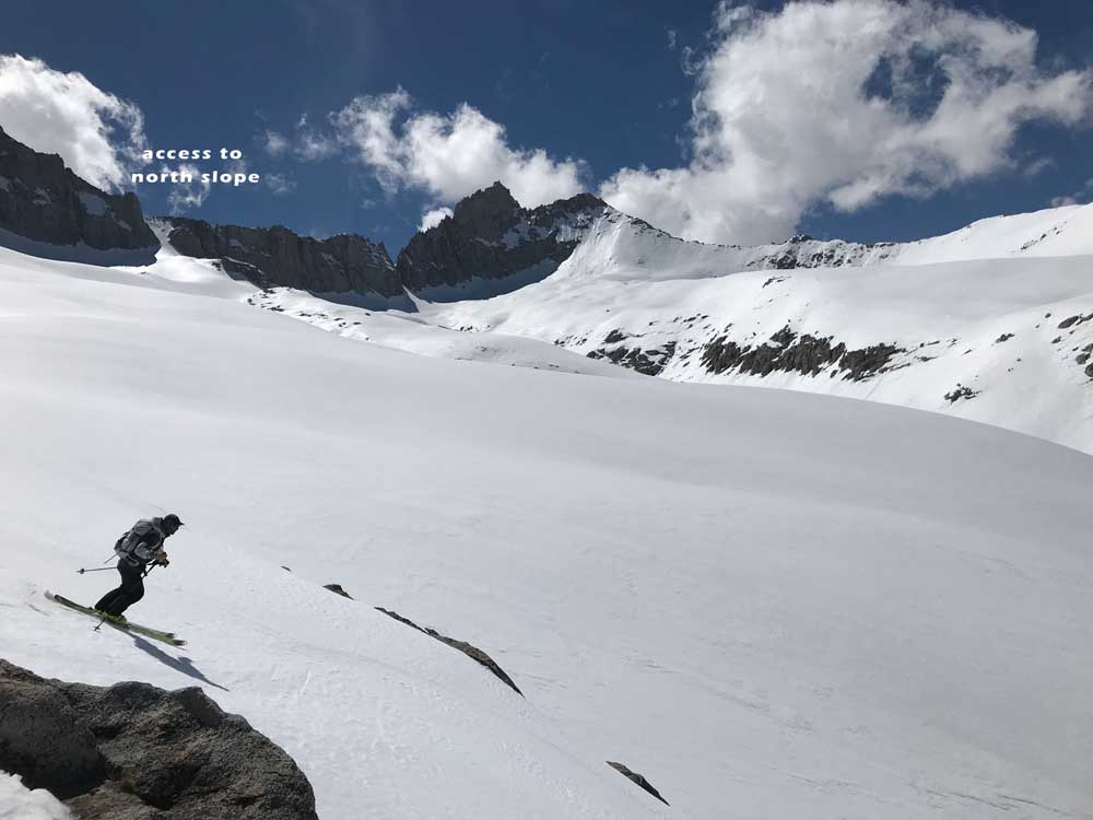
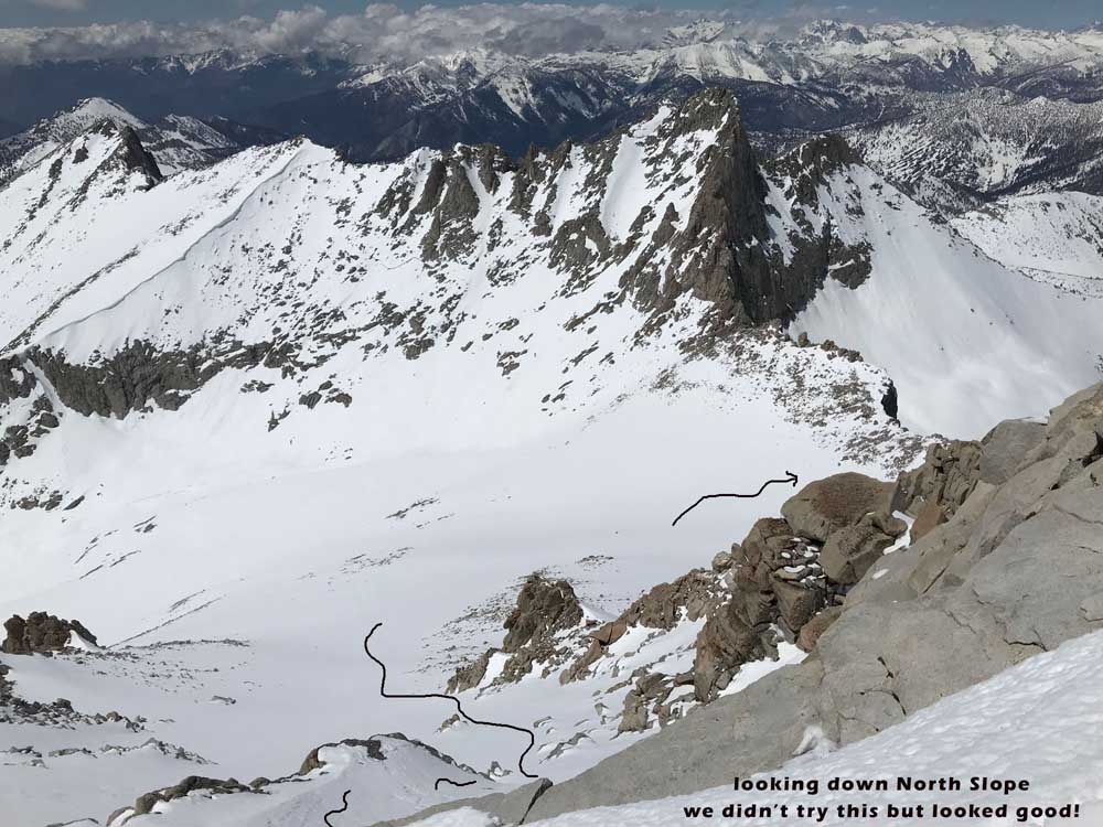
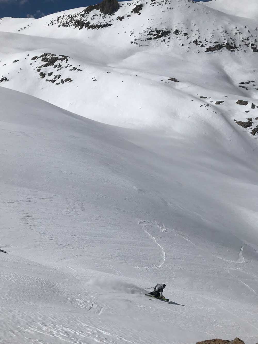
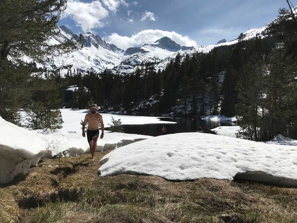
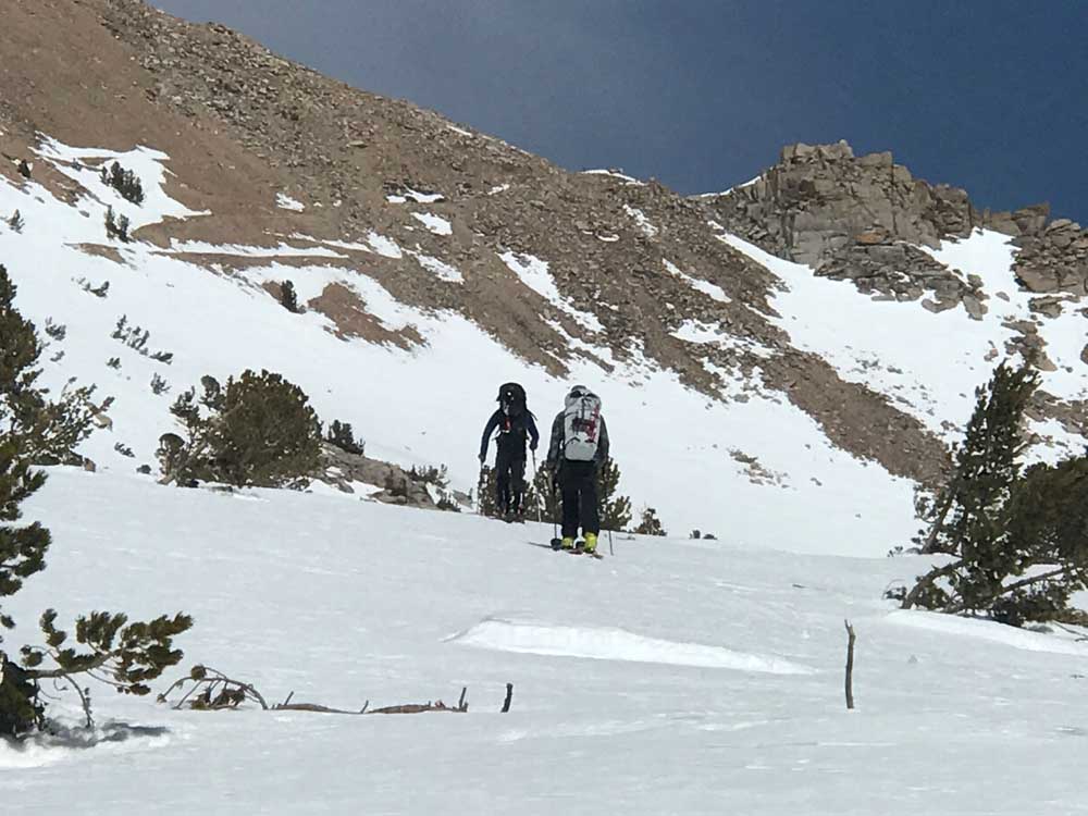
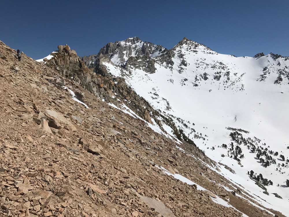
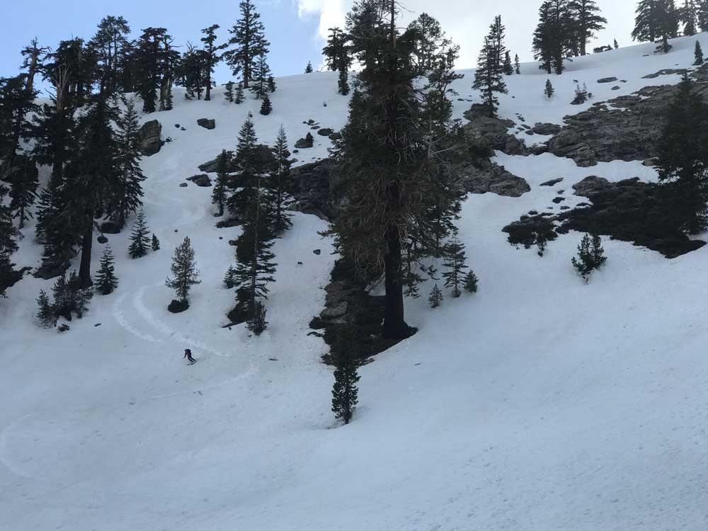
Jahren, Danny and Seth joined me on this amazing 4 day ski tour in the first week of May 2019. Danny and I had seen Mt. Brewer from Kearsarge Pass and the Deerhorn Summit the previous year. I couldn’t stop thinking about what it would be like to ski the long twisty East Ridge. I couldn’t find any online info and my interest peaked by news of Seth Lightcap’s Splitboard Trip out there the previous year, in a super long push from Bullfrog Lake. They didn’t post any info, so I’ll just dump way too many pictures for you here. Mt. Brewer is described in Paul Richin’s 50 ski tour guidebook by approaching from the West Side of the Sierra and mentions a south slope descent. His guidebook pic shows the south side holding a lot of snow to the summit, and you can tell from anywhere on the East Side Peaks that a snowy col provides some sort of access. There is also a twin access col on the north side of the peak. From the summit I”d say the south side was 35-40 degrees and the north side is a solid 45 degrees steep. We found perfect corn everywhere on the mountain and found the East Ridge via a short, steep, off camber entrance above a cliff that was a little nerve racking for the first 2 turns where the snow was firm.
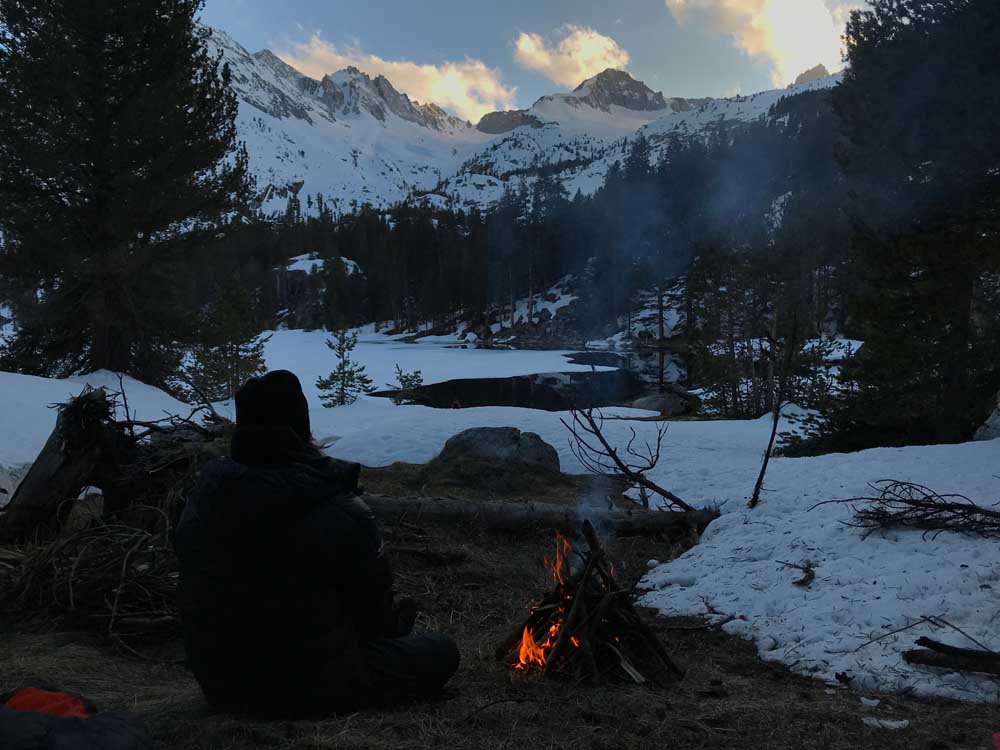
Oh sorry….did I mention this is a multi day tour? Yes! It’s so hard to get people to commit, but this is how you get the best overall experience and snow quality. No tracks, and plenty of time to figure out where the good snow is. No hurry to start in the dark because you’re already near the peak. And no hurry to get back other than to enjoy the last bit of daylight at camp.
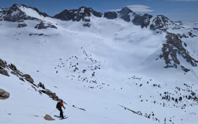
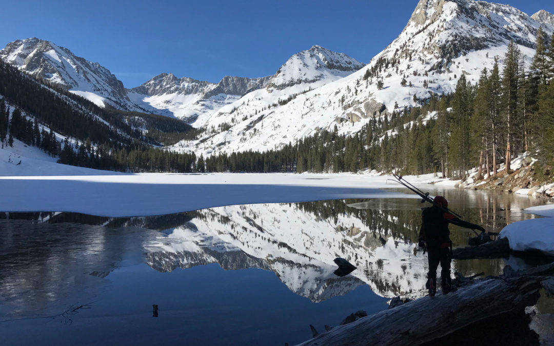
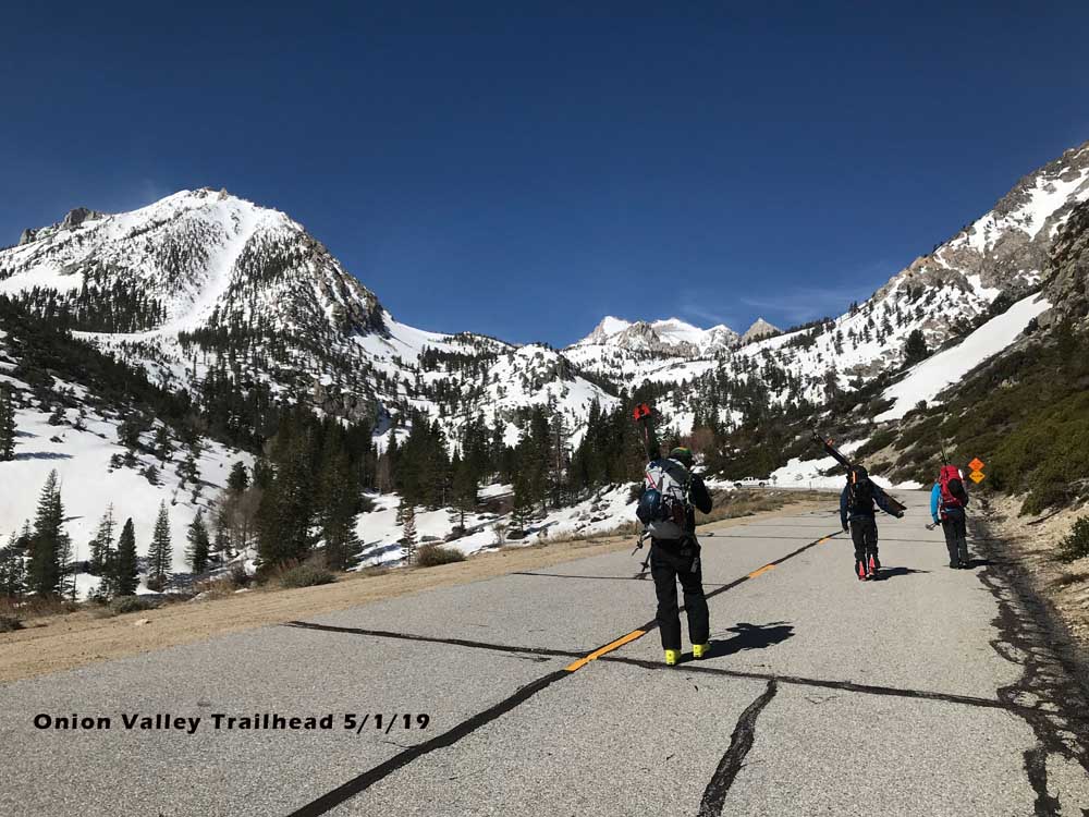
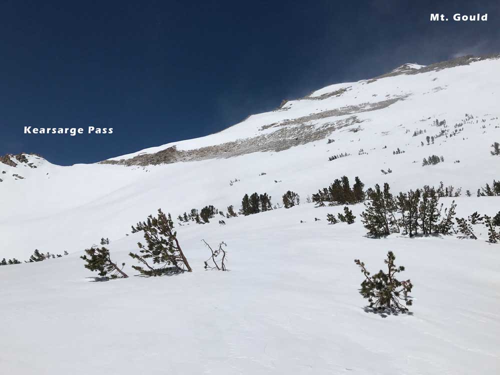
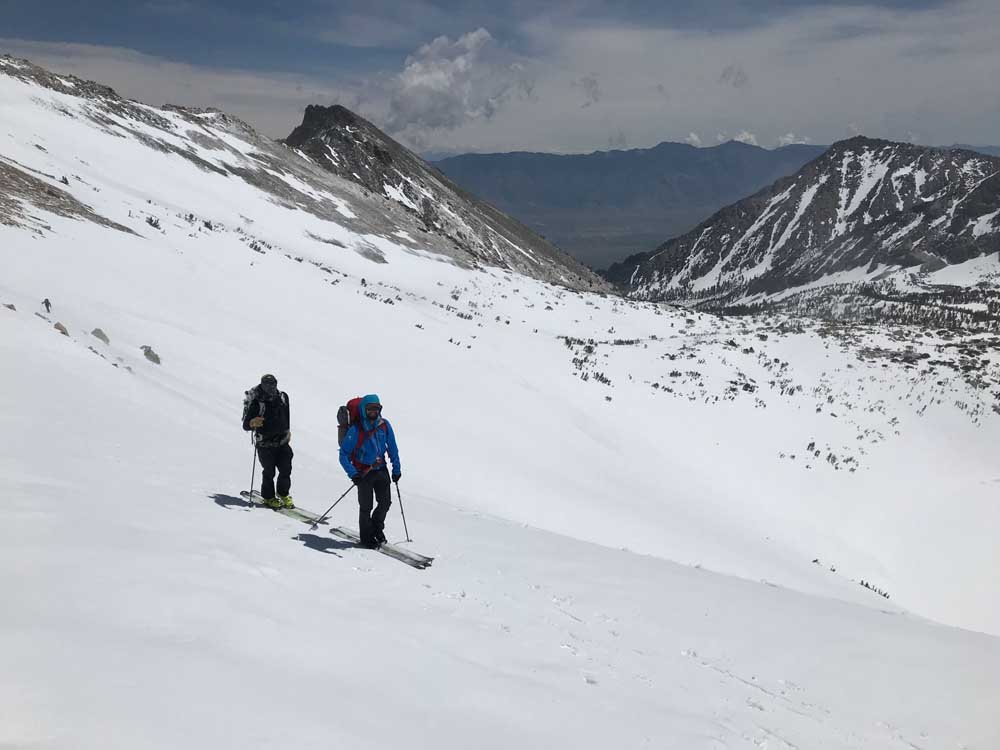
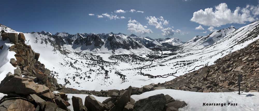
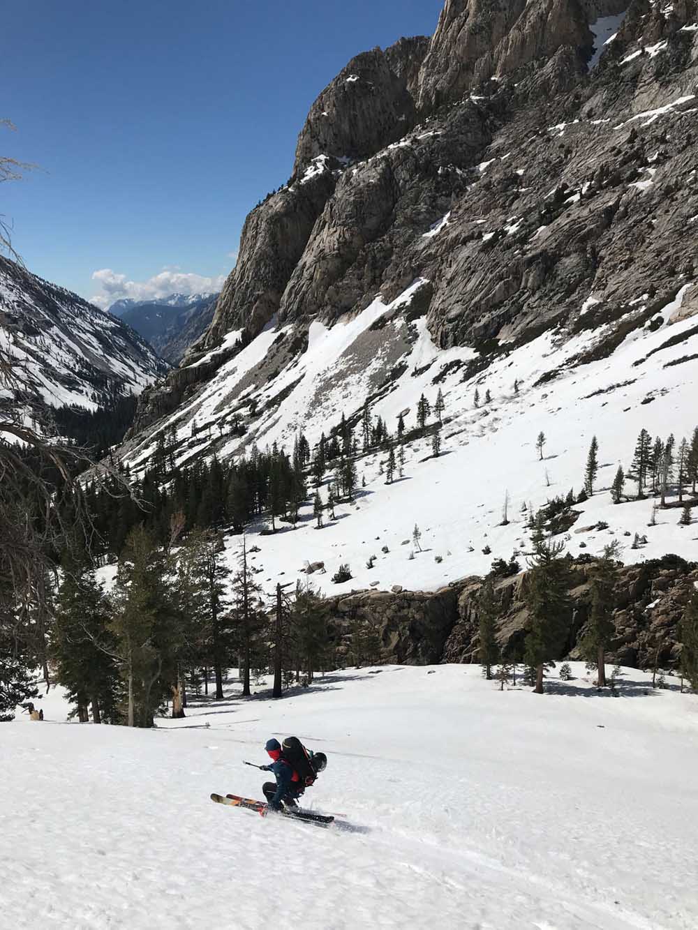
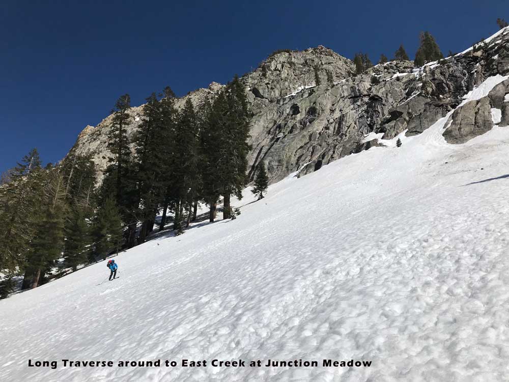
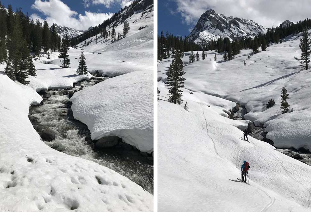
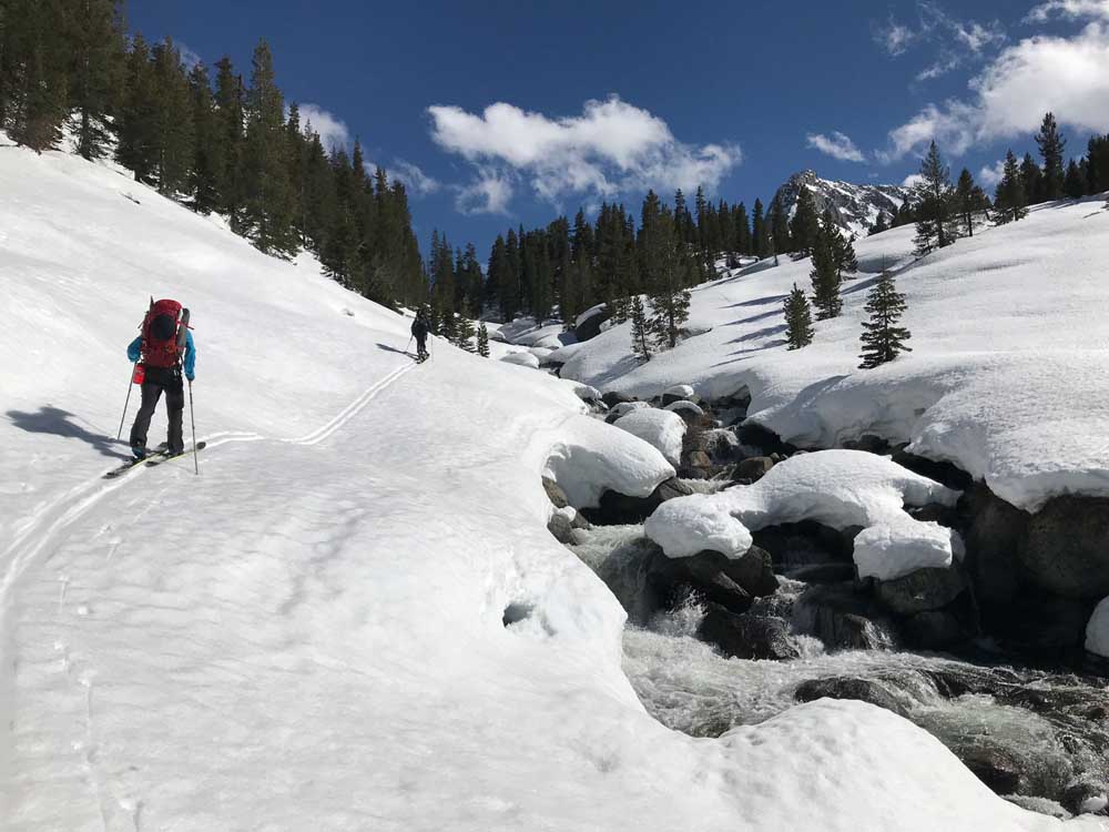
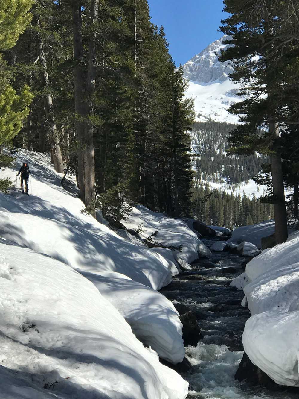
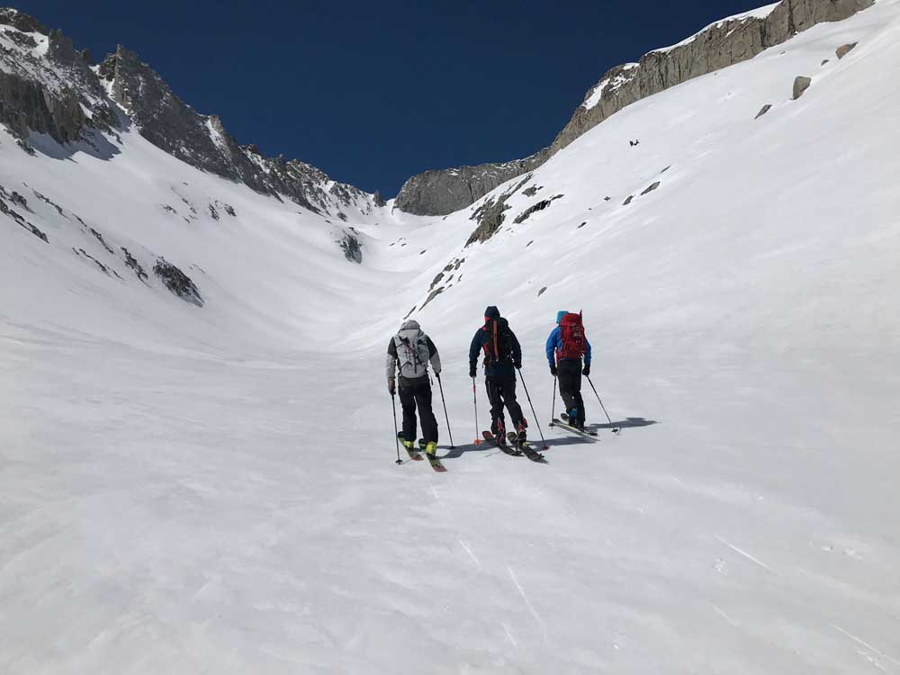
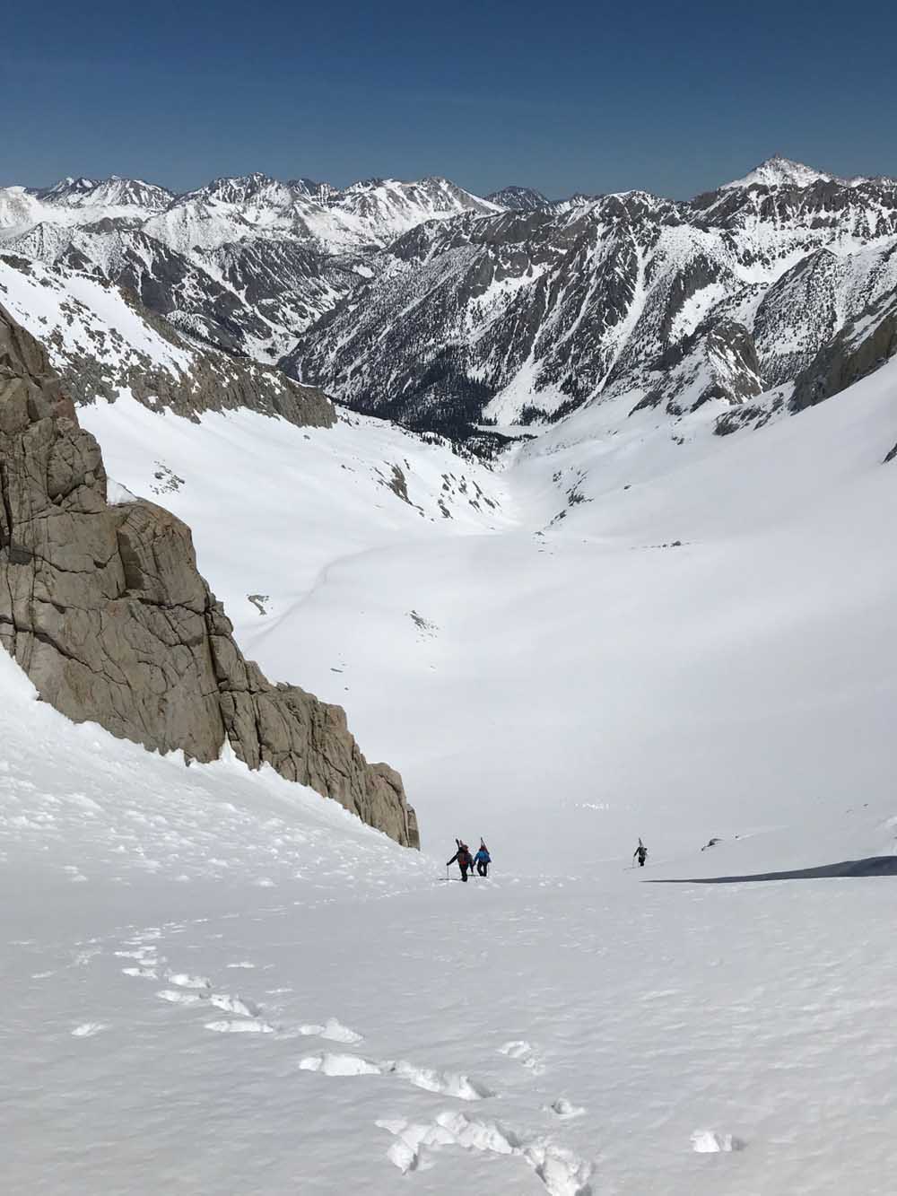
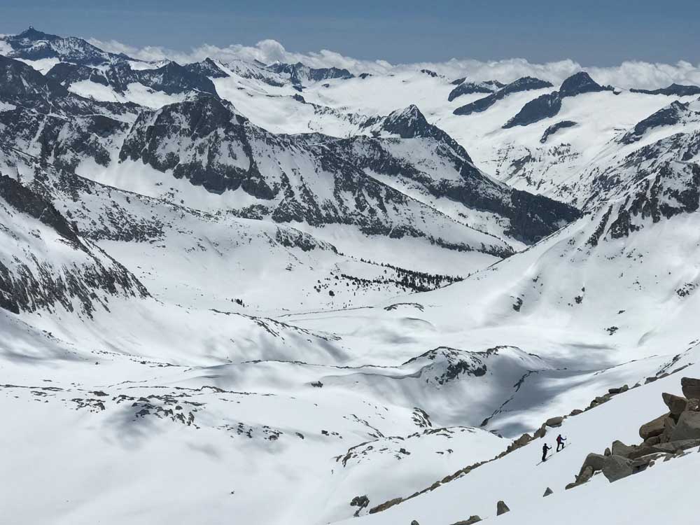
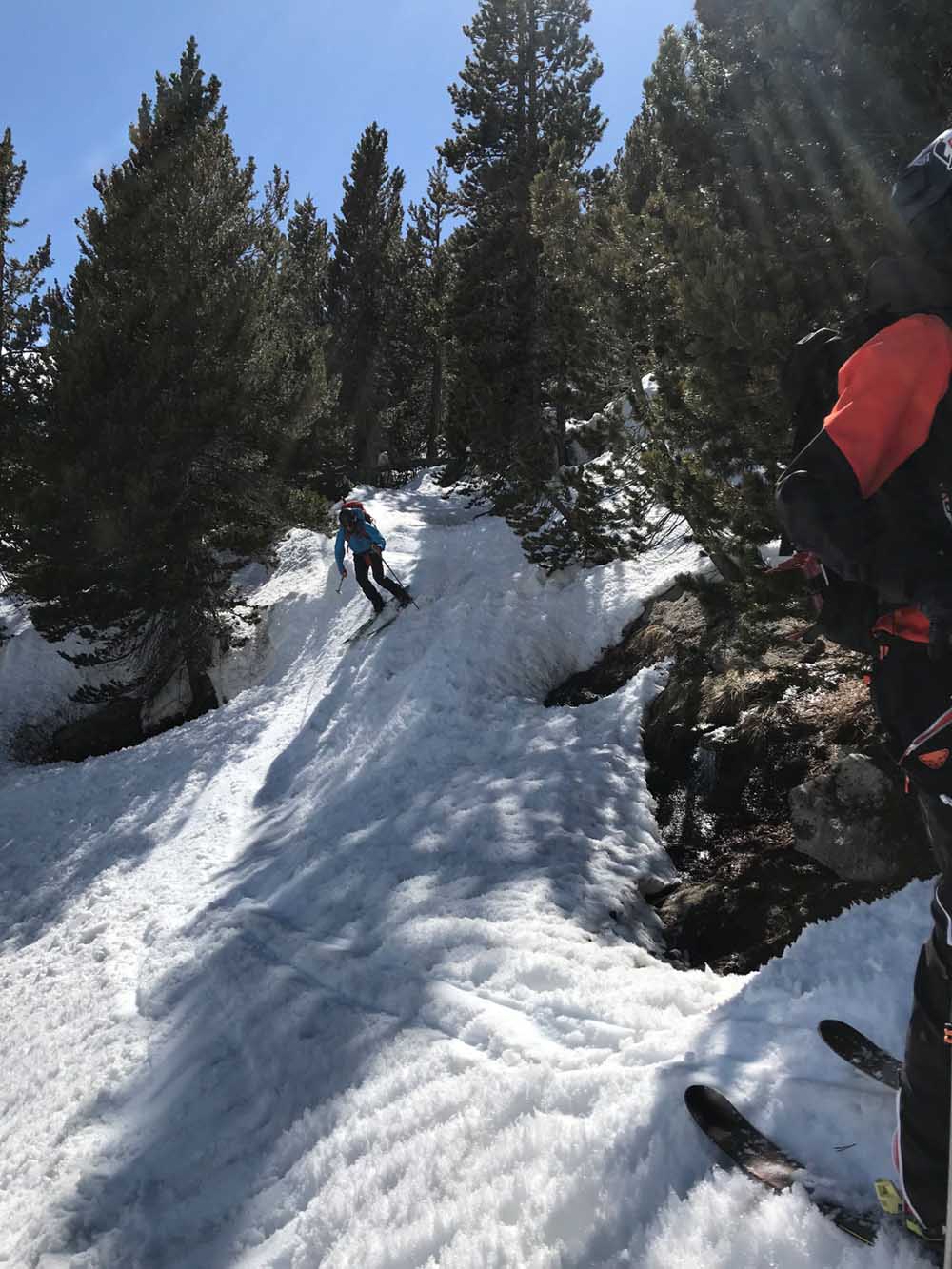
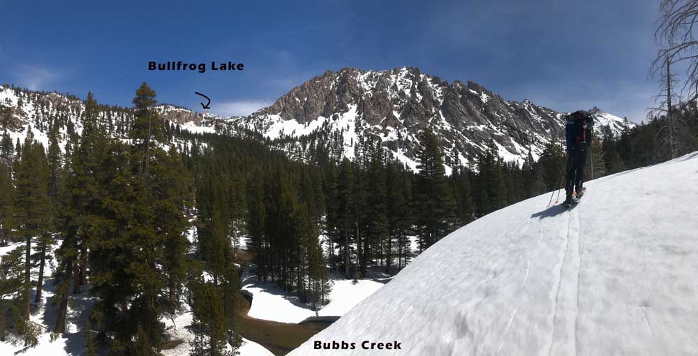
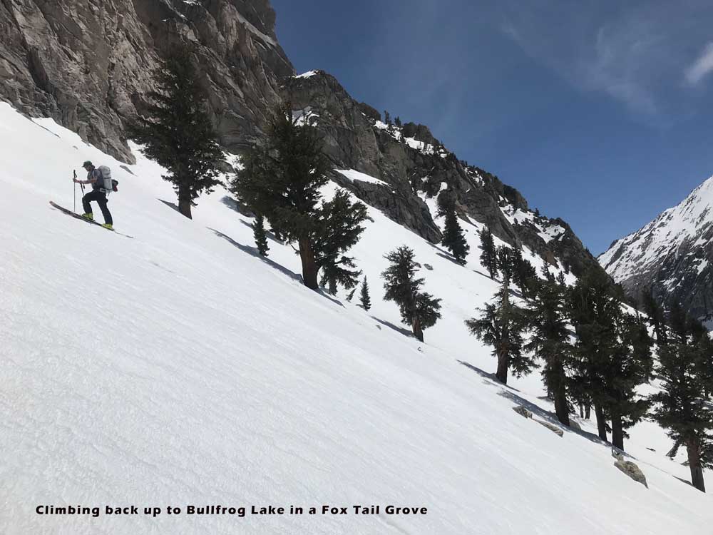
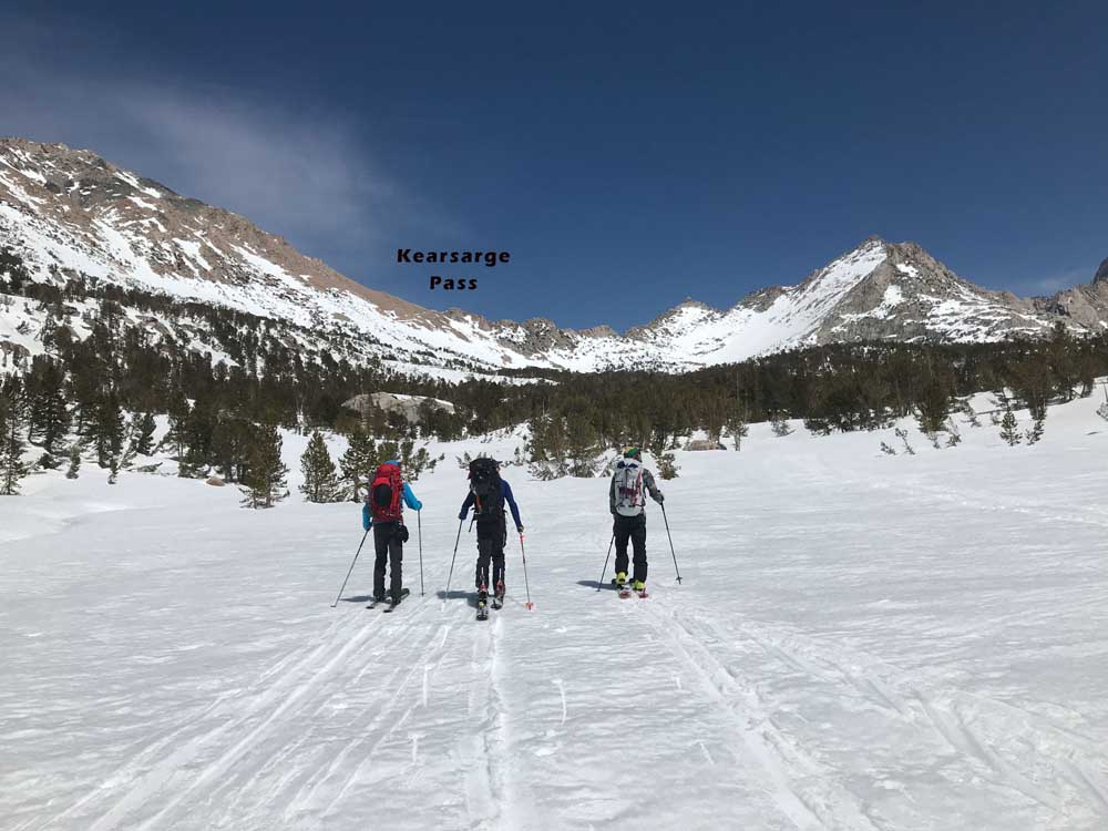
If you wanted to work your way up to Skiing Mt. Brewer, go to Onion Valley Trailhead 9200′ within a month of when the road opens and ski Mt. Gould and/or University Peak. Kearsage pass is in-between them, and your passage way to Bull Frog Lake and down to Bubb’s Creek. Next ski Deerhorn Mountain, to learn your way down and across Bubbs Creek, and also what it feels like to ski a steep line further from the car than usual. Finally to ski Brewer, you’ll want to camp near Bubbs Creek or continue on a long traverse around Junction Meadow and up East Creek to East Lake. That’s what we did, and spent about 8 hours going very casually from car to East Creek. We enjoyed plenty of corn turns on great west and north facing slopes mid day and then skinned mellow beautiful Creekside up to camp at East Lake.
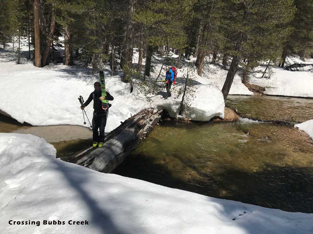
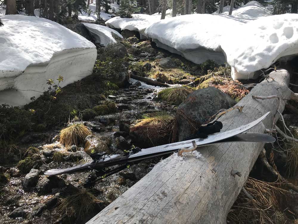
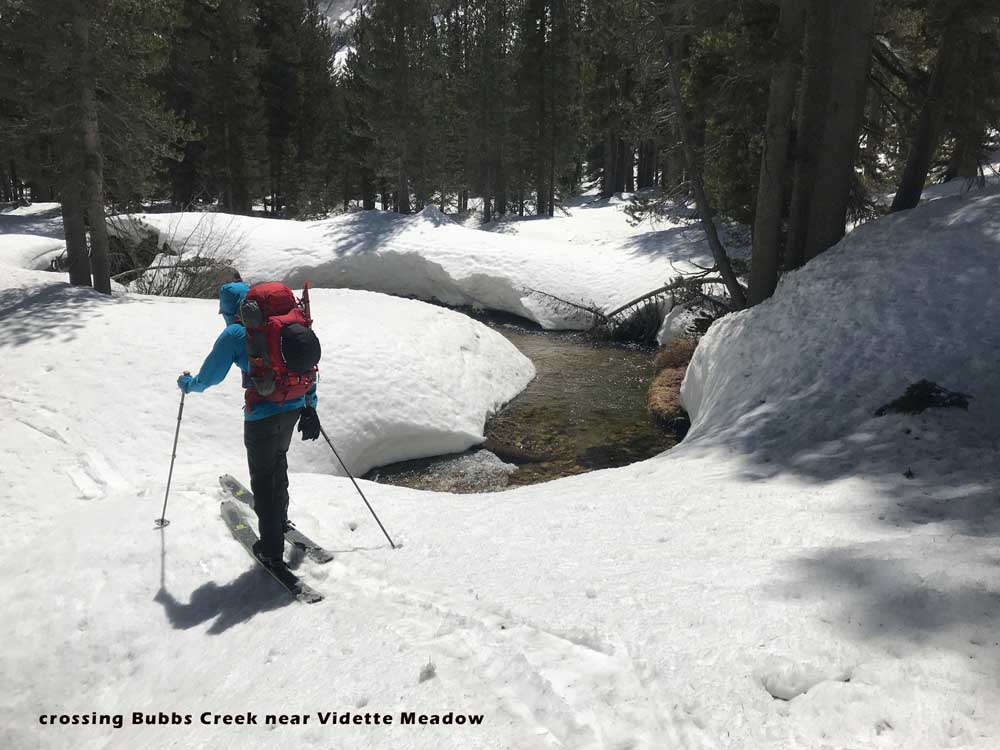
This was a fairly heavy snow winter in this zone, and we got to the trailhead on the day they were plowing the last 1/4 mile. Going between Bullfrog Lake and East Lake is quite an adventure due to the narrow canyons, raging rivers, and lower elevation. I’d say you could still have fun on this tour a month later, but it will be more annoying and you’ll be doing more transitions to walk through patchy snow. You need to ski down on the east side of the creek that drains from Bullfrog (skiers left). Then I suggest looking for the one snow bridge likely to remain near Vidette Meadow. I’ve found it easily in 2 trips out there. There is also a big log that is fairly easy to walk across nearby. If you cheat and try to traverse down to Junction Meadow a little early, you won’t find these crossings. Basically just go upstream after running out of glide when you ski down to Bubb’s Creek and you’ll find a place to cross.
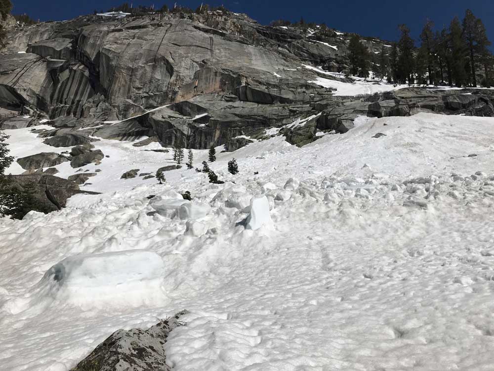
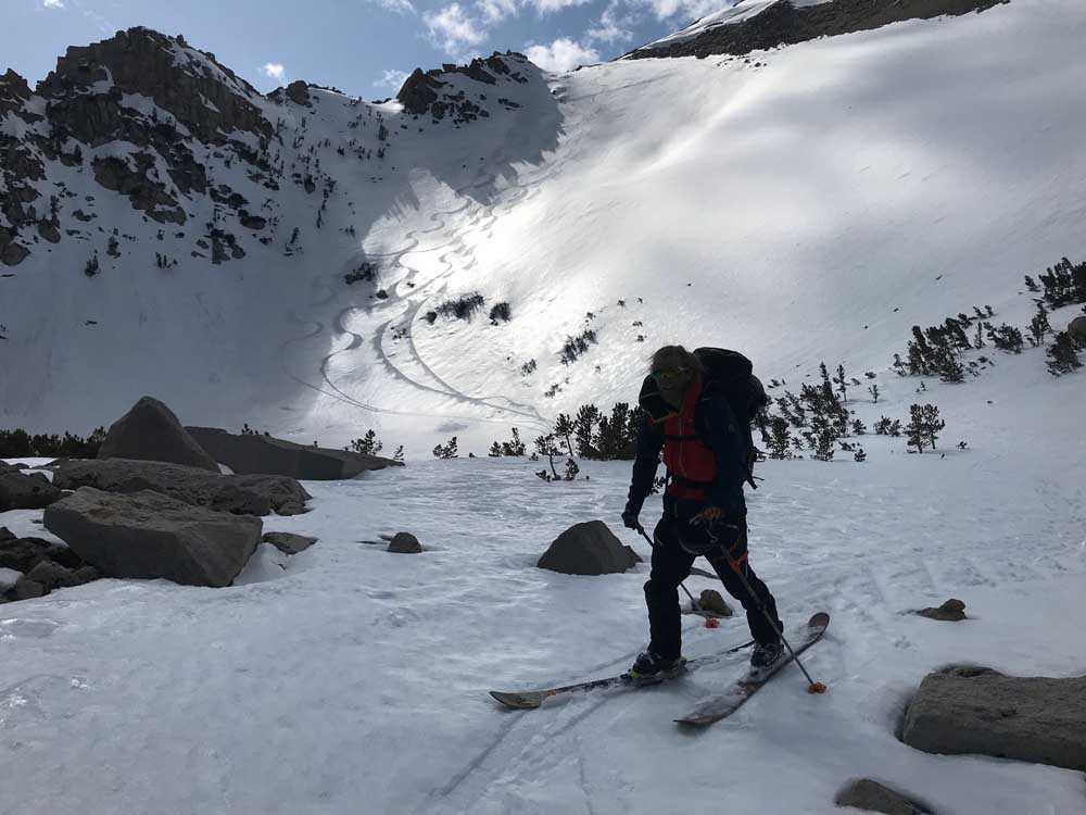
I have 2 further warnings. The slopes are a bit steep at times above the rivers as you ski or skin along Bubb’s Creek to and from East Lake. You’re going to want ski crampons if the snow is firm, or you’ll be digging in your edges in an annoying way to prevent sliding into the water with your big backpack. You’ll have ski and boot crampons, so no problem. We found soft snow going and coming, and you probably will too. There isn’t much wind down there when the sun is out. Secondly, there will be at least one shed cycle in warm weather where the slopes above East Lake Creek slide down to the water. We had night time freeze but the previous week was super warm, and plenty of slides crossed our path near Junction Meadow in both drainages.
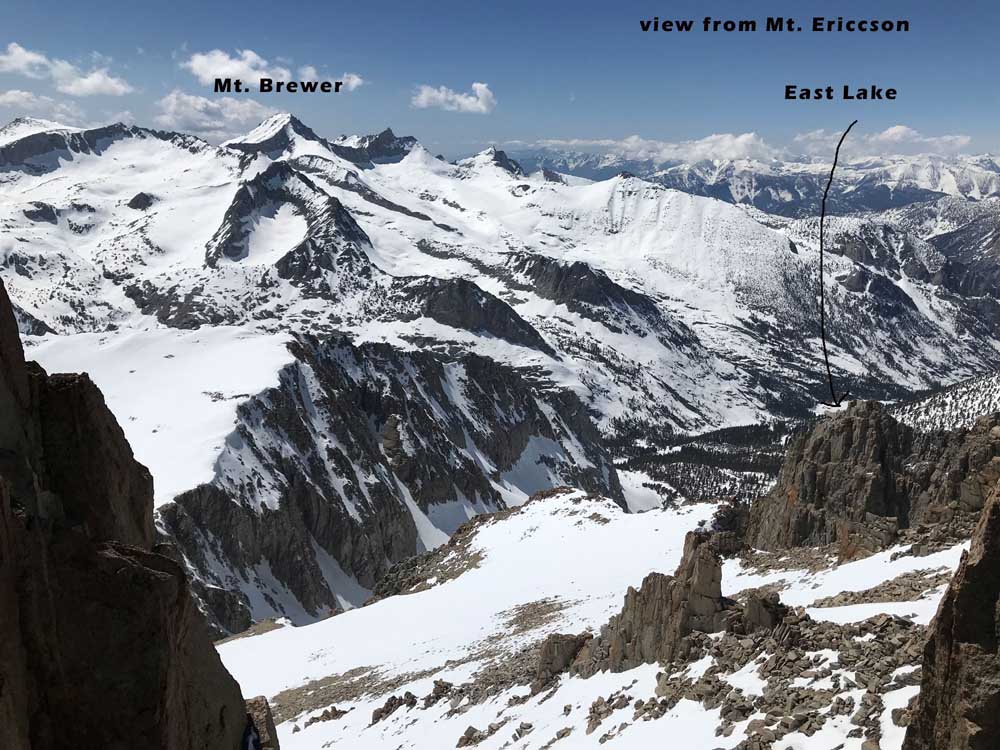
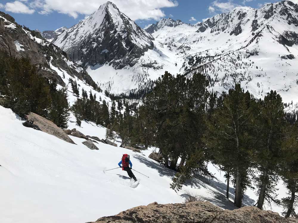
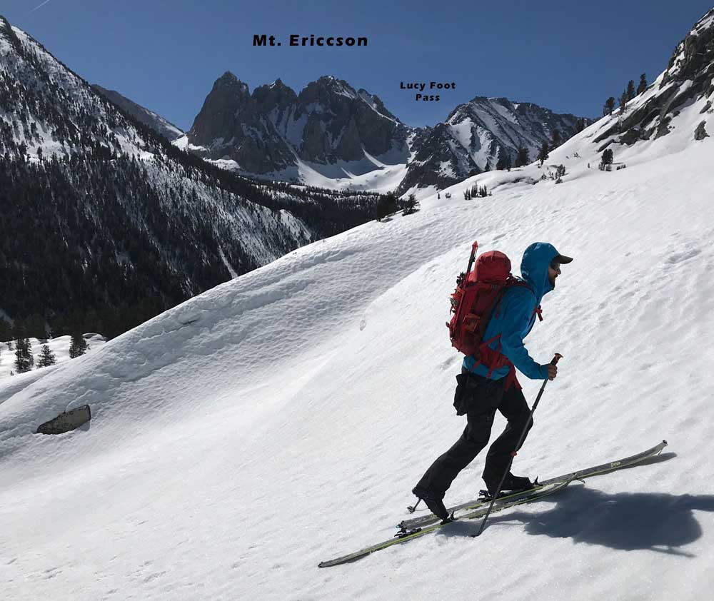
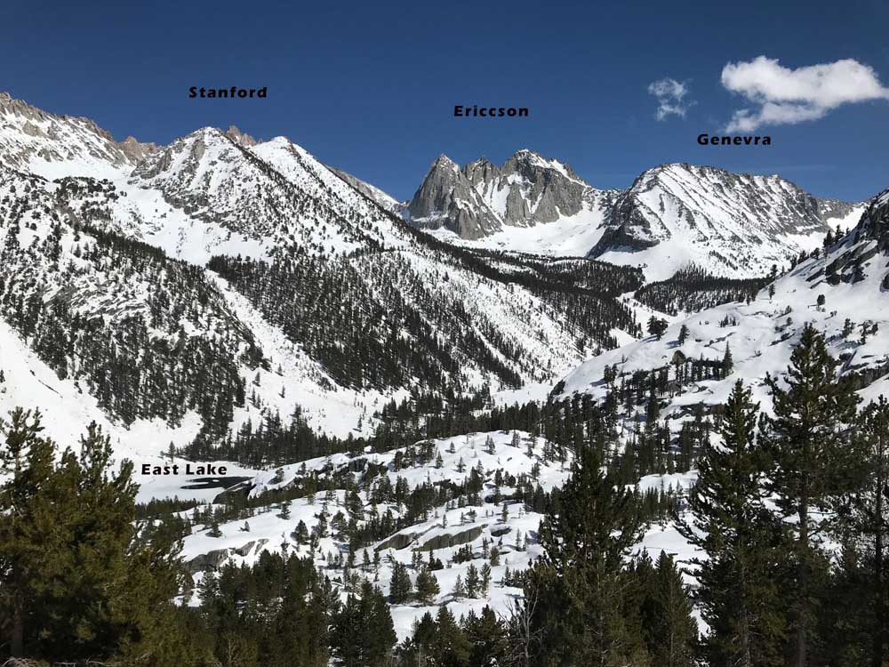
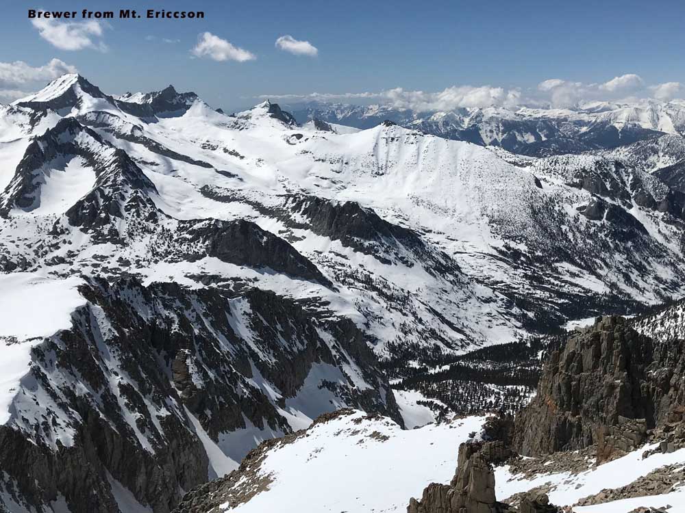
Wow, am I still talking? Ok, sorry. Mt. Brewer is the ultimate ski touring peak. It has terrain for every skill level, and you can drop 3 ways off the summit. You are in the middle of the Sierra and it only took a day and a half to get there from the Onion Valley Trailhead. We skied Mt. Ericcson the next day, which seemed to be the biggest mountain with snow to the top that I could tell made sense in a medium sized day.
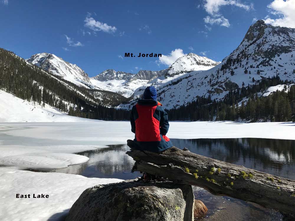
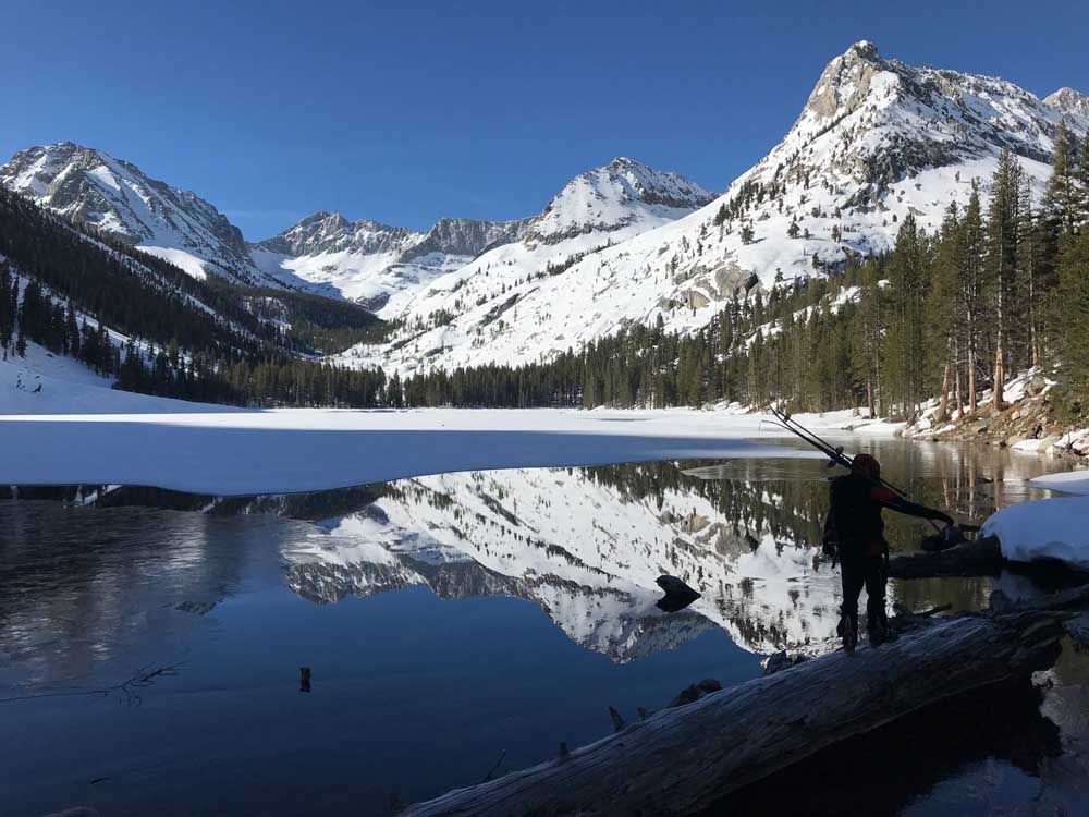
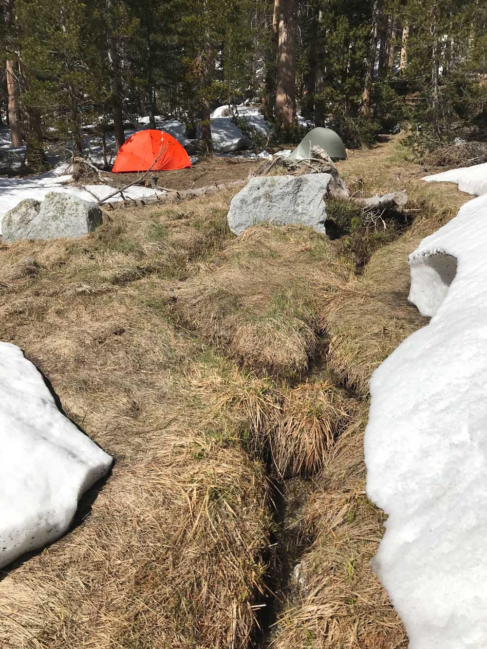
Camping at East Lake is sweet. We found a narrow lane of thick dry grass at the NE end of the lake. There was a mountain spring or snowmelt from warmer ground right there at our camp. We drank right out of the stream. We had to cross some sketchy logs to get on route in the morning. You’ll see, there is no other way except to skin all the way around East Lake. The lake wasn’t frozen enough to cross, possibly because there is a warm mountain spring draining into that end. And of course because it’s 9500′ and May already by the time you can park at the trailhead.
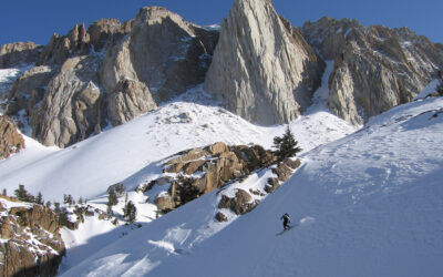
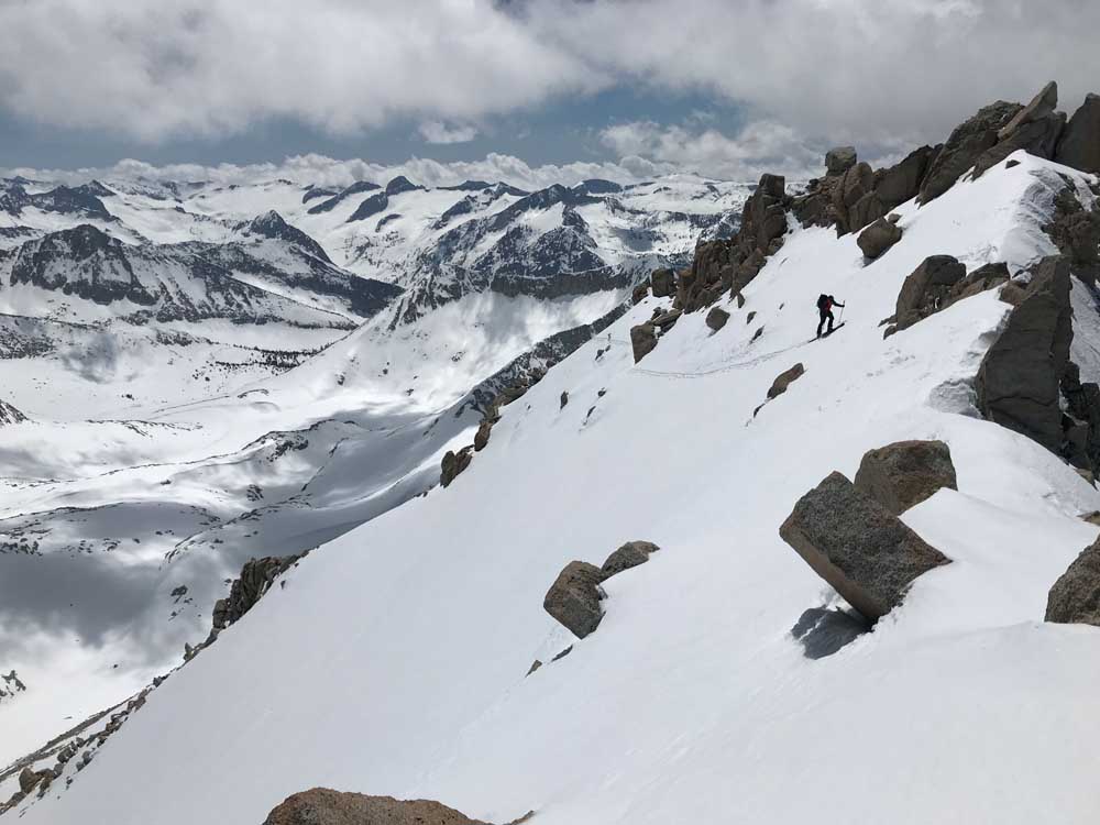
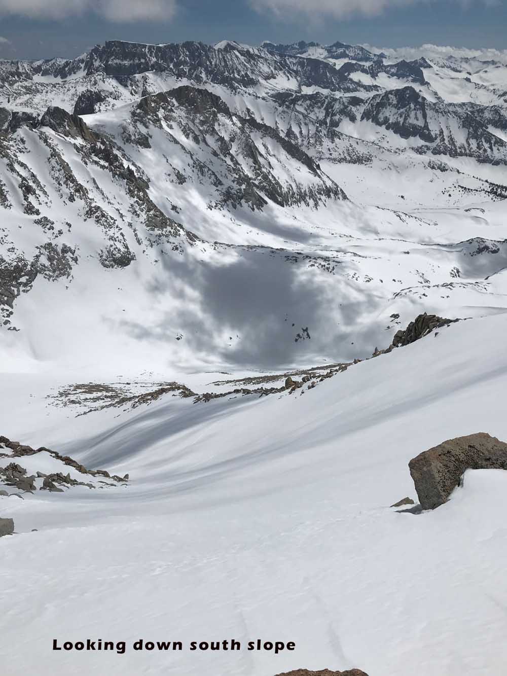
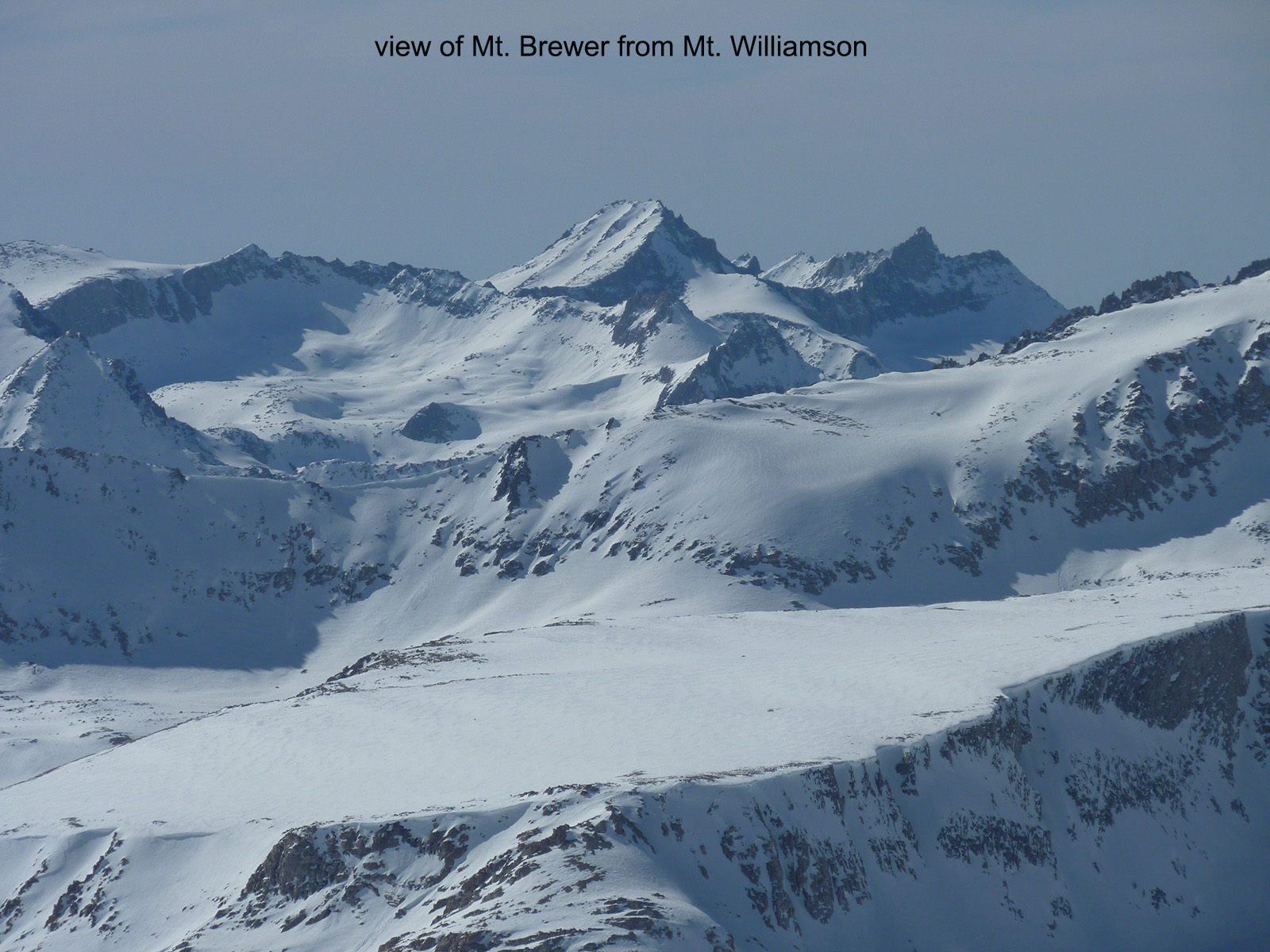
The middle part of our East Side descent on Mt. Brewer reminded me of skiing on glaciers in Alaska or Canada with it’s friendly, rolling, wide open slopes and DEEP snowpack. I really would like to go back and ski back along the east facing 3000′ bowling alley of a gully that we skinned up. The summit slope was also hard to resist, as it was perfect corn snow. We did get to enjoy a few hundred vert before Danny spotted the cairn that marks the East Ridge. I looked down the north side from the summit and didn’t see exactly how the slope meets the access col, but It looks like they connect with snow from other angles. And the snow was a little firm, so we opted out of that enticing steep slope. It was a bit of a narrow path looking down the north face near the summit. I’d say the North slope is the most serious direction to ski, with the East Ridge being close behind in challenge due to the entrance. The south Slope and South Col is the easiest way back and most likely to be soft. Watch for wet slides closer to East Lake as you return in the afternoon, as you would on any big mountain during the springtime.
Mt. Brewer

Looking for awesome ski and splitboard tours in the Sierras? We’ve got write ups on many common and uncommon tours curated by the owner of the BackCountry, Mike Schwartz.