
by Mike | Apr 1, 2026 | Backcountry Ski, Bridgeport, Eastern Sierra
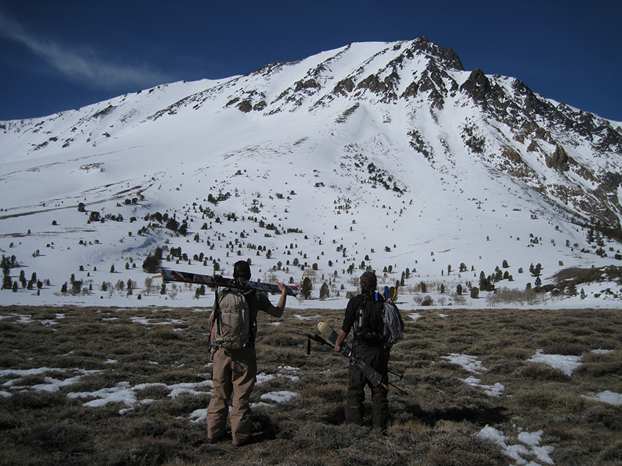
Trailhead: Twin Lakes Campground – Bridgeport Summit Elevation: 10,712′ Elevation Change: 3615′ Gabe Metzger and I had fun on this obscure Hoover Wilderness Peak 1/26/26 in very low snow conditions. We were aiming for something new in this area and...
by Mike | Apr 1, 2026 | Backcountry Ski, Bishop
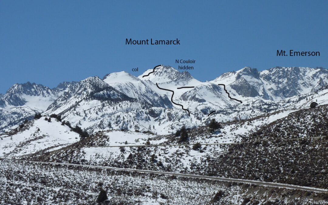
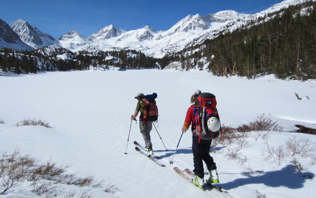
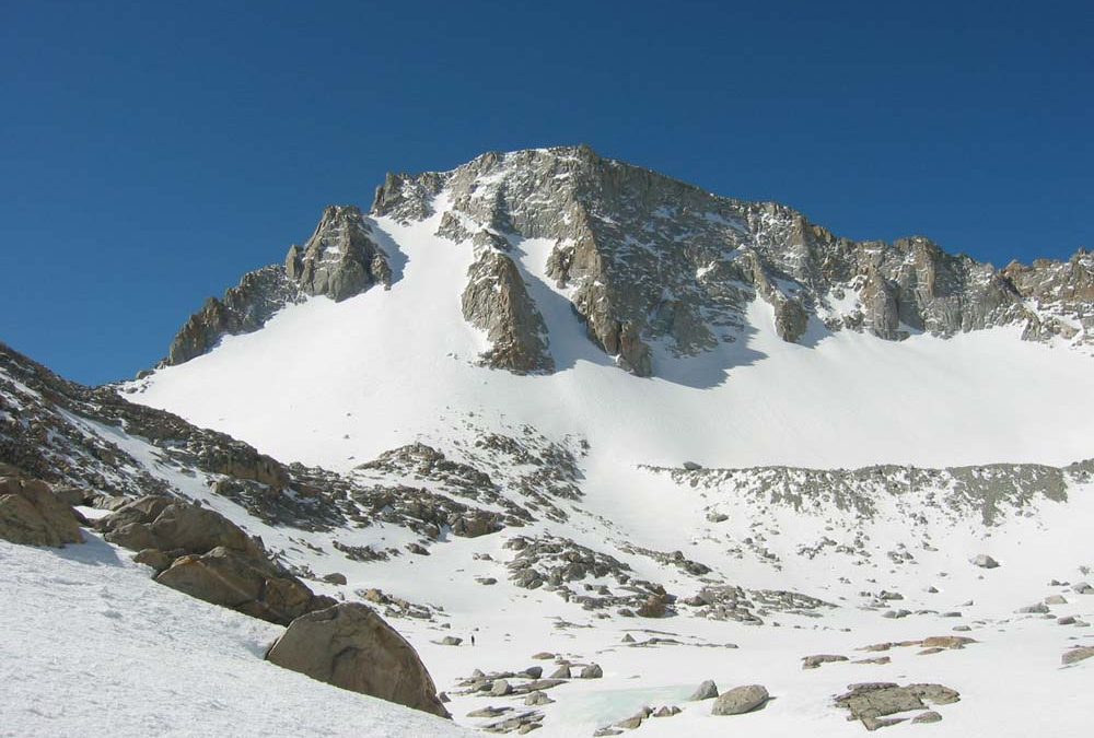
Location: North lake Trailhead 9400’Elevation: 13,412’Elevation Change: 4012′ This is a new post after skiing Mount Lamarck again on April 26, 2026. Previously I described a descent of the north couloir on the way back from Mt. Darwin. Check out...
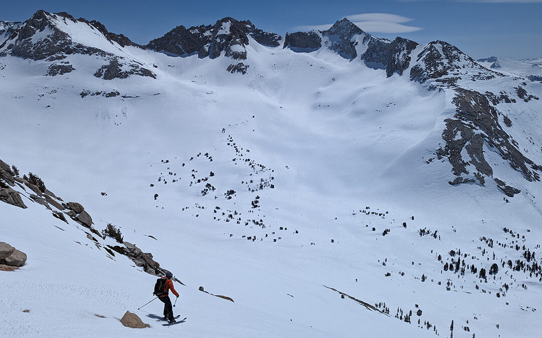
by Mike | May 27, 2025 | Backcountry Ski, Bishop, Eastern Sierra
The seed for this tour started for me in 1994 when I got my hands on the Moynier High Sierra Skiing Guidebook. This peak wasn’t in there, but I ticked all of them except one I believe passes the sketchy threshold for my age at this point. Then I moved over to...
by Mike | Jan 1, 2025 | Backcountry Ski, Eastern Sierra
Here are some pics from two separate outings. I aim for Leavitt Peak every year when Sonora Pass hwy 108 opens. Maybe I actually have got there 5 times and skied the same thing, the highest peak in a nice half day ski. I should go ski some neighboring terrain, but...
by Mike | May 11, 2023 | Backcountry Ski, Eastern Sierra, Featured Adventures
This year has been a record snowfall year. 900″ at Mammoth Mountain. Over May 6-9, 2023, Dan from Mammoth and I went to explore Taboose Pass. Neither of us had been over the Crest in this specific area, or even up this trail. My perception for Taboose pass as a...
by Mike | Apr 17, 2023 | Backcountry Ski, Eastern Sierra, Featured Adventures
First draft, excuse my late night first try at this. On April 14-16 2023 I had an insane experience touring through untracked wilderness with my new friend Javier. We met each other earlier this year by flying 40 miles north of Donald, near Golden BC, to ski tour for...
by Mike | Apr 9, 2023 | Backcountry Ski, Eastern Sierra, Featured Adventures
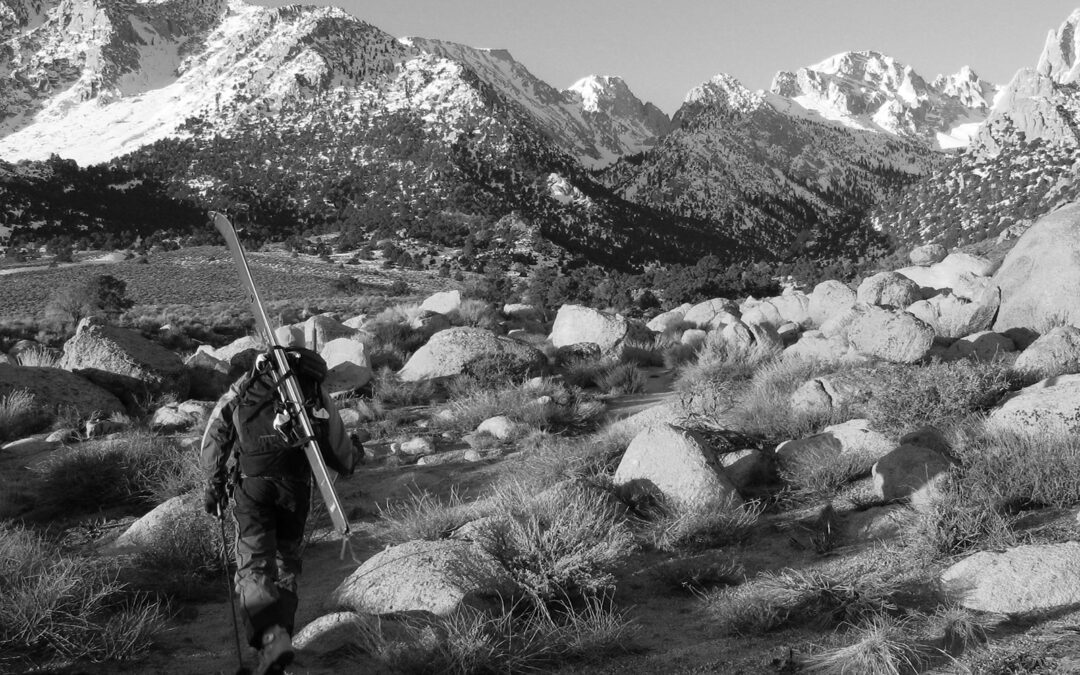
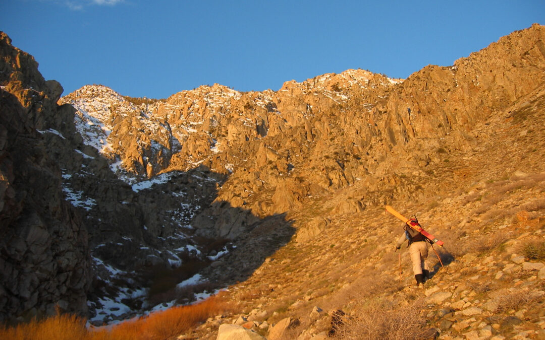
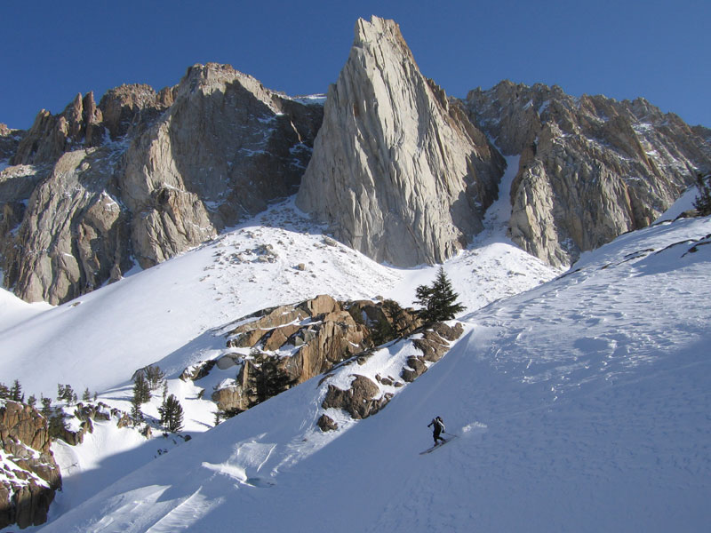
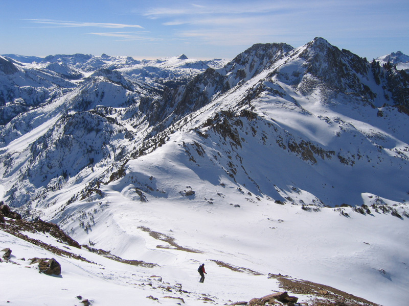
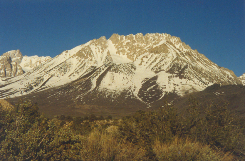
Here’s what I know about this beautiful peak. The summit of Mt. Walt isn’t easy to get on, the snow can be tricky, and it is generally overlooked. The funny thing is Mt. Walt is right above your car at Twin Lakes Campground and looks exciting, and even...
by Mike | Jan 16, 2023 | Backcountry Ski, Eastern Sierra
Dana Peak 13,061′ and Dana Plateau – Tioga Pass Tioga Pass was the most anticipated Ski Touring zone every spring in the 90’s and early 2000’s due to TPR (Tioga Pass Resort), which closed about 15 years ago. You were fed, you slept in a warm...
by Mike | Jan 11, 2023 | Backcountry Ski, Eastern Sierra
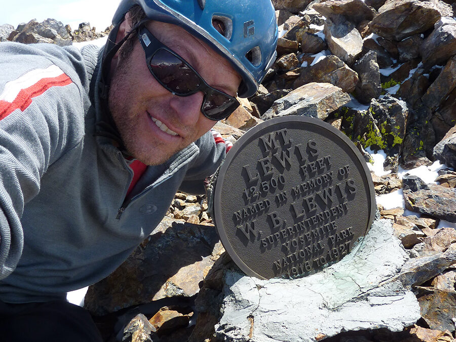
Mt. Locke 12,500′ elevation Change 4000′ This was one of my first East side Peaks following Jim Harper. I see Will Richardson in these old photos, so I assume we skied Mt. Lewis in this same trip. Jim is in those photos too. Will was my first employee. A...
by Mike | Jan 10, 2023 | Backcountry Ski, Eastern Sierra
Mt. Langley 14,042’ Elevation Change 6500’ This could be your first 14er ski descent. Mt. Langley is big and remote, but easy to navigate and not skied very often. This is the most southern California 14er, far enough from population centers that it gets...
by Mike | Jan 10, 2023 | Backcountry Ski, Eastern Sierra
Mt. Tom 13,652’ Elevation change – 7500’ In Mid-March of 2003 I skied from the summit of Mt. Tom with Scott Shield and John Crus. It was Scott’s 30th birthday. We are all the same age. 20 years later I’m sitting at home creating this website post and I feel...
by Mike | Jan 10, 2023 | Backcountry Ski, Eastern Sierra
Mt. Lewis 12,342’ Elevation change – 5000’ Here are a whole bunch of poor-quality shots from an exciting and fun day I had in April 2011. Kind of a greybird day, and my point and shoot camera skills had not yet been refined. I think I finally started framing...
by Mike | Jan 10, 2023 | Backcountry Ski, Eastern Sierra
Mt. Humphreys 13,986’ Elevation Change – 5500’ The Sierra Crest above Bishop is an impressive and attractive ski mountaineering panorama. As high as they are, however, they are only the beginning. Climb to the top of any of them and the magnitude and beauty of the...
by Mike | Jan 8, 2023 | Backcountry Ski, Eastern Sierra
Mt. Wood 12,637′ Location: silver Lake, near June Lake Elevation change: 5500′ Mt. Wood is one of the first big Eastern Sierra Peaks that people usually go for. I have skied the east side a handful of times. You can see it from hwy 395 near the North June...
by Mike | Jan 8, 2023 | Backcountry Ski, Eastern Sierra
Mt. Williamson 14,375’ These photos are from 3/6/2010. John Crus and I went for the ultimate one day East Side suffer-fest in the Moynier book. John had a cold and didn’t tell me until we were a few hours in, so he really wanted it. The snow was so bad we didn’t make...
by Mike | Jan 7, 2023 | Backcountry Ski, Eastern Sierra
Mt. Gabb 13,471’ – Mt. Hilgard 13,361’– Julius Caesar 13,200’ On May 4 2010 Greg Loring and I returned alive from this amazing 3 day ski tour. I had seen internet pics posted by a South Tahoe snowboarder BCD who posted about Mt. Gabb. I think he went down it, I’m not...
by Mike | Jan 7, 2023 | Backcountry Ski, Eastern Sierra
Pyramid peak 11,728′ If you are really into ski touring, just move to Mammoth Lakes. This is the epicenter for Sierra rock climbing, hiking, backpacking, and backcountry ski touring. I like to think of Tahoe as an ideal “center” position in...
by Mike | Jan 5, 2023 | Backcountry Ski, Eastern Sierra
Mt Mills1#image_title Mt Mills2#image_title Mt Mills3#image_title Mt Mills4#image_title Mt Mills5#image_title Mt Mills6#image_title Mt Mills7#image_title Mt Mills8#image_title Mt Mills9#image_title Mt Mills10#image_title Mt Mills11#image_title Mt Mills12#image_title...
by Mike | Jan 3, 2023 | Backcountry Ski, Eastern Sierra
Mt. Ritter – 13,143’Banner Peak – 12,936’ In May of 2002 John and I skied Mt. Ritter and Banner Peak in a 3-day tour. We tried to go up the North side of Mt. Tom in the dark, behind some of his friends, and bailed due to the chaos of a big group and...
by Mike | Dec 29, 2022 | Backcountry Ski, Eastern Sierra
North Peak 12,242′ Location: Saddlebag Lake – Tioga PassElevation Change: 2200′ I don’t remember when I skied North Peak, but I won’t ski it again. It was late 90’s with John, Aaron and Tony. Same excursion where we skied Morgan South. This is a...
by Mike | Dec 29, 2022 | Backcountry Ski, Eastern Sierra
boots University peak 13,632′ Elevation change: 4400′ These are some mixed pics from two days I skied University Peak in 2003 and 2004. The ski descent line I did was the North Face, described in the Moynier High Sierra Guidebook. This is a great...
by Mike | Dec 29, 2022 | Backcountry Ski, Eastern Sierra
Mt. Tyndall 14,018’ Location: Shepards Pass – Sierra Crest Elevation Change 7500’ On March 24, 2004, I skied one of my biggest day ski tours with John. We had skied 3 days on this east side excursion. We day skied Mt. Starr aka Pointless Peak, and Birch Mountain...
by Mike | Dec 29, 2022 | Backcountry Ski, Eastern Sierra
Mt. Gould 13,000’ Location – Onion Valley Trailhead above Independence, CA Elevation Change 3800’ I’m going to have to go back to this one soon. I’ve skied Mt. Gould a few times by myself. It’s a friendly east facing corn run to me that is skiable in late...
by Mike | Dec 28, 2022 | Backcountry Ski, Eastern Sierra
Skiing th Mt. Lyell 13,114’ Elevation Change: 4400’ but 9-mile flat approach Location: Tuolumne Meadows On June 9, 2010 Eric Ongerth and I skied Mt. Lyell with a one-night stay, starting from the parking lot at Tuolumne Meadows Lodge and the John Muir Trail. Lyell is...
by Mike | Dec 28, 2022 | Backcountry Ski, Eastern Sierra
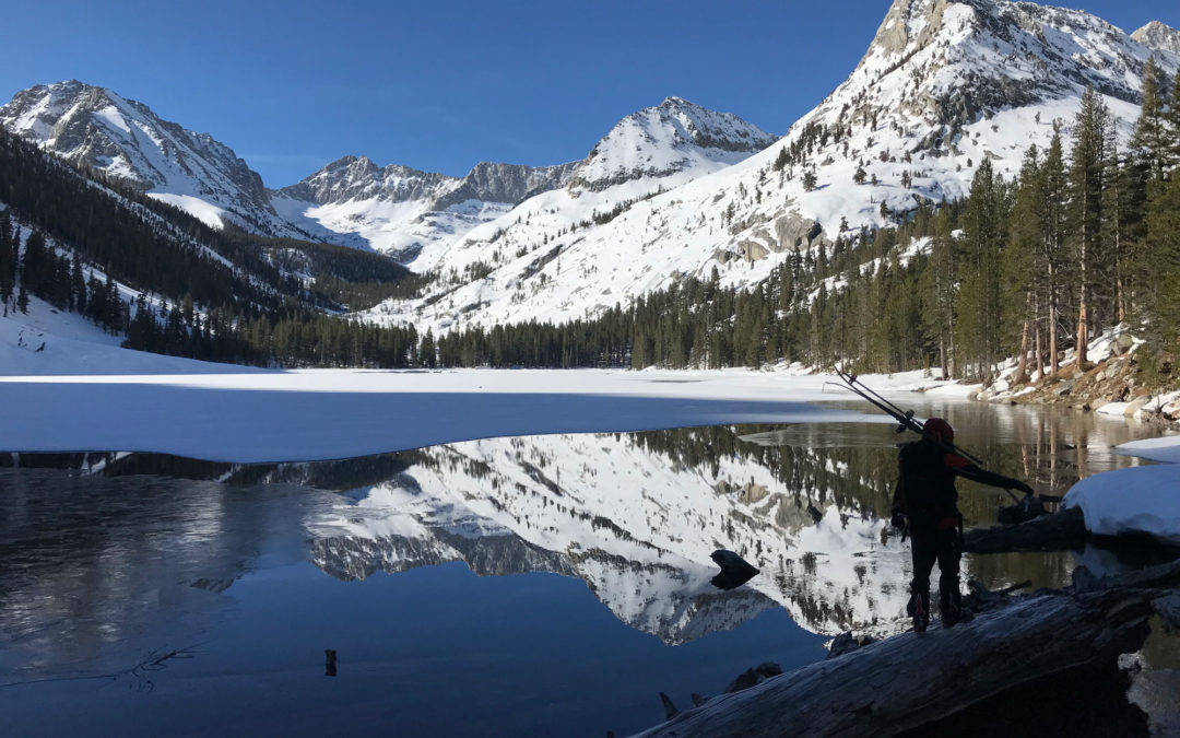
insane right? Approach to Norman Clyde Norman Clyde Couloir 13,500’ – Middle Palisades Elevation Change: 5700’ These pics are from May 18, 2019. Ben Mitchell, Christian, Nick Bliss and his dog Owen all made it up to the top of Norman Clyde Couloir with me. This was a...
by Mike | Dec 24, 2022 | Backcountry Ski, Eastern Sierra
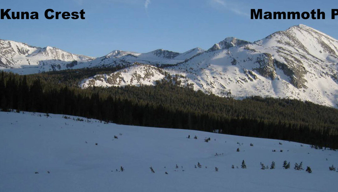
Mammoth Peak & Kuna Crest – Tuolumne: 12,112’ Elevation change: Not a ton, but some miles May 13, 2009 was a great solo overnight tour for me. There is a short window where Highway CA-120 gets plowed to the entrance of Tuolumne and they let you drive in to the...
by Mike | Dec 24, 2022 | Backcountry Ski, Eastern Sierra
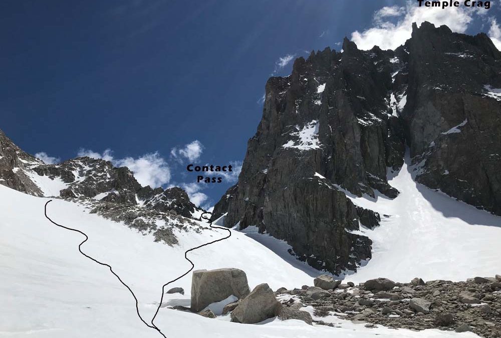
Mount Bolton Brown: 13,538’Balcony Peak: 13,840’ Location: Big Pine Creek Trailhead 7800’ Map: The Palisades – Tom Harrison I have explained some other ski tours from Big Pine Creek Trailhead on this website like Kid and Slide Mountain, right above the car. Norman...
by Mike | Dec 21, 2022 | Backcountry Ski, Eastern Sierra
Buck Mountain: 12,861’ Location: Big Pine, CA Elevation change: 5061’ Map: The Palisades Trail map – Tom Harrison The date on these photo files says February 18, 2008. This peak isn’t in the guidebooks and somewhere I heard it called Slide Mountain. Check it...
by Mike | Dec 8, 2022 | Backcountry Ski, Eastern Sierra
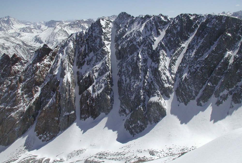
Ed Cesnalis Photo Ed Cesnalis Photo Conness_steelman2 Conness_steelman1 S Couloir below Y ara Conness from Biglines.com Location: Tioga Pass – Saddlebag LakeSummit Elevation: 12,590’Elevation Change: 3,050′ or more if you add North Peak I used to ski Tioga...
by Mike | Dec 8, 2022 | Backcountry Ski, Eastern Sierra
Big Slide Canyon end of Big Slide Canyon heading up Little slide Looking back at Victoria crossing Robinson Creek Kettle Peak in Little slide Little Slide Canyon Hulk Couloir on left of peak Kettle Couloir pass on top left reaching the top somewhere Perfect day at the...
by Mike | Dec 4, 2022 | Backcountry Ski, Eastern Sierra
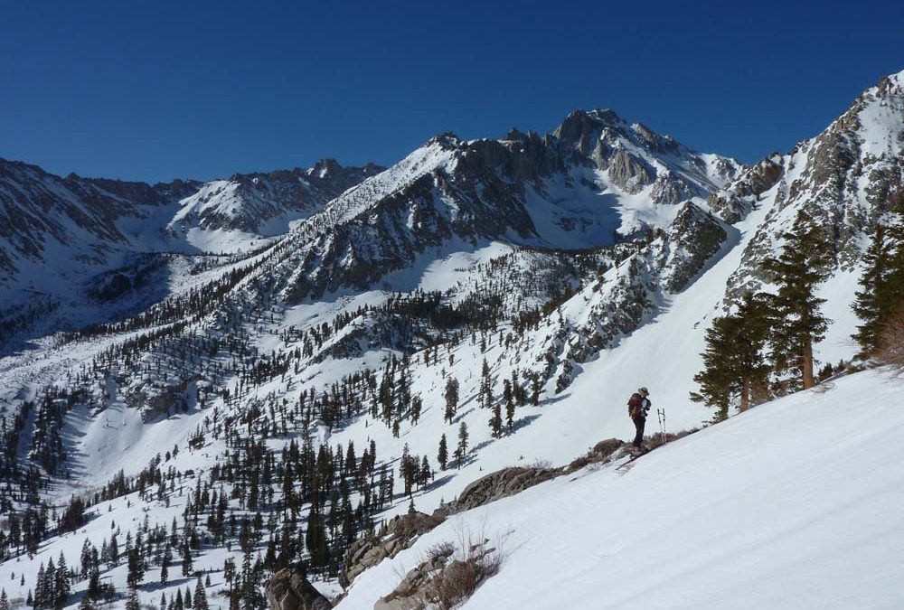
Mt. Starr – aka Pointless Peak Location: Rock Creek near MammothSummit Elevation: 12,832’Elevation Change: 4,000′ I’m reposting an old one from sometime in the early 2000’s. I was knocking out the ski tours in the John Moynier Guidebook...
by Mike | Dec 4, 2022 | Backcountry Ski, Eastern Sierra
Location: Little Lakes Valley – Rock Creek near MammothSummit Elevation: 11,732’Elevation Change: 4,700’Recommended Map: Hoover Wilderness by Tom Harrison I skied Mt.Dade with a customer named Tucker maybe around 2000. The Moynier book called it an...
by Mike | Dec 4, 2022 | Backcountry Ski, Eastern Sierra
mt. Location: Little Lakes Valley – Rock Creek near MammothSummit Elevation: 13,754’Elevation Change: 4,800′ This was another peak I skied with John, Tony, and Aaron Martin in maybe the late 90’s. It was just before Aaron died skiing off the...
by Mike | Dec 4, 2022 | Backcountry Ski, Eastern Sierra
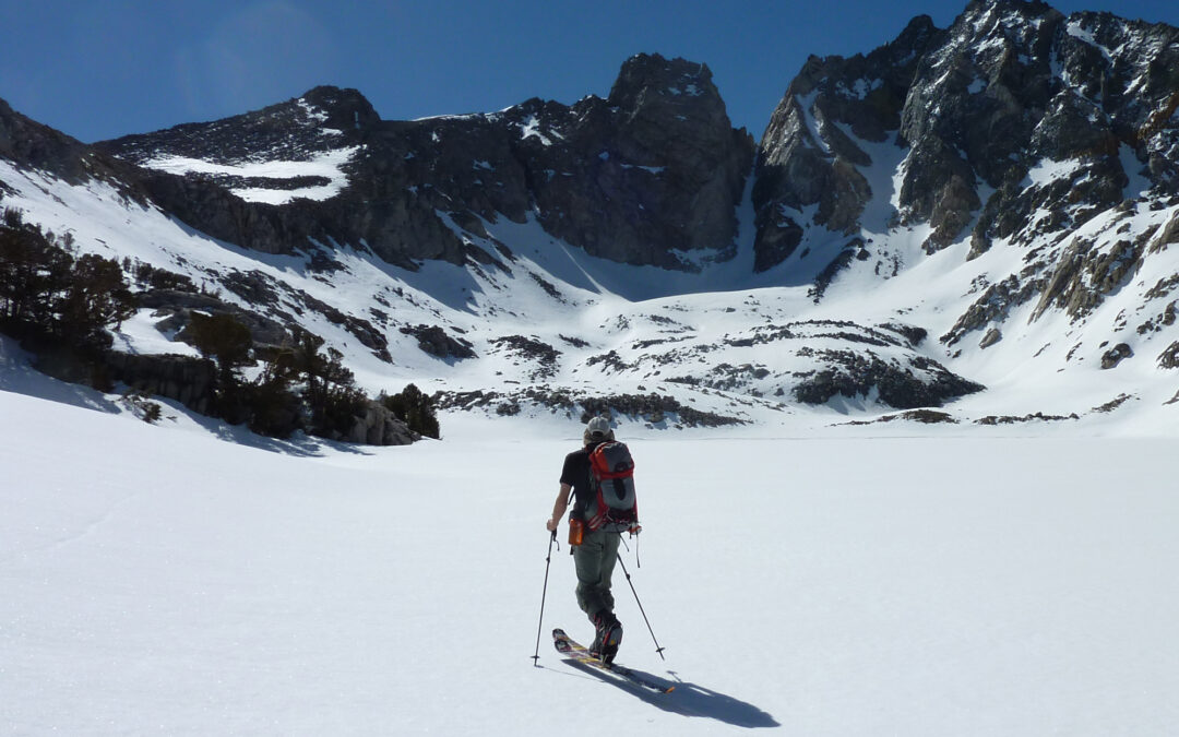
Location: Bridgeport, CA – Twin Lakes CampgroundSummit Elevation: 11,732’Elevation Change: 4,700’Recommended Map: Hoover Wilderness by Tom Harrison These pictures are from an old website post when I skied Victoria Peak first around 2004 with John...
by Mike | Mar 1, 2021 | Backcountry Ski, Eastern Sierra
Location: Dragon PeakSummit Elevation: 12,955’Elevation Change: 3,800’Recommended Map: Kearsarge Pass/Rae Lake by Tom Harrison These pictures are from a 5 day Ski Tour with Dan Molnar in May of 2011. The Dragon Peak North Couloir was a highlight we looked...
by Mike | Feb 28, 2021 | Backcountry Ski, Eastern Sierra, Independence
Location: Independence PeakSummit Elevation: 11,744Elevation Change: 2,700 This is a great introduction to East Side skiing at a moderate difficulty. With no approach time and a few hours, you can knock out a really cool looking and pointy mountain with awesome views....
by Mike | Jan 12, 2020 | Backcountry Ski, Bishop, Eastern Sierra, Featured Adventures
Location: Carson PeakSummit Elevation: 10,909′Elevation Change: 3600′Map: Tom Harrison – Mammoth High Country Carson Peak is the beautiful crown-like mountain above June Lake, and very nearby to June Mountain Ski Resort. You could even traverse over from there, but it...
by Mike | Jan 12, 2020 | Backcountry Ski, Bishop, Eastern Sierra, Featured Adventures
Location: Basin MountainSummit Elevation: 13,240′Elevation Change: 5500′Map: Tom Harrison – Mono Divide High Country Basin Mountain was one of my first Eastern Sierra Ski Descents in the early 90’s. A common story. It’s the most inviting big peak in a chain of big...
by Mike | Jan 10, 2020 | Backcountry Ski, Bishop, Eastern Sierra, Featured Adventures
Location: Northern Kings Canyon National ParkElevation: 13,568′Elevation Change: about 5000’ and multi-dayRecommended Map: Kings Canyon High Country – Tom Harrison Mt. Goddard can be seen from most every big Eastern Sierra Peak from Bishop to Big Pine. Eric Ongerth...
by Mike | Jun 7, 2019 | Backcountry Ski, Eastern Sierra, Featured Adventures, Hoover Wilderness
Location: Pyramid LakeSummit Elevation: 12,001’Elevation Change: 3500’Recommended Map: Hoover Wilderness by Tom Harrison These pics are from 5/20/19 which was a big winter and still snowing at this time. This one had been on my list for years and I grabbed...
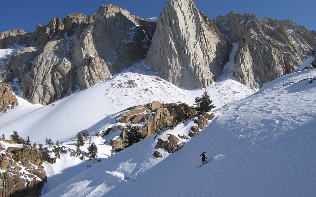
by Mike | May 27, 2019 | Backcountry Ski, Eastern Sierra, Featured Adventures, Lone Pine
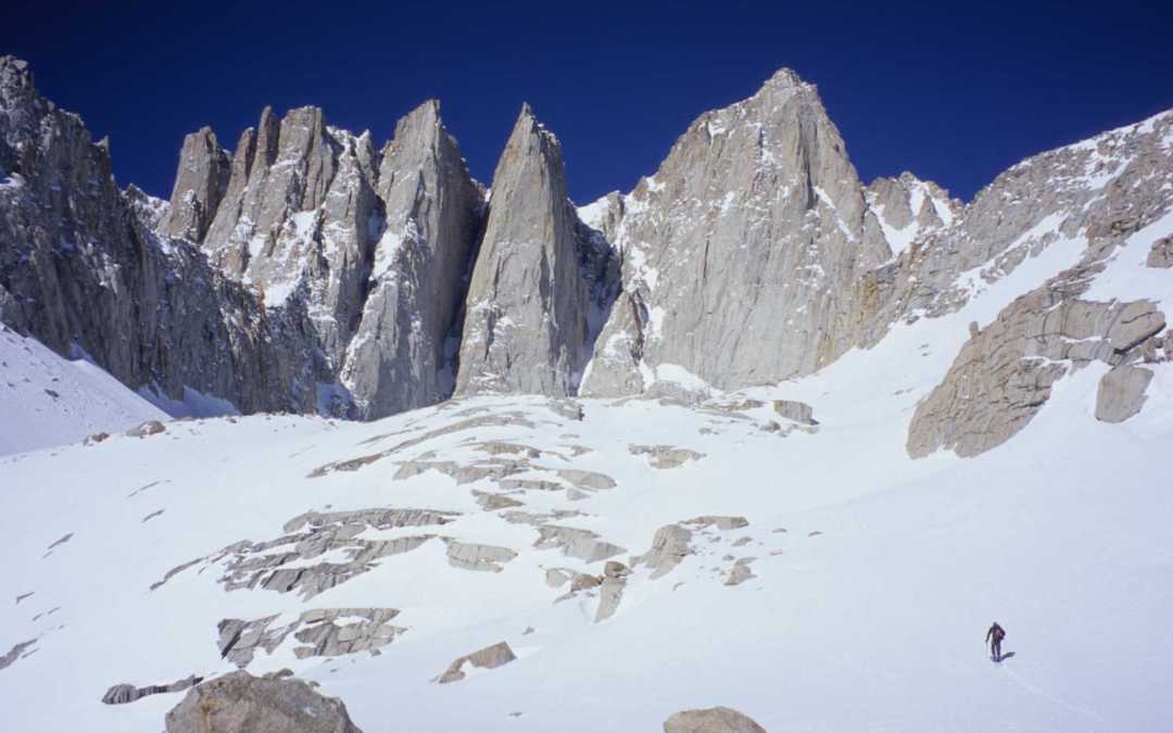
Location: Lone Pine, CASummit Elevation: 14,494Base Elevation: 8,340Elevation Change: 6,154Recommended Map: Mt. Whitney High Country – Tom Harrison These pictures are from March in 2005, which was my first and only time Skiing the Mountaineers Gully on Mt....
by Mike | May 24, 2019 | Backcountry Ski, Independence
Location: Mt. Brewer Summit Elevation: 13,570 Base Elevation: 6,370 Elevation Change: 7,200 Recommended Map: Kearsarge Pass/Rae Lake & Mt. Whitney High Country by Tom Harrison Jahren, Danny and Seth joined me on this amazing 4 day ski tour in the first week of May...
by Mike | May 10, 2019 | Backcountry Ski, Bishop, Eastern Sierra, Featured Adventures
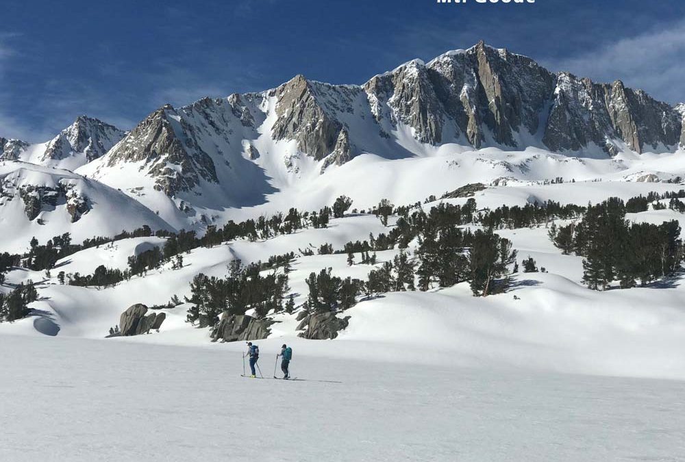
Location: South Lake above Bishop, CAElevation: 13,085’Elevation Change: 3,317’Recommended Map: Bishop Pass – Tom Harrison The view of Mt. Goode from Long Lake is one you’ll never forget, and quite easy to reach from your car. What you...
by Mike | May 10, 2019 | Backcountry Ski, Bishop, Eastern Sierra, Featured Adventures
Location: Palisades above Big Pine, CA Elevation: 14,153′ Elevation Change: 5,900′ Recommended Map: kings Canyon High Country – Tom Harrison Mt. Sill is the BIG guy you see from hwy 395 in Big Pine, CA. This 14er sits proud in the center of the...
by Mike | Apr 16, 2019 | Backcountry Ski, Bishop, Eastern Sierra, Featured Adventures
Location: Independence, CAElevation: 12,618’Elevation Change: 3,433′ up, 5000′ downRecommended Map: Kings Canyon High Country – Tom Harrison Assessing conditions for skiing Kearsarge Peak is pretty easy, you can see most of the terrain...
by Mike | Apr 11, 2019 | Backcountry Ski, Bishop, Eastern Sierra, Featured Adventures
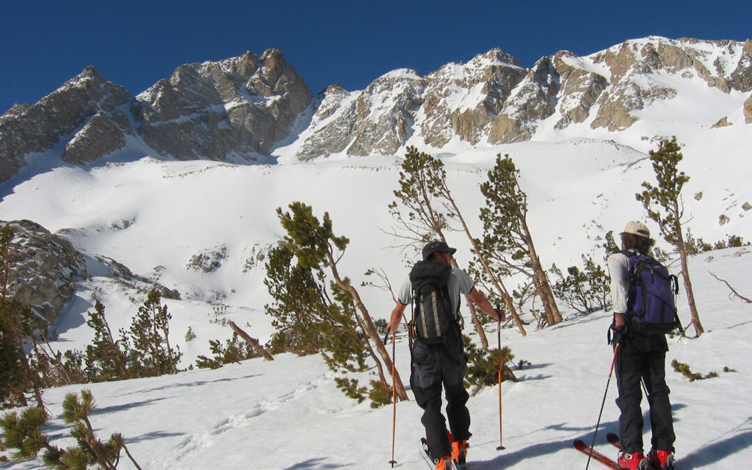
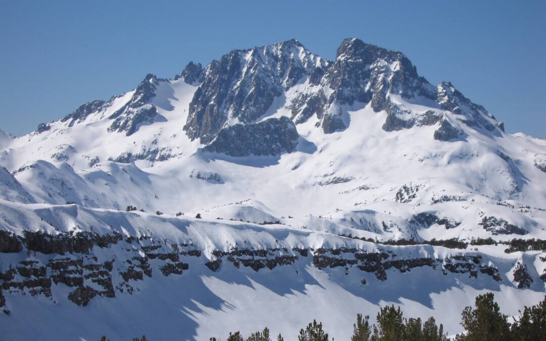
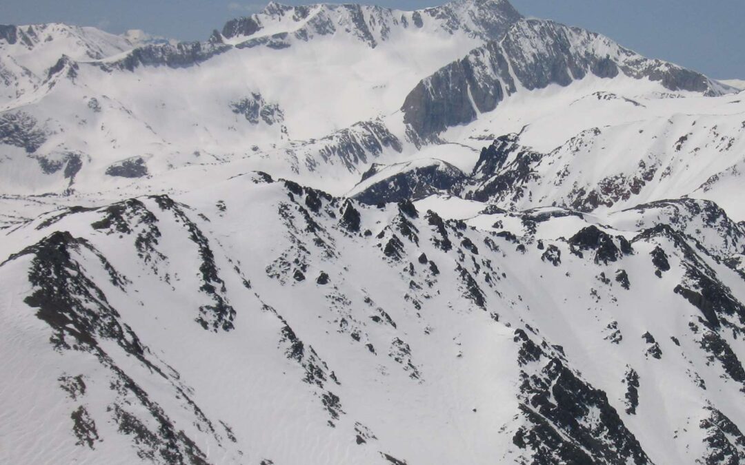
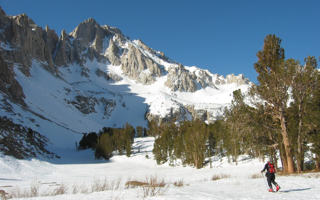
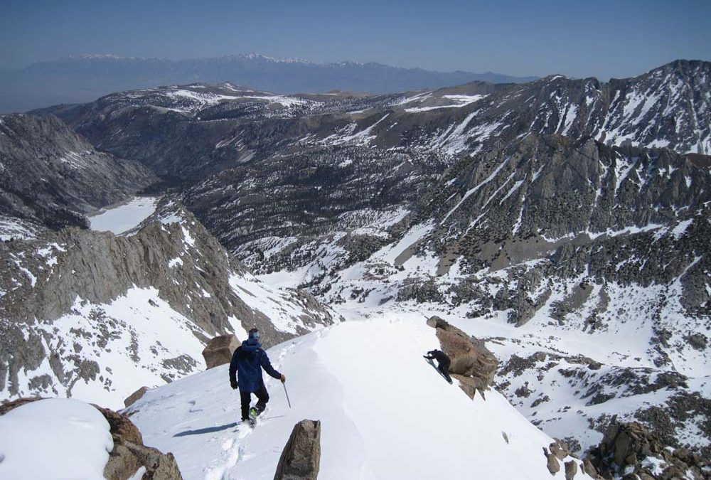
Location: North Lake above Bishop, CAElevation: Mt. Darwin 13,831′ and Mt. Lamark 13,417’Elevation Change: 4200′ for Lamarck. 5700′ for Darwin. add 500′ to connect bothRecommended Map: Bishop Pass – Tom Harrison These pics are from...
by Mike | Apr 11, 2019 | Backcountry Ski, Bishop, Eastern Sierra, Featured Adventures
Location: Buttermilks above Bishop, CA or access from AspendaleElevation: 13,225’Elevation Change: …Recommended Map: Mono Divide – Tom Harrison The North Couloir of Mt. Emerson starts the butterflies twirling in your stomach when you see it from the...
by Mike | Apr 11, 2019 | Backcountry Ski, Bishop, Eastern Sierra, Featured Adventures
Location: Pine Creek Trailhead above town of Rovana, north of BishopElevation: 13,242’Elevation Change: 5,500’Recommended Map: Mono Divide – Tom Harrison This is another one of the peaks where you know your doin’ it as soon as you see it. For...
by Mike | Apr 11, 2019 | Backcountry Ski, Eastern Sierra, Featured Adventures, Mammoth
Location: McGee Creek Trailhead near Mammoth LakesElevation: 12,200’Elevation Change: 4,500’Recommended Map: … Esha is a picturesque little peak that is easy to see and access right off hwy 395 with an ideal layout. The climb and upper descent is no...
by Mike | Apr 11, 2019 | Backcountry Ski, Bishop, Eastern Sierra, Featured Adventures
Location: South Lake above BishopElevation: 12,871’Elevation Change: 3,103’Recommended Map: Bishop Pass – Tom Harrison I won’t forget this day and need to go repeat this peak soon. These pics are from April 27, 2009. I joined up with John Morrison,...
by Mike | Apr 11, 2019 | Backcountry Ski, Big Pine, Eastern Sierra, Featured Adventures, Independence
Location: Taboose Creek Campground south of Big PineElevation: 12,772’Elevation Change: 6,500′ +/- based on snow levelRecommended Map: Kings Canyon High Country – Tom Harrison I found this less known east side giant by asking Howie Schwartz for something...