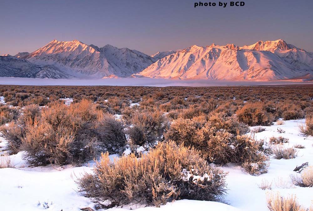
by Mike | Mar 1, 2021 | Backcountry Ski, Eastern Sierra
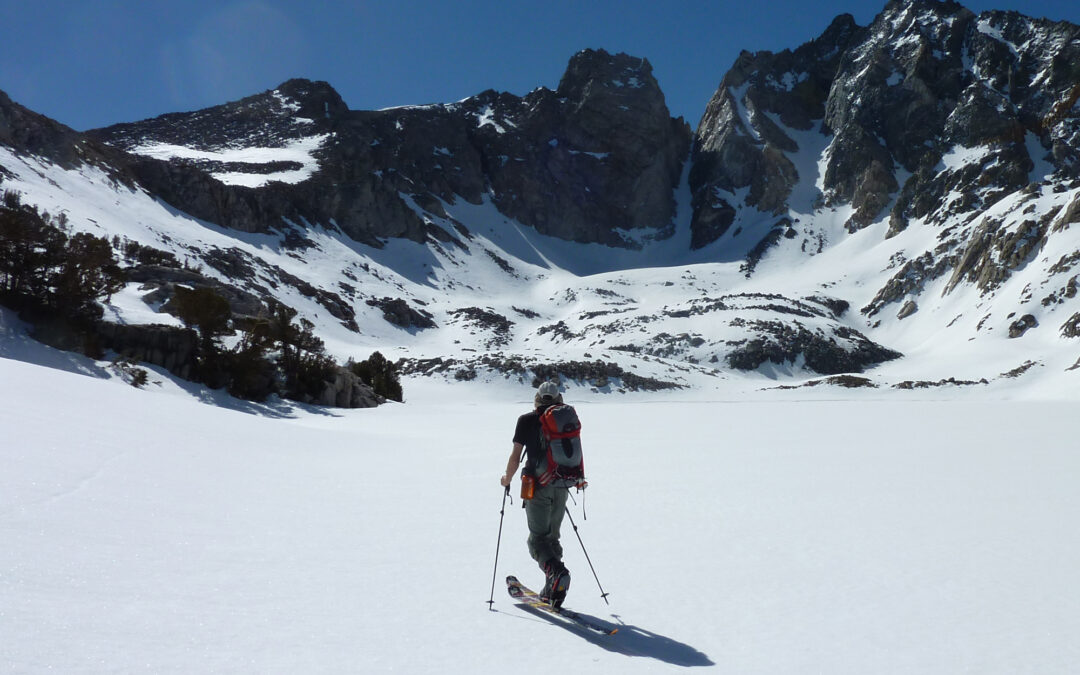
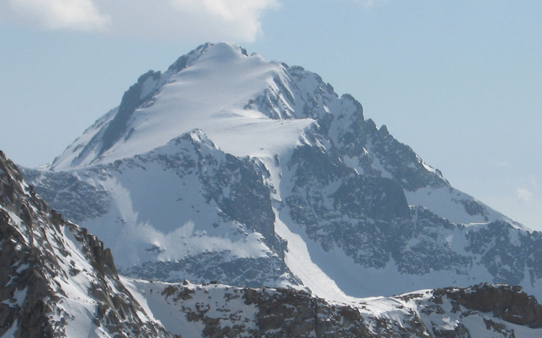
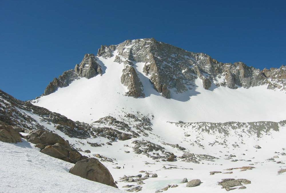
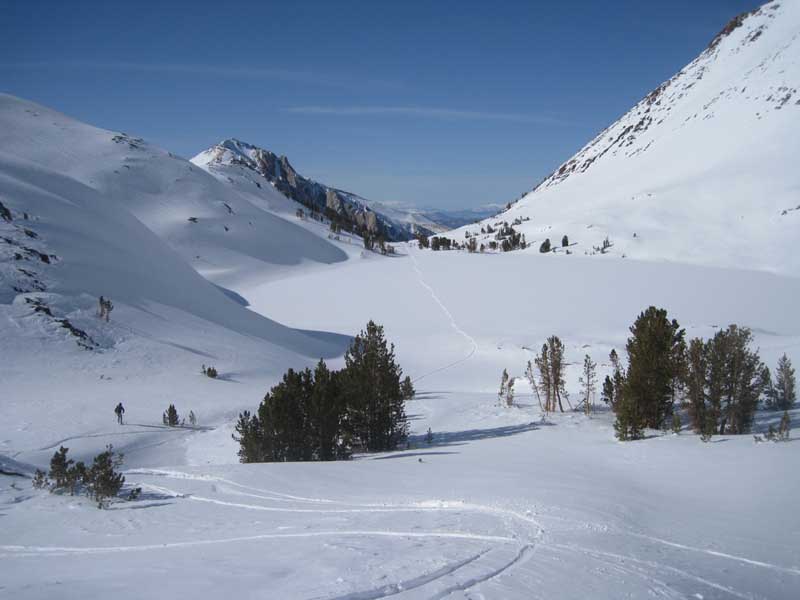
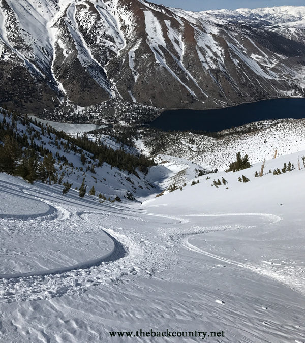
Location: Dragon PeakSummit Elevation: 12,955’Elevation Change: 3,800’Recommended Map: Kearsarge Pass/Rae Lake by Tom Harrison These pictures are from a 5 day Ski Tour with Dan Molnar in May of 2011. The Dragon Peak North Couloir was a highlight we looked...
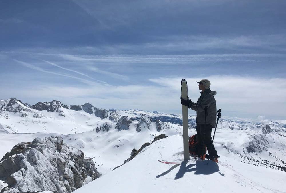
by Mike | Feb 28, 2021 | Backcountry Ski, Eastern Sierra, Independence
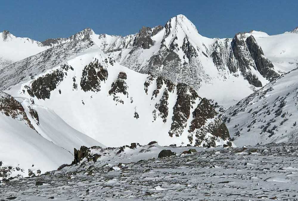
Location: Independence PeakSummit Elevation: 11,744Elevation Change: 2,700 This is a great introduction to East Side skiing at a moderate difficulty. With no approach time and a few hours, you can knock out a really cool looking and pointy mountain with awesome views....
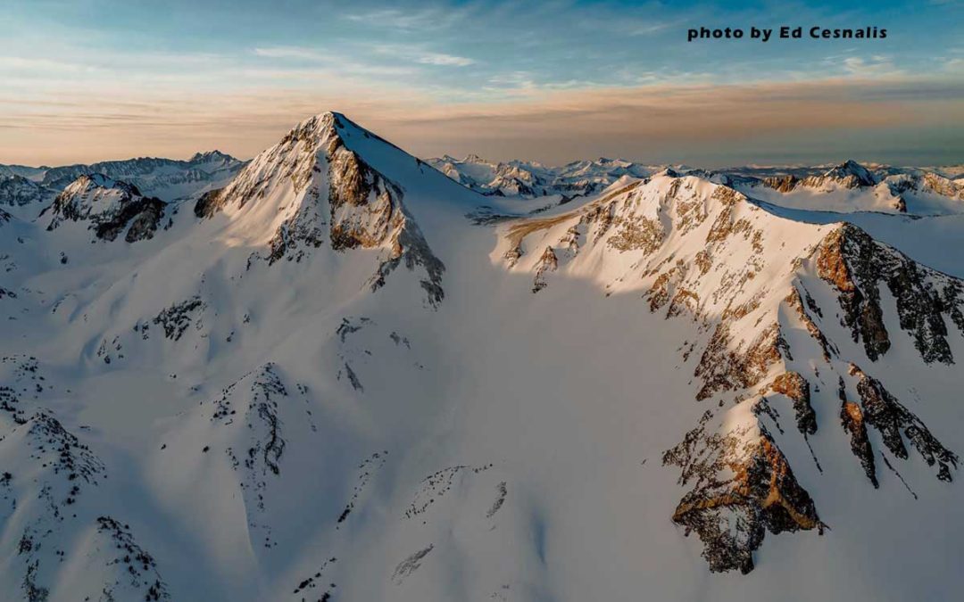
by Mike | Jan 12, 2020 | Backcountry Ski, Bishop, Eastern Sierra, Featured Adventures
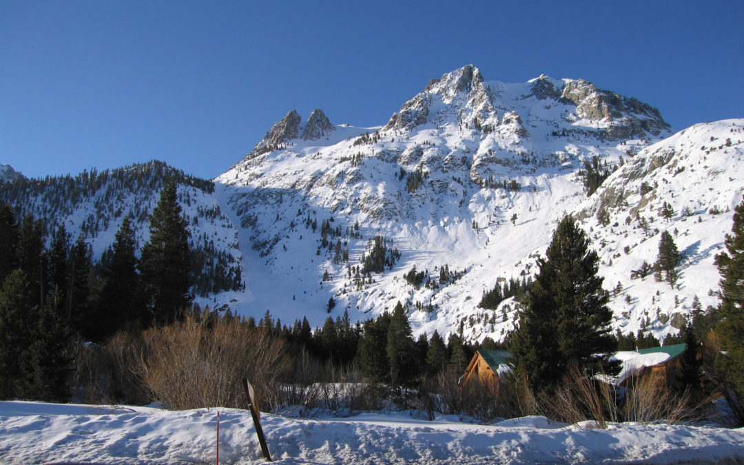
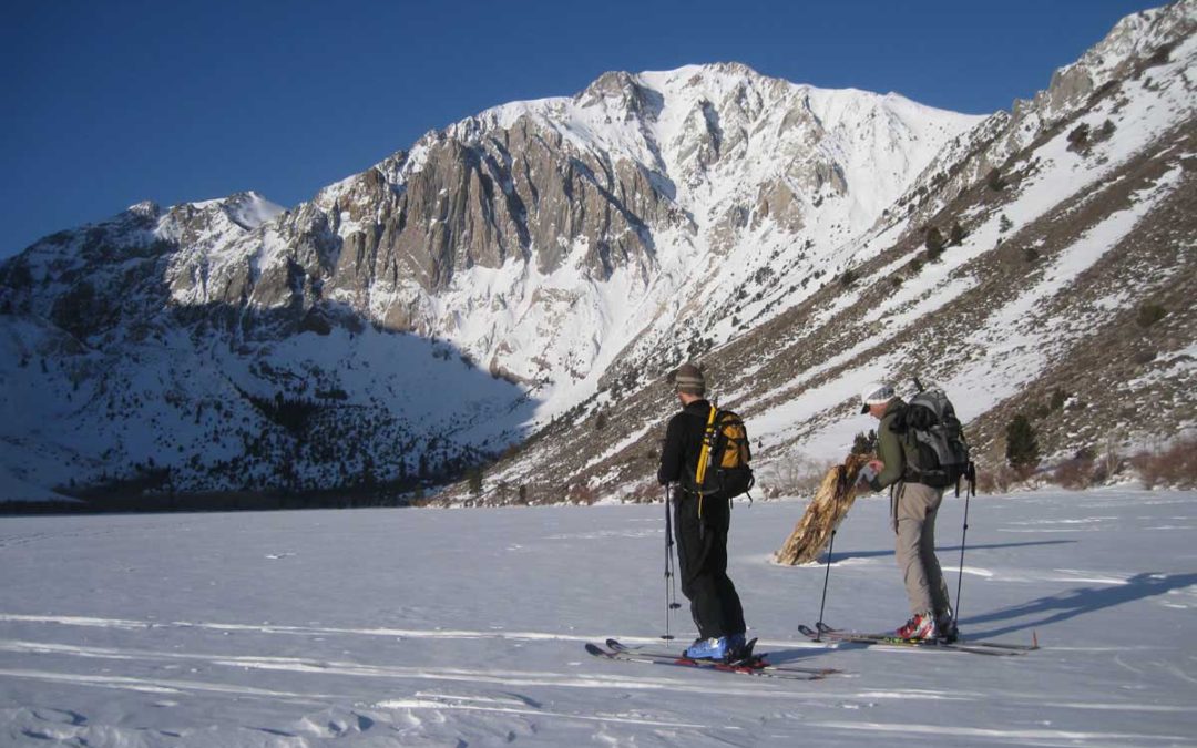
Location: Carson PeakSummit Elevation: 10,909′Elevation Change: 3600′Map: Tom Harrison – Mammoth High Country Carson Peak is the beautiful crown-like mountain above June Lake, and very nearby to June Mountain Ski Resort. You could even traverse over from there, but it...
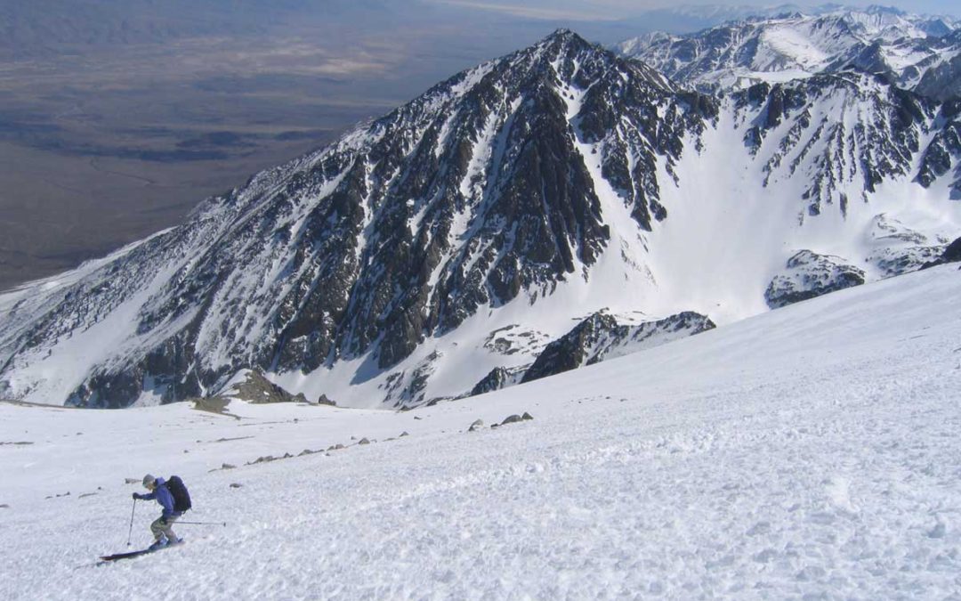
by Mike | Jan 12, 2020 | Backcountry Ski, Bishop, Eastern Sierra, Featured Adventures
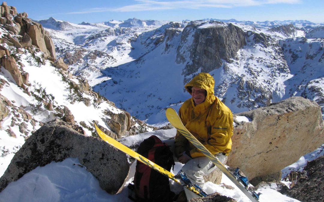
Location: Basin MountainSummit Elevation: 13,240′Elevation Change: 5500′Map: Tom Harrison – Mono Divide High Country Basin Mountain was one of my first Eastern Sierra Ski Descents in the early 90’s. A common story. It’s the most inviting big peak in a chain of big...
by Mike | Jan 10, 2020 | Backcountry Ski, Bishop, Eastern Sierra, Featured Adventures
Location: Northern Kings Canyon National ParkElevation: 13,568′Elevation Change: about 5000’ and multi-dayRecommended Map: Kings Canyon High Country – Tom Harrison Mt. Goddard can be seen from most every big Eastern Sierra Peak from Bishop to Big Pine. Eric Ongerth...
by Mike | Jun 7, 2019 | Backcountry Ski, Eastern Sierra, Featured Adventures, Hoover Wilderness
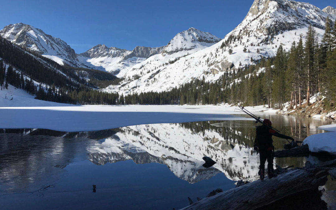
Location: Pyramid LakeSummit Elevation: 12,001’Elevation Change: 3500’Recommended Map: Hoover Wilderness by Tom Harrison These pics are from 5/20/19 which was a big winter and still snowing at this time. This one had been on my list for years and I grabbed...
by Mike | May 27, 2019 | Backcountry Ski, Eastern Sierra, Featured Adventures, Lone Pine
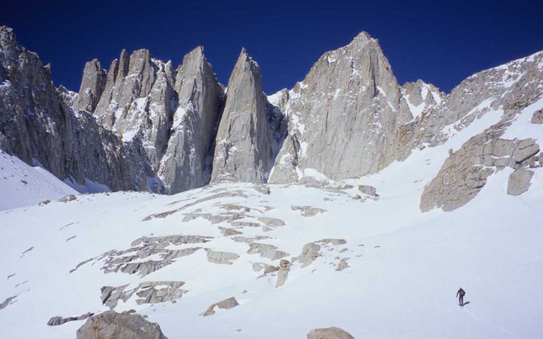
Location: Lone Pine, CASummit Elevation: 14,494Base Elevation: 8,340Elevation Change: 6,154Recommended Map: Mt. Whitney High Country – Tom Harrison These pictures are from March in 2005, which was my first and only time Skiing the Mountaineers Gully on Mt....
by Mike | May 24, 2019 | Backcountry Ski
Location: Mt. BrewerSummit Elevation: 13,570Base Elevation: 6,370Elevation Change: 7,200Recommended Map: Kearsarge Pass/Rae Lake & Mt. Whitney High Country by Tom Harrison Jahren, Danny and Seth joined me on this amazing 4 day ski tour in the first week of May...
by Mike | May 10, 2019 | Backcountry Ski, Bishop, Eastern Sierra, Featured Adventures
Location: South Lake above Bishop, CAElevation: 13,085’Elevation Change: 3,317’Recommended Map: Bishop Pass – Tom Harrison The view of Mt. Goode from Long Lake is one you’ll never forget, and quite easy to reach from your car. What you...
by Mike | May 10, 2019 | Backcountry Ski, Bishop, Eastern Sierra, Featured Adventures
Location: Palisades above Big Pine, CA Elevation: 14,153′ Elevation Change: 5,900′ Recommended Map: kings Canyon High Country – Tom Harrison Mt. Sill is the BIG guy you see from hwy 395 in Big Pine, CA. This 14er sits proud in the center of the...
by Mike | Apr 16, 2019 | Backcountry Ski, Bishop, Eastern Sierra, Featured Adventures
Location: Independence, CAElevation: 12,618’Elevation Change: 3,433′ up, 5000′ downRecommended Map: Kings Canyon High Country – Tom Harrison Assessing conditions for skiing Kearsarge Peak is pretty easy, you can see most of the terrain...
by Mike | Apr 16, 2019 | Backcountry Ski, Featured Adventures, South Shore, Tahoe Area
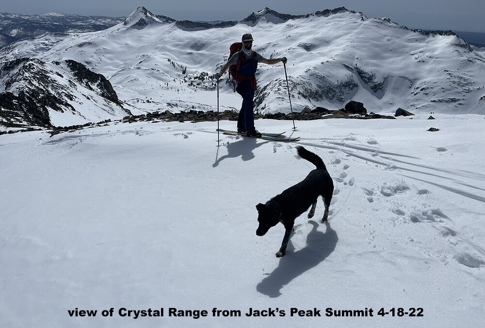
Location: Desolation WildernessElevation: 9,856’Elevation Change: 3,500’Recommended Map: Desolation Wilderness – Tom Harrison or Lake Tahoe Southwest – Alpine Ski Tours Jack’s Peak isn’t skied often, which is exactly why you should...
by Mike | Apr 11, 2019 | Backcountry Ski, Bishop, Eastern Sierra, Featured Adventures
Location: North Lake above Bishop, CAElevation: Mt. Darwin 13,831′ and Mt. Lamark 13,417’Elevation Change: 4200′ for Lamarck. 5700′ for Darwin. add 500′ to connect bothRecommended Map: Bishop Pass – Tom Harrison These pics are from...
by Mike | Apr 11, 2019 | Backcountry Ski, Bishop, Eastern Sierra, Featured Adventures
Location: Buttermilks above Bishop, CA or access from AspendaleElevation: 13,225’Elevation Change: …Recommended Map: Mono Divide – Tom Harrison The North Couloir of Mt. Emerson starts the butterflies twirling in your stomach when you see it from the...
by Mike | Apr 11, 2019 | Backcountry Ski, Bishop, Eastern Sierra, Featured Adventures
Location: Pine Creek Trailhead above town of Rovana, north of BishopElevation: 13,242’Elevation Change: 5,500’Recommended Map: Mono Divide – Tom Harrison This is another one of the peaks where you know your doin’ it as soon as you see it. For...
by Mike | Apr 11, 2019 | Backcountry Ski, Eastern Sierra, Featured Adventures, Mammoth
Location: McGee Creek Trailhead near Mammoth LakesElevation: 12,200’Elevation Change: 4,500’Recommended Map: … Esha is a picturesque little peak that is easy to see and access right off hwy 395 with an ideal layout. The climb and upper descent is no...
by Mike | Apr 11, 2019 | Backcountry Ski, Bishop, Eastern Sierra, Featured Adventures
Location: South Lake above BishopElevation: 12,871’Elevation Change: 3,103’Recommended Map: Bishop Pass – Tom Harrison I won’t forget this day and need to go repeat this peak soon. These pics are from April 27, 2009. I joined up with John Morrison,...
by Mike | Apr 11, 2019 | Backcountry Ski, Big Pine, Eastern Sierra, Featured Adventures, Independence
Location: Taboose Creek Campground south of Big PineElevation: 12,772’Elevation Change: 6,500′ +/- based on snow levelRecommended Map: Kings Canyon High Country – Tom Harrison I found this less known east side giant by asking Howie Schwartz for something...
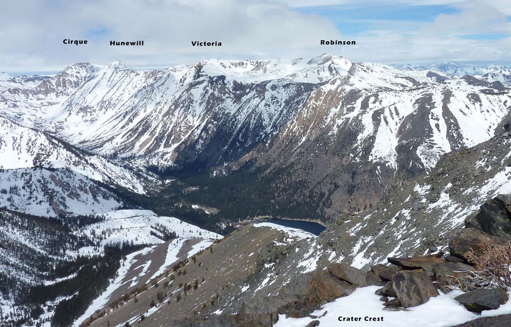
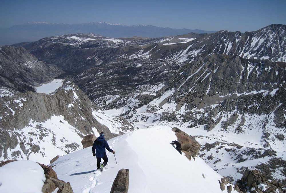
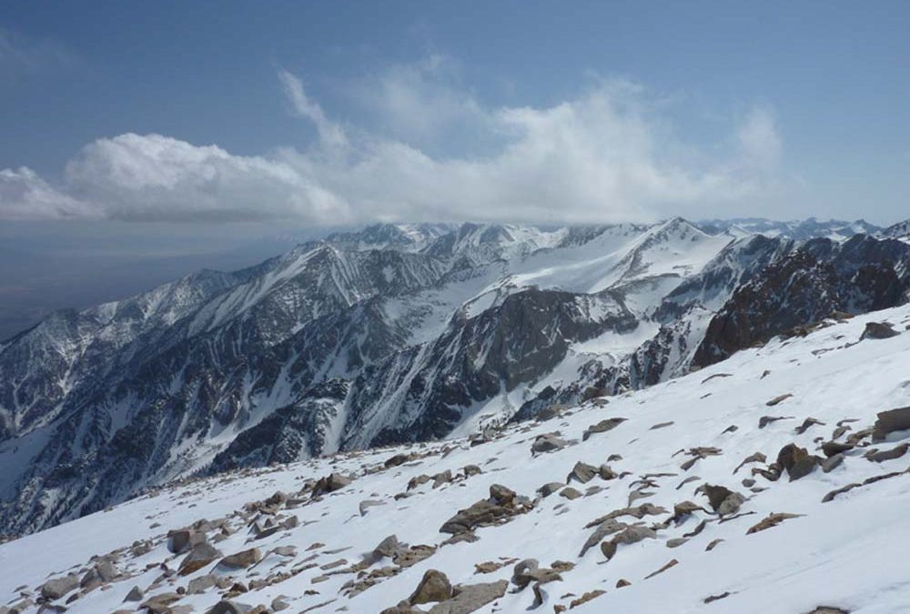
by Mike | Apr 11, 2019 | Backcountry Ski, Bridgeport, Eastern Sierra, Featured Adventures
Location: Twin Lakes – BridgeportElevation: 11,171’Elevation Change: 4,071’Recommended Map: Hoover Wilderness – Tom Harrison I liked the look of Hunewill Peak each time I ski toured out of Twin Lakes. It’s amazing to look at. I would get...
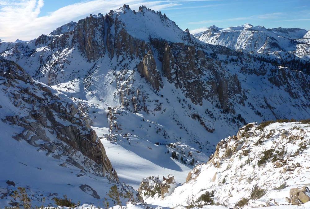
by Mike | Apr 11, 2019 | Backcountry Ski, Bridgeport, Eastern Sierra
Location: Sawtooths BridgeportElevation: 11,010’Elevation Change: 3,910’Recommended Map: Hoover Wilderness – Tom Harrison These pics are from my one time skiing Kettle Peak on March 1, 2007 with one of my first ski touring role models. But first, thanks to...
by Mike | Apr 11, 2019 | Backcountry Ski, Eastern Sierra, Featured Adventures, Mammoth
Location: Near Crowley Lake and Mammoth on hwy 395Elevation: 10,871’Elevation Change: 3,200’Recommended Map: … Mt. McGee is the most accessible big peak in the eastern sierra, which explains why mammoth Mountain Ski Corp built their first chair lift...
by Mike | Apr 5, 2019 | Backcountry Ski, Bridgeport, Eastern Sierra, Featured Adventures
Eocene Peak 11,569′ Location: Twin Lakes Campground – Bridgeport, CAElevation Change: 4481’Recommended Map: Hoover Wilderness – Tom Harrison Eocene Peak is the left side of a huge bowl seen from hwy 395 in Bridgeport. This adventure ...
by Mike | Apr 2, 2019 | Backcountry Ski, Bishop, Eastern Sierra, Featured Adventures, Mammoth
Red Slate Mountain 13,163′ Location: Convict Lake – Mammoth Lakes, CAElevation Change: 7850′ – 13,163’Recommended Map: Convict Lake – Tom Harrison The bulk of these pictures are from my first trip up Red Slate Mountain to ski the...
by Mike | Apr 2, 2019 | Backcountry Ski, Big Pine, Eastern Sierra, Featured Adventures
Birch Mountain 13,665′ Location: Big Pine, CAElevation Change: 7100’Recommended Map: Kings Canyon High Country – Tom Harrison I skied Birch Mountain in late March of 2004. This is a huge peak that you’ll start from a beautiful green meadow and...
by Mike | Apr 2, 2019 | Backcountry Ski, Eastern Sierra, Featured Adventures, Mammoth
Laurel Mountain 11,812′ Location: Convict Lake – Mammoth Lakes, CAElevation Change: 4100’Recommended Map: Mammoth High Country – Tom Harrison Laurel Mountain is more often referred to by the names of it’s two signature and impressive,...
by Mike | Apr 2, 2019 | Backcountry Ski, Bridgeport, Eastern Sierra, Featured Adventures
Crown Point 11,346′ Location: Bridgeport, CA Twin Lakes CampgroundElevation Change: 4250′ but it will feel like a lot moreRecommended Map: Hoover Wilderness – Tom Harrison These pics are from January 17, 2008. I had to ski out to this peak after...
by Mike | Apr 2, 2019 | Backcountry Ski, Bridgeport, Eastern Sierra, Featured Adventures
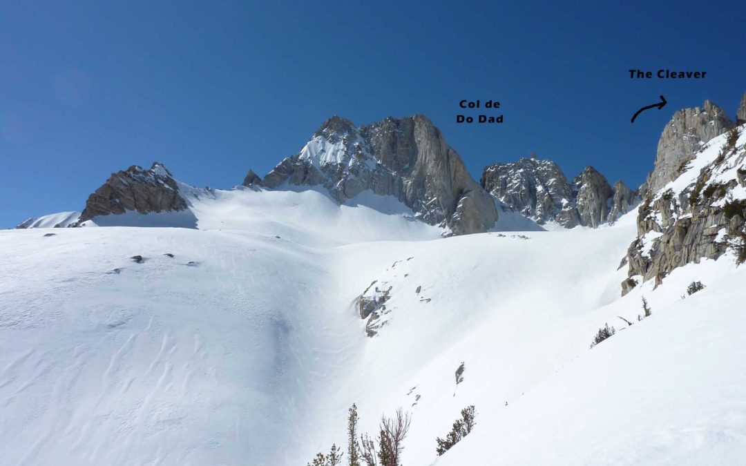
Cleaver Peak 11,760′ Location: Bridgeport, CA Twin Lakes CampgroundElevation Change: 4400′ plus 500′ for Col de Do DadRecommended Map: Hoover Wilderness – Tom Harrison These pics are from April 5, 2011. I skied two great classic names in the...
by Mike | Apr 2, 2019 | Backcountry Ski, Eastern Sierra, Featured Adventures, Mammoth
Bloody mountain 12,544′ Location: Mammoth Lakes, CAElevation Change: 5035’Recommended Map: Mammoth High Country – Tom Harrison Skiing Bloody Mountain has been a thing for a long time I’m sure, with it’s surreal North Couloir staring at...
by Mike | Apr 2, 2019 | Backcountry Ski, Eastern Sierra, Featured Adventures, Mammoth
Mount Baldwin 12,614′ Location: Convict Creek – Mammoth Lakes, CAElevation Change: 4972′ from Convict Lake, 3900′ +/ from Laurel Lakes TrailheadRecommended Map: Mammoth High Country – Tom Harrison Often overlooked, Mt. Baldwin is a big,...
by Mike | Apr 2, 2019 | Backcountry Ski, Bridgeport, Eastern Sierra, Featured Adventures
Cardinal Mountain 13,397′ Location: Red Lake Trailhead above Tinemaha Campground, South of Big PineElevation: 13,396’Recommended Map: Kings Canyon High Country – Tom Harrison These pics are from April 10, 2010. I skied the obvious NE parallel...
by Mike | Apr 2, 2019 | Backcountry Ski, Bridgeport, Eastern Sierra, Featured Adventures
Twin Peaks 11,520′ Location: Twin Lakes Campground – Bridgeport, CAElevation: 7,100 – 12,500’Recommended Map: Hoover Wilderness – Tom Harrison These pictures are from March 18, 2019. The snowpack is very deep this year and I was very...
by Mike | Apr 2, 2019 | Backcountry Ski, Bridgeport, Eastern Sierra, Featured Adventures
Glacier Col 11,560′ Location: Twin Lakes Campground – Bridgeport, CAElevation: 7,100 – 12,500’Recommended Map: Hoover Wilderness – Tom Harrison This was a new ski tour for me that I enjoyed checking out solo in mid March of 2019....

by Mike | Apr 2, 2019 | Backcountry Ski, Big Pine, Eastern Sierra, Featured Adventures
Black Giant 13,330′ Location: Deep above Bishop, Lake Sabrina, SW of Echo ColElevation: 13,330’Recommended Map: Kings Canyon High Country – Tom Harrison Black Giant at 13,330′ is really quite easy to skin and ski down. The west slope has a...
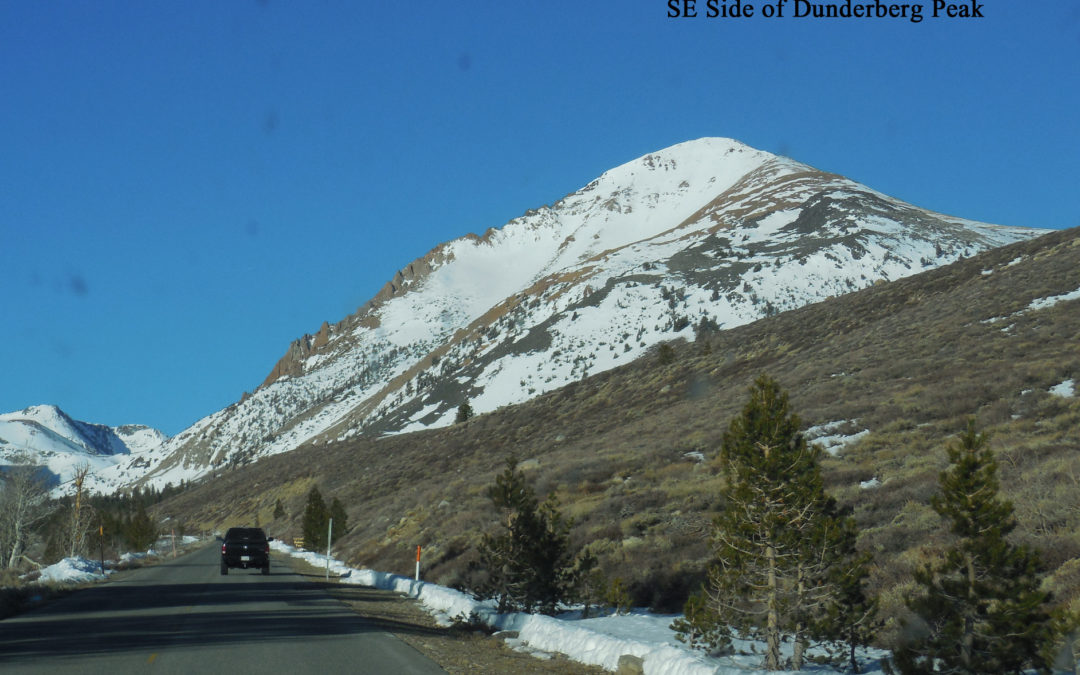
by Mike | Apr 27, 2018 | Backcountry Ski, Bridgeport, Eastern Sierra, Featured Adventures
Dunderberg Peak 12,379′ Location: Near Bridgeport, CA – East Side of the Sierras Elevation Change: 2700’ south side, 4400’ North Side Green Creek car shuttleRecommended Map: Tom Harrison Maps – Hoover Wilderness Dunderberg Peak 12,374’ – Dunderberg...
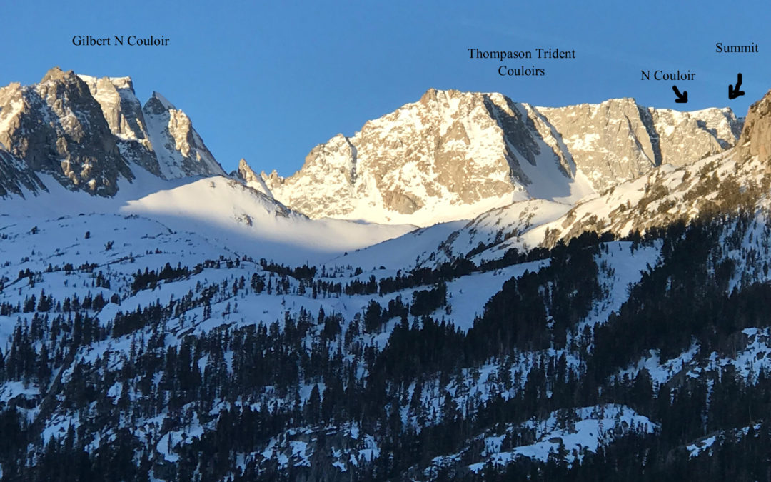
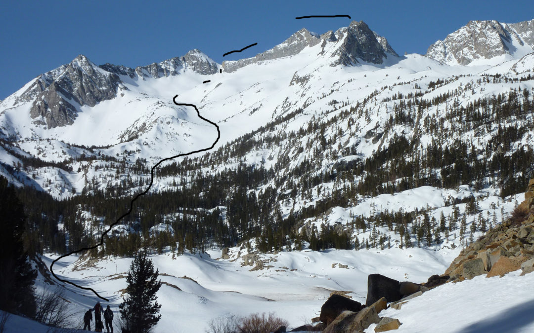
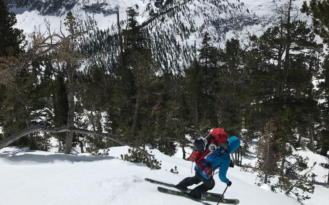
by Mike | Apr 27, 2018 | Backcountry Ski, Bishop, Eastern Sierra, Featured Adventures
Location: Near Bishop, CA – East Side of the SierrasElevation Change: 3726’Recomended Map: Tom Harrison Maps – Bishop Pass Mt. Thompson 13,494’ – Be prepared for steep couloirs with potential cornices to navigate if you want to ski Mt....
by Mike | Apr 27, 2018 | Backcountry Ski, Bishop, Eastern Sierra, Featured Adventures
Location: Near Bishop, CA – East Side of the SierraElevation Change: 3,338’Recommended Map: Tom Harrison Maps – Bishop Pass Mt. Gilbert 13,106’ – I love Mt. Gilbert for its friendly terrain, easily skied in a half day by competent backcountry skiers....
by Mike | Apr 9, 2018 | Backcountry Ski, Bridgeport, Eastern Sierra, Featured Adventures
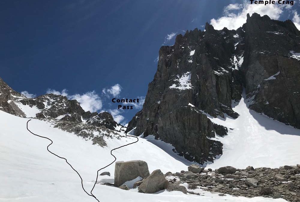
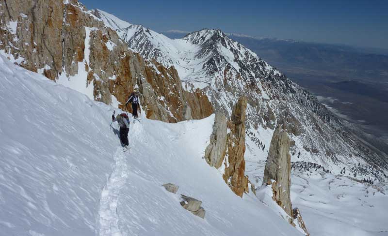
Deerhorn Mountain NE Couloir :13,265′ Location: Independence, CAElevation Change: 6300’Recommended Map: Kearsarge Pass – Rae Lakes Trail Map by Tom Harrison and Mt. Whitney High Country Map by Tom Harrison Deerhorn Mountain is an overnight ski tour...
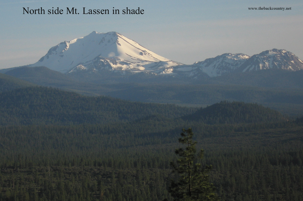
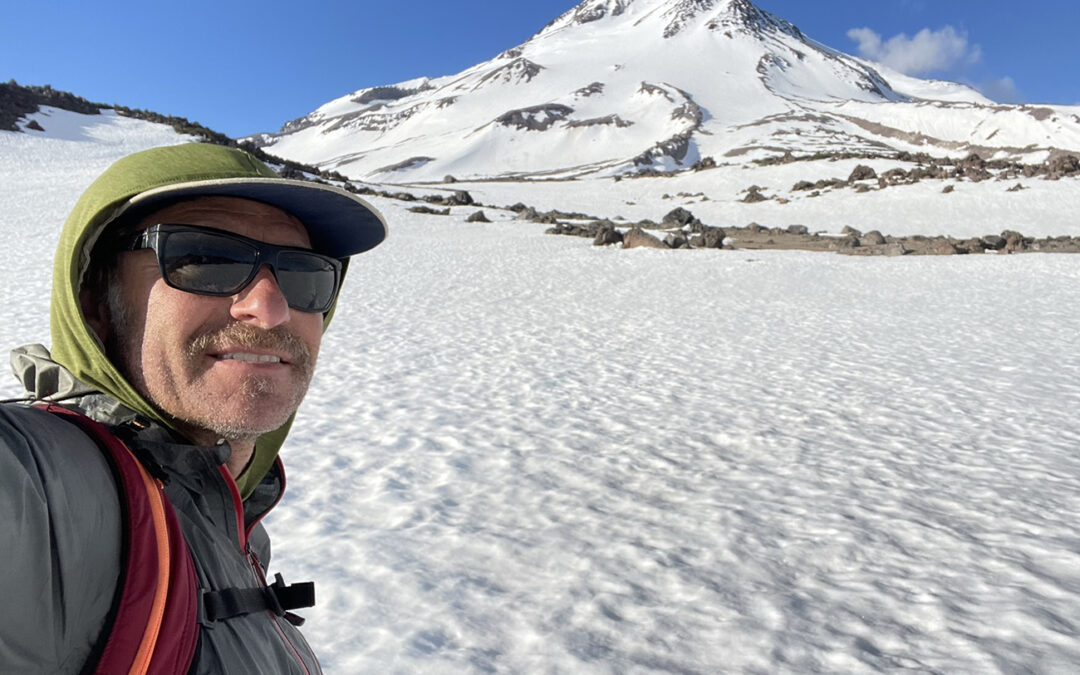
by Mike | Feb 11, 2018 | Backcountry Ski, Featured Adventures, Volcanoes
Location: Mt. Lassen National ParkElevation Change: 2-4000’Recomended Map: National Geographic – Lassen National Park Mt. Lassen 10,457′ is a friendly Northern California peak to ski. There are small sub peaks surrounding it and a nice view to the...
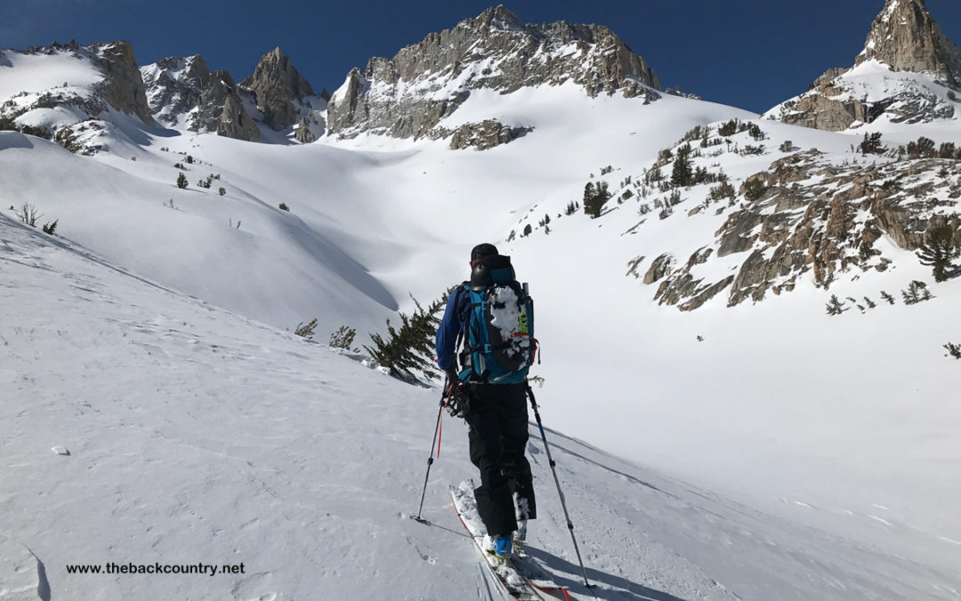
by Mike | Apr 5, 2017 | Backcountry Ski, Bishop, Eastern Sierra, Featured Adventures
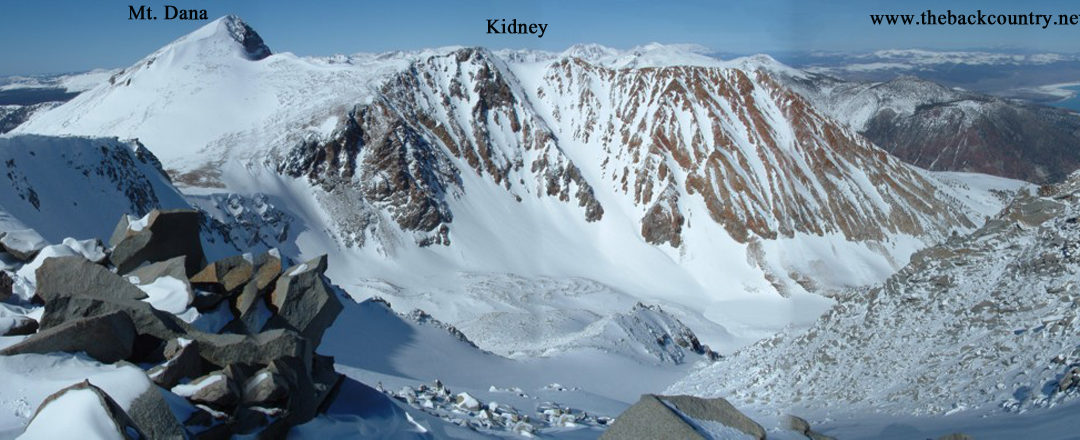
Location: Lee Vining, CA – Tioga PassElevation Change: 5000′ from the gate closer on hwy 120 to Dana PlateauRecomended Map: Tioga Pass This post is primarily about a tour I like to do, but so many variations are possible. There is too much to say about the...
by Mike | Mar 30, 2017 | Backcountry Ski, Bishop, Eastern Sierra, Featured Adventures
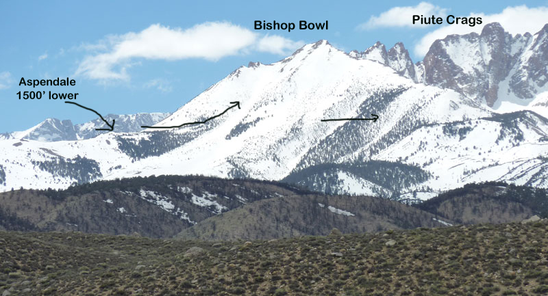
Location: Bishop, CAElevation Change: 3,700′ total vertical 8,300′ – 12,000′ I have only skied Bishop Bowl in the springtime looking for corn. This is a high elevation peak, mostly facing east. The sun and wind rough up the surface a bit, but...
by Mike | Mar 30, 2017 | Backcountry Ski, Bridgeport, Eastern Sierra, Featured Adventures
Location: Bridgeport, CAElevation Change: 7100′ to 12,264′ (summit)Recomended Map: Hoover Wilderness – Tom Harrison Maps The Sawtooth Mountain Range of Bridgeport, CA is only 2.5 hours by car from our store in Truckee. Whoo Hooooo! Drive 13 miles...
by Mike | Mar 24, 2017 | Backcountry Ski, Bridgeport, Eastern Sierra, Featured Adventures
Crater Crest 11,200′ and Monument Ridge Location: Bridgeport, CADuration: All DayElevation Change: Twin Lakes is 7100′. Crater Crest Summit is 11,200′.Recomended Map: Hoover Wilderness Map by Tom Harrison just added to end of this photo gallery,...
by Mike | Mar 22, 2017 | Backcountry Ski, Featured Adventures, Volcanoes
Location: Northern border of California Duration: 5-10 hours Elevation Change: 6860′ – 14,179′ Recommended Map: Mt. Shasta – Tom Harrison I use Gaia now. Don’t forget to download the terrain data while you have reception and save your phone...
by Mike | Feb 26, 2016 | Backcountry Ski, Desolation Wilderness, Featured Adventures, South Shore, Tahoe Area, West Shore
Location: South Shore – Lake Tahoe, CADuration: 2-3 hoursElevation Change: 3,200′ – from 6,535′ to 9,735’Recommended Map: Emerald Bay, California Elevation Profile: Map of General Route: I re-write my ski tour posts every time I look at...
by Mike | Feb 25, 2016 | Backcountry Ski, Featured Adventures, Tahoe Area, West Shore
ocation: West Shore – Lake Tahoe, CADuration: 1-2 hoursElevation Change: 2,357′ – from 6,830′ to 9,187Recommended Map: Emerald Bay, California Elevation Profile: Map of General Route: With some real sweat and skilled skinning, you can wind your...

by Mike | Feb 24, 2016 | Backcountry Ski, Featured Adventures, Tahoe Area, West Shore
Rubicon Peak 9183′ Location: West Shore – Lake Tahoe, CADuration: 1-2 hoursElevation Change: 2,200′ – from 6,800′ to 9,000’Recommended Map: Rockbound Valley & Meeks Bay, California Elevation Profile: Map of...
by Mike | Feb 23, 2016 | Backcountry Ski, Tahoe Area, West Shore
Location: West Shore – Lake Tahoe, CADuration: 1.5-2 hoursElevation Change: 2,400′ – from 6,600′ to 9,000’Recommended Map: Emerald Bay, California & Rockbound Valley, California Map of General Route: Bliss Peak, also known as Hidden...
by Mike | Feb 22, 2016 | Backcountry Ski, Tahoe Area, West Shore
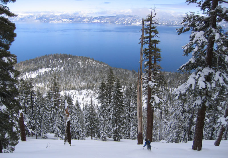
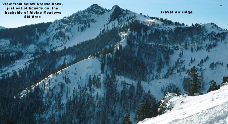
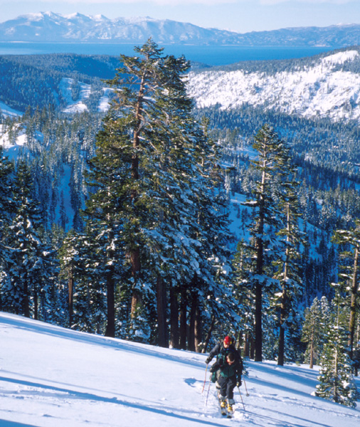
The the skiTwin Peaks/Grouse Rock Location: West Shore – Lake Tahoe, CADuration: 1 – 2 hoursElevation Change: 1,678′ – from 7,200′ to 8,878’Recommended Map: Ward Peak & Sunnyside, California If you’ve skied Alpine Meadows,...
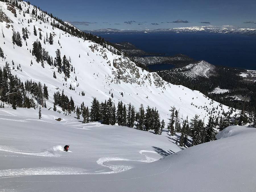
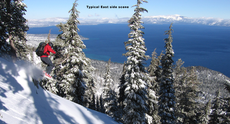
by Mike | Feb 21, 2016 | Backcountry Ski, Featured Adventures, Sierra Crest/Squaw, Tahoe Area
Stubbie and Rich late 90’s Silver Peak East Bowl East Bowl John Svahn! the Goal Post East Face of Gold Peak small group go fast looking down Silver west slope East face of Gold Tahoe zoom Silver Peak gets wind scour View of Pacific Crest from Gold Marty from...
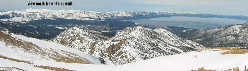
by Mike | Feb 20, 2016 | Backcountry Ski, Featured Adventures, Mt. Rose, Tahoe Area
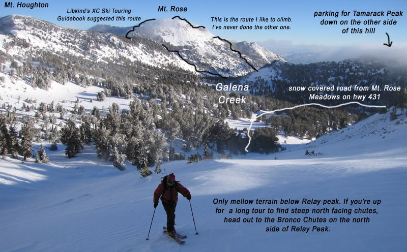
Location: Mt. Rose Wilderness – Lake Tahoe, NVDuration: 2 – 3 hoursElevation Change: 2,176′ – from 8,600′ to 10,776’Recommended Map: Mt. Rose, Nevada Elevation Profile: Map of General Route: The Mount Rose Wilderness Area is...
by Mike | Feb 19, 2016 | Backcountry Ski, South Shore, Tahoe Area
Location: South Shore – Lake Tahoe, CADuration: 4 – 5 hoursElevation Change: 3,681′ – from 7,200′ to 10,881’Recommended Map: Freel Peak, California Elevation Profile: Map of General Route: Skiing Freel Peak is generally something...