
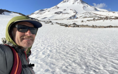
Hi, I’m Mike, and I started The BackCountry shop in 1994.
I want to thank you for helping us stay alive at our retail shop. You are supporting the families of over 30 employees as well as many local gear reps who we buy from.
This ski touring blog is in constant edit and add mode. I re-write nearly every time I look at my posts honestly. Check back regularly for improvements. Please don’t take anything I’ve said with 100% accuracy. My process is simply based on memory and looking at pictures I take. There is no precise measuring or complicated computer mapping going on here. I might start GPS tracking however with Gaia, replacing my old silly maps. Stop by the shop or contact me directly for help planning your ski tours. I am happy to direct you to the many local pro IFMGA guides as well.
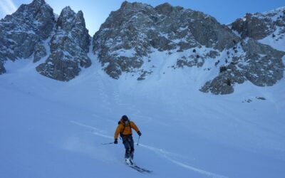
There is an absurdity in trying to describe a backcountry ski tour. There is way too much to say if I were aiming to warn you of every danger and explain how to find the best experience. I buy every guidebook for ski touring and rock climbing, and rarely find I needed the few sentences I read. But they got me in the car and pointed me towards the best stuff in the area. My main goal is to get people stoked on ski touring while I tap at a keyboard at 3am, looking over old photos.
You can now add a comment with pictures and tell us about you day or recommend how I should edit my posts. I will read it all and I really appreciate your participation! I may not publish every comment. Think about contributing to stoke, beta, or laughter.

-
-
-
Grab a map and guidebook from our shop or here on the E-com website. Search the web for more beta. Talk to me. Hire an AMGA guide to teach you the skills. Put all that together and go for it!
-
-


-
There are inherent risks when skiing, snowboarding, snowshoeing or climbing in the backcountry. The routes on these maps may be dangerous and even deadly depending on many variables such as current avalanche danger, weather, snowpack depth, skill and experience level and time of day. Plan on climbing 1000 vertical feet per hour. Add time for low angle miles, high elevation, poor equipment and slow partners. Subtract time by starting early, traveling light, and strategic tour planning.
-
If you are not an expert and experienced backcountry skier, snowboarder, snowshoer or climber, we strongly suggest that you hire a professional guide. We recommend excellent local guides and backcountry skills classes from local pro guide companies International Alpine Guides and www.AlpenglowExpeditions.com. We also highly recommend Sierra Mountain Guides out of Bishop, and Shasta Mountain Guides if you are heading up there. There are a lot of competent Sierra ski guides. Skip the learning curve and help these guys make a living. Contact me for personal guide suggestions. But you can’t go wrong with AMGA certified guides.
-
-
You take FULL responsibility for yourself and your party when using this website for advice and the author disclaims any liability for injury or any other damage by anyone traveling in the areas described.
-
Please be patient if our guidebook recommendations end up being wrong for you – we don’t know you and your skill level and experience. We’re just showing you places where we enjoy the backcountry.
- CARPOOL CARPOOL CARPOOL. Park respectfully, bring a full-size shovel, be nice to Law Enforcement and Cal Trans Drivers. Join Tahoe Backcountry Alliance please. Complain to USFS, CA State Parks and TRPA for unwillingness to facilitate access to our public lands in Tahoe for decades. I have spoken to the top officials at “stakeholder” meetings and delivered private presentations on ski touring in Tahoe many times in the last 20 years. They say they are listening and agree…meanwhile they only remove parking and access every year. They don’t stick up for us. They claim they have no control over Caltrans and CHP. These land managers are equally charged with the duty of improving public recreation opportunities, compared to environmental protection. All they do is work on development and tourism. They will literally tell you that ski areas are where we should be going.
Have a great time and please be safe!
– Mike Schwartz
SAC is Sierra Avalanche Center and ESAC is Eastern Sierra Avalanche Center. Please donate to them on their website, they need the money, and you need the info.
Featured Tours
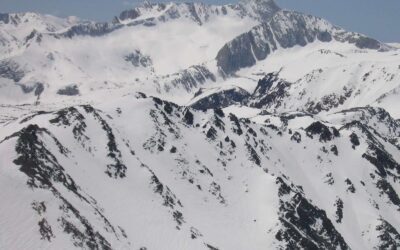
Mt. Goddard 13,568′
Location: Northern Kings Canyon National ParkElevation: 13,568′Elevation Change: about 5000’ and multi-dayRecommended Map: Kings Canyon High Country – Tom Harrison Mt. Goddard can be seen from most every big Eastern Sierra Peak from Bishop to Big Pine. Eric Ongerth...
Virginia Peak 12,001′
Location: Pyramid LakeSummit Elevation: 12,001'Elevation Change: 3500'Recommended Map: Hoover Wilderness by Tom Harrison These pics are from 5/20/19 which was a big winter and still snowing at this time. This one had been on my list for years and I grabbed Hank Baker...
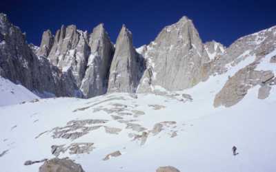
Mt. Whitney 14,494′
Location: Lone Pine, CASummit Elevation: 14,494Base Elevation: 8,340Elevation Change: 6,154Recommended Map: Mt. Whitney High Country - Tom Harrison These pictures are from March in 2005, which was my first and only time Skiing the Mountaineers Gully on Mt. Whitney...
Tahoe Area
Red Lake Peak 10,063′
Location: Carson Pass - Kirkwood, CADuration: 1 - 2 hoursElevation Change: 2,663' - from 7,400' to 10,063'Recomended Map: Caples Lake & Carson Pass, California Elevation Profile: Map of General Route: Not well known, this high elevation giant is an easy one to ski...
Roundtop 10,381′
Location: Carson Pass - Kirkwood, CA Duration: 1.5 - 2.5 hours Elevation Change: 1,781' - from 8,600' to 10,381' Recomended Map: Caples Lake & Carson Pass, California Elevation Profile: Map of General Route: Drive a mile west of Carson Pass, or a mile east of...
Waterhouse Peak 9497′
Location: Luther Pass - Lake Tahoe, CA Duration: 1 - 1.5 hours Elevation Change: 1,781' - from 7,716' to 9,497' Recomended Map: Waterhouse Peak & South Lake Tahoe, California Elevation Profile: Map of General Route: Hit Waterhouse Peak if you’re short on time, or...
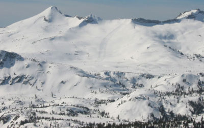
Pyramid Peak 9983′
Location: Desolation Wilderness - Lake Tahoe, CADuration: 3 - 4 hoursElevation Change: 3,806' - from 6,177' to 9,983'Recomended Map: Pyramid Peak Trailhead, California Elevation Profile: Map of General Route: When viewed from Sierra-at-Tahoe ski area or the summit of...
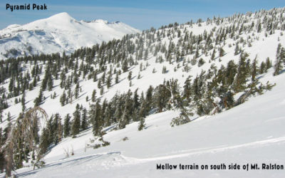
Ralston Peak 9235′
Location: Desolation Wilderness- Lake Tahoe, CADuration: 2 - 3 hoursElevation Change: 2,697' - from 6,538' to 9,235'Recomended Map: Pyramid Peak & Echo Lake, California Elevation Profile: Map of General Route: Ralston Peak is not a well-known backcountry ski...
Echo Peak 8895′
Location: South Shore - Lake Tahoe, CADuration: 1.5-2 hoursElevation Change: 2,289' - from 6,606' to 8,895'Recomended Map: Echo Lake, California Elevation Profile: Map of General Route: Echo Peak feels like the little brother to Mt. Tallac to me. It has the same...
Volcanoes
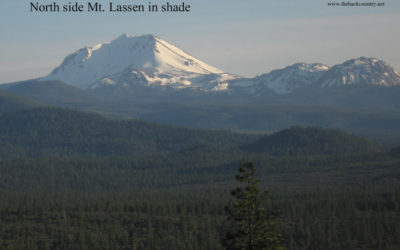
Mt. Lassen, CA 10,457′
Location: Mt. Lassen National ParkElevation Change: 2-4000'Recomended Map: National Geographic - Lassen National Park Mt. Lassen 10,457' is a friendly Northern California peak to ski. There are small sub peaks surrounding it and a nice view to the north of Mt. Shasta...
Mt. Shasta, CA 14,179′
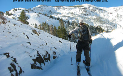
Location: Northern border of California Duration: 5-10 hours Elevation Change: 6860' - 14,179' Recommended Map: Mt. Shasta - Tom Harrison I use Gaia now. Don’t forget to download the terrain data while you have reception and save your phone battery in airplane mode....
Eastern Sierra
Pyramid Peak 11.728′ – Mammoth Lakes
Pyramid peak 11,728' If you are really into ski touring, just move to Mammoth Lakes. This is the epicenter for Sierra rock climbing, hiking, backpacking, and backcountry ski touring. I like to think of Tahoe as an ideal "center" position in California, in-between Mt....
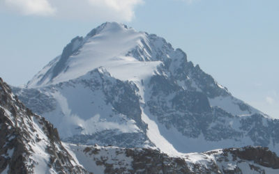
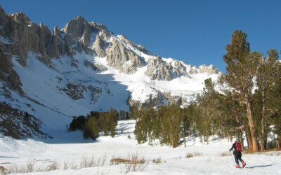
Mt. Mills 13,451′
Mt. Mills – 13,451’ I dumped a ton of photos in this one, sorry! This was a 3-day tour not far from civilization with unreal beauty. I used a point and shoot camera. A friend and IFMGA guide Howie Schwartz invited me on this tour. He said wanted to try it out on some...
Mt. Ritter 13,143′ & Banner Peak 12,936′
Mt. Ritter - 13,143’Banner Peak - 12,936’ In May of 2002 John and I skied Mt. Ritter and Banner Peak in a 3-day tour. We tried to go up the North side of Mt. Tom in the dark, behind some of his friends, and bailed due to the chaos of a big group and unknown...
North Peak 12,242′
North Peak 12,242' Location: Saddlebag Lake - Tioga PassElevation Change: 2200' I don’t remember when I skied North Peak, but I won’t ski it again. It was late 90’s with John, Aaron and Tony. Same excursion where we skied Morgan South. This is a short tour you could...
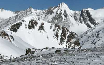
University Peak 13.362′
University peak 13,632' Elevation change: 4400' These are some mixed pics from two days I skied University Peak in 2003 and 2004. The ski descent line I did was the North Face, described in the Moynier High Sierra Guidebook. This is a great "half day" tour as he would...
Mt. Tyndall 14,018′
Mt. Tyndall 14,018’ Location: Shepards Pass - Sierra Crest Elevation Change 7500’ On March 24, 2004, I skied one of my biggest day ski tours with John. We had skied 3 days on this east side excursion. We day skied Mt. Starr aka Pointless Peak, and Birch Mountain as...